Pays/Territoires
Mise à jour 2021-01-12 18:58:07
Les noms des pays/territoires du monde sont donnés en Français et Chinois. Cette collection des précieuses terres fermes du monde que toute l'humanité partage inclut non seulement les pays indépendants, mais aussi des régions spécifiques qui ne sont pas membre de l'ONUOrganisation des Nations Unies: Nous, peuples des Nations Unies ... Une ONU plus forte pour un monde meilleur. Veuillez aussi consulter les noms des pays en masculin et féminin en Français.
GéoPays Fermer
1
id
Pays
Pays en Anglais
Afghanistan
Pays
Afghanistan
countryucasefr
AFGHANISTAN
Pays en Chinois
Pays en Espagnol
Afganistán
Pays en Italien
L'Afghanistan
Pays en Portugais
Afeganistão
Pays en Allemand
Afghanistan
countrypy
a1 fu4 han4
countrylocal
Afghanestan
countryfull
Afghanistan
countrynm
Afghanistan
ISO2
AF
ISO3
AFG
countrycodeisono
004
countrycodevehicle
AFG
countrycodeolympic
AFG
countrycodeirs
AF
countrycodeirsfr
AF
countrycodeirsmixt
AF
♂Masulin
7
2
177
languagesfr
Pashto
7
currency
afghani
currencyfr
afghani
currencyisocode
AFN
currencyisocodefull
AFN 971
currencypxcode
AFA
currencysymbol
Af
currencysubdivision
100 puls
currencyregime
float
currencyvalue
0.02337
nationality
Afghan
nationalityfr
Afghane
Capitale
Kabul
capitalfr
Kaboul
Préfixe Tél.
93
Superficie km2
652 090
arealand
647 500
landarablerate
0.1213
landforestrate
0.021
summit
Nowshak 7 485 m.
boundarycountries
Iran, Turkmenistan, Ouzbekistan, Tadjikistan, Chine, Pakistan.
timezonedeltabegin
4.5
flaglink
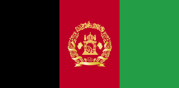
maplink
afcolor.gif
outlinemaplink
afout.gif
visapassenger
-1
maincities
Kandahar, Herat, Mazar-e-Sharif, Djalalabad, Kunduz, Baghlan.
largestcity
Kabul
largestcitypopulation
2 029 000
rankpopulation
38
Population
25 838 797
rankgdp
119
gdp
4708000000
rankgni
121
gni
4630000000
rankincomeorigin
209
rankincome
214
income
171
lifeexpectation
46.97
alphabetizationrate
0.315
natalityrate
0.04063
mortalityrate
0.01715
mortalityrateinfantile
0.14248
precipitation
313
nationalevent
Independence Day
nationaleventfr
Jour de l'Indépendance
nationalholiday
19 August (1919)
Date de naissance aaaa-mm-jj
1919-08-19 00:00:00
6
8
president
Ahmadinejad Mahmoud
location
Southern Asia, north and west of Pakistan, east of Iran
terrain
mostly rugged mountains; plains in north and southwest
naturalresources
natural gas, petroleum, coal, copper, chromite, ta
9
rgbback
16777215
todate
1
2
id
Pays
Pays en Anglais
Albania
Pays
Albanie
countryucasefr
ALBANIE
Pays en Chinois
Pays en Espagnol
Albania
Pays en Italien
L'Albania
Pays en Portugais
Albânia
Pays en Allemand
Albanien
countrypy
a1 er3 ba1 ni2 ya4
countrylocal
Shqiperia
countryfull
Albania
countrynm
Albania
ISO2
AL
ISO3
ALB
countrycodeisono
008
countrycodevehicle
AL
countrycodeolympic
ALB
countrycodeirs
AL
countrycodeirsfr
AL
countrycodeirsmixt
AL
♀Féminin
9
6
2
languagesfr
Albanais
5
currency
lek
currencyfr
lek
currencyisocode
ALL
currencyisocodefull
ALL 008
currencypxcode
ALL
currencysymbol
L
currencysubdivision
100 qindarka (qintars)
currencyregime
float
currencyvalue
0.00992
nationality
Albanese
nationalityfr
Albanaise
Capitale
Tirane
capitalfr
Tirana
Préfixe Tél.
355
Superficie km2
28 750
arealand
27 398
areawater
1 350
landarablerate
0.2109
landforestrate
0.362
coastline
362
summit
Korabi 2 764 m.
boundarycountries
Yougoslavie, Grèce, Macedoine
timezonedeltabegin
1
flaglink
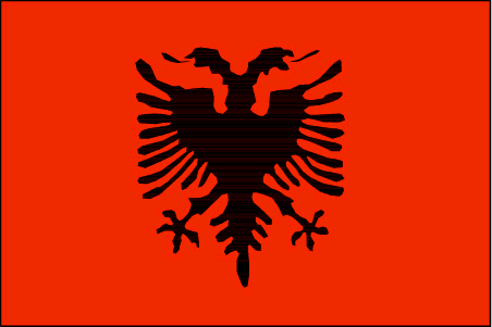
maplink
al-map.gif
outlinemaplink
al.gif
visapassenger
-1
maincities
Durrës, Elbasan, Shkodër, Vlorë, Korcë
largestcity
Tirana
largestcitypopulation
270 000
rankpopulation
131
Population
3 169 000
rankgdp
110
gdp
6124000000
rankgdpppp
108
gdpppp
14526000000
rankgni
115
gni
5509000000
rankincomeorigin
120
rankincome
132
income
1740
rankincomeppp
126
incomeppp
4710
lifeexpectation
77.06
alphabetizationrate
0.865
natalityrate
0.01508
mortalityrate
0.00502
mortalityrateinfantile
0.02231
hdi
0.735
urbanization
0.429
nationalevent
Independence Day
nationaleventfr
Jour de l'Indépendance
nationalholiday
28 November (1912)
Date de naissance aaaa-mm-jj
1912-11-28 00:00:00
9
1
location
Southeastern Europe, bordering the Adriatic Sea and Ionian Sea, between Greece and Serbia and Montenegro
terrain
mostly mountains and hills; small plains along coast
naturalresources
petroleum, natural gas, coal, chromium, copper, ti
7
Web
rgbback
16777215
todate
1
3
id
Pays
Pays en Anglais
Algeria
Pays
Algérie
countryucasefr
ALGERIE
Pays en Chinois
Pays en Espagnol
Argelia
Pays en Italien
L'Algeria
Pays en Portugais
Argélia
Pays en Allemand
Algerien
countrypy
a1 er2 ji2 li4 ya4
countrylocal
Al Jaza'ir
countryfull
Algeria
countrynm
Algeria
ISO2
DZ
ISO3
DZA
countrycodeisono
012
countrycodevehicle
DZ
countrycodeolympic
ALG
countrycodeirs
AG
countrycodeirsfr
AG
countrycodeirsmixt
AG
countrycode
213
♀Féminin
15
4
3
languagesfr
Arabe
124
currency
dinar
currencyfr
dinar algérien
currencyisocode
DZD
currencyisocodefull
DZD 012
currencypxcode
DZD
currencysymbol
DA
currencysubdivision
100 centimes
currencyregime
composite
currencyvalue
0.01397
nationality
Algerian
nationalityfr
Algérienne
Capitale
Algiers
capitalfr
Alger
Préfixe Tél.
213
Superficie km2
2 381 740
arealand
2 381 740
landarablerate
0.0321
landforestrate
0.009
coastline
998
summit
Tahat 3 003 m.
boundarycountries
Maroc, Sahara occidental, Mali, Mauritanie, Niger, Libye, Tunisie.
timezonedeltabegin
1
flaglink
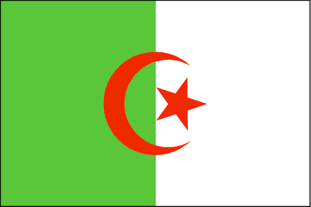
maplink
dzcolor.gif
outlinemaplink
dzout.gif
visapassenger
-1
maincities
Oran, Constantine, Annaba, Blida, Batna, Sétif
largestcity
Algiers
largestcitypopulation
3 705 000
rankpopulation
35
Population
31 833 000
rankgdp
50
gdp
66530000000
rankgdpppp
38
gdpppp
194389000000
rankgni
49
gni
61574000000
rankincomeorigin
112
rankincome
122
income
1930
rankincomeppp
103
incomeppp
5930
lifeexpectation
70.76
alphabetizationrate
0.574
natalityrate
0.02045
mortalityrate
0.00544
mortalityrateinfantile
0.0517
precipitation
686
nationalevent
Revolution Day
nationaleventfr
Jour de le Révolution
nationalholiday
1 November (1954)
Date de naissance aaaa-mm-jj
1954-11-01 00:00:00
1
7
location
Northern Africa, bordering the Mediterranean Sea, between Morocco and Tunisia
terrain
mostly high plateau and desert; some mountains; narrow, discontinuous coastal plain
naturalresources
petroleum, natural gas, iron ore, phosphates, uran
7
Web
rgbback
16777215
todate
1
Notes
Courageux peuple, le Cheval de Bois va loins dans sa logique. Il a inventé les chiffres numériques 0,1,2,3,4,5,6,7,8,9, algèbre, mathématiques.
4
id
Pays
Pays en Anglais
Andorra
Pays
Andorre
countryucasefr
ANDORRE
Pays en Chinois
Pays en Espagnol
Andorra
Pays en Italien
L'Andorra
Pays en Portugais
Andorra
Pays en Allemand
Andorra
countrypy
an1 dao4 er3 shi4
countrylocal
Andorra
countryfull
Andorra
countrynm
Andorra
ISO2
AD
ISO3
AND
countrycodeisono
020
countrycodevehicle
AND
countrycodeolympic
AND
countrycodeirs
AN
countrycodeirsfr
AN
countrycodeirsmixt
AN
countrycode
376
♂Masulin
18
6
32
languagesfr
Catalan
2
currency
euro
currencyfr
eurp
currencyisocode
EUR
currencyisocodefull
EUR 978
currencypxcode
EUR
currencysymbol
€
currencysubdivision
100 cents
currencyregime
float
currencyvalue
1.2203
nationalityfr
Angolaise
Capitale
Andorra la Vella
capitalfr
Andorre-la-Vieille
Préfixe Tél.
376
Superficie km2
466
arealand
468
landarablerate
0.0222
summit
Coma Pedrosa 2 946 m.
boundarycountries
France, Espagne
timezonedeltabegin
1
flaglink
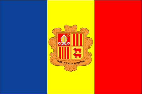
maplink
an-map.gif
outlinemaplink
ad.gif
visapassenger
-1
maincities
Les Escaldas, Canillo, Encamp, La Massana
largestcity
Andorra-la-Vella
largestcitypopulation
25 000
rankpopulation
196
Population
66 000
rankgni
166
gni
1020000000
rankincomeorigin
41
rankincome
41
income
13600
lifeexpectation
83.51
alphabetizationrate
1
natalityrate
0.009
fecondity
1.26
mortalityrate
0.00607
mortalityrateinfantile
0.00405
growthrate
0.00947
urbanization
0.9333
nationalevent
Our Lady of Meritxell Day
nationaleventfr
Jour de Notre Dame de Meritxell
nationalholiday
8 September (1278)
Date de naissance aaaa-mm-jj
1753-01-01 00:00:00
9
9
location
Southwestern Europe, between France and Spain
terrain
rugged mountains dissected by narrow valleys
naturalresources
hydropower, mineral water, timber, iron ore, lead
1
Web
rgbback
16777215
special
Yes
todate
1
5
id
Pays
Pays en Anglais
Angola
Pays
Angola
countryucasefr
ANGOLA
Pays en Chinois
Pays en Espagnol
Angola
Pays en Italien
L'Angola
Pays en Portugais
Angola
Pays en Allemand
Angola
countrypy
an1 ge1 la1
countrylocal
Angola
countryfull
Angola
countrynm
Angola
ISO2
AO
ISO3
AGO
countrycodeisono
024
countrycodeolympic
ANG
countrycodeirs
AO
countrycodeirsfr
AO
countrycodeirsmixt
AO
♂Masulin
15
2
114
languagesfr
Portugais
125
currency
kwanza
currencyfr
kwanza
currencyisocode
AOA
currencyisocodefull
AOA 024
currencypxcode
AON
currencysymbol
Kz
currencysubdivision
100 lwei
currencyregime
m.float
currencyvalue
0.01751
Capitale
Luanda
capitalfr
Luanda
Préfixe Tél.
244
Superficie km2
1 246 700
arealand
1 246 700
landarablerate
0.0241
landforestrate
0.56
coastline
1600
summit
Serra Môco 2 619 m.
boundarycountries
Congo, Congo démocratique, Zambie, Namibie.
timezonedeltabegin
1
flaglink
maplink
aocolor.gif
outlinemaplink
aoout.gif
visapassenger
-1
maincities
Huambo, Lubango, Namibe, Lobito, Benguela, Malanje.
largestcity
Luanda
largestcitypopulation
2 081 000
rankpopulation
60
Population
13 522 000
rankgdp
84
gdp
13189000000
rankgdpppp
82
gdpppp
31701000000
rankgni
93
gni
10004000000
rankincomeorigin
148
rankincome
162
income
740
rankincomeppp
162
incomeppp
1910
lifeexpectation
36.96
alphabetizationrate
0.417
natalityrate
0.04557
mortalityrate
0.02583
mortalityrateinfantile
0.19382
hdi
0.377
nationalevent
Independence Day
nationaleventfr
Jour de l'Indépendance
nationalholiday
11 November (1975)
Date de naissance aaaa-mm-jj
1975-11-11 00:00:00
2
4
location
Southern Africa, bordering the South Atlantic Ocean, between Namibia and Democratic Republic of the Congo
terrain
narrow coastal plain rises abruptly to vast interior plateau
naturalresources
petroleum, diamonds, iron ore, phosphates, copper,
cooking
Fruits de Mer
9
Web
rgbback
16777215
todate
1
Notes
Fruits de Mer
6
id
Pays
Pays en Anglais
Argentina
Pays
Argentine
countryucasefr
ARGENTINE
Pays en Chinois
Pays en Espagnol
La Argentina
Pays en Italien
L'Argentina
Pays en Portugais
Argentina
Pays en Allemand
Argentinien
countrypy
a1 gen1 ting2
countrylocal
Argentina
countryfull
Argentina
countrynm
Argentina
ISO2
AR
ISO3
ARG
countrycodeisono
032
countrycodevehicle
RA
countrycodeolympic
ARG
countrycodeirs
AR
countrycodeirsfr
AR
countrycodeirsmixt
AR
countrycode
54
♀Féminin
15
7
131
languagesfr
Espagnol
8
currency
peso
currencyfr
peso
currencyisocode
ARS
currencyisocodefull
ARS 032
currencypxcode
ARS
currencysymbol
$
currencysubdivision
100 centavos
currencyregime
float
currencyvalue
0.3469
nationalityfr
Argentine
Capitale
Buenos Aires
capitalfr
Buenos Aires
Préfixe Tél.
54
Superficie km2
2 766 890
arealand
2 736 690
areawater
30 200
landarablerate
0.0914
landforestrate
0.127
coastline
4989
summit
Cerro Aconcagua 6 962 m
boundarycountries
Chili, Bolivie, Paraguay, Brésil, Uruguay
timezonedeltabegin
-3
flaglink
maplink
arcolor.gif
outlinemaplink
ar.gif
visapassenger
-1
maincities
Córdoba, Rosario, Mendoza, La Plata, Mar del Plata, San Miguel de Tucumán.
largestcity
Buenos Aires
largestcitypopulation
11 802 000
rankpopulation
31
Population
36 772 000
rankgdp
35
gdp
129596000000
rankgdpppp
22
gdpppp
445148000000
rankgni
30
gni
140139000000
rankincomeorigin
84
rankincome
93
income
3810
rankincomeppp
66
incomeppp
11410
lifeexpectation
75.5
alphabetizationrate
0.984
mortalityrateinfantile
0.0172
urbanization
0.603
precipitation
1147
nationalevent
Revolution Day
nationaleventfr
Jour de le Révolution
nationalholiday
25 May (1810)
Date de naissance aaaa-mm-jj
1810-05-25 00:00:00
7
7
location
Southern South America, bordering the South Atlantic Ocean, between Chile and Uruguay
terrain
rich plains of the Pampas in northern half, flat to rolling plateau of Patagonia in south, rugged Andes along western border
naturalresources
fertile plains of the Pampas, lead, zinc, tin, cop
cooking
Fruits exotiques.
9
Web
rgbback
16777215
todate
1
Notes
Fruits exotiques.
7
id
Pays
Pays en Anglais
Armenia
Pays
Arménie
countryucasefr
ARMENIE
Pays en Chinois
Pays en Espagnol
Armenia
Pays en Italien
L'Armenia
Pays en Portugais
Arménia
Pays en Allemand
Armenien
countrypy
ya4 mei3 ni2 ya4
countrylocal
Hayastan
countryfull
Armenia
countrynm
Armenia
ISO2
AM
ISO3
ARM
countrycodeisono
051
countrycodevehicle
AM
countrycodeolympic
ARM
countrycodeirs
AM
countrycodeirsfr
AM
countrycodeirsmixt
AM
♀Féminin
15
6
19
languagesfr
Arménien
126
currency
dram
currencyfr
rouble
currencyisocode
AMD
currencyisocodefull
AMD 051
currencypxcode
AMD
currencysubdivision
100 luma
nationalityfr
Arménienne
Capitale
Yerevan
capitalfr
Erevan
Préfixe Tél.
7
Superficie km2
29 800
arealand
28 400
areawater
1 400
landarablerate
0.1752
landforestrate
0.124
summit
Aragats Lerr 4 095 m.
boundarycountries
Turquie, Azerbaïdjan, Iran, Géorgie.
timezonedeltabegin
4
flaglink
maplink
am-map.gif
outlinemaplink
am.gif
visapassenger
-1
maincities
Koumaïri, Karaklis, Gyumri, Kirovakan, Razdan, Echmiadzin, Abovyan.
largestcity
Yerevan
largestcitypopulation
1 278 000
rankpopulation
132
Population
3 056 000
rankgdp
136
gdp
2805000000
rankgdpppp
120
gdpppp
11217000000
rankgni
143
gni
2888000000
rankincomeorigin
139
rankincome
150
income
950
rankincomeppp
134
incomeppp
3790
lifeexpectation
66.78
natalityrate
0.0132
mortalityrate
0.01036
mortalityrateinfantile
0.04066
hdi
0.729
precipitation
277
nationalevent
Independence Day
nationaleventfr
Jour de l'Indépendance
nationalholiday
21 September (1991)
Date de naissance aaaa-mm-jj
1991-09-21 00:00:00
8
8
location
Southwestern Asia, east of Turkey
terrain
Armenian Highland with mountains; little forest land; fast flowing rivers; good soil in Aras River valley
naturalresources
small deposits of gold, copper, molybdenum, zinc,
7
Web
rgbback
16777215
todate
1
8
id
Pays
Pays en Anglais
Australia
Pays
Australie
countryucasefr
AUSTRALIE
Pays en Chinois
Pays en Espagnol
Australia
Pays en Italien
L'Australia
Pays en Portugais
Austrália
Pays en Allemand
Australien
countrypy
ao4 da4 li4 ya4
countrylocal
Australia
countryfull
Australia
countrynm
Australia
ISO2
AU
ISO3
AUS
countrycodeisono
036
countrycodevehicle
AUS
countrycodeolympic
AUS
countrycodeirs
AS
countrycodeirsfr
AS
countrycodeirsmixt
AS
countrycode
61
♀Féminin
12
7
51
languagesfr
Anglais
10
currency
dollar
currencyfr
dollar australien
currencyisocode
AUD
currencyisocodefull
AUD 036
currencypxcode
AUD
currencysymbol
A$
currencysubdivision
100 cents
currencyregime
float
currencyvalue
0.7485
nationalityfr
Australienne
Capitale
Canberra
capitalfr
Canberra
Préfixe Tél.
61
Superficie km2
7 713 360
arealand
7 617 930
areawater
68 920
landarablerate
0.0688
landforestrate
0.201
coastline
25760
summit
Mount Kosciusko 2 230 m.
timezonedeltabegin
8
timezonedeltaend
10
flaglink
maplink
aucaps.gif
outlinemaplink
auooutl.gif
maincities
Sydney, Melbourne, Brisbane, Perth, Adelaïde, Newcastle, Wollongong, Gold Coast, Hobart.
largestcity
Sydney
largestcitypopulation
3 590 000
rankpopulation
49
Population
19 881 000
rankgdp
13
gdp
522378000000
rankgdpppp
16
gdpppp
589116000000
rankgni
14
gni
436470000000
rankincomeorigin
27
rankincome
23
income
21950
rankincomeppp
15
incomeppp
28780
lifeexpectation
80
alphabetizationrate
1
mortalityrateinfantile
0.0049
precipitation
1304
nationalevent
Australia Day
nationaleventfr
Jour de l'Australie
nationalholiday
26 January (1788)
Date de naissance aaaa-mm-jj
1788-01-26 00:00:00
4
8
location
Oceania, continent between the Indian Ocean and the South Pacific Ocean
terrain
mostly low plateau with deserts; fertile plain in southeast
naturalresources
bauxite, coal, iron ore, copper, tin, gold, silver
cooking
Fruits de Mer.
8
Web
rgbback
16777215
todate
1
Notes
Fruits de Mer.
9
id
Pays
Pays en Anglais
Austria
Pays
Autriche
countryucasefr
AUTRICHE
Pays en Chinois
Pays en Espagnol
Austria
Pays en Italien
L'Austria
Pays en Portugais
Áustria
Pays en Allemand
Österreich
countrypy
ao4 di4 li4
countrylocal
Österreich
countryfull
Austria
countrynm
Austria
ISO2
AT
ISO3
AUT
countrycodeisono
040
countrycodevehicle
A
countrycodeolympic
AUT
countrycodeirs
AU
countrycodeirsfr
AU
countrycodeirsmixt
AU
countrycode
43
♀Féminin
1
7
73
languagesfr
Allemand
2
currency
euro
currencyfr
euro
currencyisocode
EUR
currencyisocodefull
EUR 978
currencypxcode
EUR
currencysymbol
€
currencysubdivision
100 cents
currencyregime
float
currencyvalue
1.2203
nationalityfr
Autrichienne
Capitale
Vienna
capitalfr
Vienne
Préfixe Tél.
43
Superficie km2
84 000
arealand
82 738
areawater
1 120
landarablerate
0.1689
landforestrate
0.47
summit
Grossglockner 3 797 m.
boundarycountries
Suisse, Liechtenstein, Allemagne, Tchéquie, Slovaquie, Hongrie, Slovénie, Italie.
timezonedeltabegin
1
flaglink
maplink
atcolor.gif
outlinemaplink
atout.gif
maincities
Graz, Linz, Salzburg, Innsbruck, Klagenfurt, Villach, Wels, Steyr, Sankt Pölten.
largestcity
Vienna
largestcitypopulation
2 060 000
rankpopulation
88
Population
8 090 000
rankgdp
20
gdp
253126000000
rankgdpppp
32
gdpppp
243458000000
rankgni
20
gni
216903000000
rankincomeorigin
16
rankincome
12
income
26810
rankincomeppp
12
incomeppp
29740
lifeexpectation
78
alphabetizationrate
0.99
mortalityrateinfantile
0.0044
precipitation
607
nationalevent
National Day
nationaleventfr
Jour National
nationalholiday
26 October (1955)
Date de naissance aaaa-mm-jj
1955-10-26 00:00:00
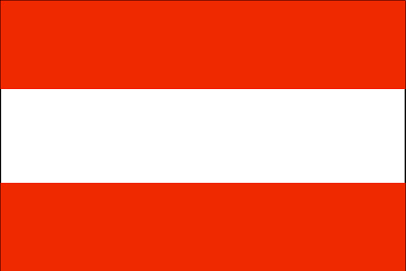
2
8
location
Central Europe, north of Italy and Slovenia
terrain
in the west and south mostly mountains (Alps); along the eastern and northern margins mostly flat or gently sloping
naturalresources
iron ore, oil, timber, magnesite, lead, coal, lign
5
Web
rgbback
16777215
todate
1
10
id
Pays
Pays en Anglais
Azerbaijan
Pays
Azerbaïdjan
countryucasefr
AZERBAIDJAN
Pays en Chinois
Pays en Espagnol
Azerbaijan
Pays en Italien
L'Azerbaijan
Pays en Portugais
Azerbaijan
Pays en Allemand
Azerbaijan
countrypy
a1 sai4 bai4 jiang1
countrylocal
Azarbaycan
countryfull
Azerbaijan
countrynm
Azerbaijan
ISO2
AZ
ISO3
AZE
countrycodeisono
031
countrycodevehicle
AZ
countrycodeolympic
AZE
countrycodeirs
AJ
countrycodeirsfr
AJ
countrycodeirsmixt
AJ
♂Masulin
15
4
178
languagesfr
Azerbaïdjanais
127
currency
manat
currencyfr
rouble
currencyisocode
AZM
currencyisocodefull
AZM 031
currencypxcode
AZM
currencysubdivision
100 gopik
nationalityfr
Azerbaïjanaise
Capitale
Baku
capitalfr
Bakou
Préfixe Tél.
994
Superficie km2
86 600
arealand
86 100
areawater
500
landarablerate
0.1931
landforestrate
0.131
summit
Bazarduzu Dagi 4 485 m.
boundarycountries
Arménie, Géorgie, Russie, Iran, Turquie.
timezonedeltabegin
4
flaglink
maplink
aj-map.gif
outlinemaplink
ajout.gif
visapassenger
-1
maincities
Gyandzha, Stepanakert, Sumgait, Sheki, Mingechaur, Nakhichevan, Lenkoran.
largestcity
Baku
largestcitypopulation
1 848 000
rankpopulation
86
Population
8 233 000
rankgdp
102
gdp
7138000000
rankgdpppp
85
gdpppp
29782000000
rankgni
104
gni
6713000000
rankincomeorigin
145
rankincome
158
income
820
rankincomeppp
139
incomeppp
3390
lifeexpectation
63.25
alphabetizationrate
0.621
natalityrate
0.01981
mortalityrate
0.00976
mortalityrateinfantile
0.08207
hdi
0.744
urbanization
0.518
precipitation
210
nationalevent
Founding of the Democratic Republic of Azerbaidzhan
nationaleventfr
Création de la République Démocratique d'Azerbaïdjan
nationalholiday
28 May (1918)
Date de naissance aaaa-mm-jj
1918-05-28 00:00:00
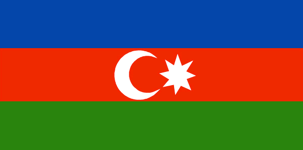
5
7
location
Southwestern Asia, bordering the Caspian Sea, between Iran and Russia, with a small European portion north of the Caucasus range
terrain
large, flat Kur-Araz Ovaligi (Kura-Araks Lowland) (much of it below sea level) with Great Caucasus Mountains to the north, Qarabag Yaylasi (Karabakh Upland) in west; Baku lies on Abseron Yasaqligi (Apsheron Peninsula) that juts into Caspian Sea
naturalresources
petroleum, natural gas, iron ore, nonferrous metal
9
Web
rgbback
16777215
todate
1
| Pays/Territoires | Régions en Chine | Provinces de Chine | Régions en France | Départements de France | Provinces du Monde | Villes/Villages | Localités | Continents du Monde | Vins AOP
