Pays/Territoires
Mise à jour 2021-01-12 18:58:56
Les noms des pays/territoires du monde sont donnés en Français et Chinois. Cette collection des précieuses terres fermes du monde que toute l'humanité partage inclut non seulement les pays indépendants, mais aussi des régions spécifiques qui ne sont pas membre de l'ONUOrganisation des Nations Unies: Nous, peuples des Nations Unies ... Une ONU plus forte pour un monde meilleur. Veuillez aussi consulter les noms des pays en masculin et féminin en Français.
GéoPays Fermer
1
id
Pays
Pays en Anglais
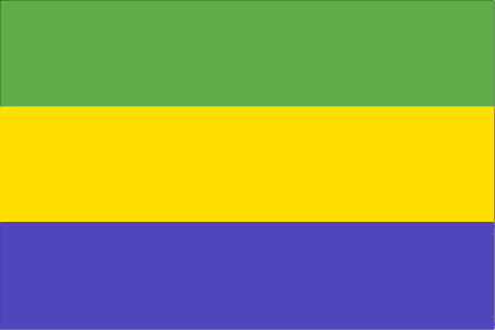
Gabon
Pays
Gabon
countryucasefr
GABON
Pays en Chinois
Pays en Espagnol
Gabón
Pays en Italien
Il Gabon
Pays en Portugais
Gabon
Pays en Allemand
Gabun
countrypy
jia1 peng2
countrylocal
Gabon
countryfull
Gabon
countrynm
Gabon
ISO2
GA
ISO3
GAB
countrycodeisono
266
countrycodevehicle
G
countrycodeolympic
GAB
countrycodeirs
GB
countrycodeirsfr
GB
countrycodeirsmixt
GB
♂Masulin
15
4
57
languagesfr
Français
119
currency
franc
currencyfr
franc C.F.A.
currencyisocode
XAF
currencyisocodefull
XAF 950
currencypxcode
XAF
currencysymbol
CFAF
currencysubdivision
100 centimes [*]
currencyregime
Euro (655.957)
currencyvalue
0.00186
nationalityfr
Française
Capitale
Libreville
capitalfr
Libreville
Préfixe Tél.
241
Superficie km2
267 667
arealand
257 667
areawater
10 000
landarablerate
0.0126
landforestrate
0.847
coastline
885
summit
Mont Iboudji 1 580 m.
boundarycountries
Guinée équatoriale, Cameroun, Congo.
timezonedeltabegin
1
flaglink
maplink
gacolor.gif
outlinemaplink
gaout.gif
visapassenger
-1
maincities
Port Gentil, Lambarené, Mouila, Tchibanga, Oyem.
largestcity
Libreville
largestcitypopulation
419 000
rankpopulation
148
Population
1 344 000
rankgdp
111
gdp
6057000000
rankgdpppp
131
gdpppp
8600000000
rankgni
124
gni
4489000000
rankincomeorigin
89
rankincome
99
income
3340
rankincomeppp
110
incomeppp
5500
lifeexpectation
56.46
alphabetizationrate
0.71
natalityrate
0.0364
mortalityrate
0.01143
mortalityrateinfantile
0.05434
hdi
0.653
urbanization
0.823
precipitation
2841
nationalevent
Founding of the Gabonese Democratic Party (PDG)
nationaleventfr
Création du Parti Démocratique Gabonais
nationalholiday
12 March (1968)
Date de naissance aaaa-mm-jj
1968-03-12 00:00:00
5
9
location
Western Africa, bordering the Atlantic Ocean at the Equator, between Republic of the Congo and Equatorial Guinea
terrain
narrow coastal plain; hilly interior; savanna in east and south
naturalresources
petroleum, manganese, uranium, gold, timber, iron
9
Web
rgbback
16777215
todate
1
2
id
Pays
Pays en Anglais
Gambia, The
Pays
Gambie
countryucasefr
GAMBIE
Pays en Chinois
Pays en Espagnol
Gambia
Pays en Italien
La Gambia
Pays en Portugais
Gambia
Pays en Allemand
Gambia
countrypy
gang1 bi3 ya4
countrylocal
The Gambia
countryfull
Gambia, The
countrynm
Gambia, The
ISO2
GM
ISO3
GMB
countrycodeisono
270
countrycodevehicle
WAG
countrycodeolympic
GAM
countrycodeirs
GA
countrycodeirsfr
GA
countrycodeirsmixt
GA
♀Féminin
15
4
51
languagesfr
Anglais
136
currency
dalasi
currencyfr
Dalasi
currencyisocode
GMD
currencyisocodefull
GMD 270
currencypxcode
GMD
currencysymbol
D
currencysubdivision
100 butut
currencyregime
float
currencyvalue
0.03663
nationalityfr
Gambienne
Capitale
Banjul
capitalfr
Banjul
Préfixe Tél.
220
Superficie km2
11 295
arealand
10 000
areawater
1 300
landarablerate
0.195
landforestrate
0.481
coastline
80
summit
53 m.
boundarycountries
Sénégal.
flaglink

maplink
gmcolor.gif
outlinemaplink
gmout.gif
visapassenger
-1
maincities
Serrekunda, Brikama, Bakau, Farafenni, Guntur, Sukuta.
largestcity
Banjul
largestcitypopulation
186 000
rankpopulation
146
Population
1 421 000
rankgdp
170
gdp
395000000
rankgdpppp
151
gdpppp
2641000000
rankgni
191
gni
387000000
rankincomeorigin
189
rankincome
203
income
270
rankincomeppp
169
incomeppp
1740
lifeexpectation
54.79
alphabetizationrate
0.3905
natalityrate
0.0403
mortalityrate
0.01208
mortalityrateinfantile
0.07348
hdi
0.463
urbanization
0.536
nationalevent
Independence Day
nationaleventfr
Jour de l'Indépendance
nationalholiday
18 February (1965)
Date de naissance aaaa-mm-jj
1965-02-18 00:00:00
2
6
location
Western Africa, bordering the North Atlantic Ocean and Senegal
terrain
flood plain of the Gambia River flanked by some low hills
naturalresources
fish
9
Web
rgbback
16777215
todate
1
3
id
Pays
Pays en Anglais
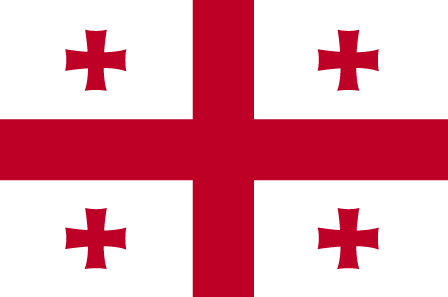
Georgia
Pays
Géorgie
countryucasefr
GEORGIE
Pays en Chinois
Pays en Espagnol
Georgia
Pays en Italien
Georgia
Pays en Portugais
Geórgia
Pays en Allemand
Georgia
countrypy
ge2 lu3 ji2 ya4
countrylocal
Sak'art'velo
countryfull
Georgia
countrynm
Georgia
ISO2
GE
ISO3
GEO
countrycodeisono
268
countrycodevehicle
GE
countrycodeolympic
GEO
countrycodeirs
GG
countrycodeirsfr
GG
countrycodeirsmixt
GG
♀Féminin
15
6
72
languagesfr
Géorgien
137
currency
lari
currencyfr
rouble
currencyisocode
GEL
currencyisocodefull
GEL 981
currencypxcode
GEL
currencysubdivision
100 tetri
currencyregime
float
nationalityfr
Georgienne
Capitale
Tbilisi
capitalfr
Tbilissi
Préfixe Tél.
995
Superficie km2
69 700
arealand
69 700
landarablerate
0.1121
landforestrate
0.437
coastline
310
summit
Mt'a Mqinvartsveri 5 048 m.
boundarycountries
Russie, Azerbaïdjan, Arménie, Turquie.
timezonedeltabegin
3
flaglink
maplink
gg-map.gif
outlinemaplink
ge.gif
visapassenger
-1
maincities
Kutaisi, Sukhumi, Rustavi, Batumi, Poti, Tskhinvali, Chiatura, Gori.
largestcity
Tbilisi
largestcitypopulation
1 342 000
rankpopulation
109
Population
5 126 000
rankgdp
128
gdp
3988000000
rankgdpppp
116
gdpppp
13264000000
rankgni
130
gni
3934000000
rankincomeorigin
147
rankincome
161
income
770
rankincomeppp
148
incomeppp
2610
lifeexpectation
64.67
natalityrate
0.01148
mortalityrate
0.01461
mortalityrateinfantile
0.05181
precipitation
498
nationalevent
Independence Day
nationaleventfr
Jour de l'Indépendance
nationalholiday
26 May (1918)
Date de naissance aaaa-mm-jj
1918-05-26 00:00:00
5
7
location
Southwestern Asia, bordering the Black Sea, between Turkey and Russia
terrain
largely mountainous with Great Caucasus Mountains in the north and Lesser Caucasus Mountains in the south; Kolkhet'is Dablobi (Kolkhida Lowland) opens to the Black Sea in the west; Mtkvari River Basin in the east; good soils in river valley flood plains, foothills of Kolkhida Lowland
naturalresources
forests, hydropower, manganese deposits, iron ore,
7
rgbback
16777215
todate
1
4
id
Pays
Pays en Anglais
South Georgia and the South Sandwich Islands
Pays
Georgie du Sud
countryucasefr
GEORGIE DU SUD
Pays en Chinois
Pays en Espagnol
Georgia Del sur
Pays en Italien
Georgia Del sud
Pays en Portugais
Geórgia Sul
Pays en Allemand
SüdcGeorgia
countryfull
South Georgia and the South Sandwich Islands
countrynm
South Georgia and the South Sandwich Islands
ISO2
GS
ISO3
SGS
countrycodeisono
239
countrycodeirs
SX
countrycodeirsfr
SX
countrycodeirsmixt
SX
♀Féminin
12
6
51
22
currencypxcode
GBP
nationalityfr
Georgienne
Capitale
Grytviken
capitalfr
Grytviken
Superficie km2
4 066
arealand
3 903
timezonedeltabegin
-2
flaglink
maplink
sx-map.jpg
visapassenger
-1
largestcity
Grytviken
rankincome
222
nationalevent
Liberation Day
nationaleventfr
Jour de la Libération
nationalholiday
14 June (1982)
Date de naissance aaaa-mm-jj
1982-06-14 00:00:00
9
11
location
Southern South America, islands in the South Atlantic Ocean, east of the tip of South America
terrain
most of the islands, rising steeply from the sea, are rugged and mountainous; South Georgia is largely barren and has steep, glacier-covered mountains; the South Sandwich Islands are of volcanic origin with some active volcanoes
naturalresources
fish
cooking
A group of British-administered volcanic islands in the southern Atlantic Ocean east-southeast of Cape Horn. Part of the Falkland Islands Dependency, the islands were discovered in 1775.
7
rgbback
16777215
todate
1
5
id
Pays
Pays en Anglais
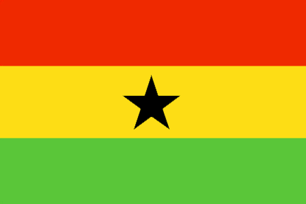
Ghana
Pays
Ghana
countryucasefr
GHANA
Pays en Chinois
Pays en Espagnol
Ghana
Pays en Italien
Il Ghana
Pays en Portugais
Ghana
Pays en Allemand
Ghana
countrypy
jia1 na4
countrylocal
Ghana
countryfull
Ghana
countrynm
Ghana
ISO2
GH
ISO3
GHA
countrycodeisono
288
countrycodevehicle
GH
countrycodeolympic
GHA
countrycodeirs
GH
countrycodeirsfr
GH
countrycodeirsmixt
GH
♂Masulin
19
6
51
languagesfr
Anglais
41
currency
new cedi
currencyfr
cedi
currencyisocode
GHC
currencyisocodefull
GHC 288
currencypxcode
GHC
currencysymbol
¢
currencysubdivision
100 psewas
currencyregime
float
currencyvalue
0.00011
Capitale
Accra
capitalfr
Accra
Préfixe Tél.
233
Superficie km2
238 538
arealand
230 940
areawater
8 520
landarablerate
0.1582
landforestrate
0.278
coastline
539
summit
Afadjoto 885 m.
boundarycountries
Côte d'Ivoire, Togo, Burkina Faso.
flaglink
maplink
ghcolor.gif
outlinemaplink
ghout.gif
visapassenger
-1
maincities
Kumasi, Tamale, Tema, Secondi-Takoradi, Cape Coast, Koforidua, Sunyani, Ho.
largestcity
Accra
largestcitypopulation
1 673 000
rankpopulation
48
Population
20 669 000
rankgdp
100
gdp
7624000000
rankgdpppp
70
gdpppp
46253000000
rankgni
107
gni
6548000000
rankincomeorigin
181
rankincome
195
income
320
rankincomeppp
155
incomeppp
2190
lifeexpectation
56.53
alphabetizationrate
0.603
natalityrate
0.02584
mortalityrate
0.01053
mortalityrateinfantile
0.05302
hdi
0.548
nationalevent
Independence Day
nationaleventfr
Jour de l'Indépendance
nationalholiday
6 March (1957)
Date de naissance aaaa-mm-jj
1957-03-06 00:00:00
4
10
location
Western Africa, bordering the Gulf of Guinea, between Cote d'Ivoire and Togo
terrain
mostly low plains with dissected plateau in south-central area
naturalresources
gold, timber, industrial diamonds, bauxite, mangan
cooking
Fruits de Mer
9
Web
rgbback
16777215
todate
1
Notes
Fruits de Mer
6
id
Pays
Pays en Anglais
Gibraltar
Pays
Gibraltar
countryucasefr
GIBRALTAR
Pays en Chinois
Pays en Espagnol
Gibraltar
Pays en Italien
La Gibilterra
Pays en Portugais
Gibraltar
Pays en Allemand
Gibraltar
countryfull
Gibraltar
countrynm
Gibraltar
ISO2
GI
ISO3
GIB
countrycodeisono
292
countrycodevehicle
GBZ
countrycodeirs
GI
countrycodeirsfr
GI
countrycodeirsmixt
GI
♂Masulin
12
6
51
42
currency
pound
currencyfr
livre sterling
currencyisocode
GIP
currencyisocodefull
GIP 292
currencypxcode
GIP
currencysymbol
£G
currencysubdivision
100 pence
currencyregime
British Pound (1.0)
currencyvalue
1.8345
Capitale
Gibraltar
capitalfr
Gibraltar
Préfixe Tél.
350
Superficie km2
6
arealand
6,50
coastline
12
timezonedeltabegin
1
flaglink
maplink
gi-map.gif
outlinemaplink
gi.gif
visapassenger
-1
largestcity
Gibraltar
rankpopulation
212
Population
27 578
rankgni
188
gni
450000000
rankincomeorigin
34
rankincome
35
income
15517
nationalevent
National Day
nationaleventfr
Jour National
nationalholiday
10 September (1967
Date de naissance aaaa-mm-jj
1967-09-10 00:00:00
4
8
president
Reine Elizabeth II
location
Southwestern Europe, bordering the Strait of Gibraltar, which links the Mediterranean Sea and the North Atlantic Ocean, on the southern coast of Spain
terrain
a narrow coastal lowland borders the Rock of Gibraltar
naturalresources
NEGL
7
rgbback
16777215
todate
1
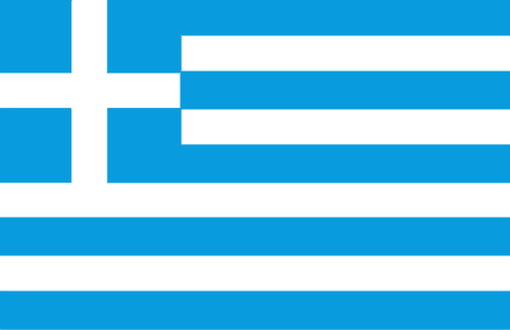
7
id
Pays
Pays en Anglais
Greece
Pays
Grèce
countryucasefr
GRECE
Pays en Chinois
Pays en Espagnol
Grecia
Pays en Italien
La Grecia
Pays en Portugais
Greece
Pays en Allemand
Griechenland
countrypy
xi1 la4
countrylocal
Ellas, Ellada
countryfull
Greece
countrynm
Greece
ISO2
GR
ISO3
GRC
countrycodeisono
300
countrycodevehicle
GR
countrycodeolympic
GRE
countrycodeirs
GR
countrycodeirsfr
GR
countrycodeirsmixt
GR
countrycode
30
♀Féminin
1
16
6
77
languagesfr
Grec
2
currency
euro
currencyfr
euro
currencyisocode
EUR
currencyisocodefull
EUR 978
currencypxcode
EUR
currencysymbol
€
currencysubdivision
100 cents
currencyregime
float
currencyvalue
1.2203
nationalityfr
Greque
Capitale
Athens
capitalfr
Athènes
Préfixe Tél.
30
Superficie km2
132 000
arealand
130 800
areawater
1 140
landarablerate
0.2212
landforestrate
0.279
coastline
13676
summit
Olimbos 2 917 m.
boundarycountries
Albanie, Macédoine, Bulgarie, Turquie
timezonedeltabegin
2
flaglink
maplink
greekisl.gif
outlinemaplink
gr.gif
maincities
Thessalonike, Le Pirée, Patras, Lárissa, Iraklio, Vólos, Kavala, La Canée, Sérrai.
largestcity
Athens
largestcitypopulation
3 093 000
rankpopulation
69
Population
11 033 000
rankgdp
27
gdp
172203000000
rankgdpppp
36
gdpppp
220148000000
rankgni
28
gni
145970000000
rankincomeorigin
45
rankincome
44
income
13230
rankincomeppp
40
incomeppp
19900
lifeexpectation
78.94
alphabetizationrate
0.9745
natalityrate
0.00973
fecondity
1.37
mortalityrate
0.01008
mortalityrateinfantile
0.00563
hdi
0.892
urbanization
0.603
precipitation
371
nationalevent
Independence Day
nationaleventfr
Jour de l'Indépendance
nationalholiday
25 March (1821)
Date de naissance aaaa-mm-jj
1821-03-25 00:00:00
8
6
location
Southern Europe, bordering the Aegean Sea, Ionian Sea, and the Mediterranean Sea, between Albania and Turkey
terrain
mostly mountains with ranges extending into the sea as peninsulas or chains of islands
naturalresources
bauxite, lignite, magnesite, petroleum, marble, hy
cooking
Fruits de Mer
7
Web
rgbback
16777215
todate
1
Notes
Fruits de Mer
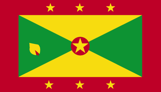
8
id
Pays
Pays en Anglais
Grenada
Pays
Grenade
countryucasefr
GRENADE
Pays en Chinois
Pays en Espagnol
Grenada
Pays en Italien
La Granada
Pays en Portugais
Grenada
Pays en Allemand
Grenada
countryfull
Grenada
countrynm
Grenada
ISO2
GD
ISO3
GRD
countrycodeisono
308
countrycodevehicle
WG
countrycodeolympic
GRN
countrycodeirs
GJ
countrycodeirsfr
GJ
countrycodeirsmixt
GJ
12
6
51
languagesfr
Anglais
35
currency
dollar
currencyfr
dollar des Caraïbes orientales
currencyisocode
XCD
currencyisocodefull
XCD 951
currencypxcode
XCD
currencysymbol
EC$
currencysubdivision
100 cents
currencyregime
US-$ (2.7)
currencyvalue
0.3745
Capitale
Saint George's
capitalfr
Saint-George's
Préfixe Tél.
1-473
Superficie km2
344
arealand
344
landarablerate
0.0588
landforestrate
0.147
coastline
121
summit
Mount Saint Catherine 840 m.
timezonedeltabegin
-4
flaglink
maplink
gdcolor.gif
outlinemaplink
gd.gif
visapassenger
-1
maincities
Gouyave, Hillsborough, Grenville, Sauteurs, Grand Roy.
largestcity
St George
largestcitypopulation
33 000
rankpopulation
187
Population
105 000
rankgdp
169
gdp
439000000
rankgdpppp
159
gdpppp
833000000
rankgni
190
gni
388000000
rankincomeorigin
85
rankincome
94
income
3710
rankincomeppp
89
incomeppp
7030
lifeexpectation
64.52
alphabetizationrate
0.98
natalityrate
0.02261
fecondity
2.5
mortalityrate
0.00731
mortalityrateinfantile
0.01462
hdi
0.738
nationalevent
Independence Day
nationaleventfr
Jour de l'Indépendance
nationalholiday
7 February (1974)
Date de naissance aaaa-mm-jj
1974-02-07 00:00:00
1
3
location
Caribbean, island between the Caribbean Sea and Atlantic Ocean, north of Trinidad and Tobago
terrain
volcanic in origin with central mountains
naturalresources
timber, tropical fruit, deepwater harbors
9
Web
rgbback
16777215
todate
1
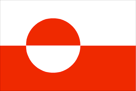
9
id
Pays
Pays en Anglais
Greenland
Pays
Groënlande
countryucasefr
GROENLANDE
Pays en Chinois
Pays en Espagnol
Groenlandia
Pays en Italien
La Groenlandia
Pays en Portugais
Greenland
Pays en Allemand
Grönland
countrypy
ge2 ling2 lan2
countrylocal
Kalaallit Nunaat, Grønland
countryfull
Greenland
countrynm
Greenland
ISO2
GL
ISO3
GRL
countrycodeisono
304
countrycodeirs
GL
countrycodeirsfr
GL
countrycodeirsmixt
GL
♀Féminin
18
6
38
languagesfr
Groenlandais, Danois.
33
currency
krone (pl. kroner)
currencyfr
krone
currencyisocode
DKK
currencyisocodefull
DKK 208
currencypxcode
DKK
currencysymbol
Dkr
currencysubdivision
100 øre
currencyregime
EMS-II
currencyvalue
0.164
nationalityfr
Norvégienne
Capitale
Nuuk
capitalfr
Nuuk
Préfixe Tél.
299
Superficie km2
2 175 600
arealand
2 166 086
coastline
44087
summit
Gunnbjørns Fjeld 3 733 m.
timezonedeltabegin
-3
flaglink
maplink
glcolor.gif
outlinemaplink
glout.gif
visapassenger
-1
maincities
Daugavpils, Liepaja, Jelgava, Jurmala, Ventspils, Rezekne.
largestcity
Nuuk
rankpopulation
199
Population
56 000
rankgni
165
gni
1080000000
rankincomeorigin
26
rankincome
27
income
19286
lifeexpectation
69.32
natalityrate
0.01596
mortalityrate
0.0077
mortalityrateinfantile
0.01631
urbanization
0.823
nationalevent
Longest day
nationaleventfr
Jour de Solstice
nationalholiday
June 21
Date de naissance aaaa-mm-jj
2000-06-21 00:00:00
7
5
location
Northern North America, island between the Arctic Ocean and the North Atlantic Ocean, northeast of Canada
terrain
flat to gradually sloping icecap covers all but a narrow, mountainous, barren, rocky coast
naturalresources
zinc, lead, iron ore, coal, molybdenum, gold, plat
9
rgbback
16777215
todate
1
10
id
Pays
Pays en Anglais
Guadeloupe
Pays
Guadeloupe
countryucasefr
GUADELOUPE
Pays en Chinois
Pays en Espagnol
Guadalupe
Pays en Italien
La Guadalupa
Pays en Portugais
Guadalupe
Pays en Allemand
Guadeloupe
countryfull
Guadeloupe
countrynm
Guadeloupe
ISO2
GP
ISO3
GLP
countrycodeisono
312
countrycodeirs
GP
countrycodeirsfr
GP
countrycodeirsmixt
GP
♀Féminin
15
6
57
languagesfr
Français
2
currency
euro
currencyfr
euro
currencyisocode
EUR
currencyisocodefull
EUR 978
currencypxcode
EUR
currencysymbol
€
currencysubdivision
100 cents
currencyregime
float
currencyvalue
1.2203
nationalityfr
Française
Capitale
Pointe à Pitre
capitalfr
Pointe à Pitre
Préfixe Tél.
590
Superficie km2
1 780
arealand
1 706
areawater
74
landarablerate
0.1065
landforestrate
0.485
coastline
306
summit
Soufrière 1 467 m.
timezonedeltabegin
-4
flaglink
maplink
gpcolor.gif
outlinemaplink
gp.gif
visapassenger
-1
maincities
Abymes, Pointe-à-Pitre, Le Gosier, Sainte Anne, Moule, Morne-à-l'Eau, Petit Bourg, Sainte Rose, Saint Claude
largestcity
Pointe à Pitre
rankpopulation
169
Population
435 739
rankgni
130
gni
3640000000
rankincomeorigin
62
rankincome
63
income
7913
lifeexpectation
77.71
alphabetizationrate
0.9
natalityrate
0.01579
mortalityrate
0.00605
mortalityrateinfantile
0.00883
urbanization
0.996
nationalevent
Bastille Day
nationaleventfr
Jour de la prise de la Bastille
nationalholiday
14 July (1789)
Date de naissance aaaa-mm-jj
1789-07-14 00:00:00
6
10
location
Caribbean, islands between the Caribbean Sea and the North Atlantic Ocean, southeast of Puerto Rico
terrain
Basse-Terre is volcanic in origin with interior mountains; Grande-Terre is low limestone formation; most of the seven other islands are volcanic in origin
naturalresources
cultivable land, beaches and climate that foster t
2
Web
rgbback
16777215
todate
1
| Pays/Territoires | Régions en Chine | Provinces de Chine | Régions en France | Départements de France | Provinces du Monde | Villes/Villages | Localités | Continents du Monde | Vins AOP
