Pays/Territoires
Mise à jour 2021-01-12 18:58:07
Les noms des pays/territoires du monde sont donnés en Français et Chinois. Cette collection des précieuses terres fermes du monde que toute l'humanité partage inclut non seulement les pays indépendants, mais aussi des régions spécifiques qui ne sont pas membre de l'ONUOrganisation des Nations Unies: Nous, peuples des Nations Unies ... Une ONU plus forte pour un monde meilleur. Veuillez aussi consulter les noms des pays en masculin et féminin en Français.
GéoPays Fermer
11
id
Pays
Pays en Anglais
Morocco
Pays
Maroc
countryucasefr
MAROC
Pays en Chinois
Pays en Espagnol
Marruecos
Pays en Italien
Il Marocco
Pays en Portugais
Marrocos
Pays en Allemand
Marokko
countrypy
mo2 luo4 ge1
countrylocal
Al Maghrib
countryfull
Morocco
countrynm
Morocco
ISO2
MA
ISO3
MAR
countrycodeisono
504
countrycodevehicle
MA
countrycodeolympic
MAR
countrycodeirs
MO
countrycodeirsfr
MO
countrycodeirsmixt
MO
countrycode
212
♂Masulin
12
6
3
languagesfr
Arabe
121
currency
dirham
currencyfr
dirham
currencyisocode
MAD
currencyisocodefull
MAD 504
currencypxcode
MAD
currencysymbol
DH
currencysubdivision
100 centimes
currencyregime
composite
currencyvalue
0.1111
nationalityfr
Marocaine
Capitale
Rabat
capitalfr
Rabat
Préfixe Tél.
212
Superficie km2
446 550
arealand
446 300
areawater
250
landarablerate
0.2012
landforestrate
0.068
coastline
1835
summit
Jebel Toubkal 4 165 m.
boundarycountries
Algérie, Sahara occidental.
flaglink
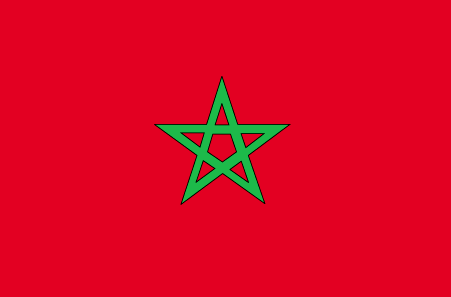
maplink
macolor.gif
outlinemaplink
maout.gif
visapassenger
-1
maincities
Casablanca, Marrakech, Fès, Oujda, Kenitra, Tetouan, Safi, Meknès, Agadir, Tanger.
largestcity
Casablanca
largestcitypopulation
3 101 000
rankpopulation
37
Population
30 113 000
rankgdp
56
gdp
43727000000
rankgdpppp
53
gdpppp
120578000000
rankgni
57
gni
39367000000
rankincomeorigin
128
rankincome
140
income
1310
rankincomeppp
132
incomeppp
3940
lifeexpectation
70.35
alphabetizationrate
0.5085
natalityrate
0.02279
mortalityrate
0.00571
mortalityrateinfantile
0.04325
hdi
0.606
urbanization
0.551
precipitation
426
nationalevent
Throne Day (accession of King MOHAMED VI to the throne)
nationaleventfr
Jour du Tronc (accession du Roi MOHAMED VI au Tronc)
nationalholiday
30 July (1999)
Date de naissance aaaa-mm-jj
1999-07-30 00:00:00
6
4
location
Northern Africa, bordering the North Atlantic Ocean and the Mediterranean Sea, between Algeria and Western Sahara
terrain
northern coast and interior are mountainous with large areas of bordering plateaus, intermontane valleys, and rich coastal plains
naturalresources
phosphates, iron ore, manganese, lead, zinc, fish,
cooking
Tagines.
7
Web
rgbback
16777215
todate
1
Notes
Tagines.
Nation de suprême intelligence, le Lapin de Terre a inventé les chiffres numériques 0,1,2,3,4,5,6,7,8,9, algèbre, mathématiques.
12
id
Pays
Pays en Anglais
Marshall Islands
Pays
Marshall (îles)
countryucasefr
MARSHALL (ILES)
Pays en Chinois
Pays en Espagnol
Forme Las Islas
Pays en Italien
Ordini Le Isole
Pays en Portugais
Marshall Consoles
Pays en Allemand
Marshall Inseln
countryfull
Marshall Islands
countrynm
Marshall Islands
ISO2
MH
ISO3
MHL
countrycodeisono
584
countrycodeolympic
MHL
countrycodeirs
RM
countrycodeirsfr
RM
countrycodeirsmixt
RM
♀Féminin
19
6
51
languagesfr
Anglais
1
currencyfr
dollar
currencysymbol
$
Capitale
Majuro
capitalfr
Uliga
Préfixe Tél.
692
Superficie km2
181,30
arealand
181,30
landarablerate
0.1667
coastline
370.4
summit
10 m.
timezonedeltabegin
12
flaglink
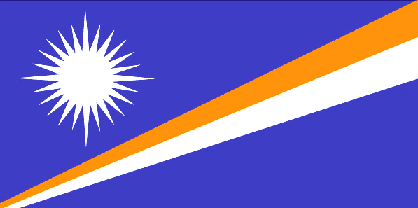
maplink
mhcolor.gif
outlinemaplink
mh.gif
visapassenger
-1
maincities
Ebeye
largestcity
Majuro
largestcitypopulation
28 000
rankpopulation
200
Population
53 000
rankgdp
183
gdp
106000000
rankgni
205
gni
142000000
rankincomeorigin
96
rankincome
106
income
2710
lifeexpectation
70.01
alphabetizationrate
0.937
natalityrate
0.03352
fecondity
4.02
mortalityrate
0.00488
mortalityrateinfantile
0.02945
growthrate
0.02274
hdi
0.738
urbanization
0.6618
nationalevent
Constitution Day
nationaleventfr
Jour de la Constitution
nationalholiday
1 May (1979)
Date de naissance aaaa-mm-jj
1979-05-01 00:00:00
6
8
location
Oceania, group of atolls and reefs in the North Pacific Ocean, about one-half of the way from Hawaii to Australia
terrain
low coral limestone and sand islands
naturalresources
coconut products, marine products, deep seabed min
9
rgbback
16777215
todate
1
13
id
Pays
Pays en Anglais
Martinique
Pays
Martinique
countryucasefr
MARTINIQUE
Pays en Chinois
Pays en Espagnol
Martinica
Pays en Italien
La Martinica
Pays en Portugais
Martinica
Pays en Allemand
Martinique
countrypy
ma3 ding1 ni2 ke4 dao3
countrylocal
Martinique
countryfull
Martinique
countrynm
Martinique
ISO2
MQ
ISO3
MTQ
countrycodeisono
474
countrycodeirs
MB
countrycodeirsfr
MB
countrycodeirsmixt
MB
♀Féminin
15
6
57
languagesfr
Français
2
currency
euro
currencyfr
Euro
currencyisocode
EUR
currencyisocodefull
EUR 978
currencypxcode
EUR
currencysymbol
€
currencysubdivision
100 cents
currencyregime
float
currencyvalue
1.2203
nationalityfr
Martinicaise
Capitale
Fort-de-France
capitalfr
Fort-de-France
Préfixe Tél.
596
Superficie km2
1 079
arealand
1 060
areawater
40
landarablerate
0.0943
landforestrate
0.439
coastline
350
summit
Montagne Pelée 1 397 m.
timezonedeltabegin
-4
flaglink
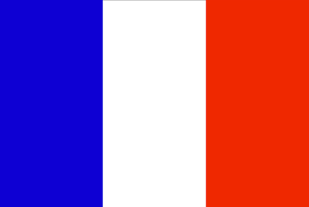
maplink
mqcolor.gif
outlinemaplink
mq.gif
visapassenger
-1
maincities
Le Lamentin, Sainte Marie, Schoelcher, Le François, La Trinité, Saint Pierre, Ducos
largestcity
Fort-de-France
rankpopulation
172
Population
422 277
rankgni
117
gni
5080000000
rankincomeorigin
45
rankincome
45
income
13026
lifeexpectation
78.88
alphabetizationrate
0.976
natalityrate
0.01456
mortalityrate
0.00643
mortalityrateinfantile
0.00727
urbanization
0.97
nationalevent
Bastille Day
nationaleventfr
Jour de la prise de la Bastille
nationalholiday
14 July (1789)
Date de naissance aaaa-mm-jj
1789-07-14 00:00:00
6
10
location
Caribbean, island between the Caribbean Sea and North Atlantic Ocean, north of Trinidad and Tobago
terrain
mountainous with indented coastline; dormant volcano
naturalresources
coastal scenery and beaches, cultivable land
cooking
Cuisine des Îles, Alcool fort.
2
Web
rgbback
16777215
todate
1
Notes
Cuisine des Îles, Alcool fort.
14
id
Pays
Pays en Anglais
Mauritius
Pays
Maurice (îles)
countryucasefr
MAURICE (ILES)
Pays en Chinois
Pays en Espagnol
Isla Mauricio
Pays en Italien
L'isola Maurizio
Pays en Portugais
Mauritius
Pays en Allemand
Mauritius
countrypy
mao2 li3 qiu2 si1
countrylocal
Mauritius
countryfull
Mauritius
countrynm
Mauritius
ISO2
MU
ISO3
MUS
countrycodeisono
480
countrycodevehicle
MS
countrycodeolympic
MRI
countrycodeirs
MP
countrycodeirsfr
MP
countrycodeirsmixt
MP
♀Féminin
18
6
51
languagesfr
Anglais
68
currency
rupee
currencyfr
roupie mauricienne
currencyisocode
MUR
currencyisocodefull
MUR 480
currencypxcode
MUR
currencysymbol
Mau Rs
currencysubdivision
100 cents
currencyregime
composite
currencyvalue
0.03458
nationalityfr
Mauricienne
Capitale
Port Louis
capitalfr
Port-Louis
Préfixe Tél.
230
Superficie km2
1 865
arealand
2 030
areawater
10
landarablerate
0.4926
landforestrate
0.079
coastline
177
summit
Piton de la Petite Rivière Noire 826 m.
timezonedeltabegin
4
flaglink
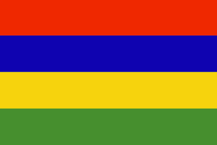
maplink
mucolor.gif
outlinemaplink
muout.gif
visapassenger
-1
maincities
Beau Bassin, Quatre Bornes, Curepipe, Vacoas-Phoenix, Rose Hill, Mahébourg.
largestcity
Port Louis
largestcitypopulation
165 000
rankpopulation
150
Population
1 222 000
rankgdp
117
gdp
5224000000
rankgdpppp
114
gdpppp
13795000000
rankgni
119
gni
5009000000
rankincomeorigin
78
rankincome
86
income
4100
rankincomeppp
68
incomeppp
11280
lifeexpectation
72.09
alphabetizationrate
0.8535
natalityrate
0.01585
mortalityrate
0.00682
mortalityrateinfantile
0.01557
hdi
0.779
urbanization
0.616
precipitation
1793
nationalevent
Independence Day
nationaleventfr
Jour de l'Indépendance
nationalholiday
12 March (1968)
Date de naissance aaaa-mm-jj
1968-03-12 00:00:00
5
9
location
Southern Africa, island in the Indian Ocean, east of Madagascar
terrain
small coastal plain rising to discontinuous mountains encircling central plateau
naturalresources
arable land, fish
9
Web
rgbback
16777215
todate
1
15
id
Pays
Pays en Anglais
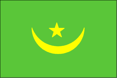
Mauritania
Pays
Mauritanie
countryucasefr
MAURITANIE
Pays en Chinois
Pays en Espagnol
Mauritania
Pays en Italien
La Mauritania
Pays en Portugais
Mauritânia
Pays en Allemand
Mauretanien
countrypy
mao2 li4 ta3 ni2 ya4
countrylocal
Muritaniyah
countryfull
Mauritania
countrynm
Mauritania
ISO2
MR
ISO3
MRT
countrycodeisono
478
countrycodevehicle
RIM
countrycodeolympic
MTN
countrycodeirs
MR
countrycodeirsfr
MR
countrycodeirsmixt
MR
♀Féminin
15
4
3
languagesfr
Arabe, Français
123
currency
ouguiya
currencyfr
ougiya
currencyisocode
MRO
currencyisocodefull
MRO 478
currencypxcode
MRO
currencysymbol
UM
currencysubdivision
5 khoums
currencyregime
composite
currencyvalue
0.0038
nationalityfr
Mauritanienne
Capitale
Nouakchott
capitalfr
Nouakchott
Préfixe Tél.
222
Superficie km2
1 030 700
arealand
1 030 400
areawater
300
landarablerate
0.0048
landforestrate
0.003
coastline
754
summit
Kediet Ijill 915 m.
boundarycountries
Sahara occidental, Algérie, Mali, Sénégal.
flaglink
maplink
mrcolor.gif
outlinemaplink
mrout.gif
visapassenger
-1
maincities
Nouadhibou, Kaédi, Zouerate, Rosso, Atar, Kiffa, Sélibaby, Néma.
largestcity
Nouakchott
largestcitypopulation
694 000
rankpopulation
134
Population
2 848 000
rankgdp
154
gdp
1093000000
rankgdpppp
140
gdpppp
5029000000
rankgni
167
gni
1142000000
rankincomeorigin
173
rankincome
187
income
400
rankincomeppp
163
incomeppp
1870
lifeexpectation
51.93
alphabetizationrate
0.34
natalityrate
0.04216
mortalityrate
0.01304
mortalityrateinfantile
0.0738
nationalevent
Independence Day
nationaleventfr
Jour de l'Indépendance
nationalholiday
28 November (1960)
Date de naissance aaaa-mm-jj
1960-11-28 00:00:00
7
1
location
Northern Africa, bordering the North Atlantic Ocean, between Senegal and Western Sahara
terrain
mostly barren, flat plains of the Sahara; some central hills
naturalresources
iron ore, gypsum, copper, phosphate, diamonds, gol
9
Web
rgbback
16777215
todate
1
16
id
Pays
Pays en Anglais
Mayotte
Pays
Mayotte
countryucasefr
MAYOTTE
Pays en Chinois
Pays en Espagnol
Mayotte
Pays en Italien
Mayotte
Pays en Portugais
Mayotte
Pays en Allemand
Mayotte
countryfull
Mayotte
countrynm
Mayotte
ISO2
YT
ISO3
MYT
countrycodeisono
175
countrycodeirs
MF
countrycodeirsfr
MF
countrycodeirsmixt
MF
♀Féminin
15
6
57
2
currencypxcode
EUR
Capitale
Mamoutzou
capitalfr
Mamoutzou
Préfixe Tél.
269
Superficie km2
374
arealand
374
coastline
185.2
timezonedeltabegin
3
flaglink

maplink
kmcolor.gif
outlinemaplink
kmout.gif
visapassenger
-1
largestcity
Mamoutzou
rankpopulation
179
Population
166 000
rankgni
189
gni
420000000
rankincomeorigin
103
rankincome
108
income
2471
lifeexpectation
60.99
natalityrate
0.04219
mortalityrate
0.00811
mortalityrateinfantile
0.06419
growthrate
0.04087
urbanization
0.7
nationalevent
Bastille Day
nationaleventfr
Jour de la prise de la Bastille
nationalholiday
14 July (1789)
Date de naissance aaaa-mm-jj
1789-07-14 00:00:00
6
10
location
Southern Africa, island in the Mozambique Channel, about one-half of the way from northern Madagascar to northern Mozambique
terrain
generally undulating, with deep ravines and ancient volcanic peaks
naturalresources
NEGL
3
rgbback
16777215
todate
1
17
id
Pays
Pays en Anglais
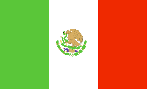
Mexico
Pays
Mexique
countryucasefr
MEXIQUE
Pays en Chinois
Pays en Espagnol
México
Pays en Italien
Il Messico
Pays en Portugais
México
Pays en Allemand
Mexiko
countrypy
mo4 xi1 ge1
countrylocal
Estados Unidos Mexicanos
countryfull
Mexico
countrynm
Mexico
ISO2
MX
ISO3
MEX
countrycodeisono
484
countrycodevehicle
MEX
countrycodeolympic
MEX
countrycodeirs
MX
countrycodeirsfr
MX
countrycodeirsmixt
MX
countrycode
52
♂Masulin
7
131
languagesfr
Espagnol
69
currency
peso
currencyfr
peso mexicain
currencyisocode
MXN
currencyisocodefull
MXN 484
currencypxcode
MXN
currencysymbol
Mex$
currencysubdivision
100 centavos
currencyregime
float
currencyvalue
0.09239
nationalityfr
Mexicaine
Capitale
Mexico City
capitalfr
Mexico
Préfixe Tél.
52
Superficie km2
1 972 547
arealand
1 923 040
areawater
49 510
landarablerate
0.132
landforestrate
0.289
coastline
9330
summit
Citlaltépelt 5 700 m.
boundarycountries
Etats-Unis, Guatémala, Bélize.
timezonedeltabegin
-6
flaglink
maplink
mxcolor.gif
outlinemaplink
mxout.gif
visapassenger
-1
maincities
Guadalajara, Monterrey, Zaragoza, León, Ciudad Juárez, Culiacán, Mexicali, Tijuana, Mérida, Acapulco, Chihuahua, San Luis Potosî, Hermosillo
largestcity
Mexico City
largestcitypopulation
16 562 000
rankpopulation
11
Population
102 291 000
rankgdp
10
gdp
626080000000
rankgdpppp
12
gdpppp
937836000000
rankgni
10
gni
637159000000
rankincomeorigin
68
rankincome
75
income
6230
rankincomeppp
80
incomeppp
8980
lifeexpectation
74.94
alphabetizationrate
0.917
natalityrate
0.02144
mortalityrate
0.00473
mortalityrateinfantile
0.02169
hdi
0.8
precipitation
848
nationalevent
Independence Day
nationaleventfr
Jour de l'Indépendance
nationalholiday
16 September (1810)
Date de naissance aaaa-mm-jj
1810-09-16 00:00:00
7
7
location
Middle America, bordering the Caribbean Sea and the Gulf of Mexico, between Belize and the US and bordering the North Pacific Ocean, between Guatemala and the US
terrain
high, rugged mountains; low coastal plains; high plateaus; desert
naturalresources
petroleum, silver, copper, gold, lead, zinc, natur
cooking
Spécialités très Epicées.
9
Web
rgbback
16777215
todate
1
Notes
Spécialités très Epicées.
18
id
Pays
Pays en Anglais
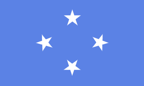
Micronesia, Federated States of
Pays
Micronésie
countryucasefr
MICRONESIE
Pays en Chinois
Pays en Espagnol
Micronesia, estados federados de
Pays en Italien
La Micronesia, condizioni federated di
Pays en Portugais
Micronesia, estados federados de
Pays en Allemand
Mikronesien, zu einem Bündnis vereingigte Zustände von
countryfull
Micronesia, Federated States of
countrynm
Micronesia, Federated States of
ISO2
FM
ISO3
FSM
countrycodeisono
583
countrycodeolympic
FSM
countrycodeirs
FM
countrycodeirsfr
FM
countrycodeirsmixt
FM
♀Féminin
19
7
51
languagesfr
Anglais
6
currency
dollar
currencyfr
dollar
currencyisocode
USD
currencyisocodefull
USD 840
currencypxcode
USD
currencysymbol
$
currencysubdivision
100 cents
currencyregime
float
currencyvalue
1
nationalityfr
Micronésienne
Capitale
Palikir
capitalfr
Palikir
Préfixe Tél.
691
Superficie km2
707
arealand
702
landarablerate
0.0571
landforestrate
0.217
coastline
6112
summit
Totolom 791 m.
timezonedeltabegin
10
flaglink
maplink
fmcolor.gif
outlinemaplink
fm.gif
visapassenger
-1
maincities
Pohnpei, Yap.
largestcity
Palikir
rankpopulation
184
Population
125 000
rankgdp
179
gdp
243000000
rankgni
198
gni
258000000
rankincomeorigin
109
rankincome
119
income
2070
lifeexpectation
69.44
alphabetizationrate
0.895
natalityrate
0.0258
fecondity
3.8
mortalityrate
0.00497
mortalityrateinfantile
0.03128
urbanization
0.286
nationalevent
Constitution Day
nationaleventfr
Jour de la Constitution
nationalholiday
10 May (1979)
Date de naissance aaaa-mm-jj
1979-05-10 00:00:00
6
8
location
Oceania, island group in the North Pacific Ocean, about three-quarters of the way from Hawaii to Indonesia
terrain
islands vary geologically from high mountainous islands to low, coral atolls; volcanic outcroppings on Pohnpei, Kosrae, and Chuuk
naturalresources
forests, marine products, deep-seabed minerals
9
rgbback
16777215
todate
1
19
id
Pays
Pays en Anglais
Middle East & North Africa
Pays
Middle East & North Africa
countryucasefr
Middle East & North Africa
Pays en Chinois
Pays en Espagnol
Middle East & North Africa
Pays en Italien
Middle East & North Africa
Pays en Portugais
Middle East & North Africa
Pays en Allemand
Middle East & North Africa
ISO2
MEA
ISO3
MEA
todate
1
20
id
Pays
Pays en Anglais
Middle East & North Africa (excluding high income)
Pays
Middle East & North Africa (excluding high income)
countryucasefr
Middle East & North Africa (excluding high income)
Pays en Chinois
Pays en Espagnol
Middle East & North Africa (excluding high income)
Pays en Italien
Middle East & North Africa (excluding high income)
Pays en Portugais
Middle East & North Africa (excluding high income)
Pays en Allemand
Middle East & North Africa (excluding high income)
ISO2
MNA
ISO3
MNA
todate
1
| Pays/Territoires | Régions en Chine | Provinces de Chine | Régions en France | Départements de France | Provinces du Monde | Villes/Villages | Localités | Continents du Monde | Vins AOP

