Pays/Territoires
Mise à jour 2021-01-12 18:58:07
Les noms des pays/territoires du monde sont donnés en Français et Chinois. Cette collection des précieuses terres fermes du monde que toute l'humanité partage inclut non seulement les pays indépendants, mais aussi des régions spécifiques qui ne sont pas membre de l'ONUOrganisation des Nations Unies: Nous, peuples des Nations Unies ... Une ONU plus forte pour un monde meilleur. Veuillez aussi consulter les noms des pays en masculin et féminin en Français.
GéoPays Fermer
11
id
Pays
Pays en Anglais
Tokelau
Pays
Tokelau
countryucasefr
TOKELAU
Pays en Chinois
Pays en Espagnol
Tokelau
Pays en Italien
Il Tokelau
Pays en Portugais
Tokelau
Pays en Allemand
Tokelau
countryfull
Tokelau
countrynm
Tokelau
ISO2
TK
ISO3
TKL
countrycodeisono
772
countrycodeirs
TL
countrycodeirsfr
TL
countrycodeirsmixt
TL
♂Masulin
18
6
51
75
currency
dollar
currencyisocode
NZD
currencyisocodefull
NZD 554
currencypxcode
NZD
currencysymbol
NZ$
currencysubdivision
100 cents
currencyregime
float
currencyvalue
0.6966
Préfixe Tél.
690
Superficie km2
10
arealand
10
coastline
101
timezonedeltabegin
-12
flaglink
maplink
tokelau.gif
visapassenger
-1
rankpopulation
228
Population
1 800
rankincome
222
nationalevent
Waitangi Day (Treaty of Waitangi established British sovereignty over New Zealand)
nationaleventfr
Jour Waitangi
nationalholiday
6 February (1840)
Date de naissance aaaa-mm-jj
1840-02-06 00:00:00
7
1
location
Oceania, group of three atolls in the South Pacific Ocean, about one-half of the way from Hawaii to New Zealand
terrain
low-lying coral atolls enclosing large lagoons
naturalresources
NEGL
cooking
Oceania, group of three atolls in the South Pacific Ocean, about one-half of the way from Hawaii to New Zealand
9
rgbback
16777215
todate
1
12
id
Pays
Pays en Anglais
Tonga
Pays
Tonga
countryucasefr
TONGA
Pays en Chinois
Pays en Espagnol
Tonga
Pays en Italien
La Tonga
Pays en Portugais
Tonga
Pays en Allemand
Tonga
countryfull
Tonga
countrynm
Tonga
ISO2
TO
ISO3
TON
countrycodeisono
776
countrycodeolympic
TGA
countrycodeirs
TN
countrycodeirsfr
TN
countrycodeirsmixt
TN
♀Féminin
12
4
202
languagesfr
Tongan, Anglais
160
currency
pa'anga
currencyfr
paanga
currencyisocode
TOP
currencyisocodefull
TOP 776
currencypxcode
TOP
currencysymbol
PT or T$
currencysubdivision
100 seniti
currencyregime
composite
currencyvalue
0.5262
Capitale
Nuku'alofa
capitalfr
Nukualofa
Préfixe Tél.
676
Superficie km2
748
arealand
718
areawater
30
landarablerate
0.2361
landforestrate
0.055
coastline
419
summit
1 033 m.
timezonedeltabegin
13
flaglink
maplink
tocolor.gif
outlinemaplink
to.gif
visapassenger
-1
maincities
Neiafu, Pangai.
largestcity
Nuku' alofa
largestcitypopulation
40 000
rankpopulation
188
Population
102 000
rankgdp
181
gdp
163000000
rankgdpppp
162
gdpppp
710000000
rankgni
204
gni
152000000
rankincomeorigin
123
rankincome
135
income
1490
rankincomeppp
91
incomeppp
6910
lifeexpectation
69.2
natalityrate
0.02487
fecondity
3.71
mortalityrate
0.00545
mortalityrateinfantile
0.01299
growthrate
0.011
urbanization
0.53
nationalevent
Independence Day
nationaleventfr
Jour de l'Indépendance
nationalholiday
4 June (1970)
Date de naissance aaaa-mm-jj
1970-06-04 00:00:00
7
11
location
Oceania, archipelago in the South Pacific Ocean, about two-thirds of the way from Hawaii to New Zealand
terrain
most islands have limestone base formed from uplifted coral formation; others have limestone overlying volcanic base
naturalresources
fish, fertile soil
9
rgbback
16777215
todate
1
13
id
Pays
Pays en Anglais
Trinidad and Tobago
Pays
Trinité-et-Tobago
countryucasefr
TRINITE-ET-TOBAGO
Pays en Chinois
Pays en Espagnol
Trinidad y Trinidad y Tobago
Pays en Italien
La Trinidad ed il Tobago
Pays en Portugais
Trinidad e tobago
Pays en Allemand
Trinidad und Tobago
countrypy
te4 li4 ni2 da2 he2 duo1 ba1 ge1
countrylocal
Trinidad and Tobago
countryfull
Trinidad and Tobago
countrynm
Trinidad and Tobago
ISO2
TT
ISO3
TTO
countrycodeisono
780
countrycodevehicle
TT
countrycodeolympic
TRI
countrycodeirs
TD
countrycodeirsfr
TD
countrycodeirsmixt
TD
18
6
51
languagesfr
Anglais
104
currency
dollar
currencyfr
dollar de la Trinité
currencyisocode
TTD
currencyisocodefull
TTD 780
currencypxcode
TTD
currencysymbol
TT$
currencysubdivision
100 cents
currencyregime
float
currencyvalue
0.1613
Capitale
Port-of-Spain
capitalfr
Port of Spain
Préfixe Tél.
1-868
Superficie km2
5 128
arealand
5 128
landarablerate
0.1462
landforestrate
0.505
coastline
362
summit
El Cerro del Aripo 940 m.
timezonedeltabegin
-4
flaglink
maplink
tt.jpg
outlinemaplink
trintbgo.gif
visapassenger
-1
maincities
San Fernando, Arima, Scarborough .
largestcity
Port of Spain
largestcitypopulation
52 000
rankpopulation
149
Population
1 313 000
rankgdp
92
gdp
10511000000
rankgdpppp
111
gdpppp
14132000000
rankgni
90
gni
10220000000
rankincomeorigin
60
rankincome
66
income
7790
rankincomeppp
74
incomeppp
10390
lifeexpectation
69.28
alphabetizationrate
0.985
natalityrate
0.01275
mortalityrate
0.00902
mortalityrateinfantile
0.02464
hdi
0.802
urbanization
0.745
precipitation
1870
nationalevent
Independence Day
nationaleventfr
Jour de l'Indépendance
nationalholiday
31 August (1962)
Date de naissance aaaa-mm-jj
1962-08-31 00:00:00
9
3
location
Caribbean, islands between the Caribbean Sea and the North Atlantic Ocean, northeast of Venezuela
terrain
mostly plains with some hills and low mountains
naturalresources
petroleum, natural gas, asphalt
9
Web
rgbback
16777215
todate
1
14
id
Pays
Pays en Anglais
Tristan da Cunha Island
Pays
Tristan da Cunha
countryucasefr
TRISTAN DA CUNHA
Pays en Chinois
countryfull
Tristan da Cunha Island
countrynm
Tristan da Cunha Island
ISO2
TDC
ISO3
TDC
countrycodeisono
654
countrycodeirs
SH
countrycodeirsfr
SH
countrycodeirsmixt
TDC
♂Masulin
12
8
51
languagesfr
Anglais
22
currency
Livre Sterling
currencyfr
Livre Sterling
Capitale
Edingburgh
capitalfr
Edingburgh
Préfixe Tél.
290
Superficie km2
65
arealand
65
flaglink
maplink
tristandc.gif
largestcity
Edingburgh
Population
310
rankincome
222
location
Îles situées dans lOcéan Atlantique Sud comprenant lÎle Tristan da Cunha (Tristan da Cunha Island), lÎle Gough (Gough Island), lÎle Inaccessible (Inaccessible Island) et lÎle Nightingale (Nightingale Island).
9
rgbback
16777215
todate
1
Notes
Belongs to Saint Helena
15
id
Pays
Pays en Anglais
Trust Territory of Pacific Islands
Pays
Trust Territory of Pacific Islands
countryucasefr
TRUST TERRITORY OF PACIFIC ISLANDS
Pays en Chinois
Pays en Espagnol
Territorio de la confianza de las islas pacíficas
Pays en Italien
Territorio di fiducia delle isole pacifiche
Pays en Portugais
Território da confiança de consoles pacíficos
Pays en Allemand
Vertrauensgegend von pazifischen Inseln
countryfull
Trust Territory of Pacific Islands
countrynm
Trust Territory of Pacific Islands
ISO2
UM
ISO3
UMI
countrycodeisono
581
countrycodeirs
PS
countrycodeirsfr
PS
countrycodeirsmixt
UM
♀Féminin
17
7
51
1
currencypxcode
USD
Capitale
Koror
capitalfr
Koror
Superficie km2
458
timezonedeltabegin
11
flaglink
maplink
trustpacific.gif
visapassenger
-1
largestcity
Koror
Population
16 071
rankincome
222
cooking
Pacific Islands, Trust Territory of the, former trust territory in the western Pacific Ocean that was administered by the United States. The stars in the flag represented the Mariana Islands, Marshall Islands, Ponape, Truk, Yap, and Palau.
9
rgbback
16777215
todate
1
16
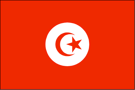
id
Pays
Pays en Anglais
Tunisia
Pays
Tunisie
countryucasefr
TUNISIE
Pays en Chinois
Pays en Espagnol
Túnez
Pays en Italien
La Tunisia
Pays en Portugais
Tunísia
Pays en Allemand
Tunesien
countrypy
tu1 ni2 xi1 ya4
countrylocal
Tunis
countryfull
Tunisia
countrynm
Tunisia
ISO2
TN
ISO3
TUN
countrycodeisono
788
countrycodevehicle
TN
countrycodeolympic
TUN
countrycodeirs
TS
countrycodeirsfr
TS
countrycodeirsmixt
TS
countrycode
216
♀Féminin
15
4
3
languagesfr
Arabe
161
currency
dinar
currencyfr
dinar tunisien
currencyisocode
TND
currencyisocodefull
TND 788
currencypxcode
TND
currencysymbol
TD
currencysubdivision
1,000 millimes
currencyregime
m.float (1.0)
currencyvalue
0.7685
nationalityfr
Tunisienne
Capitale
Tunis
capitalfr
Tunis
Préfixe Tél.
216
Superficie km2
163 610
arealand
155 360
areawater
8 250
landarablerate
0.1867
landforestrate
0.031
coastline
1148
summit
Jabal ash Sha'ambi 1 544 m.
boundarycountries
Algérie, Libye.
timezonedeltabegin
1
flaglink
maplink
tncolor.gif
outlinemaplink
tnout.gif
visapassenger
-1
maincities
Sfax, Bizerte, Djerba, Gabès, Sousse, Kairouan, Gafsa.
largestcity
Tunis
largestcitypopulation
1 722 000
rankpopulation
77
Population
9 895 000
rankgdp
65
gdp
25037000000
rankgdpppp
60
gdpppp
70863000000
rankgni
68
gni
22204000000
rankincomeorigin
103
rankincome
113
income
2240
rankincomeppp
92
incomeppp
6850
lifeexpectation
72.9
alphabetizationrate
0.753
natalityrate
0.0169
mortalityrate
0.0055
mortalityrateinfantile
0.0228
precipitation
466
nationalevent
Independence Day
nationaleventfr
Jour de l'Indépendance
nationalholiday
20 March (1956)
Date de naissance aaaa-mm-jj
1956-03-20 00:00:00
3
9
location
Northern Africa, bordering the Mediterranean Sea, between Algeria and Libya
terrain
mountains in north; hot, dry central plain; semiarid south merges into the Sahara
naturalresources
petroleum, phosphates, iron ore, lead, zinc, salt
cooking
Couscous.
7
Web
rgbback
16777215
todate
1
Notes
Couscous.
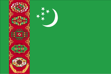
17
id
Pays
Pays en Anglais
Turkmenistan
Pays
Turkménistan
countryucasefr
TURKMENISTAN
Pays en Chinois
Pays en Espagnol
Turkmenistan
Pays en Italien
Turkmenistan
Pays en Portugais
Turkmenistan
Pays en Allemand
Turkmenistan
countrypy
tu3 ku4 man4
countrylocal
Turkmenistan
countryfull
Turkmenistan
countrynm
Turkmenistan
ISO2
TM
ISO3
TKM
countrycodeisono
795
countrycodevehicle
TM
countrycodeolympic
TKM
countrycodeirs
TX
countrycodeirsfr
TX
countrycodeirsmixt
TX
♂Masulin
15
1
201
languagesfr
Turkmen
162
currency
manat
currencyfr
rouble
currencyisocode
TMM
currencyisocodefull
TMM 795
currencypxcode
TMM
currencysubdivision
100 tenga
currencyregime
US-$ (10.0;230.0)
nationalityfr
Turkmen
Capitale
Ashgabat
capitalfr
Achkhabad
Préfixe Tél.
993
Superficie km2
488 100
arealand
488 100
landarablerate
0.0347
landforestrate
0.08
summit
Ayrybaba 3 189 m.
boundarycountries
Iran, Kazakhstan, Ouzbekistan, Afghanistan.
timezonedeltabegin
5
flaglink
maplink
tmcolor.gif
outlinemaplink
tmout.gif
visapassenger
-1
maincities
Chardzhou, Tashauz, Krasnovodsk
largestcity
Ashkhabad
largestcitypopulation
462 000
rankpopulation
111
Population
4 864 000
rankgdp
109
gdp
6201000000
rankgdpppp
86
gdpppp
28881000000
rankgni
116
gni
5442000000
rankincomeorigin
131
rankincome
143
income
1120
rankincomeppp
106
incomeppp
5860
lifeexpectation
61.29
alphabetizationrate
0.98
natalityrate
0.02782
mortalityrate
0.00882
mortalityrateinfantile
0.07313
hdi
0.748
urbanization
0.449
precipitation
227
nationalevent
Independence Day
nationaleventfr
Jour de l'Indépendance
nationalholiday
27 October (1991)
Date de naissance aaaa-mm-jj
1991-10-27 00:00:00
8
8
location
Central Asia, bordering the Caspian Sea, between Iran and Kazakhstan
terrain
flat-to-rolling sandy desert with dunes rising to mountains in the south; low mountains along border with Iran; borders Caspian Sea in west
naturalresources
petroleum, natural gas, coal, sulfur, salt
9
Web
rgbback
16777215
todate
1
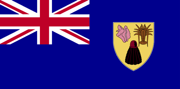
18
id
Pays
Pays en Anglais
Turks and Caicos Islands
Pays
Turks et Caicos (îles)
countryucasefr
TURKS ET CAICOS (ILES)
Pays en Chinois
Pays en Espagnol
Turcos e islas de Caicos
Pays en Italien
Turchi ed isole del Caicos
Pays en Portugais
Turks e consoles de Caicos
Pays en Allemand
Türken und Caicosinseln
countryfull
Turks and Caicos Islands
countrynm
Turks and Caicos Islands
ISO2
TC
ISO3
TCA
countrycodeisono
796
countrycodeirs
TK
countrycodeirsfr
TK
countrycodeirsmixt
TK
♀Féminin
12
6
51
6
currency
dollar
currencyfr
dollar des Caraïbes orientales
currencyisocode
USD
currencyisocodefull
USD 840
currencypxcode
USD
currencysymbol
$
currencysubdivision
100 cents
currencyregime
float
currencyvalue
1
Capitale
Grand Turk
capitalfr
Grand Turk
Préfixe Tél.
1-649
Superficie km2
430
arealand
430
landarablerate
0.0233
coastline
389
timezonedeltabegin
-5
flaglink
maplink
tccolor.gif
outlinemaplink
tc.gif
visapassenger
-1
largestcity
Grand Turk
rankpopulation
217
Population
17 502
rankgni
208
gni
120000000
rankincomeorigin
67
rankincome
71
income
7059
nationalevent
Constitution Day
nationaleventfr
Jour de la Constitution
nationalholiday
30 August (1976)
Date de naissance aaaa-mm-jj
1976-08-30 00:00:00
3
5
location
Caribbean, two island groups in the North Atlantic Ocean, southeast of The Bahamas, north of Haiti
terrain
low, flat limestone; extensive marshes and mangrove swamps
naturalresources
spiny lobster, conch
9
rgbback
16777215
todate
1
19
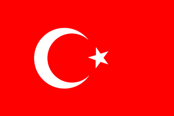
id
Pays
Pays en Anglais
Turkey
Pays
Turquie
countryucasefr
TURQUIE
Pays en Chinois
Pays en Espagnol
Turquía
Pays en Italien
La Turchia
Pays en Portugais
Turquia
Pays en Allemand
Die Türkei
countrypy
tu3 er3 qi2
countrylocal
Turkiye
countryfull
Turkey
countrynm
Turkey
ISO2
TR
ISO3
TUR
countrycodeisono
792
countrycodevehicle
TR
countrycodeolympic
TUR
countrycodeirs
TU
countrycodeirsfr
TU
countrycodeirsmixt
TU
countrycode
90
♀Féminin
18
6
166
languagesfr
Turc
105
currency
new lira
currencyfr
livre turque
currencyisocode
TRY
currencyisocodefull
TRY 949
currencypxcode
TRY
currencysymbol
YTL
currencysubdivision
100 new kurus
currencyregime
float
currencyvalue
0.74129
nationalityfr
Turque
Capitale
Ankara
capitalfr
Ankara
Préfixe Tél.
90
Superficie km2
780 576
arealand
770 760
areawater
9 820
landarablerate
0.3453
landforestrate
0.133
coastline
7200
summit
Büyük Agri Dagi 5 185 m.
boundarycountries
Grèce, Bulgarie, Géorgie, Arménie, Azerbaïdjan, Iran, Irak, Syrie.
timezonedeltabegin
2
flaglink
maplink
treunewl.gif
outlinemaplink
tr.gif
visapassenger
-1
maincities
Istanbul, Izmir, Adana, Bursa, Gaziantep, Konya, Kayseri, Eskisehir, Mersin, Diyarbakir.
largestcity
Istanbul
largestcitypopulation
7 911 000
rankpopulation
15
Population
70 712 000
rankgdp
21
gdp
240376000000
rankgdpppp
17
gdpppp
478891000000
rankgni
24
gni
197788000000
rankincomeorigin
93
rankincome
103
income
2800
rankincomeppp
94
incomeppp
6710
lifeexpectation
71.8
alphabetizationrate
0.8144
natalityrate
0.01759
mortalityrate
0.00595
mortalityrateinfantile
0.0442
precipitation
697
nationalevent
Independence Day
nationaleventfr
Jour de l'Indépendance
nationalholiday
29 October (1923)
Date de naissance aaaa-mm-jj
1923-10-29 00:00:00
10
12
location
southeastern Europe and southwestern Asia (that portion of Turkey west of the Bosporus is geographically part of Europe), bordering the Black Sea, between Bulgaria and Georgia, and bordering the Aegean Sea and the Mediterranean Sea, between Greece and Syr
terrain
high central plateau (Anatolia); narrow coastal plain; several mountain ranges
naturalresources
antimony, coal, chromium, mercury, copper, borate,
7
Web
rgbback
16777215
todate
1
20
id
Pays
Pays en Anglais
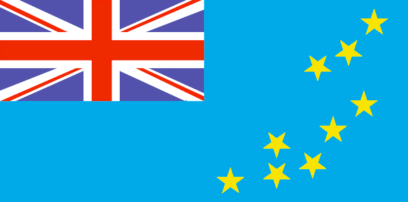
Tuvalu
Pays
Tuvalu
countryucasefr
TUVALU
Pays en Chinois
Pays en Espagnol
Tuvalu
Pays en Italien
Tuvalu
Pays en Portugais
Tuvalu
Pays en Allemand
Tuvalu
countrypy
tu3 wa3 lu3
countryfull
Tuvalu
countrynm
Tuvalu
ISO2
TV
ISO3
TUV
countrycodeisono
798
countrycodeolympic
TUV
countrycodeirs
TV
countrycodeirsfr
TV
countrycodeirsmixt
TV
♂Masulin
12
6
51
languagesfr
Anglais
10
currency
dollar
currencyfr
dollar australien
currencyisocode
AUD
currencyisocodefull
AUD 036
currencypxcode
AUD
currencysymbol
A$
currencysubdivision
100 cents
currencyregime
float
currencyvalue
0.7485
Capitale
Funafuti
capitalfr
Funafuti
Préfixe Tél.
688
Superficie km2
26
arealand
26
coastline
24
summit
5 m.
timezonedeltabegin
12
flaglink
maplink
tvcolor.gif
outlinemaplink
tv.gif
visapassenger
-1
largestcity
Funafuti
rankpopulation
221
Population
10 838
rankgni
216
gni
20000000
rankincomeorigin
120
rankincome
129
income
1818
lifeexpectation
67.66
alphabetizationrate
0.55
natalityrate
0.02163
mortalityrate
0.00724
mortalityrateinfantile
0.02069
urbanization
0.532
nationalevent
Independence Day
nationaleventfr
Jour de l'Indépendance
nationalholiday
1 October (1978)
Date de naissance aaaa-mm-jj
1978-10-01 00:00:00
5
7
president
Reine Elisabeth II
location
Oceania, island group consisting of nine coral atolls in the South Pacific Ocean, about one-half of the way from Hawaii to Australia
terrain
very low-lying and narrow coral atolls
naturalresources
fish
9
rgbback
16777215
todate
1
| Pays/Territoires | Régions en Chine | Provinces de Chine | Régions en France | Départements de France | Provinces du Monde | Villes/Villages | Localités | Continents du Monde | Vins AOP
