Indonésie 印度尼西亚 => Pays de Beau Bois

Indonésie 印度尼西亚 => Pays de Beau Bois

Les artisans

Sélection des meubles indonésiens

Les objets

Histoire des meubles indonésiens

Indonésie 印度尼西亚 => Pays de Beau Bois

Mise à jour 2023-11-09 09:24:11

L'Indonésie est un pays situé en Asie dont la capitale est Jakarta. La hiérarchie des divisions administratives est la suivante : L'Indonésie est subdivisée en provinces, qui se divisent à leur tour en régences (kabupaten), villes (kota), qui se divisent à leur tour en districts, qui se divisent à leur tour en bourgades, villages.

Les noms des pays/territoires du monde sont donnés en Français et Chinois. Cette collection des précieuses terres fermes du monde que toute l'humanité partage inclut non seulement les pays indépendants, mais aussi des régions spécifiques qui ne sont pas membre de l'ONUOrganisation des Nations Unies: Nous, peuples des Nations Unies ... Une ONU plus forte pour un monde meilleur. Veuillez aussi consulter les noms des pays en masculin et féminin en Français.

GéoPays    Fermer
Indonésie | Pays/Territoires | Régions en Chine | Provinces de Chine | Régions en France | Départements de France | Provinces du Monde | Villes/Villages | Localités | Continents du Monde | Vins AOP

1

id
Pays
Pays en Anglais
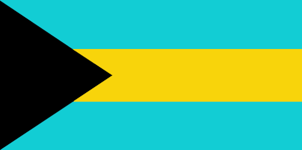
Bahamas, The
Pays
Bahamas
countryucasefr
BAHAMAS
Pays en Chinois
Pays en Espagnol
Bahamas
Pays en Italien
Le Bahamas
Pays en Portugais
Bahamas
Pays en Allemand
Bahamas
countrypy
ba1 ha1 ma3
countrylocal
Bahamas
countryfull
Bahamas, The
countrynm
Bahamas, The
ISO2
BS
ISO3
BHS
countrycodeisono
044
countrycodevehicle
BS
countrycodeolympic
BAH
countrycodeirs
BF
countrycodeirsfr
BF
countrycodeirsmixt
BF
♀Féminin
20
6
51
languagesfr
Anglais
12
currency
dollar
currencyfr
dollar des Bahamas
currencyisocode
BSD
currencyisocodefull
BSD 044
currencypxcode
BSD
currencysymbol
B$
currencysubdivision
100 cents
currencyregime
US-$ (1.0)
currencyvalue
1.005
Capitale
Nassau
capitalfr
Nassau
Préfixe Tél.
1-242
Superficie km2
13 935
arealand
10 070
areawater
3 870
landarablerate
0.006
landforestrate
0.841
coastline
3542
summit
Mount Alvernia 63 m.
timezonedeltabegin
-5
flaglink
maplink
bscolor.gif
outlinemaplink
bs.gif
visapassenger
-1
maincities
Freeport, Nicolls Town, West End, Andros Town.
largestcity
Nassau
largestcitypopulation
195 000
rankpopulation
169
Population
317 000
rankgdp
116
gdp
5260000000
rankgdpppp
138
gdpppp
5291000000
rankgni
120
gni
4684000000
rankincomeorigin
41
rankincome
37
income
14920
rankincomeppp
54
incomeppp
16140
lifeexpectation
65.63
alphabetizationrate
0.9555
natalityrate
0.01822
fecondity
2.29
mortalityrate
0.00882
mortalityrateinfantile
0.0257
hdi
0.812
urbanization
0.889
precipitation
1360
nationalevent
Independence Day
nationaleventfr
Jour de l'Indépendance
nationalholiday
10 July (1973)
Date de naissance aaaa-mm-jj
1973-07-10 00:00:00
10
2
location
Caribbean, chain of islands in the North Atlantic Ocean, southeast of Florida, northeast of Cuba
terrain
long, flat coral formations with some low rounded hills
naturalresources
salt, aragonite, timber, arable land
9
Web
rgbback
16777215
todate
1

2

id
Pays
Pays en Anglais
Bahrain
Pays
Bahreïn
countryucasefr
BAHREIN
Pays en Chinois
Pays en Espagnol
Bahrein
Pays en Italien
La Bahrain
Pays en Portugais
Barém
Pays en Allemand
Bahrain
countrypy
ba1 lin2
countrylocal
Al Bahrayn
countryfull
Bahrain
countrynm
Bahrain
ISO2
BH
ISO3
BHR
countrycodeisono
048
countrycodevehicle
BRN
countrycodeolympic
BRN
countrycodeirs
BA
countrycodeirsfr
BA
countrycodeirsmixt
BA
♂Masulin
12
4
3
languagesfr
Arabe
128
currency
dinar
currencyfr
dinar de Bahraïn
currencyisocode
BHD
currencyisocodefull
BHD 048
currencypxcode
BHD
currencysymbol
BD
currencysubdivision
1,000 fils
currencyregime
US-$ (lim.flex.)
currencyvalue
2.6527
Capitale
Manama
capitalfr
Manama
Préfixe Tél.
973
Superficie km2
680
arealand
665
landarablerate
0.0435
coastline
161
summit
Jabal ad Dukhan 122 m.
timezonedeltabegin
3
flaglink
maplink
bhcolor.gif
outlinemaplink
bhout.gif
visapassenger
-1
maincities
Al Muharraq, Jidd Hafs, Isa, Al Hadd.
largestcity
Manama
largestcitypopulation
148 000
rankpopulation
157
Population
712 000
rankgdp
99
gdp
7683000000
rankgdpppp
118
gdpppp
11979000000
rankgni
98
gni
7569000000
rankincomeorigin
52
rankincome
55
income
10850
rankincomeppp
53
incomeppp
16180
lifeexpectation
73.98
alphabetizationrate
0.879
natalityrate
0.01854
fecondity
2.66
mortalityrate
0.00403
mortalityrateinfantile
0.01791
hdi
0.839
urbanization
0.925
precipitation
72
nationalevent
National Day
nationaleventfr
Jour National
nationalholiday
16 December (1971)
Date de naissance aaaa-mm-jj
1971-12-16 00:00:00
8
12
location
Middle East, archipelago in the Persian Gulf, east of Saudi Arabia
terrain
mostly low desert plain rising gently to low central escarpment
naturalresources
oil, associated and nonassociated natural gas, fis
9
Web
rgbback
16777215
todate
1

3

id
Pays
Pays en Anglais
Gaza Strip
Pays
Bande de Gaza
countryucasefr
BANDE DE GAZA
Pays en Chinois
Pays en Espagnol
Tira De Gaza
Pays en Italien
Striscia Di Gaza
Pays en Portugais
Tira De Gaza
Pays en Allemand
Streifen Gaza
countryfull
Gaza Strip
countrynm
Gaza Strip
ISO2
PSEG
ISO3
PSEG
countrycodeisono
275
countrycodeolympic
PLE
countrycodeirs
GZ
countrycodeirsfr
GZ
countrycodeirsmixt
GZ
♀Féminin
7
2
3
languagesfr
Arabe
54
currency
new shekel
currencyfr
Livre palestinienne
currencyisocode
ILS
currencyisocodefull
ILS 376
currencypxcode
ILS
currencysymbol
NIS
currencysubdivision
100 new agorot
currencyregime
m.float
currencyvalue
0.2268
nationalityfr
Gabonaise
Capitale
Hamala
capitalfr
Gaza
Préfixe Tél.
970
Superficie km2
360
arealand
360
landarablerate
0.2632
coastline
40
timezonedeltabegin
2
flaglink
maplink
gaza.gif
visapassenger
-1
largestcity
Hamala
Population
1 225 911
rankincome
222
natalityrate
0.04185
mortalityrate
0.00412
mortalityrateinfantile
0.02476
growthrate
0.04
location
Middle East, bordering the Mediterranean Sea, between Egypt and Israel
terrain
flat to rolling, sand- and dune-covered coastal plain
naturalresources
arable land, natural gas
9
rgbback
16777215
todate
1

4

id
Pays
Pays en Anglais
Bangladesh
Pays
Bangladesh
countryucasefr
BANGLADESH
Pays en Chinois
Pays en Espagnol
Bangladesh
Pays en Italien
La Bangladesh
Pays en Portugais
Bangladesh
Pays en Allemand
Bangladesh
countrypy
meng4 jia1 la1 guo2
countrylocal
Bangladesh
countryfull
Bangladesh
countrynm
Bangladesh
ISO2
BD
ISO3
BGD
countrycodeisono
050
countrycodevehicle
BD
countrycodeolympic
BAN
countrycodeirs
BG
countrycodeirsfr
BG
countrycodeirsmixt
BGD
♂Masulin
18
6
26
languagesfr
Bengali
129
currency
taka
currencyfr
taka
currencyisocode
BDT
currencyisocodefull
BDT 050
currencypxcode
BDT
currencysymbol
Tk
currencysubdivision
100 paisa (poisha)
currencyregime
composite
currencyvalue
0.01569
Capitale
Dhaka
capitalfr
Dacca
Préfixe Tél.
880
Superficie km2
144 000
arealand
133 910
areawater
10 090
landarablerate
0.607
landforestrate
0.102
coastline
580
summit
Reng Tlang 957 m.
boundarycountries
Inde, Birmanie..
timezonedeltabegin
6
flaglink
maplink
bdcolor.gif
outlinemaplink
bdout.gif
visapassenger
-1
maincities
Chittagong, Khulna, Narayanganj, Rajshali, Mymensingh, Comilla, Barisal, Sylhet, Ranjpur.
largestcity
Dhaka
largestcitypopulation
8 545 000
rankpopulation
8
Population
138 066 000
rankgdp
54
gdp
51914000000
rankgdpppp
31
gdpppp
244402000000
rankgni
51
gni
55009000000
rankincomeorigin
173
rankincome
187
income
400
rankincomeppp
163
incomeppp
1870
lifeexpectation
61.71
alphabetizationrate
0.423
natalityrate
0.03003
fecondity
3.46
mortalityrate
0.00852
mortalityrateinfantile
0.06432
hdi
0.502
nationalevent
Independence Day
nationaleventfr
Jour de l'Indépendance
nationalholiday
26 March (1971)
Date de naissance aaaa-mm-jj
1971-03-26 00:00:00
8
12
location
Southern Asia, bordering the Bay of Bengal, between Burma and India
terrain
mostly flat alluvial plain; hilly in southeast
naturalresources
natural gas, arable land, timber, coal
cooking
Meilleurs Gambas, Crevettes: Black Tiger.
9
Web
rgbback
16777215
todate
1
Notes
Meilleurs Gambas, Crevettes: Black Tiger.

5

id
Pays
Pays en Anglais
Barbados
Pays
Barbade
countryucasefr
BARBADE
Pays en Chinois
Pays en Espagnol
Barbados
Pays en Italien
Le Barbados
Pays en Portugais
Barbados
Pays en Allemand
Barbados
countrypy
ba1 bei4 duo1
countrylocal
Barbados
countryfull
Barbados
countrynm
Barbados
ISO2
BB
ISO3
BRB
countrycodeisono
052
countrycodevehicle
BDS
countrycodeolympic
BAR
countrycodeirs
BB
countrycodeirsfr
BB
countrycodeirsmixt
BB
♀Féminin
18
6
51
languagesfr
Anglais
13
currency
dollar
currencyfr
dollar de la Barbade
currencyisocode
BBD
currencyisocodefull
BBD 052
currencypxcode
BBD
currencysymbol
Bds$
currencysubdivision
100 cents
currencyregime
US-$ (2.0)
currencyvalue
0.5128
Capitale
Bridgetown
capitalfr
Bridgetown
Préfixe Tél.
1-246
Superficie km2
430
arealand
431
landarablerate
0.3721
landforestrate
0.047
coastline
97
summit
Mount Hillaby 336 m.
timezonedeltabegin
-4
flaglink
maplink
bbcolor.gif
outlinemaplink
bb.gif
visapassenger
-1
maincities
Oistins, Holetown, Speightstown, Crab Hill, Hastings, Bathsheba.
largestcity
Bridgetown
largestcitypopulation
123 000
rankpopulation
173
Population
271 000
rankgdp
138
gdp
2627000000
rankgdpppp
145
gdpppp
4254000000
rankgni
146
gni
2507000000
rankincomeorigin
55
rankincome
59
income
9260
rankincomeppp
57
incomeppp
15060
lifeexpectation
71.64
alphabetizationrate
0.997
natalityrate
0.01298
fecondity
1.5
mortalityrate
0.00908
mortalityrateinfantile
0.01261
hdi
0.888
urbanization
0.504
nationalevent
Independence Day
nationaleventfr
Jour de l'Indépendance
nationalholiday
30 November (1966)
Date de naissance aaaa-mm-jj
1966-11-30 00:00:00
3
7
location
Caribbean, island in the North Atlantic Ocean, northeast of Venezuela
terrain
relatively flat; rises gently to central highland region
naturalresources
petroleum, fish, natural gas
9
Web
rgbback
16777215
todate
1

6

id
Pays
Pays en Anglais
Bassas da India
Pays
Bassas da India
countryucasefr
BASSAS DA INDIA
Pays en Chinois
Pays en Espagnol
Da la India de Bassas
Pays en Italien
Da India di Bassas
Pays en Portugais
Da India de Bassas
Pays en Allemand
Da Indien Bassas
countryfull
Bassas da India
countrynm
Bassas da India
ISO2
REUI
ISO3
REUI
countrycodeisono
638
countrycodeirs
BS
countrycodeirsfr
BS
countrycodeirsmixt
BS
15
6
57
2
currencypxcode
EUR
Préfixe Tél.
262
Superficie km2
1
arealand
0,20
coastline
35.2
timezonedeltabegin
5
flaglink
maplink
bs-map.gif
visapassenger
-1
rankincome
222
location
Southern Africa, islands in the southern Mozambique Channel, about one-half of the way from Madagascar to Mozambique
terrain
volcanic rock
naturalresources
none
9
rgbback
16777215
todate
1

7

id
Pays
Pays en Anglais
Belgium
Pays
Belgique
countryucasefr
BELGIQUE
Pays en Chinois
Pays en Espagnol
Bélgica
Pays en Italien
Il Belgio
Pays en Portugais
Bélgica
Pays en Allemand
Belgien
countrypy
bi3 li4 shi2
countrylocal
Belgique/Belgie
countryfull
Belgium
countrynm
Belgium
ISO2
BE
ISO3
BEL
countrycodeisono
056
countrycodevehicle
B
countrycodeolympic
BEL
countrycodeirs
BE
countrycodeirsfr
BE
countrycodeirsmixt
BE
countrycode
32
♀Féminin
1
20
7
57
languagesfr
Néerlandais, Français, Allemand
2
currency
euro
currencyfr
euro
currencyisocode
EUR
currencyisocodefull
EUR 978
currencypxcode
EUR
currencysymbol
currencysubdivision
100 cents
currencyregime
float
currencyvalue
1.2203
nationalityfr
Belge
Capitale
Brussels
capitalfr
Bruxelles
Préfixe Tél.
32
Superficie km2
31 100
arealand
30 230
areawater
280
landarablerate
0.25
coastline
66
summit
Signal de Botrange 694 m.
boundarycountries
France, Pays-Bas, Allemagne, Luxembourg
timezonedeltabegin
1
flaglink
maplink
becolor.gif
outlinemaplink
be.gif
maincities
Anvers, Gand, Charleroi, Liège, Bruges, Namur, Mons, Louvain, Alost, Courtrai.
largestcity
Brussels
largestcitypopulation
1 122 000
rankpopulation
73
Population
10 376 000
rankgdp
18
gdp
301896000000
rankgdpppp
28
gdpppp
294001000000
rankgni
18
gni
267250000000
rankincomeorigin
20
rankincome
16
income
25760
rankincomeppp
14
incomeppp
28920
lifeexpectation
78.13
alphabetizationrate
0.99
natalityrate
0.0106
mortalityrate
0.01008
mortalityrateinfantile
0.00464
nationalevent
Ascension to the Throne of King Leopold I
nationaleventfr
Ascension au Tronc du Roi Léopold I
nationalholiday
21 July (1831)
Date de naissance aaaa-mm-jj
1831-06-21 00:00:00
8
4
location
Western Europe, bordering the North Sea, between France and the Netherlands
terrain
flat coastal plains in northwest, central rolling hills, rugged mountains of Ardennes Forest in southeast
naturalresources
coal, natural gas
cooking
Bonbons.
4
Web
rgbback
16777215
todate
1
Notes
Bonbons.

8

id
Pays
Pays en Anglais
Belize
Pays
Belize
countryucasefr
BELIZE
Pays en Chinois
Pays en Espagnol
Belice
Pays en Italien
Belize
Pays en Portugais
Belize
Pays en Allemand
Belize
countryfull
Belize
countrynm
Belize
ISO2
BZ
ISO3
BLZ
countrycodeisono
084
countrycodevehicle
BH
countrycodeolympic
BIZ
countrycodeirs
BH
countrycodeirsfr
BH
countrycodeirsmixt
BH
♂Masulin
18
6
51
languagesfr
Anglais
15
currency
dollar
currencyfr
dollar de Bélize
currencyisocode
BZD
currencyisocodefull
BZD 084
currencypxcode
BZD
currencysymbol
BZ$
currencysubdivision
100 cents
currencyregime
US-$ (2.0)
currencyvalue
0.5089
Capitale
Belmopan
capitalfr
Belmopan
Préfixe Tél.
501
Superficie km2
22 963
arealand
22 806
areawater
160
landarablerate
0.0281
landforestrate
0.591
coastline
386
summit
Victoria Peak 1 122 m.
boundarycountries
Guatémala, Mexique.
timezonedeltabegin
-6
flaglink
maplink
bzcolor.gif
outlinemaplink
bzoutl.gif
visapassenger
-1
maincities
Belize, Corozal, San Ignacio, Dangriga, Orange Walk.
largestcity
Belmopan
largestcitypopulation
6 000
rankpopulation
172
Population
274 000
rankgdp
155
gdp
988000000
rankgdpppp
153
gdpppp
1902000000
rankgni
174
gni
923000000
rankincomeorigin
88
rankincome
98
income
3370
rankincomeppp
98
incomeppp
6320
lifeexpectation
67.43
alphabetizationrate
0.937
natalityrate
0.02989
fecondity
3.15
mortalityrate
0.00604
mortalityrateinfantile
0.02637
growthrate
0.02385
hdi
0.776
urbanization
0.481
nationalevent
Independence Day
nationaleventfr
Jour de l'Indépendance
nationalholiday
21 September (1981)
Date de naissance aaaa-mm-jj
1981-09-21 00:00:00
8
10
location
Middle America, bordering the Caribbean Sea, between Guatemala and Mexico
terrain
flat, swampy coastal plain; low mountains in south
naturalresources
arable land potential, timber, fish, hydropower
9
Web
rgbback
16777215
todate
1

9

id
Pays
Pays en Anglais
Benin
Pays
Bénin
countryucasefr
BENIN
Pays en Chinois
Pays en Espagnol
Benin
Pays en Italien
Il Benin
Pays en Portugais
Benin
Pays en Allemand
Benin
countrypy
bei4 ning2
countrylocal
Benin
countryfull
Benin
countrynm
Benin
ISO2
BJ
ISO3
BEN
countrycodeisono
204
countrycodevehicle
DY
countrycodeolympic
BEN
countrycodeirs
BN
countrycodeirsfr
BN
countrycodeirsmixt
BN
♂Masulin
15
4
57
languagesfr
Français
119
currency
franc
currencyfr
franc C.F.A.
currencyisocode
XOF
currencyisocodefull
XOF 952
currencypxcode
XOF
currencysymbol
CFAF
currencysubdivision
100 centimes
currencyregime
Euro (655.957)
currencyvalue
0.00186
nationalityfr
Béninoise
Capitale
Porto-Novo
capitalfr
Porto-Novo
Préfixe Tél.
229
Superficie km2
112 622
arealand
110 620
areawater
2 000
landarablerate
0.1528
landforestrate
0.24
coastline
121
summit
Mont Tanekas 641 m.
boundarycountries
Togo, Burkina Faso, Niger, Nigeria.
timezonedeltabegin
1
flaglink
maplink
bjcolor.gif
outlinemaplink
bjout.gif
visapassenger
-1
maincities
Cotonou, Parakou, Abomey, Natitingou.
largestcity
Porto-Novo
largestcitypopulation
194 000
rankpopulation
95
Population
6 720 000
rankgdp
131
gdp
3476000000
rankgdpppp
133
gdpppp
7490000000
rankgni
141
gni
2972000000
rankincomeorigin
170
rankincome
184
income
440
rankincomeppp
184
incomeppp
1110
lifeexpectation
50.81
alphabetizationrate
0.4015
natalityrate
0.04257
mortalityrate
0.01369
mortalityrateinfantile
0.08588
hdi
0.411
urbanization
0.43
nationalevent
National Day
nationaleventfr
Jour National
nationalholiday
1 August (1960)
Date de naissance aaaa-mm-jj
1960-08-01 00:00:00
7
1
location
Western Africa, bordering the Bight of Benin, between Nigeria and Togo
terrain
mostly flat to undulating plain; some hills and low mountains
naturalresources
small offshore oil deposits, limestone, marble, ti
9
Web
rgbback
16777215
todate
1

10

id
Pays
Pays en Anglais
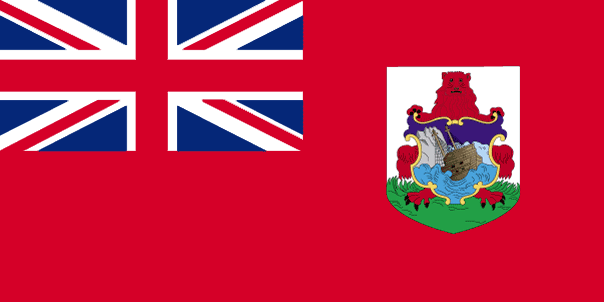
Bermuda
Pays
Bermudes
countryucasefr
BERMUDES
Pays en Chinois
Pays en Espagnol
Bermudas
Pays en Italien
Le Bermude
Pays en Portugais
Bermuda
Pays en Allemand
Bermuda
countrypy
bai3 mu4 da2
countrylocal
Bermuda
countryfull
Bermuda
countrynm
Bermuda
ISO2
BM
ISO3
BMU
countrycodeisono
060
countrycodeolympic
BER
countrycodeirs
BD
countrycodeirsfr
BD
countrycodeirsmixt
BD
♀Féminin
18
6
51
languagesfr
Anglais
16
currency
dollar
currencyfr
Dollar des Bermudes
currencyisocode
BMD
currencyisocodefull
BMD 060
currencypxcode
BMD
currencysymbol
Bd$
currencysubdivision
100 cents
currencyregime
US-$ (1.0)
currencyvalue
0.9995
Capitale
Hamilton
capitalfr
Hamilton
Préfixe Tél.
1-441
Superficie km2
53
arealand
53,30
landarablerate
0.06
coastline
103
summit
Town Hill 79 m.
timezonedeltabegin
-4
flaglink
maplink
bermuda.gif
visapassenger
-1
maincities
Saint George, Tucker's Town, The Flatt's Village
largestcity
Hamilton
rankpopulation
197
Population
64 000
rankgni
143
gni
2540000000
rankincomeorigin
2
rankincome
222
rankincomeppp
2
lifeexpectation
77.79
alphabetizationrate
1
natalityrate
0.0116
fecondity
1.8
mortalityrate
0.00763
mortalityrateinfantile
0.00853
growthrate
0.00641
hdi
0.8
urbanization
1
nationalevent
Bermuda Day
nationaleventfr
Jour de Bermuda
nationalholiday
24 May
Date de naissance aaaa-mm-jj
2000-05-24 00:00:00
7
5
location
North America, group of islands in the North Atlantic Ocean, east of North Carolina (US)
terrain
low hills separated by fertile depressions
naturalresources
limestone, pleasant climate fostering tourism
9
Web
rgbback
16777215
todate
1

11

id
Pays
Pays en Anglais
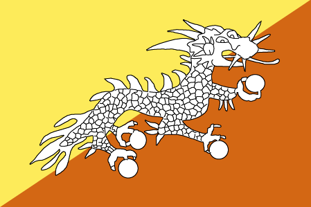
Bhutan
Pays
Bhoutan
countryucasefr
BHOUTAN
Pays en Chinois
Pays en Espagnol
Bhután
Pays en Italien
Il Bhutan
Pays en Portugais
Bhutan
Pays en Allemand
Bhutan
countrypy
bu4 dan1
countrylocal
Bhutan
countryfull
Bhutan
countrynm
Bhutan
ISO2
BT
ISO3
BTN
countrycodeisono
064
countrycodeolympic
BHU
countrycodeirs
BT
countrycodeirsfr
BT
countrycodeirsmixt
BT
♂Masulin
1
3
179
languagesfr
Dzongkha
130
currency
ngultrum
currencyfr
ngultrom et roupie indienne
currencyisocode
BTN
currencyisocodefull
BTN 064
currencypxcode
BTN
currencysymbol
Nu
currencysubdivision
100 chetrum
currencyregime
Indian Rupee (1.0)
currencyvalue
0.0221
nationalityfr
Bhoutanaise
Capitale
Thimphu
capitalfr
Thimbu
Préfixe Tél.
975
Superficie km2
46 620
arealand
47 000
landarablerate
0.0298
landforestrate
0.642
summit
Kula Kangri 7 554 m.
boundarycountries
Inde, Chine.
timezonedeltabegin
6
flaglink
maplink
btcolor.gif
outlinemaplink
btout.gif
visapassenger
-1
maincities
Taga Dzong, Punakha, Bumtang, Phuntsholing.
largestcity
Thimphu
largestcitypopulation
22 000
rankpopulation
153
Population
874 000
rankgdp
164
gdp
697000000
rankgni
188
gni
554000000
rankincomeorigin
154
rankincome
168
income
630
lifeexpectation
53.99
alphabetizationrate
0.4735
natalityrate
0.03441
mortalityrate
0.0132
mortalityrateinfantile
0.10256
hdi
0.511
urbanization
0.084
nationalevent
National Day (Ugyen WANGCHUCK became first hereditary king)
nationaleventfr
Jour National
nationalholiday
17 December (1907)
Date de naissance aaaa-mm-jj
1907-12-17 00:00:00
4
8
location
Southern Asia, between China and India
terrain
mostly mountainous with some fertile valleys and savanna
naturalresources
timber, hydropower, gypsum, calcium carbide
9
rgbback
16777215
todate
1

12

id
Pays
Pays en Anglais
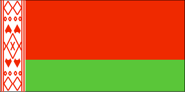
Belarus
Pays
Biélorussie
countryucasefr
BIELORUSSIE
Pays en Chinois
Pays en Espagnol
Belarus
Pays en Italien
Belarus
Pays en Portugais
Belarus
Pays en Allemand
Belarus
countrypy
bai2 e2 luo2 si1
countrylocal
Byelarus
countryfull
Belarus
countrynm
Belarus
ISO2
BY
ISO3
BLR
countrycodeisono
112
countrycodevehicle
BY
countrycodeolympic
BLR
countrycodeirs
BO
countrycodeirsfr
BO
countrycodeirsmixt
BO
♀Féminin
15
4
31
languagesfr
Biélorusse
14
currency
ruble
currencyfr
rouble
currencyisocode
BYR
currencyisocodefull
BYR 112
currencypxcode
BYR
currencysymbol
BR
currencyregime
m.float
Capitale
Minsk
capitalfr
Minsk
Préfixe Tél.
375
Superficie km2
207 600
arealand
207 600
landarablerate
0.2976
landforestrate
0.453
summit
Dzyarzhynskaya Hara 346 m.
boundarycountries
Pologne, Lituanie, Lettonie, Russie, Ukraine
timezonedeltabegin
2
flaglink
maplink
bo-map.gif
outlinemaplink
by.gif
visapassenger
-1
maincities
Gomel, Vitebsk, Brest, Grodno, Mogilev, Bobruysk, Baranovichi, Borisov, Orsha, Pinsk, Mozyr.
largestcity
Minsk
largestcitypopulation
1 784 000
rankpopulation
78
Population
9 881 000
rankgdp
77
gdp
17493000000
rankgdpppp
64
gdpppp
59803000000
rankgni
79
gni
15831000000
rankincomeorigin
121
rankincome
133
income
1600
rankincomeppp
102
incomeppp
6050
lifeexpectation
68.57
alphabetizationrate
1
natalityrate
0.01052
mortalityrate
0.0141
mortalityrateinfantile
0.01362
hdi
0.804
urbanization
0.711
nationalevent
Independence Day
nationaleventfr
Jour de l'Indépendance
nationalholiday
3 July (1944)
Date de naissance aaaa-mm-jj
1944-07-03 00:00:00
1
9
location
Eastern Europe, east of Poland
terrain
generally flat and contains much marshland
naturalresources
forests, peat deposits, small quantities of oil an
7
Web
rgbback
16777215
todate
1

13

id
Pays
Pays en Anglais
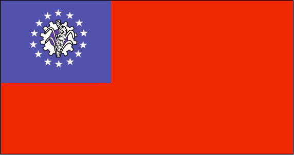
Myanmar
Pays
Birmanie
countryucasefr
BIRMANIE
Pays en Chinois
Pays en Espagnol
Birmania
Pays en Italien
La Birmania
Pays en Portugais
Burma
Pays en Allemand
Birma
countrypy
mian3 dian4
countrylocal
Myanma Naingngandaw
countryfull
Burma
countrynm
Burma
ISO2
MM
ISO3
MMR
countrycodeisono
104
countrycodevehicle
BUR
countrycodeolympic
MYA
countrycodeirs
BM
countrycodeirsfr
BM
countrycodeirsmixt
BM
♀Féminin
2
1
30
languagesfr
Birman
120
currency
kyat
currencyfr
kyat
currencyisocode
MMK
currencyisocodefull
MMK 104
currencypxcode
MMK
currencysymbol
K
currencysubdivision
100 pyas
currencyregime
US-$ (5.86of, 200-300bm)
currencyvalue
0.1599
Capitale
Rangoon
capitalfr
Rangoon
Préfixe Tél.
95
Superficie km2
676 552
arealand
657 740
areawater
20 760
landarablerate
0.1453
landforestrate
0.523
coastline
1930
summit
Hkakabo Razi 5 881 m.
boundarycountries
Bangladesh, Inde, Tibet, Chine, Laos, Thaïlande.
timezonedeltabegin
6.5
flaglink
maplink
mmcolor.gif
outlinemaplink
mmout.gif
visapassenger
-1
maincities
Mandalay, Moulmein, Pegu, Bassein, Akyab, Myeik.
largestcity
Yangon
largestcitypopulation
3 873 000
rankpopulation
24
Population
49 363 000
rankgni
38
gni
92900000000
rankincomeorigin
117
rankincome
126
income
1896
lifeexpectation
55.79
alphabetizationrate
0.806
natalityrate
0.01915
mortalityrate
0.01217
mortalityrateinfantile
0.07035
precipitation
2681
nationalevent
Independence Day
nationaleventfr
Jour de l'Indépendance
nationalholiday
4 January (1948)
Date de naissance aaaa-mm-jj
1948-01-04 00:00:00
4
12
location
Southeastern Asia, bordering the Andaman Sea and the Bay of Bengal, between Bangladesh and Thailand
terrain
central lowlands ringed by steep, rugged highlands
naturalresources
petroleum, timber, tin, antimony, zinc, copper, tu
9
rgbback
16777215
todate
1

14

id
Pays
Pays en Anglais
Bolivia
Pays
Bolivie
countryucasefr
BOLIVIE
Pays en Chinois
Pays en Espagnol
Bolivia
Pays en Italien
La Bolivia
Pays en Portugais
Bolívia
Pays en Allemand
Bolivien
countrypy
bo1 li4 wei2 ya4
countrylocal
Bolivia
countryfull
Bolivia
countrynm
Bolivia
ISO2
BO
ISO3
BOL
countrycodeisono
068
countrycodevehicle
BOL
countrycodeolympic
BOL
countrycodeirs
BL
countrycodeirsfr
BL
countrycodeirsmixt
BL
countrycode
591
♀Féminin
15
6
131
languagesfr
Quechua, Espagnol, Aymara
17
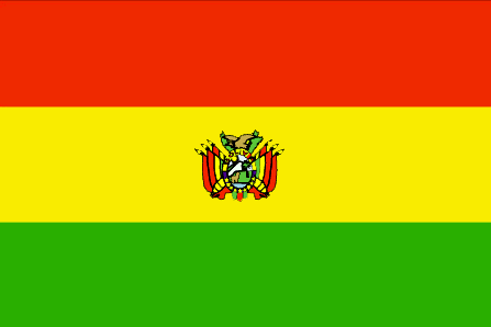
currency
boliviano
currencyfr
boliviano
currencyisocode
BOB
currencyisocodefull
BOB 068
currencypxcode
BOB
currencysymbol
Bs
currencysubdivision
100 centavos
currencyregime
float
currencyvalue
0.1239
nationalityfr
Bolivienne
Capitale
La Paz
capitalfr
La Paz
Préfixe Tél.
591
Superficie km2
1 098 581
arealand
1 084 390
areawater
14 190
landarablerate
0.0173
landforestrate
0.489
summit
Cerro Illimani 6 882 m.
boundarycountries
Pérou, Brésil, Paraguay, Argentine, Chili.
timezonedeltabegin
-4
flaglink
maplink
bocolor.gif
outlinemaplink
bo.gif
visapassenger
-1
maincities
Cochabamba, Oruro, Santa Cruz, Sucre, Potosi.
largestcity
La Paz
largestcitypopulation
1 250 000
rankpopulation
81
Population
8 814 000
rankgdp
98
gdp
7867000000
rankgdpppp
96
gdpppp
22800000000
rankgni
99
gni
7924000000
rankincomeorigin
142
rankincome
155
income
900
rankincomeppp
151
incomeppp
2490
lifeexpectation
64.78
alphabetizationrate
0.8229
natalityrate
0.02553
mortalityrate
0.00791
mortalityrateinfantile
0.05605
hdi
0.643
nationalevent
Independence Day
nationaleventfr
Jour de l'Indépendance
nationalholiday
6 August (1825)
Date de naissance aaaa-mm-jj
1825-08-06 00:00:00
2
10
location
Central South America, southwest of Brazil
terrain
rugged Andes Mountains with a highland plateau (Altiplano), hills, lowland plains of the Amazon Basin
naturalresources
tin, natural gas, petroleum, zinc, tungsten, antim
9
Web
rgbback
16777215
todate
1

15

id
Pays
Pays en Anglais
Bonaire
Pays
Bonaire
countryucasefr
Bonaire
Pays en Chinois
Pays en Espagnol
Bonaire
Pays en Italien
Bonaire
Pays en Portugais
Bonaire
Pays en Allemand
Bonaire
ISO2
XA
ISO3
NL-BQ1
todate
1

16

id
Pays
Pays en Anglais
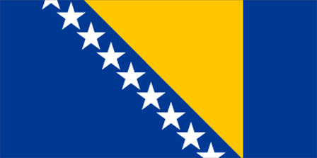
Bosnia and Herzegovina
Pays
Bosnie-Herzégovine
countryucasefr
BOSNIE-HERZEGOVINE
Pays en Chinois
Pays en Espagnol
Bosnia-bosnia-Herzegovina
Pays en Italien
Bosnia-bosnia-Herzegovina
Pays en Portugais
Bósnia-bosnia-Herzegovina
Pays en Allemand
Bosnien-Bosnia-Herzegovina
countrypy
bo1 si1 ni2 ya4 he2 hei1 se4 ge1 wei2 na4
countrylocal
Bosna i Hercegovina
countryfull
Bosnia and Herzegovina
countrynm
Bosnia and Herzegovina
ISO2
BA
ISO3
BIH
countrycodeisono
070
countrycodevehicle
BIH
countrycodeolympic
BIH
countrycodeirs
BK
countrycodeirsfr
BK
countrycodeirsmixt
BK
♀Féminin
9
6
180
languagesfr
Bosniaque, Croate, Serbe
18
currency
convertible mark
currencyfr
mark convertible
currencyisocode
BAM
currencyisocodefull
BAM 977
currencypxcode
BAM
currencysymbol
KM
currencysubdivision
100 fennig
currencyregime
Euro (1.95583)
nationalityfr
Bosniaque
Capitale
Sarajevo
capitalfr
Sarajevo
Préfixe Tél.
387
Superficie km2
51 129
arealand
51 129
landarablerate
0.098
landforestrate
0.446
coastline
20
summit
Maglic 2 386 m.
boundarycountries
Yougoslavie, Croatie
timezonedeltabegin
1
flaglink
maplink
bk-map.gif
outlinemaplink
ba.gif
visapassenger
-1
maincities
Zenica, Tuzla, Gorazde, Bihac, Livno, Siroki, Brijeg, Mostar, Banjaluka
largestcity
Sarajevo
largestcitypopulation
465 000
rankpopulation
119
Population
4 140 000
rankgdp
104
gdp
6973000000
rankgdpppp
92
gdpppp
24703000000
rankgni
109
gni
6352000000
rankincomeorigin
122
rankincome
134
income
1530
rankincomeppp
101
incomeppp
6250
lifeexpectation
72.57
natalityrate
0.01256
mortalityrate
0.00833
mortalityrateinfantile
0.02188
hdi
0.777
urbanization
0.434
nationalevent
National Day
nationaleventfr
Jour National
nationalholiday
25 November (1943)
Date de naissance aaaa-mm-jj
1943-11-25 00:00:00
10
8
location
Southeastern Europe, bordering the Adriatic Sea and Croatia
terrain
mountains and valleys
naturalresources
coal, iron, bauxite, manganese, forests, copper, c
7
Web
rgbback
16777215
todate
1

17

id
Pays
Pays en Anglais
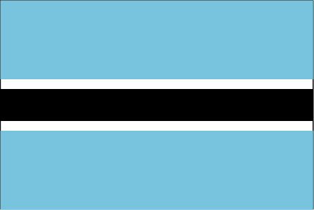
Botswana
Pays
Botswana
countryucasefr
BOTSWANA
Pays en Chinois
Pays en Espagnol
Botswana
Pays en Italien
Il Botswana
Pays en Portugais
Botswana
Pays en Allemand
Botswana
countrypy
bo2 ci2 wa3 na4
countrylocal
Botswana
countryfull
Botswana
countrynm
Botswana
ISO2
BW
ISO3
BWA
countrycodeisono
072
countrycodevehicle
BW
countrycodeolympic
BOT
countrycodeirs
BC
countrycodeirsfr
BC
countrycodeirsmixt
BC
♂Masulin
16
6
51
languagesfr
Anglais
19
currency
pula
currencyfr
pula
currencyisocode
BWP
currencyisocodefull
BWP 072
currencypxcode
BWP
currencysymbol
P
currencysubdivision
100 thebe
currencyregime
composite
currencyvalue
0.1795
nationalityfr
Botswanaise
Capitale
Gaborone
capitalfr
Gaberone
Préfixe Tél.
267
Superficie km2
600 372
arealand
585 370
areawater
15 000
landarablerate
0.0061
landforestrate
0.219
summit
Tsodilo Hill 1 489 m.
boundarycountries
Afrique du Sud, Namibie, Zambie, Zimbabwe.
timezonedeltabegin
2
flaglink
maplink
bwcolor.gif
outlinemaplink
bwout.gif
visapassenger
-1
maincities
Francistown, Lobatsi, Serowe, Selebi-Pikwe, Tutume, Bobonong.
largestcity
Gaborone
largestcitypopulation
182 000
rankpopulation
144
Population
1 722 000
rankgdp
101
gdp
7530000000
rankgdpppp
106
gdpppp
15010000000
rankgni
112
gni
6075000000
rankincomeorigin
86
rankincome
95
income
3530
rankincomeppp
83
incomeppp
8370
lifeexpectation
30.76
alphabetizationrate
0.7885
natalityrate
0.02471
mortalityrate
0.03363
mortalityrateinfantile
0.06998
hdi
0.614
nationalevent
Independence Day (Botswana Day)
nationaleventfr
Jour de l'Indépendance (Jour de Botswana)
nationalholiday
30 September (1966)
Date de naissance aaaa-mm-jj
1966-09-30 00:00:00
3
7
location
Southern Africa, north of South Africa
terrain
predominantly flat to gently rolling tableland; Kalahari Desert in southwest
naturalresources
diamonds, copper, nickel, salt, soda ash, potash,
9
Web
rgbback
16777215
todate
1

18

id
Pays
Pays en Anglais
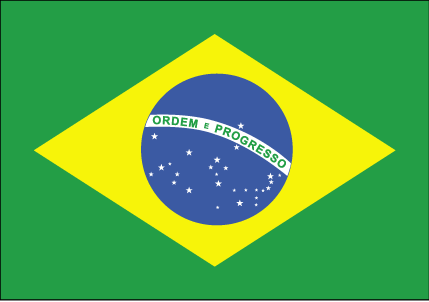
Brazil
Pays
Brésil
countryucasefr
BRESIL
Pays en Chinois
Pays en Espagnol
El Brasil
Pays en Italien
Il Brasile
Pays en Portugais
Brasil
Pays en Allemand
Brasilien
countrypy
ba1 xi1
countrylocal
Brasil
countryfull
Brazil
countrynm
Brazil
ISO2
BR
ISO3
BRA
countrycodeisono
076
countrycodevehicle
BR
countrycodeolympic
BRA
countrycodeirs
BR
countrycodeirsfr
BR
countrycodeirsmixt
BR
countrycode
55
♂Masulin
17
6
114
languagesfr
Portugais
21
currency
real
currencyfr
real
currencyisocode
BRL
currencyisocodefull
BRL 986
currencypxcode
BRL
currencysymbol
R$
currencysubdivision
100 centavos
currencyregime
float
currencyvalue
0.4091
nationalityfr
Brésilienne
Capitale
Brasilia
capitalfr
Brasilia
Préfixe Tél.
55
Superficie km2
8 511 965
arealand
8 456 510
areawater
55 455
landarablerate
0.063
landforestrate
0.643
coastline
7491
summit
Pico de Neblina 3 014 m.
boundarycountries
Uruguay, Argentine, Bolivie, Paraguay, Pérou, Colombie, Vénézuéla, Guyane.
timezonedeltabegin
-2
timezonedeltaend
-5
flaglink
maplink
brcolor.gif
outlinemaplink
br.gif
visapassenger
-1
maincities
Sao Paulo, Rio de Janeiro, Belo Horizonte, Salvador, Fortaleza, Nova Iguaçu, Recife, Curitiba, Pôrto Alegre, Belém, Goiâna, Campinas.
largestcity
Sao Paulo
largestcitypopulation
16 533 000
rankpopulation
5
Population
176 596 000
rankgdp
15
gdp
492338000000
rankgdpppp
9
gdpppp
1375756000000
rankgni
13
gni
479515000000
rankincomeorigin
95
rankincome
105
income
2720
rankincomeppp
86
incomeppp
7510
lifeexpectation
71.41
alphabetizationrate
0.86
natalityrate
0.01725
mortalityrate
0.00614
mortalityrateinfantile
0.03066
hdi
0.777
nationalevent
Independence Day
nationaleventfr
Jour de l'Indépendance
nationalholiday
7 September (1822)
Date de naissance aaaa-mm-jj
1822-09-07 00:00:00
9
7
location
Eastern South America, bordering the Atlantic Ocean
terrain
mostly flat to rolling lowlands in north; some plains, hills, mountains, and narrow coastal belt
naturalresources
bauxite, gold, iron ore, manganese, nickel, phosph
cooking
Football + Cuisine Epicée.
9
Web
rgbback
16777215
todate
1
Notes
Football + Cuisine Epicée.

19

id
Pays
Pays en Anglais
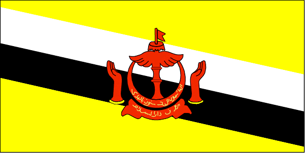
Brunei
Pays
Brunei
countryucasefr
BRUNEI
Pays en Chinois
Pays en Espagnol
Brunei
Pays en Italien
Brunei
Pays en Portugais
Brunei
Pays en Allemand
Brunei
countrypy
wen2 lai2 da2 lu3 sa4 lan2 guo2
countrylocal
Negara Brunei Darussalam
countryfull
Brunei
countrynm
Brunei
ISO2
BN
ISO3
BRN
countrycodeisono
096
countrycodevehicle
BRU
countrycodeolympic
BRU
countrycodeirs
BX
countrycodeirsfr
BX
countrycodeirsmixt
BX
♂Masulin
12
3
100
languagesfr
Malais
23
currency
ringgit (a.k.a. Bruneian dollar)
currencyfr
dollar de Brunei
currencyisocode
BND
currencyisocodefull
BND 096
currencypxcode
BND
currencysymbol
B$
currencysubdivision
100 sen (a.k.a. 100 cents)
currencyregime
S$ (1.0)
currencyvalue
0.602
Capitale
Bandar Seri Begawan
capitalfr
Bandar Seri Begawan
Préfixe Tél.
673
Superficie km2
5 765
arealand
5 270
areawater
500
landarablerate
0.0057
coastline
161
summit
Gunung Pâgon Periok 1 850 m.
boundarycountries
Malaisie
timezonedeltabegin
8
flaglink
maplink
bncolor.gif
outlinemaplink
bnout.gif
visapassenger
-1
maincities
Seria, Kuala Belait, Lumut.
largestcity
Bandar Seri Begawan
rankpopulation
168
Population
356 000
rankgni
96
gni
7960000000
rankincomeorigin
19
rankincome
22
income
22743
lifeexpectation
74.54
alphabetizationrate
0.9135
natalityrate
0.01933
fecondity
2.48
mortalityrate
0.0034
mortalityrateinfantile
0.01305
hdi
0.872
urbanization
0.728
nationalevent
National Day
nationaleventfr
Jour National
nationalholiday
23 February (1984)
Date de naissance aaaa-mm-jj
1984-02-23 00:00:00
1
1
location
Southeastern Asia, bordering the South China Sea and Malaysia
terrain
flat coastal plain rises to mountains in east; hilly lowland in west
naturalresources
petroleum, natural gas, timber
9
rgbback
16777215
todate
1

20

id
Pays
Pays en Anglais
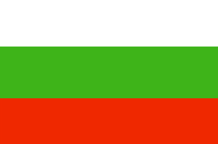
Bulgaria
Pays
Bulgarie
countryucasefr
BULGARIE
Pays en Chinois
Pays en Espagnol
Bulgaria
Pays en Italien
La Bulgaria
Pays en Portugais
Bulgária
Pays en Allemand
Bulgarien
countrypy
bao3 jia1 li4 ya4
countrylocal
Bulgaria
countryfull
Bulgaria
countrynm
Bulgaria
ISO2
BG
ISO3
BGR
countrycodeisono
100
countrycodevehicle
BG
countrycodeolympic
BUL
countrycodeirs
BU
countrycodeirsfr
BU
countrycodeirsmixt
BU
♀Féminin
18
6
29
languagesfr
Bulgare
20
currency
new lev
currencyfr
lev
currencyisocode
BGN
currencyisocodefull
BGN 975
currencypxcode
BGL
currencysymbol
Lv
currencysubdivision
100 stotinki
currencyregime
Euro (1.95583)
currencyvalue
0.6252
nationalityfr
Bulgare
Capitale
Sofia
capitalfr
Sofia
Préfixe Tél.
359
Superficie km2
111 000
arealand
110 550
areawater
360
landarablerate
0.39
landforestrate
0.334
coastline
354
summit
Musala 2 925 m.
boundarycountries
Yougoslavie, Macédoine, Turquie, Roumanie, Grèce
timezonedeltabegin
2
flaglink
maplink
bu-map.gif
outlinemaplink
bg.gif
visapassenger
-1
maincities
Plovdiv, Varna, Burgas, Ruse, Stara Zagora, Pleven, Tolbukhin, Sliven, Shumen
largestcity
Sofia
largestcitypopulation
1 188 000
rankpopulation
90
Population
7 823 000
rankgdp
70
gdp
19860000000
rankgdpppp
63
gdpppp
60483000000
rankgni
76
gni
16637000000
rankincomeorigin
107
rankincome
117
income
2130
rankincomeppp
85
incomeppp
7540
lifeexpectation
71.75
alphabetizationrate
0.98
natalityrate
0.00965
mortalityrate
0.01425
mortalityrateinfantile
0.02131
hdi
0.795
urbanization
0.674
nationalevent
Liberation Day
nationaleventfr
Jour de la Libération
nationalholiday
3 March (1878)
Date de naissance aaaa-mm-jj
1878-03-03 00:00:00
5
3
location
Southeastern Europe, bordering the Black Sea, between Romania and Turkey
terrain
mostly mountains with lowlands in north and southeast
naturalresources
bauxite, copper, lead, zinc, coal, timber, arable
7
Web
rgbback
16777215
todate
1

21

id
Pays
Pays en Anglais
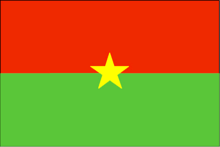
Burkina Faso
Pays
Burkina Faso
countryucasefr
BURKINA FASO
Pays en Chinois
Pays en Espagnol
Burkino Faso
Pays en Italien
Burkino Faso
Pays en Portugais
Burkino Faso
Pays en Allemand
Burkino Faso
countrypy
bu4 ji1 na4 fa3 suo3
countrylocal
Burkina Faso
countryfull
Burkina Faso
countrynm
Burkina Faso
ISO2
BF
ISO3
BFA
countrycodeisono
854
countrycodevehicle
BF
countrycodeolympic
BUR
countrycodeirs
UV
countrycodeirsfr
UV
countrycodeirsmixt
UV
♂Masulin
16
4
57
languagesfr
Français
119
currency
franc
currencyfr
franc C.F.A.
currencyisocode
XOF
currencyisocodefull
XOF 952
currencypxcode
XOF
currencysymbol
CFAF
currencysubdivision
100 centimes
currencyregime
Euro (655.957)
currencyvalue
0.00186
Capitale
Ouagadougou
capitalfr
Ouagadougou
Préfixe Tél.
226
Superficie km2
274 200
arealand
273 800
areawater
400
landarablerate
0.1243
landforestrate
0.259
summit
Tena Kourou 749 m.
boundarycountries
Côte d'Ivoire, Mali, Bénin, Togo, Ghana.
flaglink
maplink
bfcolor.gif
outlinemaplink
bfout.gif
visapassenger
-1
maincities
Bobo Dioulasso, Koudougou, Ouahigouya, Banfora, Kaya.
largestcity
Ouagadougou
largestcitypopulation
824 000
rankpopulation
65
Population
12 109 000
rankgdp
126
gdp
4182000000
rankgdpppp
110
gdpppp
14218000000
rankgni
135
gni
3587000000
rankincomeorigin
183
rankincome
197
income
300
rankincomeppp
183
incomeppp
1170
lifeexpectation
53.8
alphabetizationrate
0.2585
natalityrate
0.04478
mortalityrate
0.01876
mortalityrateinfantile
0.09978
hdi
0.33
nationalevent
Republic Day
nationaleventfr
Jour de la République
nationalholiday
11 December (1958)
Date de naissance aaaa-mm-jj
1958-12-11 00:00:00
5
11
location
Western Africa, north of Ghana
terrain
mostly flat to dissected, undulating plains; hills in west and southeast
naturalresources
manganese, limestone, marble; small deposits of go
9
Web
rgbback
16777215
todate
1

22

id
Pays
Pays en Anglais
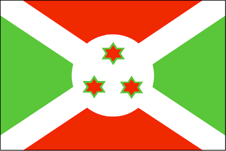
Burundi
Pays
Burundi
countryucasefr
BURUNDI
Pays en Chinois
Pays en Espagnol
Burundi
Pays en Italien
Il Burundi
Pays en Portugais
Burundi
Pays en Allemand
Burundi
countrypy
pu2 long2 di4
countrylocal
Burundi
countryfull
Burundi
countrynm
Burundi
ISO2
BI
ISO3
BDI
countrycodeisono
108
countrycodevehicle
RU
countrycodeolympic
BDI
countrycodeirs
BY
countrycodeirsfr
BY
countrycodeirsmixt
BY
♂Masulin
15
2
57
languagesfr
Français
131
currency
franc
currencyfr
franc de Burundi
currencyisocode
BIF
currencyisocodefull
BIF 108
currencypxcode
BIF
currencysymbol
FBu
currencysubdivision
100 centimes [*]
currencyregime
composite
currencyvalue
0.00097
Capitale
Bujumbura
capitalfr
Bujumbura
Préfixe Tél.
257
Superficie km2
27 834
arealand
25 650
areawater
2 180
landarablerate
0.2998
landforestrate
0.037
summit
Mont Heha 2 760 m.
boundarycountries
Congo démocratique, Rwanda, Tanzanie.
timezonedeltabegin
2
flaglink
maplink
bicolor.gif
outlinemaplink
biout.gif
visapassenger
-1
maincities
Gitega, Bururi, Rumonge, Ngozi.
largestcity
Bujumbura
largestcitypopulation
278 000
rankpopulation
92
Population
7 206 000
rankgdp
167
gdp
595000000
rankgdpppp
142
gdpppp
4668000000
rankgni
186
gni
628000000
rankincomeorigin
207
rankincome
220
income
90
rankincomeppp
205
incomeppp
630
lifeexpectation
43.36
alphabetizationrate
0.507
natalityrate
0.03968
mortalityrate
0.01761
mortalityrateinfantile
0.0704
hdi
0.37
urbanization
0.093
nationalevent
Independence Day
nationaleventfr
Jour de l'Indépendance
nationalholiday
1 July (1962)
Date de naissance aaaa-mm-jj
1962-07-01 00:00:00
9
3
location
Central Africa, east of Democratic Republic of the Congo
terrain
hilly and mountainous, dropping to a plateau in east, some plains
naturalresources
nickel, uranium, rare earth oxides, peat, cobalt,
9
Web
rgbback
16777215
todate
1

Plus+
A | B | C | D | E | F | G | H | I | J | K | L | M | N | O | P | Q | R | S | T | U | V | W | X | Y | Z
 

Envoyez vos commentaires (37)

37. Visiteur *.*.164.* - 2022-03-16 17:43:29
Buenas recomendaciones y todo lo que lleva el contenido de la web es increíble!
36. Visiteur *.*.222.* - 2022-02-09 12:45:33
Los materiales que se utilizan para realizar este tipo de prácticas están todos hechos de madera!
35. Visiteur *.*.225.* - 2022-01-24 16:55:06
Buenas ideas sabemos como podemos inspirarnos gracias a links así!
34. Visiteur *.*.32.* - 2022-01-19 19:32:41
Los sitios web de esta manera me inspiran a seguir trabajando duro!
33. Visiteur *.*.146.* - 2021-11-26 15:19:37
Excellent information on your content, thank you for taking the time to share with us.
Email Web

Veuillez recopier la chaîne :
Texte à recopier.

Asia Home™ > Indonésie > Bahamas 巴哈马 => Indonésie 印度尼西亚 => Pays de Beau Bois | Conditions générales de vente | Retours et remboursements | Clauses de Confidentialité | FAQ
  

Envie de venir ? | Appelez-nous 7/704 67 79 04 87 (Service Epices)

Fêtes    Fermer
09133200.jpg
Le muguet porte bonheur, offre un brin à l'élu de ton coeur !
Joyeuse Fête du travail. Les Baguettes de Pain et Fleurs Muguet sont disponibles. En effet : Mercredi 1er Mai, Asia Home™ sera ouvert de 9:00 à 0, vous viendrez ? Horaires
 
Fenêtre contextuelle    Fermer
Veuillez patienter...