Indonésie 印度尼西亚 => Pays de Beau Bois

Indonésie 印度尼西亚 => Pays de Beau Bois

Les artisans

Sélection des meubles indonésiens

Les objets

Histoire des meubles indonésiens

Indonésie 印度尼西亚 => Pays de Beau Bois

Mise à jour 2023-11-09 09:24:11

L'Indonésie est un pays situé en Asie dont la capitale est Jakarta. La hiérarchie des divisions administratives est la suivante : L'Indonésie est subdivisée en provinces, qui se divisent à leur tour en régences (kabupaten), villes (kota), qui se divisent à leur tour en districts, qui se divisent à leur tour en bourgades, villages.

Les noms des pays/territoires du monde sont donnés en Français et Chinois. Cette collection des précieuses terres fermes du monde que toute l'humanité partage inclut non seulement les pays indépendants, mais aussi des régions spécifiques qui ne sont pas membre de l'ONUOrganisation des Nations Unies: Nous, peuples des Nations Unies ... Une ONU plus forte pour un monde meilleur. Veuillez aussi consulter les noms des pays en masculin et féminin en Français.

GéoPays    Fermer
Indonésie | Pays/Territoires | Régions en Chine | Provinces de Chine | Régions en France | Départements de France | Provinces du Monde | Villes/Villages | Localités | Continents du Monde | Vins AOP

1

id
Pays
Pays en Anglais
Kingman Reef
Pays
Récif Kingman
countryucasefr
RECIF KINGMAN
Pays en Chinois
Pays en Espagnol
Filón De Kingman
Pays en Italien
Reef Di Kingman
Pays en Portugais
Recife De Kingman
Pays en Allemand
Reef Kingman
countryfull
Kingman Reef
countrynm
Kingman Reef
ISO2
UMI9
ISO3
UMI9
countrycodeisono
581
countrycodeirs
KQ
countrycodeirsfr
KQ
countrycodeirsmixt
KQ
♂Masulin
17
7
51
1
currencypxcode
USD
Superficie km2
1
arealand
1
coastline
3
timezonedeltabegin
-11
flaglink
maplink
kq-map.gif
visapassenger
-1
rankincome
222
location
Oceania, reef in the North Pacific Ocean, about half way between Hawaii and American Samoa
terrain
low and nearly level
naturalresources
terrestrial and aquatic wildlife
cooking
Oceania, reef in the North Pacific Ocean, about half way between Hawaii and American Samoa
9
rgbback
16777215
todate
1

2

id
Pays
Pays en Anglais
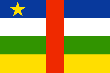
Central Africa
Pays
République Centrafricaine
countryucasefr
CENTRAFRICAINE
Pays en Chinois
Pays en Espagnol
República Africana De centro
Pays en Italien
Repubblica Africana Concenta
Pays en Portugais
República Africana Center
Pays en Allemand
Afrikanische Mittelrepublik
countrypy
zhong1 fei1 gong4 he2 guo2
countrylocal
Republique Centrafricaine
countryfull
Central African Republic
countrynm
Central African Republic
ISO2
CF
ISO3
CAF
countrycodeisono
140
countrycodevehicle
RCA
countrycodeolympic
CAF
countrycodeirs
CT
countrycodeirsfr
CT
countrycodeirsmixt
CT
♀Féminin
15
1
57
languagesfr
Français
119
currency
franc
currencyfr
franc C.F.A.
currencyisocode
XAF
currencyisocodefull
XAF 950
currencypxcode
XAF
currencysymbol
CFAF
currencysubdivision
100 centimes
currencyregime
Euro (655.957)
currencyvalue
0.00186
nationalityfr
Centre-Africaine
Capitale
Bangui
capitalfr
Bangui
Préfixe Tél.
236
Superficie km2
622 984
arealand
622 984
landarablerate
0.031
landforestrate
0.368
summit
Mont Gaou 1 420 m.
boundarycountries
Cameroun, Tchad, Soudan, Congo démocratique, Congo.
timezonedeltabegin
1
flaglink
maplink
cfcolor.gif
outlinemaplink
cfout.gif
visapassenger
-1
maincities
Berbérati, Bouar, Bambari, Bangassou, Mbaïki.
largestcity
Bangui
largestcitypopulation
553 000
rankpopulation
125
Population
3 881 000
rankgdp
151
gdp
1198000000
rankgdpppp
146
gdpppp
4225000000
rankgni
172
gni
1019000000
rankincomeorigin
190
rankincome
204
income
260
rankincomeppp
185
incomeppp
1080
lifeexpectation
41.71
alphabetizationrate
0.377
natalityrate
0.03593
mortalityrate
0.01973
mortalityrateinfantile
0.0933
nationalevent
Republic Day
nationaleventfr
Jour de la République
nationalholiday
1 December (1958)
Date de naissance aaaa-mm-jj
1958-12-01 00:00:00
5
11
location
Central Africa, north of Democratic Republic of the Congo
terrain
vast, flat to rolling, monotonous plateau; scattered hills in northeast and southwest
naturalresources
diamonds, uranium, timber, gold, oil, hydropower
9
Web
rgbback
16777215
todate
1

3

id
Pays
Pays en Anglais
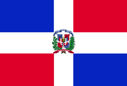
Dominican Republic
Pays
République Dominicaine
countryucasefr
DOMINICAINE (REPUBLIQUE)
Pays en Chinois
Pays en Espagnol
República Dominicana
Pays en Italien
Repubblica Domenicana
Pays en Portugais
República Dominican
Pays en Allemand
Dominikanische Republik
countrypy
duo1 mi3 ni2 jia1 gong4 he2 guo2
countrylocal
Dominicana, Republica
countryfull
Dominican Republic
countrynm
Dominican Republic
ISO2
DO
ISO3
DOM
countrycodeisono
214
countrycodevehicle
DOM
countrycodeolympic
DOM
countrycodeirs
DR
countrycodeirsfr
DR
countrycodeirsmixt
DR
countrycode
1809
♀Féminin
18
6
131
languagesfr
Espagnol
34
currency
peso
currencyfr
peso dominicain
currencyisocode
DOP
currencyisocodefull
DOP 214
currencypxcode
DOP
currencysymbol
RD$
currencysubdivision
100 centavos
currencyregime
m.float
currencyvalue
0.03472
nationalityfr
Dominicaine
Capitale
Santo Domingo
capitalfr
Saint-Domingue
Préfixe Tél.
1-809
Superficie km2
48 734
arealand
48 380
areawater
350
landarablerate
0.2108
landforestrate
0.284
coastline
1288
summit
Pico Duarte 3 175 m.
boundarycountries
Haïti.
timezonedeltabegin
-4
flaglink
maplink
docolor.gif
outlinemaplink
do.gif
visapassenger
-1
maincities
Santiago, La Vega, Puerto Plata, Barahona, La Romana, San Pedro de Macoris, San Francisco de Macoris, San Juan.
largestcity
Santo Domingo
largestcitypopulation
3 166 000
rankpopulation
82
Population
8 739 000
rankgdp
80
gdp
16541000000
rankgdpppp
65
gdpppp
59622000000
rankgni
72
gni
18601000000
rankincomeorigin
107
rankincome
117
income
2130
rankincomeppp
99
incomeppp
6310
lifeexpectation
67.63
alphabetizationrate
0.8435
natalityrate
0.0236
mortalityrate
0.0071
mortalityrateinfantile
0.03328
hdi
0.737
urbanization
0.66
precipitation
1448
nationalevent
Independence Day
nationaleventfr
Jour de l'Indépendance
nationalholiday
27 February (1844)
Date de naissance aaaa-mm-jj
1844-02-27 00:00:00
1
5
location
Caribbean, eastern two-thirds of the island of Hispaniola, between the Caribbean Sea and the North Atlantic Ocean, east of Haiti
terrain
rugged highlands and mountains with fertile valleys interspersed
naturalresources
nickel, bauxite, gold, silver
cooking
Fruits de Mer
9
Web
rgbback
16777215
todate
1
Notes
Fruits de Mer

4

id
Pays
Pays en Anglais
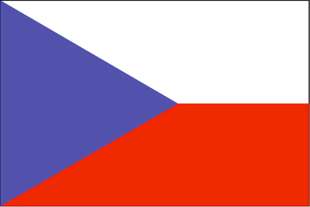
Czech Republic
Pays
République Tchèque
countryucasefr
TCHEQUE (REPUBLIQUE)
Pays en Chinois
Pays en Espagnol
República Checa
Pays en Italien
Repubblica Ceca
Pays en Portugais
República Czech
Pays en Allemand
Tschechische Republik
countrypy
jie2 ke4 gong4 he2 guo2
countrylocal
Ceska Republika
countryfull
Czech Republic
countrynm
Czech Republic
ISO2
CZ
ISO3
CZE
countrycodeisono
203
countrycodevehicle
CZ
countrycodeolympic
CZE
countrycodeirs
CZ
countrycodeirsfr
CZ
countrycodeirsmixt
CZ
countrycode
42
♀Féminin
18
6
37
languagesfr
Tchèque
32
currency
koruna
currencyfr
couronne
currencyisocode
CZK
currencyisocodefull
CZK 203
currencypxcode
CZK
currencysymbol
Kc (with h
currencysubdivision
100 haleru
currencyregime
float
currencyvalue
0.04019
nationalityfr
Czech
Capitale
Prague
capitalfr
Prague
Préfixe Tél.
420
Superficie km2
8 838
arealand
77 276
areawater
1 590
landarablerate
0.4
landforestrate
0.341
summit
Snezka 1 602 m.
boundarycountries
Allemagne, Pologne, Slovaquie, Autriche.
timezonedeltabegin
1
flaglink
maplink
ez-map.gif
outlinemaplink
cz.gif
visapassenger
-1
maincities
Brno, Ostrava, Plzen, Olomouc, Usti Nad Labem, Liberec, Hradec Králové, Pardubice, Ceské Budejovice.
largestcity
Prague
largestcitypopulation
1 225 000
rankpopulation
75
Population
10 202 000
rankgdp
39
gdp
89715000000
rankgdpppp
43
gdpppp
166877000000
rankgni
45
gni
72899000000
rankincomeorigin
63
rankincome
69
income
7150
rankincomeppp
56
incomeppp
15600
lifeexpectation
75.78
alphabetizationrate
1
natalityrate
0.0091
mortalityrate
0.01054
mortalityrateinfantile
0.00397
hdi
0.861
urbanization
0.745
precipitation
527
nationalevent
Czech Founding Day
nationaleventfr
Jour National
nationalholiday
28 October (1918)
Date de naissance aaaa-mm-jj
1918-10-28 00:00:00
5
7
location
Central Europe, southeast of Germany
terrain
Bohemia in the west consists of rolling plains, hills, and plateaus surrounded by low mountains; Moravia in the east consists of very hilly country
naturalresources
hard coal, soft coal, kaolin, clay, graphite, timb
6
Web
rgbback
16777215
todate
1

5

id
Pays
Pays en Anglais
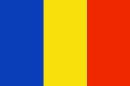
Romania
Pays
Roumanie
countryucasefr
ROUMANIE
Pays en Chinois
Pays en Espagnol
Rumania
Pays en Italien
La Romania
Pays en Portugais
Rumania
Pays en Allemand
Rumänien
countrypy
luo2 ma3 ni2 ya4
countrylocal
Romania
countryfull
Romania
countrynm
Romania
ISO2
RO
ISO3
ROU
countrycodeisono
642
countrycodevehicle
RO
countrycodeolympic
ROU
countrycodeirs
RO
countrycodeirsfr
RO
countrycodeirsmixt
RO
♀Féminin
15
6
117
languagesfr
Roumain
87
currency
[new] leu (pl. lei)
currencyfr
leu
currencyisocode
RON
currencyisocodefull
RON
currencypxcode
ROL
currencysymbol
L
currencysubdivision
100 bani
currencyregime
float
currencyvalue
0.00003
Capitale
Bucharest
capitalfr
Bucarest
Préfixe Tél.
40
Superficie km2
238 000
arealand
230 340
areawater
7 160
landarablerate
0.4057
landforestrate
0.28
coastline
225
summit
Moldoveanul 2 543 m.
boundarycountries
Hongrie, Ukraine, Moldavie, Yougoslavie, Bulgarie.
timezonedeltabegin
2
flaglink
maplink
ro-map.gif
outlinemaplink
ro.gif
visapassenger
-1
maincities
Brasov, Constanta, Timisoara, Iasi, Cluj-Napoca, Galati, Craiova, Braila, Ploiesti, Oradea, Arad, Sibiu.
largestcity
Bucharest
largestcitypopulation
2 100 000
rankpopulation
47
Population
21 744 000
rankgdp
53
gdp
56951000000
rankgdpppp
45
gdpppp
158234000000
rankgni
52
gni
49045000000
rankincomeorigin
102
rankincome
112
income
2260
rankincomeppp
88
incomeppp
7140
lifeexpectation
70.62
alphabetizationrate
0.9644
natalityrate
0.01079
mortalityrate
0.01225
mortalityrateinfantile
0.0184
hdi
0.772
precipitation
595
nationalevent
Unification Day (of Romania and Transylvania)
nationaleventfr
Jour de l'Unification
nationalholiday
1 December (1918)
Date de naissance aaaa-mm-jj
1918-12-01 00:00:00
5
7
location
Southeastern Europe, bordering the Black Sea, between Bulgaria and Ukraine
terrain
central Transylvanian Basin is separated from the Plain of Moldavia on the east by the Carpathian Mountains and separated from the Walachian Plain on the south by the Transylvanian Alps
naturalresources
petroleum (reserves declining), timber, natural ga
7
Web
rgbback
16777215
todate
1

Plus+
A | B | C | D | E | F | G | H | I | J | K | L | M | N | O | P | Q | R | S | T | U | V | W | X | Y | Z
 

Envoyez vos commentaires (37)

37. Visiteur *.*.164.* - 2022-03-16 17:43:29
Buenas recomendaciones y todo lo que lleva el contenido de la web es increíble!
36. Visiteur *.*.222.* - 2022-02-09 12:45:33
Los materiales que se utilizan para realizar este tipo de prácticas están todos hechos de madera!
35. Visiteur *.*.225.* - 2022-01-24 16:55:06
Buenas ideas sabemos como podemos inspirarnos gracias a links así!
34. Visiteur *.*.32.* - 2022-01-19 19:32:41
Los sitios web de esta manera me inspiran a seguir trabajando duro!
33. Visiteur *.*.146.* - 2021-11-26 15:19:37
Excellent information on your content, thank you for taking the time to share with us.
Email Web

Veuillez recopier la chaîne :
Texte à recopier.

Asia Home™ > Indonésie > Récif Kingman 王家岩石岛 => Indonésie 印度尼西亚 => Pays de Beau Bois | Conditions générales de vente | Retours et remboursements | Clauses de Confidentialité | FAQ
  

Envie de venir ? | Appelez-nous 7/704 67 79 04 87 (Service Epices)

Fenêtre contextuelle    Fermer
Veuillez patienter...