Pays/Territoires
Mise à jour 2021-01-12 18:58:56
Les noms des pays/territoires du monde sont donnés en Français et Chinois. Cette collection des précieuses terres fermes du monde que toute l'humanité partage inclut non seulement les pays indépendants, mais aussi des régions spécifiques qui ne sont pas membre de l'ONUOrganisation des Nations Unies: Nous, peuples des Nations Unies ... Une ONU plus forte pour un monde meilleur. Veuillez aussi consulter les noms des pays en masculin et féminin en Français.
GéoPays Fermer
1
id
Pays
Pays en Anglais
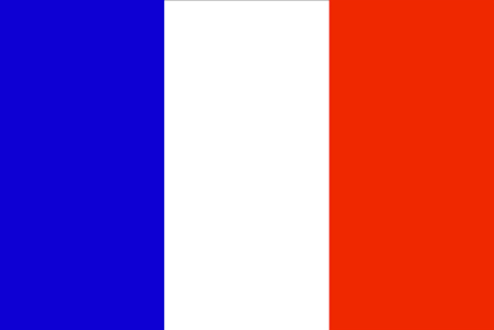
French Guiana
Pays
Guyane française
countryucasefr
GUYANE FRANCAISE
Pays en Chinois
Pays en Espagnol
La Guayana Francesa
Pays en Italien
Guiana Francese
Pays en Portugais
Guiana Francês
Pays en Allemand
Französisch-Guayana
countryfull
French Guiana
countrynm
French Guiana
ISO2
GF
ISO3
GUF
countrycodeisono
254
countrycodeirs
FG
countrycodeirsfr
FG
countrycodeirsmixt
FG
♀Féminin
15
6
57
languagesfr
Français
2
currency
euro
currencyfr
Euro
currencyisocode
EUR
currencyisocodefull
EUR 978
currencypxcode
EUR
currencysymbol
€
currencysubdivision
100 cents
currencyregime
float
currencyvalue
1.2203
nationalityfr
Française
Capitale
Cayenne
capitalfr
Cayenne
Préfixe Tél.
594
Superficie km2
90 909
arealand
89 150
areawater
1 850
landarablerate
0.0011
landforestrate
0.899
coastline
378
summit
Bellevue de l'Inini 851 m.
boundarycountries
Surinam, Brésil.
timezonedeltabegin
-3
flaglink
maplink
gfcolor.gif
outlinemaplink
gf.gif
visapassenger
-1
maincities
Kourou, Saint Laurent, Rémire, Sinnamary
largestcity
Cayenne
rankpopulation
186
Population
182 333
rankgni
157
gni
1480000000
rankincomeorigin
57
rankincome
58
income
9427
lifeexpectation
76.89
alphabetizationrate
0.985
natalityrate
0.021
fecondity
3.33
mortalityrate
0.00482
mortalityrateinfantile
0.01246
urbanization
0.752
nationalevent
Bastille Day
nationaleventfr
Jour de la prise de la Bastille
nationalholiday
14 July (1789)
Date de naissance aaaa-mm-jj
1789-07-14 00:00:00
6
10
location
Northern South America, bordering the North Atlantic Ocean, between Brazil and Suriname
terrain
low-lying coastal plains rising to hills and small mountains
naturalresources
bauxite, timber, gold (widely scattered), cinnabar
2
Web
rgbback
16777215
todate
1
2
id
Pays
Pays en Anglais
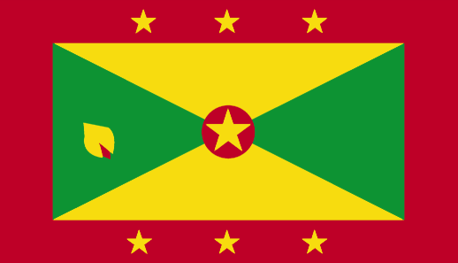
Grenada
Pays
Grenade
countryucasefr
GRENADE
Pays en Chinois
Pays en Espagnol
Grenada
Pays en Italien
La Granada
Pays en Portugais
Grenada
Pays en Allemand
Grenada
countryfull
Grenada
countrynm
Grenada
ISO2
GD
ISO3
GRD
countrycodeisono
308
countrycodevehicle
WG
countrycodeolympic
GRN
countrycodeirs
GJ
countrycodeirsfr
GJ
countrycodeirsmixt
GJ
12
6
51
languagesfr
Anglais
35
currency
dollar
currencyfr
dollar des Caraïbes orientales
currencyisocode
XCD
currencyisocodefull
XCD 951
currencypxcode
XCD
currencysymbol
EC$
currencysubdivision
100 cents
currencyregime
US-$ (2.7)
currencyvalue
0.3745
Capitale
Saint George's
capitalfr
Saint-George's
Préfixe Tél.
1-473
Superficie km2
344
arealand
344
landarablerate
0.0588
landforestrate
0.147
coastline
121
summit
Mount Saint Catherine 840 m.
timezonedeltabegin
-4
flaglink
maplink
gdcolor.gif
outlinemaplink
gd.gif
visapassenger
-1
maincities
Gouyave, Hillsborough, Grenville, Sauteurs, Grand Roy.
largestcity
St George
largestcitypopulation
33 000
rankpopulation
187
Population
105 000
rankgdp
169
gdp
439000000
rankgdpppp
159
gdpppp
833000000
rankgni
190
gni
388000000
rankincomeorigin
85
rankincome
94
income
3710
rankincomeppp
89
incomeppp
7030
lifeexpectation
64.52
alphabetizationrate
0.98
natalityrate
0.02261
fecondity
2.5
mortalityrate
0.00731
mortalityrateinfantile
0.01462
hdi
0.738
nationalevent
Independence Day
nationaleventfr
Jour de l'Indépendance
nationalholiday
7 February (1974)
Date de naissance aaaa-mm-jj
1974-02-07 00:00:00
1
3
location
Caribbean, island between the Caribbean Sea and Atlantic Ocean, north of Trinidad and Tobago
terrain
volcanic in origin with central mountains
naturalresources
timber, tropical fruit, deepwater harbors
9
Web
rgbback
16777215
todate
1
3
id
Pays
Pays en Anglais
Guadeloupe
Pays
Guadeloupe
countryucasefr
GUADELOUPE
Pays en Chinois
Pays en Espagnol
Guadalupe
Pays en Italien
La Guadalupa
Pays en Portugais
Guadalupe
Pays en Allemand
Guadeloupe
countryfull
Guadeloupe
countrynm
Guadeloupe
ISO2
GP
ISO3
GLP
countrycodeisono
312
countrycodeirs
GP
countrycodeirsfr
GP
countrycodeirsmixt
GP
♀Féminin
15
6
57
languagesfr
Français
2
currency
euro
currencyfr
euro
currencyisocode
EUR
currencyisocodefull
EUR 978
currencypxcode
EUR
currencysymbol
€
currencysubdivision
100 cents
currencyregime
float
currencyvalue
1.2203
nationalityfr
Française
Capitale
Pointe à Pitre
capitalfr
Pointe à Pitre
Préfixe Tél.
590
Superficie km2
1 780
arealand
1 706
areawater
74
landarablerate
0.1065
landforestrate
0.485
coastline
306
summit
Soufrière 1 467 m.
timezonedeltabegin
-4
flaglink
maplink
gpcolor.gif
outlinemaplink
gp.gif
visapassenger
-1
maincities
Abymes, Pointe-à-Pitre, Le Gosier, Sainte Anne, Moule, Morne-à-l'Eau, Petit Bourg, Sainte Rose, Saint Claude
largestcity
Pointe à Pitre
rankpopulation
169
Population
435 739
rankgni
130
gni
3640000000
rankincomeorigin
62
rankincome
63
income
7913
lifeexpectation
77.71
alphabetizationrate
0.9
natalityrate
0.01579
mortalityrate
0.00605
mortalityrateinfantile
0.00883
urbanization
0.996
nationalevent
Bastille Day
nationaleventfr
Jour de la prise de la Bastille
nationalholiday
14 July (1789)
Date de naissance aaaa-mm-jj
1789-07-14 00:00:00
6
10
location
Caribbean, islands between the Caribbean Sea and the North Atlantic Ocean, southeast of Puerto Rico
terrain
Basse-Terre is volcanic in origin with interior mountains; Grande-Terre is low limestone formation; most of the seven other islands are volcanic in origin
naturalresources
cultivable land, beaches and climate that foster t
2
Web
rgbback
16777215
todate
1
4
id
Pays
Pays en Anglais
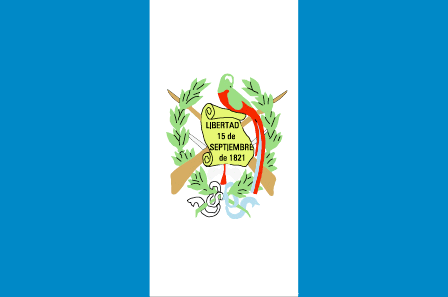
Guatemala
Pays
Guatemala
countryucasefr
GUATEMALA
Pays en Chinois
Pays en Espagnol
Guatemala
Pays en Italien
Il Guatemala
Pays en Portugais
Guatemala
Pays en Allemand
Guatemala
countrypy
gua1 di4 ma3 la1
countrylocal
Guatemala
countryfull
Guatemala
countrynm
Guatemala
ISO2
GT
ISO3
GTM
countrycodeisono
320
countrycodevehicle
GCA
countrycodeolympic
GUA
countrycodeirs
GT
countrycodeirsfr
GT
countrycodeirsmixt
GT
countrycode
502
♂Masulin
19
6
131
languagesfr
Espagnol
43
currency
quetzal
currencyfr
quetzal
currencyisocode
GTQ
currencyisocodefull
GTQ 320
currencypxcode
GTQ
currencysymbol
Q
currencysubdivision
100 centavos
currencyregime
float
currencyvalue
0.1317
Capitale
Guatemala City
capitalfr
Guatemala
Préfixe Tél.
502
Superficie km2
108 890
arealand
108 430
areawater
460
landarablerate
0.1254
landforestrate
0.263
coastline
400
summit
Volcán Tajumulco 4 220 m
boundarycountries
Mexique, Bélize, El Salvador, Honduras.
timezonedeltabegin
-6
flaglink
maplink
gtcolor.gif
outlinemaplink
gtoutl.gif
visapassenger
-1
maincities
Escuintla, Quezaltenango, Puerto Barrios, Retlahuleu, Cobán, Chiquimula, Mazatenangoy
largestcity
Guatemala City
largestcitypopulation
2 205 000
rankpopulation
64
Population
12 307 000
rankgdp
66
gdp
24730000000
rankgdpppp
66
gdpppp
51056000000
rankgni
67
gni
23486000000
rankincomeorigin
114
rankincome
124
income
1910
rankincomeppp
130
incomeppp
4090
lifeexpectation
65.26
alphabetizationrate
0.551
natalityrate
0.03551
mortalityrate
0.00677
mortalityrateinfantile
0.03896
nationalevent
Independence Day
nationaleventfr
Jour de l'Indépendance
nationalholiday
15 September (1821)
Date de naissance aaaa-mm-jj
1821-09-15 00:00:00
8
6
location
Middle America, bordering the North Pacific Ocean, between El Salvador and Mexico, and bordering the Gulf of Honduras (Caribbean Sea) between Honduras and Belize
terrain
mostly mountains with narrow coastal plains and rolling limestone plateau (Peten)
naturalresources
petroleum, nickel, rare woods, fish, chicle, hydro
9
Web
rgbback
16777215
todate
1
5
id
Pays
Pays en Anglais
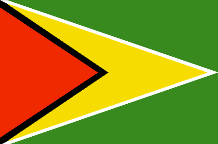
Guyana
Pays
Guyana
countryucasefr
GUYANA
Pays en Chinois
Pays en Espagnol
Guyana
Pays en Italien
La Guyana
Pays en Portugais
Guyana
Pays en Allemand
Guyana
countrypy
gui1 ya4 na4
countrylocal
Guyana
countryfull
Guyana
countrynm
Guyana
ISO2
GY
ISO3
GUY
countrycodeisono
328
countrycodevehicle
GUY
countrycodeolympic
GUY
countrycodeirs
GY
countrycodeirsfr
GY
countrycodeirsmixt
GY
♂Masulin
15
6
51
languagesfr
Anglais
45
currency
dollar
currencyfr
dollar de Guyana
currencyisocode
GYD
currencyisocodefull
GYD 328
currencypxcode
GYD
currencysymbol
G$
currencysubdivision
100 cents
currencyregime
float
currencyvalue
0.0056
nationalityfr
Guyanaise
Capitale
Georgetown
capitalfr
Georgetown
Préfixe Tél.
592
Superficie km2
214 970
arealand
196 850
areawater
18 120
landarablerate
0.0244
landforestrate
0.785
coastline
459
summit
Mount Roraima 2 772 m.
boundarycountries
Vénézuéla, Surinam, Brésil .
timezonedeltabegin
-3
flaglink
maplink
gycolor.gif
outlinemaplink
gy.gif
visapassenger
-1
maincities
Linden, New Amsterdam, Corriverton, Mahaicony.
largestcity
Georgetown
largestcitypopulation
254 000
rankpopulation
156
Population
769 000
rankgdp
161
gdp
742000000
rankgdpppp
149
gdpppp
3253000000
rankgni
182
gni
689000000
rankincomeorigin
142
rankincome
155
income
900
rankincomeppp
131
incomeppp
3980
lifeexpectation
62.43
alphabetizationrate
0.9865
natalityrate
0.01785
mortalityrate
0.00971
mortalityrateinfantile
0.03722
hdi
0.74
urbanization
0.00467
precipitation
2262
nationalevent
Republic Day
nationaleventfr
Jour de la République
nationalholiday
23 February (1970)
Date de naissance aaaa-mm-jj
1970-02-23 00:00:00
7
11
location
Northern South America, bordering the North Atlantic Ocean, between Suriname and Venezuela
terrain
mostly rolling highlands; low coastal plain; savanna in south
naturalresources
bauxite, gold, diamonds, hardwood timber, shrimp,
cooking
Sucre.
9
rgbback
16777215
todate
1
Notes
Sucre.
6
id
Pays
Pays en Anglais
South Georgia and the South Sandwich Islands
Pays
Georgie du Sud
countryucasefr
GEORGIE DU SUD
Pays en Chinois
Pays en Espagnol
Georgia Del sur
Pays en Italien
Georgia Del sud
Pays en Portugais
Geórgia Sul
Pays en Allemand
SüdcGeorgia
countryfull
South Georgia and the South Sandwich Islands
countrynm
South Georgia and the South Sandwich Islands
ISO2
GS
ISO3
SGS
countrycodeisono
239
countrycodeirs
SX
countrycodeirsfr
SX
countrycodeirsmixt
SX
♀Féminin
12
6
51
22
currencypxcode
GBP
nationalityfr
Georgienne
Capitale
Grytviken
capitalfr
Grytviken
Superficie km2
4 066
arealand
3 903
timezonedeltabegin
-2
flaglink
maplink
sx-map.jpg
visapassenger
-1
largestcity
Grytviken
rankincome
222
nationalevent
Liberation Day
nationaleventfr
Jour de la Libération
nationalholiday
14 June (1982)
Date de naissance aaaa-mm-jj
1982-06-14 00:00:00
9
11
location
Southern South America, islands in the South Atlantic Ocean, east of the tip of South America
terrain
most of the islands, rising steeply from the sea, are rugged and mountainous; South Georgia is largely barren and has steep, glacier-covered mountains; the South Sandwich Islands are of volcanic origin with some active volcanoes
naturalresources
fish
cooking
A group of British-administered volcanic islands in the southern Atlantic Ocean east-southeast of Cape Horn. Part of the Falkland Islands Dependency, the islands were discovered in 1775.
7
rgbback
16777215
todate
1
| Pays/Territoires | Régions en Chine | Provinces de Chine | Régions en France | Départements de France | Provinces du Monde | Villes/Villages | Localités | Continents du Monde | Vins AOP
