Pays/Territoires
Mise à jour 2021-01-12 18:58:56
Les noms des pays/territoires du monde sont donnés en Français et Chinois. Cette collection des précieuses terres fermes du monde que toute l'humanité partage inclut non seulement les pays indépendants, mais aussi des régions spécifiques qui ne sont pas membre de l'ONUOrganisation des Nations Unies: Nous, peuples des Nations Unies ... Une ONU plus forte pour un monde meilleur. Veuillez aussi consulter les noms des pays en masculin et féminin en Français.
GéoPays Fermer
1
id
Pays
Pays en Anglais
Saba
Pays
Saba
countryucasefr
Saba
Pays en Chinois
Pays en Espagnol
Saba
Pays en Italien
Saba
Pays en Portugais
Saba
Pays en Allemand
Saba
ISO2
XC
ISO3
NL-BQ3
todate
1
2
id
Pays
Pays en Anglais
Saint Barthelemy
Pays
Saint Barthélemy
countryucasefr
Saint Barthelemy
Pays en Chinois
Pays en Espagnol
Saint Barthelemy
Pays en Italien
Saint Barthelemy
Pays en Portugais
Saint Barthelemy
Pays en Allemand
Saint Barthelemy
ISO2
BL
ISO3
BLM
todate
1
3
id
Pays
Pays en Anglais
San Marino
Pays
Saint-Marin
countryucasefr
SAINT-MARIN
Pays en Chinois
Pays en Espagnol
San Marino
Pays en Italien
San Marino
Pays en Portugais
San Marino
Pays en Allemand
San Marino
countrypy
sheng4 ma3 li4 nuo4
countrylocal
San Marino
countryfull
San Marino
countrynm
San Marino
ISO2
SM
ISO3
SMR
countrycodeisono
674
countrycodevehicle
RSM
countrycodeolympic
SMR
countrycodeirs
SM
countrycodeirsfr
SM
countrycodeirsmixt
SM
15
6
84
languagesfr
Italien
2
currency
euro
currencyfr
euro
currencyisocode
EUR
currencyisocodefull
EUR 978
currencypxcode
EUR
currencysymbol
€
currencysubdivision
100 cents
currencyregime
float
currencyvalue
1.2203
Capitale
Saint-Marin
capitalfr
Saint-Marin
Préfixe Tél.
378
Superficie km2
62
arealand
61,20
landarablerate
0.1667
summit
Monte Titano 739 m.
boundarycountries
Italie.
timezonedeltabegin
1
flaglink
maplink
sm-map.gif
outlinemaplink
sm.gif
visapassenger
-1
maincities
Serravalle, Borgo Maggiore
largestcity
San Marino
largestcitypopulation
5 000
rankpopulation
206
Population
28 000
rankgdp
156
gdp
880000000
rankgni
178
gni
653000000
rankincomeorigin
15
rankincome
222
rankincomeppp
13
nationalevent
Founding of the Republic
nationaleventfr
Jour National
nationalholiday
3 September (301)
Date de naissance aaaa-mm-jj
1753-01-01 00:00:00
9
9
location
Southern Europe, an enclave in central Italy
terrain
rugged mountains
naturalresources
building stone
9
Web
rgbback
16777215
todate
1
4
id
Pays
Pays en Anglais
Saint Vincent and the Grenadines
Pays
Saint-Vincent-et-les Grenadines
countryucasefr
SAINT-VINCENT-ET-LES GRENADINES
Pays en Chinois
Pays en Espagnol
St. Vincent y el Grenadines
Pays en Italien
St Vincent & il Grenadines
Pays en Portugais
St. Vincent & o Grenadines
Pays en Allemand
Str. Vincent u. das Grenadines
countrypy
sheng4 wen2 sen1 te4 he2 ge2 lin2 na4 ding1 si1
countrylocal
Saint Vincent and the Grenadines
countryfull
Saint Vincent and the Grenadines
countrynm
Saint Vincent and the Grenadines
ISO2
VC
ISO3
VCT
countrycodeisono
670
countrycodevehicle
WV
countrycodeolympic
VIN
countrycodeirs
VC
countrycodeirsfr
VC
countrycodeirsmixt
VC
18
6
51
languagesfr
Anglais
35
currency
dollar
currencyfr
dollar des Caraïbes orientales
currencyisocode
XCD
currencyisocodefull
XCD 951
currencypxcode
XCD
currencysymbol
EC$
currencysubdivision
100 cents
currencyregime
US-$ (2.7)
currencyvalue
0.3745
nationalityfr
Française
Capitale
Kingstown
capitalfr
Kingstown
Préfixe Tél.
1-784
Superficie km2
389
arealand
389
landarablerate
0.1026
landforestrate
0.154
coastline
84
summit
Soufrière 1 234 m.
timezonedeltabegin
-4
flaglink
maplink
vccolor.gif
outlinemaplink
vc.gif
visapassenger
-1
maincities
Georgetown, Fancy, Chateaubelair, Layou.
largestcity
Kingstown
largestcitypopulation
27 000
rankpopulation
186
Population
109 000
rankgdp
171
gdp
371000000
rankgdpppp
163
gdpppp
668000000
rankgni
192
gni
361000000
rankincomeorigin
91
rankincome
101
income
3310
rankincomeppp
105
incomeppp
5870
lifeexpectation
73.35
alphabetizationrate
0.96
natalityrate
0.01677
fecondity
2.23
mortalityrate
0.00604
mortalityrateinfantile
0.01524
hdi
0.755
urbanization
0.56
nationalevent
Independence Day
nationaleventfr
Jour de l'Indépendance
nationalholiday
27 October (1979)
Date de naissance aaaa-mm-jj
1979-10-27 00:00:00
6
8
location
Caribbean, islands between the Caribbean Sea and North Atlantic Ocean, north of Trinidad and Tobago
terrain
volcanic, mountainous
naturalresources
hydropower, cropland
9
Web
rgbback
16777215
todate
1
5
id
Pays
Pays en Anglais
Saint Lucia
Pays
Sainte-Lucie
countryucasefr
SAINTE-LUCIE
Pays en Chinois
Pays en Espagnol
St. Lucia
Pays en Italien
St Lucia
Pays en Portugais
St. Lucia
Pays en Allemand
Str. Lucia
countrypy
sheng4 lu2 xi1 ya4
countrylocal
Saint Lucia
countryfull
Saint Lucia
countrynm
Saint Lucia
ISO2
LC
ISO3
LCA
countrycodeisono
662
countrycodevehicle
WL
countrycodeolympic
LCA
countrycodeirs
ST
countrycodeirsfr
ST
countrycodeirsmixt
ST
♀Féminin
18
6
51
languagesfr
Anglais
35
currency
dollar
currencyfr
dollar des Caraïbes orientales
currencyisocode
XCD
currencyisocodefull
XCD 951
currencypxcode
XCD
currencysymbol
EC$
currencysubdivision
100 cents
currencyregime
US-$ (2.7)
currencyvalue
0.3745
Capitale
Castries
capitalfr
Castries
Préfixe Tél.
1-758
Superficie km2
620
arealand
606
areawater
10
landarablerate
0.0492
landforestrate
0.148
coastline
158
summit
Mont Gimie 950 m.
timezonedeltabegin
-4
flaglink
maplink
lccolor.gif
outlinemaplink
lc.gif
visapassenger
-1
maincities
Vieux Fort, Dennery, Micoud, Soufrière.
largestcity
Castries
largestcitypopulation
53 000
rankpopulation
181
Population
161 000
rankgdp
165
gdp
693000000
rankgdpppp
158
gdpppp
917000000
rankgni
184
gni
650000000
rankincomeorigin
80
rankincome
88
income
4050
rankincomeppp
114
incomeppp
5310
lifeexpectation
73.34
alphabetizationrate
0.67
natalityrate
0.0205
fecondity
2.27
mortalityrate
0.00518
mortalityrateinfantile
0.01395
hdi
0.775
urbanization
0.38
nationalevent
Independence Day
nationaleventfr
Jour de l'Indépendance
nationalholiday
22 February (1979)
Date de naissance aaaa-mm-jj
1979-02-22 00:00:00
6
8
president
Reine Elisabeth II
location
Caribbean, island between the Caribbean Sea and North Atlantic Ocean, north of Trinidad and Tobago
terrain
volcanic and mountainous with some broad, fertile valleys
naturalresources
forests, sandy beaches, minerals (pumice), mineral
9
Web
rgbback
16777215
todate
1
6
id
Pays
Pays en Anglais
Solomon Islands
Pays
Salomon
countryucasefr
SALOMON
Pays en Chinois
Pays en Espagnol
Islas De Solomon
Pays en Italien
Isole Di Solomon
Pays en Portugais
Consoles De Solomon
Pays en Allemand
Inseln Solomon
countryfull
Solomon Islands
countrynm
Solomon Islands
ISO2
SB
ISO3
SLB
countrycodeisono
090
countrycodeolympic
SOL
countrycodeirs
BP
countrycodeirsfr
BP
countrycodeirsmixt
BP
18
6
51
languagesfr
Anglais
94
currency
dollar
currencyfr
dollar des Salomon
currencyisocode
SBD
currencyisocodefull
SBD 090
currencypxcode
SBD
currencysymbol
SI$
currencysubdivision
100 cents
currencyregime
composite
currencyvalue
0.1358
Capitale
Honiara
capitalfr
Honiara
Préfixe Tél.
677
Superficie km2
28 450
arealand
27 540
areawater
910
landarablerate
0.015
landforestrate
0.888
coastline
5313
summit
Mount Makarakomburu 2 447 m.
timezonedeltabegin
11
flaglink
maplink
sbcolor.gif
outlinemaplink
sb.gif
visapassenger
-1
maincities
Kirakira, Auki, Tangarare, Gizo, Gateri.
largestcity
Honiara
largestcitypopulation
53 000
rankpopulation
163
Population
457 000
rankgdp
178
gdp
253000000
rankgdpppp
161
gdpppp
800000000
rankgni
200
gni
255000000
rankincomeorigin
158
rankincome
172
income
560
rankincomeppp
174
incomeppp
1710
lifeexpectation
72.38
alphabetizationrate
0.77
natalityrate
0.0316
fecondity
4.42
mortalityrate
0.00404
mortalityrateinfantile
0.02209
growthrate
0.02756
hdi
0.632
urbanization
0.202
precipitation
3290
nationalevent
Independence Day
nationaleventfr
Jour de l'Indépendance
nationalholiday
7 July (1978)
Date de naissance aaaa-mm-jj
1978-07-07 00:00:00
5
7
location
Oceania, group of islands in the South Pacific Ocean, east of Papua New Guinea
terrain
mostly rugged mountains with some low coral atolls
naturalresources
fish, forests, gold, bauxite, phosphates, lead, zi
9
rgbback
16777215
todate
1
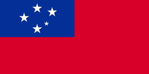
7
id
Pays
Pays en Anglais
Samoa
Pays
Samoa Occidental
countryucasefr
SAMOA OCCIDENTAL
Pays en Chinois
Pays en Espagnol
Samoa (Occidental)
Pays en Italien
La Samoa (Occidentale)
Pays en Portugais
Samoa (Ocidental)
Pays en Allemand
Samoa-Inseln (Westlich)
countrypy
sa4 mo2 ya4
countrylocal
Samoa
countryfull
Samoa
countrynm
Samoa
ISO2
WS
ISO3
WSM
countrycodeisono
882
countrycodevehicle
WS
countrycodeolympic
SAM
countrycodeirs
WS
countrycodeirsfr
WS
countrycodeirsmixt
WS
♂Masulin
12
6
185
languagesfr
Samoan, Anglais
117
currency
tala
currencyfr
dollar des Samoa
currencyisocode
WST
currencyisocodefull
WST 882
currencypxcode
WST
currencysymbol
WS$
currencysubdivision
100 sene
currencyregime
composite
currencyvalue
0.367
Capitale
Apia
capitalfr
Apia
Préfixe Tél.
685
Superficie km2
2 860
arealand
2 934
areawater
10
landarablerate
0.1943
landforestrate
0.372
coastline
403
summit
Mauga Silisili 1 857 m.
timezonedeltabegin
-11
flaglink
maplink
wscolor.gif
outlinemaplink
ws.gif
visapassenger
-1
maincities
Satupaitea, Tuasivi, Salaiula, Siumu
largestcity
Apia
largestcitypopulation
33 000
rankpopulation
178
Population
178 000
rankgdp
176
gdp
268000000
rankgdpppp
156
gdpppp
1042000000
rankgni
199
gni
257000000
rankincomeorigin
124
rankincome
136
income
1440
rankincomeppp
108
incomeppp
5780
lifeexpectation
70.41
alphabetizationrate
0.9965
natalityrate
0.01569
fecondity
4.12
mortalityrate
0.00647
mortalityrateinfantile
0.02872
hdi
0.775
urbanization
0.377
nationalevent
Independence Day Celebration
nationaleventfr
Jour de l'Indépendance
nationalholiday
1 June (1962)
Date de naissance aaaa-mm-jj
1962-06-01 00:00:00
9
3
location
Oceania, group of islands in the South Pacific Ocean, about one-half of the way from Hawaii to New Zealand
terrain
narrow coastal plain with volcanic, rocky, rugged mountains in interior
naturalresources
hardwood forests, fish, hydropower
9
rgbback
16777215
todate
1
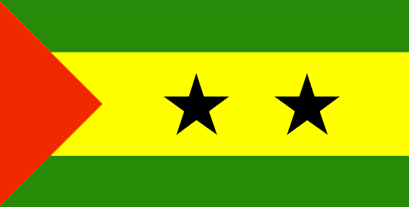
8
id
Pays
Pays en Anglais
Sao Tome and Principe
Pays
Sao Tomé-et-Principe
countryucasefr
SAO TOME-ET-PRINCIPE
Pays en Chinois
Pays en Espagnol
Tomo de sao y Príncipe
Pays en Italien
Tomo di sao ed il Principe
Pays en Portugais
Tome de sao e principe
Pays en Allemand
Saotome und principe
countrypy
sheng4 duo1 mei3 he2 pu3 lin2 xi1 bi3
countrylocal
São Tomé e Príncipe
countryfull
Sao Tome and Principe
countrynm
Sao Tome and Principe
ISO2
ST
ISO3
STP
countrycodeisono
678
countrycodeolympic
STP
countrycodeirs
TP
countrycodeirsfr
TP
countrycodeirsmixt
TP
♂Masulin
15
6
114
languagesfr
Portugais
2
currency
dobra
currencyfr
dobra
currencyisocode
STD
currencyisocodefull
STD 678
currencypxcode
STD
currencysymbol
Db
currencysubdivision
100 centimos [*]
currencyregime
m.float
currencyvalue
0.00011
Capitale
Sao Tome
capitalfr
Sao Tomé
Préfixe Tél.
239
Superficie km2
963
arealand
1 001
landarablerate
0.02
landforestrate
0.283
coastline
209
summit
Pico de São Tomé 2 024 m.
flaglink
maplink
stcolor.gif
outlinemaplink
stout.gif
visapassenger
-1
maincities
Santo António, Porto Alegre.
largestcity
Sao Tome
largestcitypopulation
57 000
rankpopulation
182
Population
157 000
rankgdp
184
gdp
59000000
rankgni
208
gni
48000000
rankincomeorigin
183
rankincome
197
income
300
lifeexpectation
66.28
alphabetizationrate
0.574
natalityrate
0.04781
mortalityrate
0.00711
mortalityrateinfantile
0.04604
hdi
0.547
nationalevent
Independence Day
nationaleventfr
Jour de l'Indépendance
nationalholiday
12 July (1975)
Date de naissance aaaa-mm-jj
1975-07-12 00:00:00
2
4
location
Western Africa, islands in the Gulf of Guinea, straddling the Equator, west of Gabon
terrain
volcanic, mountainous
naturalresources
fish, hydropower
9
Web
rgbback
16777215
todate
1
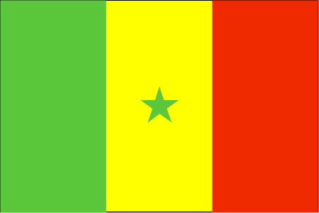
9
id
Pays
Pays en Anglais
Senegal
Pays
Sénégal
countryucasefr
SENEGAL
Pays en Chinois
Pays en Espagnol
Senegal
Pays en Italien
Il Senegal
Pays en Portugais
Senegal
Pays en Allemand
Senegal
countrypy
se4 nei4 jia1 er3
countrylocal
Senegal
countryfull
Senegal
countrynm
Senegal
ISO2
SN
ISO3
SEN
countrycodeisono
686
countrycodevehicle
SN
countrycodeolympic
SEN
countrycodeirs
SG
countrycodeirsfr
SG
countrycodeirsmixt
SE
countrycode
221
♂Masulin
15
6
57
languagesfr
Français
119
currency
franc
currencyfr
franc C.F.A.
currencyisocode
XOF
currencyisocodefull
XOF 952
currencypxcode
XOF
currencysymbol
CFAF
currencysubdivision
100 centimes
currencyregime
Euro (655.957)
currencyvalue
0.00186
nationalityfr
Sénégalaise
Capitale
Dakar
capitalfr
Dakar
Préfixe Tél.
221
Superficie km2
196 192
arealand
192 000
areawater
4 190
landarablerate
0.1158
landforestrate
0.322
coastline
531
summit
Futa Jaldon Foothills 581 m.
boundarycountries
Mauritanie, Mali, Guinée Bissau, Guinée, Gambie.
flaglink
maplink
sncolor.gif
outlinemaplink
snout.gif
visapassenger
-1
maincities
Thiès, Kaolack, Ziguinchor, Saint Louis, Diourbel.
largestcity
Dakar
largestcitypopulation
1 708 000
rankpopulation
74
Population
10 240 000
rankgdp
107
gdp
6496000000
rankgdpppp
104
gdpppp
16875000000
rankgni
114
gni
5563000000
rankincomeorigin
159
rankincome
173
income
540
rankincomeppp
177
incomeppp
1620
lifeexpectation
56.37
alphabetizationrate
0.383
natalityrate
0.03623
mortalityrate
0.01088
mortalityrateinfantile
0.05757
hdi
0.423
nationalevent
Independence Day
nationaleventfr
Jour de l'Indépendance
nationalholiday
4 April (1960)
Date de naissance aaaa-mm-jj
1960-04-04 00:00:00
7
1
location
Western Africa, bordering the North Atlantic Ocean, between Guinea-Bissau and Mauritania
terrain
generally low, rolling, plains rising to foothills in southeast
naturalresources
fish, phosphates, iron ore
cooking
Farine de Bonfoufou.
9
Web
rgbback
16777215
todate
1
Notes
Farine de Bonfoufou.
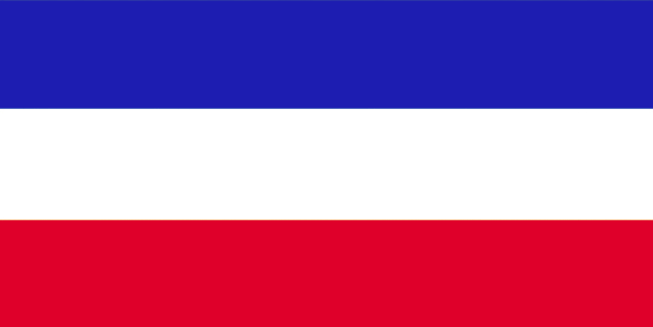
10
id
Pays
Pays en Anglais
Serbia
Pays
Serbie
countryucasefr
SERBIE
Pays en Chinois
Pays en Espagnol
Serbia
Pays en Italien
La Serbia
Pays en Portugais
Serbia
Pays en Allemand
Serbien
countrypy
sai1 er3 wei2 ya4 ji2 meng2 te4 ni2 ge1 luo2
countrylocal
Srbija i Crna Gora
countryfull
Serbia and Montenegro
countrynm
Serbia
ISO2
RS
ISO3
SRB
countrycodeisono
688
countrycodeolympic
SRB
countrycodeirs
SR
countrycodeirsfr
SR
countrycodeirsmixt
SR
countrycode
381
♀Féminin
15
6
182
languagesfr
Serbe
91
currency
dinar
currencyfr
dinar
currencyisocode
YUM
currencyisocodefull
YUM 891
currencypxcode
CSD
currencysymbol
Din
currencysubdivision
100 paras
currencyvalue
0.01479
nationalityfr
Serbe
Capitale
Belgrade
capitalfr
Belgrade
Préfixe Tél.
381
Superficie km2
102 200
arealand
102 136
areawater
214
landarablerate
0.3634
landforestrate
0.283
coastline
199
summit
Daravica 2 656 m.
boundarycountries
Albanie, Bosnie-Herzégovine, Bulgarie, Croatie, Hongrie, Macédoine, Roumanie.
timezonedeltabegin
1
flaglink
maplink
yi-map.gif
outlinemaplink
yu.gif
visapassenger
-1
maincities
Novi Sad, Niš, Subotica, Kragujevac, Zrenjanin, Pec, Podgorica, Pristina, Cacak, Kikinda, Sombor, Leskovac.
largestcity
Belgrade
largestcitypopulation
1 746 528
rankpopulation
87
Population
8 104 000
rankgdp
68
gdp
20729000000
rankgni
78
gni
15848000000
rankincomeorigin
114
rankincome
124
income
1910
lifeexpectation
74.22
alphabetizationrate
0.95
natalityrate
0.01268
mortalityrate
0.01069
mortalityrateinfantile
0.01637
nationalevent
National Day
nationaleventfr
Jour National
nationalholiday
27 April
Date de naissance aaaa-mm-jj
2000-04-17 00:00:00
7
5
location
Southeastern Europe, bordering the Adriatic Sea, between Albania and Bosnia and Herzegovina
terrain
extremely varied; to the north, rich fertile plains; to the east, limestone ranges and basins; to the southeast, ancient mountains and hills; to the southwest, extremely high shoreline with no islands off the coast
naturalresources
oil, gas, coal, antimony, copper, lead, zinc, nick
7
Web
rgbback
16777215
todate
1
| Pays/Territoires | Régions en Chine | Provinces de Chine | Régions en France | Départements de France | Provinces du Monde | Villes/Villages | Localités | Continents du Monde | Vins AOP
