Pays/Territoires
Mise à jour 2021-01-12 18:58:56
Les noms des pays/territoires du monde sont donnés en Français et Chinois. Cette collection des précieuses terres fermes du monde que toute l'humanité partage inclut non seulement les pays indépendants, mais aussi des régions spécifiques qui ne sont pas membre de l'ONUOrganisation des Nations Unies: Nous, peuples des Nations Unies ... Une ONU plus forte pour un monde meilleur. Veuillez aussi consulter les noms des pays en masculin et féminin en Français.
GéoPays Fermer
11
id
Pays
Pays en Anglais
Hong Kong
Pays
Hong Kong
countryucasefr
HONG KONG
Pays en Chinois
Pays en Espagnol
Hong Kong
Pays en Italien
Hong Kong
Pays en Portugais
Hong Kong
Pays en Allemand
Hong Kong
countrypy
xiang1 gang3
countrylocal
Xianggang
countryfull
Hong Kong
countrynm
Hong Kong
ISO2
HK
ISO3
HKG
countrycodeisono
344
countrycodeolympic
HKG
countrycodeirs
HK
countrycodeirsfr
HK
countrycodeirsmixt
HK
♂Masulin
8
1
163
languagesfr
Chinois, Anglais
47
currency
dollar
currencyfr
dollar de Hong Kong
currencyisocode
HKD
currencyisocodefull
HKD 344
currencypxcode
HKD
currencysymbol
HK$
currencysubdivision
100 cents
currencyregime
US-$ (7.73 central parity)
currencyvalue
0.1285
nationalityfr
Chinoise
Capitale
Hong Kong
capitalfr
Victoria
Préfixe Tél.
852
Superficie km2
1 040
arealand
1 042
areawater
50
landarablerate
0.0505
coastline
733
summit
Tai Mo Shan 958 m.
boundarycountries
Chine.
timezonedeltabegin
8
flaglink
maplink
hkcolor.gif
outlinemaplink
hkout.gif
visapassenger
-1
maincities
Kowloon, Kwun Tong, Aberdeen, New Kowloon, Tsuen Wani.
largestcity
Hong Kong
largestcitypopulation
6 816 000
rankpopulation
94
Population
6 816 000
rankgdp
30
gdp
156679000000
rankgdpppp
40
gdpppp
185250000000
rankgni
26
gni
176230000000
rankincomeorigin
19
rankincome
15
income
25860
rankincomeppp
16
incomeppp
28680
lifeexpectation
80.07
alphabetizationrate
0.916
natalityrate
0.01051
mortalityrate
0.00628
mortalityrateinfantile
0.00554
hdi
0.88
urbanization
1
nationalevent
National Day (Anniversary of the Founding of the People's Republic of China)
nationaleventfr
Jour National (Anniversaire de la Fondation de la République Populaire de Chine)
nationalholiday
1 October (1949)
Date de naissance aaaa-mm-jj
1949-10-01 00:00:00
6
2
location
Eastern Asia, bordering the South China Sea and China
terrain
hilly to mountainous with steep slopes; lowlands in north
naturalresources
outstanding deepwater harbor, feldspar
cooking
Cuisines des Cinq Continents.
8
Web
rgbback
16777215
todate
1
Notes
Cuisines des Cinq Continents.
12
id
Pays
Pays en Anglais
India
Pays
Inde
countryucasefr
INDE
Pays en Chinois
Pays en Espagnol
La India
Pays en Italien
L'India
Pays en Portugais
India
Pays en Allemand
Indien
countrypy
yin4 du4
countrylocal
Bharat
countryfull
India
countrynm
India
ISO2
IN
ISO3
IND
countrycodeisono
356
countrycodevehicle
IND
countrycodeolympic
IND
countrycodeirs
IN
countrycodeirsfr
IN
countrycodeirsmixt
IND
♀Féminin
7
80
languagesfr
Hindi, Telugu, Bengali, Marathi, Tamoul, Ourdou, Gujarati, Kannada, Malayalam, Oriya, Pendjabi, Assamese, Kashmiri, Sindhi, Sanskrit, Anglais.
50
currency
rupee
currencyfr
roupie
currencyisocode
INR
currencyisocodefull
INR 356
currencypxcode
INR
currencysymbol
Rs
currencysubdivision
100 paise
currencyregime
float
currencyvalue
0.0229
nationalityfr
Indienne
Capitale
New Delhi
capitalfr
New Delhi
Préfixe Tél.
91
Superficie km2
3 287 590
arealand
2 973 190
areawater
314 400
landarablerate
0.5435
landforestrate
0.216
coastline
7000
summit
Nanda Devi 7 817 m.
boundarycountries
Pakistan, Chine, Népal, Bhoutan, Myanmar, Bangladesh.
timezonedeltabegin
5.5
flaglink
maplink
inlarge.gif
outlinemaplink
inout.gif
visapassenger
-1
maincities
Mumbai, Calcutta, Jaipur, Lucknow, Indore, Madurai, Surat.
largestcity
Bombay
largestcitypopulation
15 138 000
rankpopulation
2
Population
1 080 264 388
rankgdp
12
gdp
600637000000
rankgdpppp
4
gdpppp
3078024000000
rankgni
12
gni
570760000000
rankincomeorigin
159
rankincome
173
income
540
rankincomeppp
146
incomeppp
2880
lifeexpectation
63.25
alphabetizationrate
0.5221
natalityrate
0.02377
mortalityrate
0.00061
mortalityrateinfantile
0.06131
precipitation
2168
nationalevent
Republic Day
nationaleventfr
Jour de la République
nationalholiday
26 January (1950)
Date de naissance aaaa-mm-jj
1950-01-26 00:00:00
6
2
location
Southern Asia, bordering the Arabian Sea and the Bay of Bengal, between Burma and Pakistan
terrain
upland plain (Deccan Plateau) in south, flat to rolling plain along the Ganges, deserts in west, Himalayas in north
naturalresources
coal (fourth-largest reserves in the world), iron
cooking
Samoussa, Carry/Curry, Spécialiste de Merveilleux Mélanges Culinaires.
8
Web
rgbback
16777215
todate
1
Notes
Samoussa, Carry/Curry, Spécialiste de Merveilleux Mélanges Culinaires.
13
id
Pays
Pays en Anglais
Indonesia
Pays
Indonésie
countryucasefr
INDONESIE
Pays en Chinois
Pays en Espagnol
Indonesia
Pays en Italien
L'Indonesia
Pays en Portugais
Indonésia
Pays en Allemand
Indonesien
countrypy
yin1 du4 ni2 xi1 ya4, yin4 ni2
countrylocal
Indonesia
countryfull
Indonesia
countrynm
Indonesia
ISO2
ID
ISO3
IDN
countrycodeisono
360
countrycodevehicle
RI
countrycodeolympic
INA
countrycodeirs
ID
countrycodeirsfr
ID
countrycodeirsmixt
ID
countrycode
62
♀Féminin
15
6
83
languagesfr
Indonésien
51
currency
rupiah
currencyfr
rupiah
currencyisocode
IDR
currencyisocodefull
IDR 360
currencypxcode
IDR
currencysymbol
Rp
currencysubdivision
100 sen (no longer used)
currencyregime
m.float
currencyvalue
0.0001
nationalityfr
Indonésienne
Capitale
Jakarta
capitalfr
Jakarta
Préfixe Tél.
62
Superficie km2
1 919 440
arealand
1 826 440
areawater
93 000
landarablerate
0.099
landforestrate
0.58
coastline
54716
summit
Puntjak Djaja 5 030 m.
boundarycountries
Papouasie - Nouvelle Guinée, Malaisie, Timor oriental.
timezonedeltabegin
7
timezonedeltaend
9
flaglink
maplink
idlarge.gif
outlinemaplink
idout.gif
visapassenger
-1
maincities
Surabaya, Bandung, Medan, Semarang, Palembang, Ujung Pandang, Malang, Padang, Surakarta, Kupang, Djokjakarta, Banjarmasin.
largestcity
Jakarta
largestcitypopulation
8 621 000
rankpopulation
4
Population
214 674 000
rankgdp
26
gdp
208312000000
rankgdpppp
15
gdpppp
721533000000
rankgni
27
gni
173540000000
rankincomeorigin
146
rankincome
159
income
810
rankincomeppp
142
incomeppp
3210
lifeexpectation
68.63
alphabetizationrate
0.8406
natalityrate
0.02187
mortalityrate
0.00628
mortalityrateinfantile
0.0394
nationalevent
Independence Day
nationaleventfr
Jour de l'Indépendance
nationalholiday
17 August (1945)
Date de naissance aaaa-mm-jj
1945-08-17 00:00:00
2
10
location
Southeastern Asia, archipelago between the Indian Ocean and the Pacific Ocean
terrain
mostly coastal lowlands; larger islands have interior mountains
naturalresources
petroleum, tin, natural gas, nickel, timber, bauxi
cooking
Fruits de Mer de l'Océan Pacifique.
9
Web
rgbback
65280
todate
1
Notes
Fruits de Mer de l'Océan Pacifique.
14
id
Pays
Pays en Anglais
Iran
Pays
Iran
countryucasefr
IRAN
Pays en Chinois
Pays en Espagnol
Irán
Pays en Italien
L'Iran
Pays en Portugais
Irã
Pays en Allemand
Der Iran
countrypy
yi1 lang3
countrylocal
Iran
countryfull
Iran
countrynm
Iran
ISO2
IR
ISO3
IRN
countrycodeisono
364
countrycodevehicle
IR
countrycodeolympic
IRI
countrycodeirs
IR
countrycodeirsfr
IR
countrycodeirsmixt
IR
countrycode
98
♂Masulin
4
4
55
languagesfr
Farsi
52
currency
rial
currencyfr
rial
currencyisocode
IRR
currencyisocodefull
IRR 364
currencypxcode
IRR
currencysymbol
Rls
currencysubdivision
10 rials = 1 toman
currencyregime
US-$ (4750)
currencyvalue
0.00013
nationality
Iranian
nationalityfr
Iranienne
Capitale
Tehran
capitalfr
Téhéran
Préfixe Tél.
98
Superficie km2
1 648 000
arealand
1 636 000
areawater
12 000
landarablerate
0.1017
coastline
2440
summit
Qolleh-ye Damavand 5 671 m.
boundarycountries
Irak, Turquie, Azerbaïdjan, Arménie, Turkmenistan, Afghanistan, Pakistan.
timezonedeltabegin
3.5
flaglink
maplink
ircolor.gif
outlinemaplink
irout.gif
visapassenger
-1
maincities
Mashhad, Ispahan, Tabriz, Chitaz, Ahvaz, Bakhtaran, Qom, Karaj, Urumiyeh, Abadan, Rasht, Kerman.
largestcity
Tehran
largestcitypopulation
6 836 000
rankpopulation
18
Population
66 392 000
rankgdp
34
gdp
137144000000
rankgdpppp
21
gdpppp
464394000000
rankgni
32
gni
133152000000
rankincomeorigin
110
rankincome
120
income
2010
rankincomeppp
90
incomeppp
7000
lifeexpectation
69.35
alphabetizationrate
0.54
natalityrate
0.01723
mortalityrate
0.00554
mortalityrateinfantile
0.04417
precipitation
230
nationalevent
Republic Day
nationaleventfr
Jour de la République
nationalholiday
1 April (1979)
Date de naissance aaaa-mm-jj
1979-04-01 00:00:00
6
8
location
Middle East, bordering the Gulf of Oman, the Persian Gulf, and the Caspian Sea, between Iraq and Pakistan
terrain
rugged, mountainous rim; high, central basin with deserts, mountains; small, discontinuous plains along both coasts
naturalresources
petroleum, natural gas, coal, chromium, copper, ir
cooking
Fruits Secs: Noix de Cajou, Pistaches.
9
Web
rgbback
16777215
todate
1
Notes
Fruits Secs: Noix de Cajou, Pistaches.
15
id
Pays
Pays en Anglais
Iraq
Pays
Iraq
countryucasefr
IRAQ
Pays en Chinois
Pays en Espagnol
Iraq
Pays en Italien
L'Iraq
Pays en Portugais
Iraq
Pays en Allemand
Der Irak
countrypy
yi1 la1 ke4
countrylocal
Iraq
countryfull
Iraq
countrynm
Iraq
ISO2
IQ
ISO3
IRQ
countrycodeisono
368
countrycodevehicle
IRQ
countrycodeolympic
IRQ
countrycodeirs
IZ
countrycodeirsfr
IZ
countrycodeirsmixt
IZ
♂Masulin
1
3
languagesfr
Arabe
141
currency
dinar
currencyfr
dinar irakien
currencyisocode
IQN
currencyisocodefull
IQN
currencypxcode
IQD
currencysymbol
ID
currencysubdivision
1,000 fils
currencyregime
m.float
currencyvalue
0.00072
nationality
Irakian
nationalityfr
Iraqienne
Capitale
Baghdad
capitalfr
Bagdad
Préfixe Tél.
964
Superficie km2
434 924
arealand
432 162
areawater
4 910
landarablerate
0.1189
landforestrate
0.018
coastline
58
summit
Gundah Zhur 3 608 m.
boundarycountries
Syrie, Turquie, Arabie Saoudite, Iran, Koweït, Jordanie.
timezonedeltabegin
3
flaglink
maplink
iqcolor.gif
outlinemaplink
iqout.gif
visapassenger
-1
maincities
Basra, Mossoul, Kirkouk, Arbil, Karbala, As Sulaymaniyah, An Najaf, Al Hillah, Ba'qubah, An Nasiriyah, Ar Ramadi, Samarra, Al Amarah.
largestcity
Baghdad
largestcitypopulation
4 336 000
rankpopulation
43
Population
24 700 000
rankgni
71
gni
18200000000
rankincomeorigin
156
rankincome
160
income
772
lifeexpectation
60.7
alphabetizationrate
0.398
natalityrate
0.03309
mortalityrate
0.00566
mortalityrateinfantile
0.05271
urbanization
0.674
nationalevent
Revolution Day
nationaleventfr
Jour de le Révolution
nationalholiday
17 July (1968)
Date de naissance aaaa-mm-jj
1968-07-17 00:00:00
5
9
location
Middle East, bordering the Persian Gulf, between Iran and Kuwait
terrain
mostly broad plains; reedy marshes along Iranian border in south with large flooded areas; mountains along borders with Iran and Turkey
naturalresources
petroleum, natural gas, phosphates, sulfur
9
Web
rgbback
16777215
todate
1
16
id
Pays
Pays en Anglais
Japan
Pays
Japon
countryucasefr
JAPON
Pays en Chinois
Pays en Espagnol
Japón
Pays en Italien
Il Giappone
Pays en Portugais
Japão
Pays en Allemand
Japan
countrypy
ri4 ben3
countrylocal
Nippon
countryfull
Japan
countrynm
Japan
ISO2
JP
ISO3
JPN
countrycodeisono
392
countrycodevehicle
J
countrycodeolympic
JPN
countrycodeirs
JA
countrycodeirsfr
JP
countrycodeirsmixt
JP
countrycode
81
♂Masulin
12
6
85
languagesfr
Japonais
4
currency
yen
currencyfr
Yen
currencyisocode
JPY
currencyisocodefull
JPY 392
currencypxcode
JPY
currencysymbol
¥
currencysubdivision
100 sen (not used)
currencyregime
float
currencyvalue
0.0092
nationality
Japanese
nationalityfr
Japonaise
Capitale
Tokyo
capitalfr
Tokyo
Préfixe Tél.
81
Superficie km2
377 835
arealand
374 744
areawater
3 091
landarablerate
0.1213
landforestrate
0.64
coastline
29751
summit
Fujisan 3 776 m.
timezonedeltabegin
9
flaglink
maplink
jpcolor.gif
outlinemaplink
jpout.gif
maincities
Yokohama, Osaka, Nagoya, Sapporo, Kyoto, Kobe, Fukuoka, Kawasaki, Hiroshima, Kita-Kyushu, Sendai, Kagoshima, Niigata.
largestcity
Tokyo
largestcitypopulation
26 959 000
rankpopulation
10
Population
127 573 000
rankgdp
2
gdp
4300858000000
rankgdpppp
3
gdpppp
3567804000000
rankgni
2
gni
4360824000000
rankincomeorigin
7
rankincome
5
income
34180
rankincomeppp
19
incomeppp
28450
lifeexpectation
81
alphabetizationrate
0.99
mortalityrate
0.003
precipitation
1406
nationalevent
Birthday of Emperor AKIHITO
nationaleventfr
Anniversaire de l'Empereur AKIHITO
nationalholiday
23 December (1933)
Date de naissance aaaa-mm-jj
1933-12-23 00:00:00
10
10
location
Eastern Asia, island chain between the North Pacific Ocean and the Sea of Japan, east of the Korean Peninsula
terrain
mostly rugged and mountainous
naturalresources
negligible mineral resources, fish
cooking
Sushi, Sake - Alcool de Riz très fin.
8
Web
rgbback
16777215
todate
1
Notes
Sushi, Sake - Alcool de Riz très fin.
17
id
Pays
Pays en Anglais
Kazakhstan
Pays
Kazakhstan
countryucasefr
KAZAKHSTAN
Pays en Chinois
Pays en Espagnol
Kazakhstan
Pays en Italien
Kazakhstan
Pays en Portugais
Kazakhstan
Pays en Allemand
Kazakhstan
countrypy
ha1 sa4 ke4 si1 tan3
countrylocal
Qazaqstan
countryfull
Kazakhstan
countrynm
Kazakhstan
ISO2
KZ
ISO3
KAZ
countrycodeisono
398
countrycodevehicle
KZ
countrycodeolympic
KAZ
countrycodeirs
KZ
countrycodeirsfr
KZ
countrycodeirsmixt
KZ
♂Masulin
15
4
190
languagesfr
Kazakh
57
currency
tenge
currencyfr
rouble
currencyisocode
KZT
currencyisocodefull
KZT 398
currencypxcode
KZT
currencysubdivision
100 tiyn
currencyregime
float
currencyvalue
0.00759
nationalityfr
Kazakh
Capitale
Astana
capitalfr
Alma-Ata
Préfixe Tél.
7
Superficie km2
2 717 300
arealand
2 669 800
areawater
47 500
landarablerate
0.1123
landforestrate
0.045
summit
Zhengis Shingy 7 439 m.
boundarycountries
Russie, Chine, Kirghizstan, Ouzbekistan, Turkmenistan.
timezonedeltabegin
6
flaglink
maplink
kzcolor.gif
outlinemaplink
kzout.gif
visapassenger
-1
maincities
Alma Ata, Karaganda, Chimkent, Semipalatinsk, Pavlodar, Dzhambul, Ust-Kamenogorsk, Tselinograd, Aktyubinsk, Petropavlovsk, Kustanay, Ural'sk, Shevshenko.
largestcity
Astana
rankpopulation
59
Population
14 878 000
rankgdp
60
gdp
29749000000
rankgdpppp
55
gdpppp
99254000000
rankgni
62
gni
26535000000
rankincomeorigin
119
rankincome
131
income
1780
rankincomeppp
100
incomeppp
6280
lifeexpectation
63.48
alphabetizationrate
0.9778
natalityrate
0.01402
mortalityrate
0.01059
mortalityrateinfantile
0.01886
hdi
0.742
precipitation
264
nationalevent
Republic Day
nationaleventfr
Jour de la République
nationalholiday
25 October (1990)
Date de naissance aaaa-mm-jj
1990-10-25 00:00:00
7
7
location
Central Asia, northwest of China; a small portion west of the Ural River in eastern-most Europe
terrain
extends from the Volga to the Altai Mountains and from the plains in western Siberia to oases and desert in Central Asia
naturalresources
major deposits of petroleum, natural gas, coal, ir
9
Web
rgbback
16777215
todate
1
18
id
Pays
Pays en Anglais
Korea, North
Pays
Corée du Nord
countryucasefr
COREE DU NORD
Pays en Chinois
Pays en Espagnol
Corea, Del norte (Representante Democrático De la Gente)
Pays en Italien
La Corea, Del nord (Rappresentante Democratico Della Gente)
Pays en Portugais
Coreia, Norte (Representante Democrático Dos Povos)
Pays en Allemand
Korea, Nord (Demokratischer VölkercRepräsentant)
countrypy
bei3 han2, bei3 chao2 xian3
countrylocal
Choson
countryfull
Korea, North
countrynm
Korea, North
ISO2
KP
ISO3
PRK
countrycodeisono
408
countrycodeolympic
PRK
countrycodeirs
KN
countrycodeirsfr
KN
countrycodeirsmixt
KN
♀Féminin
6
1
92
languagesfr
Coréen
58
currency
won
currencyfr
won
currencyisocode
KPW
currencyisocodefull
KPW 408
currencypxcode
KPW
currencysymbol
Wn
currencysubdivision
100 chon
currencyvalue
0.4545
nationalityfr
Coréenne
Capitale
Pyongyang
capitalfr
Pyongyang
Préfixe Tél.
850
Superficie km2
120 540
arealand
120 410
areawater
130
landarablerate
0.1412
landforestrate
0.682
coastline
2495
summit
Paektu-san 2 744 m.
boundarycountries
Chine, Corée du Sud.
timezonedeltabegin
9
flaglink
maplink
kpcolor.gif
outlinemaplink
kpout.gif
visapassenger
-1
maincities
Ch'ongjin, Chinnamp'o, Sinuiju, Hungnam, Wonsan, Kaesong, Hamhung, Kimch'aek, Haeju, Sariwon.
largestcity
Pyongyang
largestcitypopulation
3 245 305
rankpopulation
45
Population
22 612 000
rankincome
164
income
735
lifeexpectation
70.79
alphabetizationrate
0.999
natalityrate
0.01761
mortalityrate
0.00693
mortalityrateinfantile
0.02566
precipitation
1001
nationalevent
Founding of the Democratic People's Republic of Korea (DPRK)
nationaleventfr
Création de la République Populaire de Corée
nationalholiday
9 September (1948)
Date de naissance aaaa-mm-jj
1948-09-09 00:00:00
5
1
location
Eastern Asia, northern half of the Korean Peninsula bordering the Korea Bay and the Sea of Japan, between China and South Korea
terrain
mostly hills and mountains separated by deep, narrow valleys; coastal plains wide in west, discontinuous in east
naturalresources
coal, lead, tungsten, zinc, graphite, magnesite, i
9
rgbback
16777215
todate
1
19
id
Pays
Pays en Anglais
Korea, South
Pays
Corée du Sud
countryucasefr
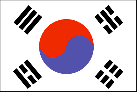
COREE DU SUD
Pays en Chinois
Pays en Espagnol
Corea, del sur (república de)
Pays en Italien
La Corea, del sud (Repubblica di)
Pays en Portugais
Coreia, sul (república de)
Pays en Allemand
Korea, Süd (Republik von)
countrypy
han2 guo2, guang1 zhou1
countrylocal
Han-guk
countryfull
Korea, South
countrynm
Korea, South
ISO2
KR
ISO3
KOR
countrycodeisono
410
countrycodevehicle
ROK
countrycodeolympic
KOR
countrycodeirs
KS
countrycodeirsfr
CR
countrycodeirsmixt
KR
countrycode
82
♀Féminin
15
6
92
languagesfr
Coréen
59
currency
won
currencyfr
won
currencyisocode
KRW
currencyisocodefull
KRW 410
currencypxcode
KRW
currencysymbol
W
currencysubdivision
100 chon [*]
currencyregime
float
currencyvalue
0.00099
nationalityfr
Coréenne
Capitale
Soul
capitalfr
Séoul
Préfixe Tél.
82
Superficie km2
98 992
arealand
98 190
areawater
290
landarablerate
0.1744
landforestrate
0.633
coastline
2413
summit
Halla-san 1 950 m.
boundarycountries
Corée du Nord.
timezonedeltabegin
9
flaglink
maplink
krcolor.gif
outlinemaplink
krout.gif
maincities
Pusan, Taegu, Inch'on, Kwangju, Taejon, Ulsan, Masan, Sunwon, Chonju.
largestcity
Soul
largestcitypopulation
21 738 345
rankpopulation
26
Population
47 912 000
rankgdp
11
gdp
605331000000
rankgdpppp
14
gdpppp
861042000000
rankgni
11
gni
576426000000
rankincomeorigin
49
rankincome
49
income
12030
rankincomeppp
47
incomeppp
18000
lifeexpectation
75.36
alphabetizationrate
0.9796
natalityrate
0.0126
mortalityrate
0.00603
mortalityrateinfantile
0.00731
precipitation
1371
nationalevent
Liberation Day
nationaleventfr
Jour de la Libération
nationalholiday
15 August (1945)
Date de naissance aaaa-mm-jj
1945-08-15 00:00:00
2
10
location
Eastern Asia, southern half of the Korean Peninsula bordering the Sea of Japan and the Yellow Sea
terrain
mostly hills and mountains; wide coastal plains in west and south
naturalresources
coal, tungsten, graphite, molybdenum, lead, hydrop
cooking
Nouilles Piquantes: Climant froid.
8
Web
rgbback
16777215
todate
1
Notes
Nouilles Piquantes: Climant froid.
20
id
Pays
Pays en Anglais
Kuwait
Pays
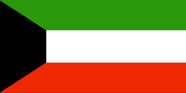
Koweït
countryucasefr
KOWEIT
Pays en Chinois
Pays en Espagnol
Kuwait
Pays en Italien
Il Kuwait
Pays en Portugais
Kuwait
Pays en Allemand
Kuwait
countrypy
ke1 wei1 te4
countrylocal
Al Kuwayt
countryfull
Kuwait
countrynm
Kuwait
ISO2
KW
ISO3
KWT
countrycodeisono
414
countrycodevehicle
KWT
countrycodeolympic
KUW
countrycodeirs
KU
countrycodeirsfr
KU
countrycodeirsmixt
KU
countrycode
965
♂Masulin
12
4
3
languagesfr
Arabe
144
currency
dinar
currencyfr
dinar koweïtien
currencyisocode
KWD
currencyisocodefull
KWD 414
currencypxcode
KWD
currencysymbol
KD
currencysubdivision
1,000 fils
currencyregime
composite
currencyvalue
3.4258
nationalityfr
Kowaïtienne
Capitale
Kuwait City
capitalfr
Koweït city
Préfixe Tél.
965
Superficie km2
17 818
arealand
17 820
landarablerate
0.0034
landforestrate
0.003
coastline
499
summit
306 m.
boundarycountries
Iraq, Arabie Saoudite.
timezonedeltabegin
3
flaglink
maplink
kwcolor.gif
outlinemaplink
kwout.gif
visapassenger
-1
maincities
Salmiya, Hawalli, Al Jahra, Mina Ahmadi, Al Ahmadi.
largestcity
Kuwait City
largestcitypopulation
2 388 688
rankpopulation
138
Population
2 396 000
rankgdp
57
gdp
41748000000
rankgdpppp
72
gdpppp
43248000000
rankgni
56
gni
43048000000
rankincomeorigin
34
rankincome
29
income
17960
rankincomeppp
43
incomeppp
19480
lifeexpectation
76.65
alphabetizationrate
0.73
natalityrate
0.02183
mortalityrate
0.00245
mortalityrateinfantile
0.01057
precipitation
108
nationalevent
National Day
nationaleventfr
Jour National
nationalholiday
25 February (1950)
Date de naissance aaaa-mm-jj
1950-02-25 00:00:00
7
3
location
Middle East, bordering the Persian Gulf, between Iraq and Saudi Arabia
terrain
flat to slightly undulating desert plain
naturalresources
petroleum, fish, shrimp, natural gas
9
Web
rgbback
16777215
todate
1
| Pays/Territoires | Régions en Chine | Provinces de Chine | Régions en France | Départements de France | Provinces du Monde | Villes/Villages | Localités | Continents du Monde | Vins AOP
