Pays/Territoires
Mise à jour 2021-01-12 18:58:56
Les noms des pays/territoires du monde sont donnés en Français et Chinois. Cette collection des précieuses terres fermes du monde que toute l'humanité partage inclut non seulement les pays indépendants, mais aussi des régions spécifiques qui ne sont pas membre de l'ONUOrganisation des Nations Unies: Nous, peuples des Nations Unies ... Une ONU plus forte pour un monde meilleur. Veuillez aussi consulter les noms des pays en masculin et féminin en Français.
GéoPays Fermer
1
id
Pays
Pays en Anglais
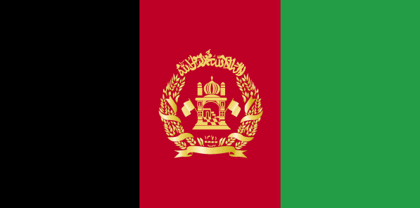
Afghanistan
Pays
Afghanistan
countryucasefr
AFGHANISTAN
Pays en Chinois
Pays en Espagnol
Afganistán
Pays en Italien
L'Afghanistan
Pays en Portugais
Afeganistão
Pays en Allemand
Afghanistan
countrypy
a1 fu4 han4
countrylocal
Afghanestan
countryfull
Afghanistan
countrynm
Afghanistan
ISO2
AF
ISO3
AFG
countrycodeisono
004
countrycodevehicle
AFG
countrycodeolympic
AFG
countrycodeirs
AF
countrycodeirsfr
AF
countrycodeirsmixt
AF
♂Masulin
7
2
177
languagesfr
Pashto
7
currency
afghani
currencyfr
afghani
currencyisocode
AFN
currencyisocodefull
AFN 971
currencypxcode
AFA
currencysymbol
Af
currencysubdivision
100 puls
currencyregime
float
currencyvalue
0.02337
nationality
Afghan
nationalityfr
Afghane
Capitale
Kabul
capitalfr
Kaboul
Préfixe Tél.
93
Superficie km2
652 090
arealand
647 500
landarablerate
0.1213
landforestrate
0.021
summit
Nowshak 7 485 m.
boundarycountries
Iran, Turkmenistan, Ouzbekistan, Tadjikistan, Chine, Pakistan.
timezonedeltabegin
4.5
flaglink
maplink
afcolor.gif
outlinemaplink
afout.gif
visapassenger
-1
maincities
Kandahar, Herat, Mazar-e-Sharif, Djalalabad, Kunduz, Baghlan.
largestcity
Kabul
largestcitypopulation
2 029 000
rankpopulation
38
Population
25 838 797
rankgdp
119
gdp
4708000000
rankgni
121
gni
4630000000
rankincomeorigin
209
rankincome
214
income
171
lifeexpectation
46.97
alphabetizationrate
0.315
natalityrate
0.04063
mortalityrate
0.01715
mortalityrateinfantile
0.14248
precipitation
313
nationalevent
Independence Day
nationaleventfr
Jour de l'Indépendance
nationalholiday
19 August (1919)
Date de naissance aaaa-mm-jj
1919-08-19 00:00:00
6
8
president
Ahmadinejad Mahmoud
location
Southern Asia, north and west of Pakistan, east of Iran
terrain
mostly rugged mountains; plains in north and southwest
naturalresources
natural gas, petroleum, coal, copper, chromite, ta
9
rgbback
16777215
todate
1
2
id
Pays
Pays en Anglais
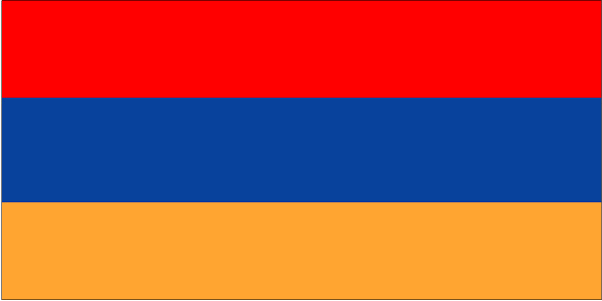
Armenia
Pays
Arménie
countryucasefr
ARMENIE
Pays en Chinois
Pays en Espagnol
Armenia
Pays en Italien
L'Armenia
Pays en Portugais
Arménia
Pays en Allemand
Armenien
countrypy
ya4 mei3 ni2 ya4
countrylocal
Hayastan
countryfull
Armenia
countrynm
Armenia
ISO2
AM
ISO3
ARM
countrycodeisono
051
countrycodevehicle
AM
countrycodeolympic
ARM
countrycodeirs
AM
countrycodeirsfr
AM
countrycodeirsmixt
AM
♀Féminin
15
6
19
languagesfr
Arménien
126
currency
dram
currencyfr
rouble
currencyisocode
AMD
currencyisocodefull
AMD 051
currencypxcode
AMD
currencysubdivision
100 luma
nationalityfr
Arménienne
Capitale
Yerevan
capitalfr
Erevan
Préfixe Tél.
7
Superficie km2
29 800
arealand
28 400
areawater
1 400
landarablerate
0.1752
landforestrate
0.124
summit
Aragats Lerr 4 095 m.
boundarycountries
Turquie, Azerbaïdjan, Iran, Géorgie.
timezonedeltabegin
4
flaglink
maplink
am-map.gif
outlinemaplink
am.gif
visapassenger
-1
maincities
Koumaïri, Karaklis, Gyumri, Kirovakan, Razdan, Echmiadzin, Abovyan.
largestcity
Yerevan
largestcitypopulation
1 278 000
rankpopulation
132
Population
3 056 000
rankgdp
136
gdp
2805000000
rankgdpppp
120
gdpppp
11217000000
rankgni
143
gni
2888000000
rankincomeorigin
139
rankincome
150
income
950
rankincomeppp
134
incomeppp
3790
lifeexpectation
66.78
natalityrate
0.0132
mortalityrate
0.01036
mortalityrateinfantile
0.04066
hdi
0.729
precipitation
277
nationalevent
Independence Day
nationaleventfr
Jour de l'Indépendance
nationalholiday
21 September (1991)
Date de naissance aaaa-mm-jj
1991-09-21 00:00:00
8
8
location
Southwestern Asia, east of Turkey
terrain
Armenian Highland with mountains; little forest land; fast flowing rivers; good soil in Aras River valley
naturalresources
small deposits of gold, copper, molybdenum, zinc,
7
Web
rgbback
16777215
todate
1
3
id
Pays
Pays en Anglais
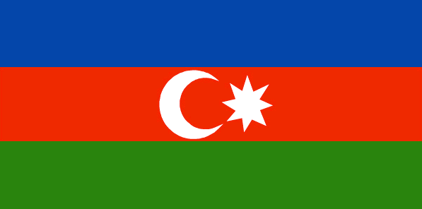
Azerbaijan
Pays
Azerbaïdjan
countryucasefr
AZERBAIDJAN
Pays en Chinois
Pays en Espagnol
Azerbaijan
Pays en Italien
L'Azerbaijan
Pays en Portugais
Azerbaijan
Pays en Allemand
Azerbaijan
countrypy
a1 sai4 bai4 jiang1
countrylocal
Azarbaycan
countryfull
Azerbaijan
countrynm
Azerbaijan
ISO2
AZ
ISO3
AZE
countrycodeisono
031
countrycodevehicle
AZ
countrycodeolympic
AZE
countrycodeirs
AJ
countrycodeirsfr
AJ
countrycodeirsmixt
AJ
♂Masulin
15
4
178
languagesfr
Azerbaïdjanais
127
currency
manat
currencyfr
rouble
currencyisocode
AZM
currencyisocodefull
AZM 031
currencypxcode
AZM
currencysubdivision
100 gopik
nationalityfr
Azerbaïjanaise
Capitale
Baku
capitalfr
Bakou
Préfixe Tél.
994
Superficie km2
86 600
arealand
86 100
areawater
500
landarablerate
0.1931
landforestrate
0.131
summit
Bazarduzu Dagi 4 485 m.
boundarycountries
Arménie, Géorgie, Russie, Iran, Turquie.
timezonedeltabegin
4
flaglink
maplink
aj-map.gif
outlinemaplink
ajout.gif
visapassenger
-1
maincities
Gyandzha, Stepanakert, Sumgait, Sheki, Mingechaur, Nakhichevan, Lenkoran.
largestcity
Baku
largestcitypopulation
1 848 000
rankpopulation
86
Population
8 233 000
rankgdp
102
gdp
7138000000
rankgdpppp
85
gdpppp
29782000000
rankgni
104
gni
6713000000
rankincomeorigin
145
rankincome
158
income
820
rankincomeppp
139
incomeppp
3390
lifeexpectation
63.25
alphabetizationrate
0.621
natalityrate
0.01981
mortalityrate
0.00976
mortalityrateinfantile
0.08207
hdi
0.744
urbanization
0.518
precipitation
210
nationalevent
Founding of the Democratic Republic of Azerbaidzhan
nationaleventfr
Création de la République Démocratique d'Azerbaïdjan
nationalholiday
28 May (1918)
Date de naissance aaaa-mm-jj
1918-05-28 00:00:00
5
7
location
Southwestern Asia, bordering the Caspian Sea, between Iran and Russia, with a small European portion north of the Caucasus range
terrain
large, flat Kur-Araz Ovaligi (Kura-Araks Lowland) (much of it below sea level) with Great Caucasus Mountains to the north, Qarabag Yaylasi (Karabakh Upland) in west; Baku lies on Abseron Yasaqligi (Apsheron Peninsula) that juts into Caspian Sea
naturalresources
petroleum, natural gas, iron ore, nonferrous metal
9
Web
rgbback
16777215
todate
1
4
id
Pays
Pays en Anglais
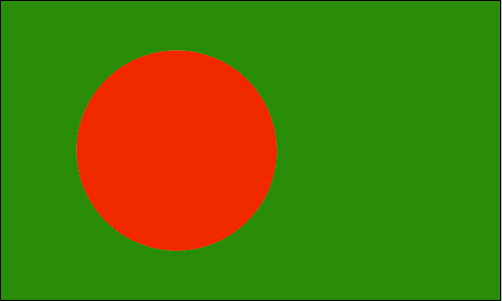
Bangladesh
Pays
Bangladesh
countryucasefr
BANGLADESH
Pays en Chinois
Pays en Espagnol
Bangladesh
Pays en Italien
La Bangladesh
Pays en Portugais
Bangladesh
Pays en Allemand
Bangladesh
countrypy
meng4 jia1 la1 guo2
countrylocal
Bangladesh
countryfull
Bangladesh
countrynm
Bangladesh
ISO2
BD
ISO3
BGD
countrycodeisono
050
countrycodevehicle
BD
countrycodeolympic
BAN
countrycodeirs
BG
countrycodeirsfr
BG
countrycodeirsmixt
BGD
♂Masulin
18
6
26
languagesfr
Bengali
129
currency
taka
currencyfr
taka
currencyisocode
BDT
currencyisocodefull
BDT 050
currencypxcode
BDT
currencysymbol
Tk
currencysubdivision
100 paisa (poisha)
currencyregime
composite
currencyvalue
0.01569
Capitale
Dhaka
capitalfr
Dacca
Préfixe Tél.
880
Superficie km2
144 000
arealand
133 910
areawater
10 090
landarablerate
0.607
landforestrate
0.102
coastline
580
summit
Reng Tlang 957 m.
boundarycountries
Inde, Birmanie..
timezonedeltabegin
6
flaglink
maplink
bdcolor.gif
outlinemaplink
bdout.gif
visapassenger
-1
maincities
Chittagong, Khulna, Narayanganj, Rajshali, Mymensingh, Comilla, Barisal, Sylhet, Ranjpur.
largestcity
Dhaka
largestcitypopulation
8 545 000
rankpopulation
8
Population
138 066 000
rankgdp
54
gdp
51914000000
rankgdpppp
31
gdpppp
244402000000
rankgni
51
gni
55009000000
rankincomeorigin
173
rankincome
187
income
400
rankincomeppp
163
incomeppp
1870
lifeexpectation
61.71
alphabetizationrate
0.423
natalityrate
0.03003
fecondity
3.46
mortalityrate
0.00852
mortalityrateinfantile
0.06432
hdi
0.502
nationalevent
Independence Day
nationaleventfr
Jour de l'Indépendance
nationalholiday
26 March (1971)
Date de naissance aaaa-mm-jj
1971-03-26 00:00:00
8
12
location
Southern Asia, bordering the Bay of Bengal, between Burma and India
terrain
mostly flat alluvial plain; hilly in southeast
naturalresources
natural gas, arable land, timber, coal
cooking
Meilleurs Gambas, Crevettes: Black Tiger.
9
Web
rgbback
16777215
todate
1
Notes
Meilleurs Gambas, Crevettes: Black Tiger.
5
id
Pays
Pays en Anglais
Bhutan
Pays
Bhoutan
countryucasefr
BHOUTAN
Pays en Chinois
Pays en Espagnol
Bhután
Pays en Italien
Il Bhutan
Pays en Portugais
Bhutan
Pays en Allemand
Bhutan
countrypy
bu4 dan1
countrylocal
Bhutan
countryfull
Bhutan
countrynm
Bhutan
ISO2
BT
ISO3
BTN
countrycodeisono
064
countrycodeolympic
BHU
countrycodeirs
BT
countrycodeirsfr
BT
countrycodeirsmixt
BT
♂Masulin
1
3
179
languagesfr
Dzongkha
130
currency
ngultrum
currencyfr
ngultrom et roupie indienne
currencyisocode
BTN
currencyisocodefull
BTN 064
currencypxcode
BTN
currencysymbol
Nu
currencysubdivision
100 chetrum
currencyregime
Indian Rupee (1.0)
currencyvalue
0.0221
nationalityfr
Bhoutanaise
Capitale
Thimphu
capitalfr
Thimbu
Préfixe Tél.
975
Superficie km2
46 620
arealand
47 000
landarablerate
0.0298
landforestrate
0.642
summit
Kula Kangri 7 554 m.
boundarycountries
Inde, Chine.
timezonedeltabegin
6
flaglink
maplink
btcolor.gif
outlinemaplink
btout.gif
visapassenger
-1
maincities
Taga Dzong, Punakha, Bumtang, Phuntsholing.
largestcity
Thimphu
largestcitypopulation
22 000
rankpopulation
153
Population
874 000
rankgdp
164
gdp
697000000
rankgni
188
gni
554000000
rankincomeorigin
154
rankincome
168
income
630
lifeexpectation
53.99
alphabetizationrate
0.4735
natalityrate
0.03441
mortalityrate
0.0132
mortalityrateinfantile
0.10256
hdi
0.511
urbanization
0.084
nationalevent
National Day (Ugyen WANGCHUCK became first hereditary king)
nationaleventfr
Jour National
nationalholiday
17 December (1907)
Date de naissance aaaa-mm-jj
1907-12-17 00:00:00
4
8
location
Southern Asia, between China and India
terrain
mostly mountainous with some fertile valleys and savanna
naturalresources
timber, hydropower, gypsum, calcium carbide
9
rgbback
16777215
todate
1
6
id
Pays
Pays en Anglais
Brunei
Pays
Brunei
countryucasefr
BRUNEI
Pays en Chinois
Pays en Espagnol
Brunei
Pays en Italien
Brunei
Pays en Portugais
Brunei
Pays en Allemand
Brunei
countrypy
wen2 lai2 da2 lu3 sa4 lan2 guo2
countrylocal
Negara Brunei Darussalam
countryfull
Brunei
countrynm
Brunei
ISO2
BN
ISO3
BRN
countrycodeisono
096
countrycodevehicle
BRU
countrycodeolympic
BRU
countrycodeirs
BX
countrycodeirsfr
BX
countrycodeirsmixt
BX
♂Masulin
12
3
100
languagesfr
Malais
23
currency
ringgit (a.k.a. Bruneian dollar)
currencyfr
dollar de Brunei
currencyisocode
BND
currencyisocodefull
BND 096
currencypxcode
BND
currencysymbol
B$
currencysubdivision
100 sen (a.k.a. 100 cents)
currencyregime
S$ (1.0)
currencyvalue
0.602
Capitale
Bandar Seri Begawan
capitalfr
Bandar Seri Begawan
Préfixe Tél.
673
Superficie km2
5 765
arealand
5 270
areawater
500
landarablerate
0.0057
coastline
161
summit
Gunung Pâgon Periok 1 850 m.
boundarycountries
Malaisie
timezonedeltabegin
8
flaglink
maplink
bncolor.gif
outlinemaplink
bnout.gif
visapassenger
-1
maincities
Seria, Kuala Belait, Lumut.
largestcity
Bandar Seri Begawan
rankpopulation
168
Population
356 000
rankgni
96
gni
7960000000
rankincomeorigin
19
rankincome
22
income
22743
lifeexpectation
74.54
alphabetizationrate
0.9135
natalityrate
0.01933
fecondity
2.48
mortalityrate
0.0034
mortalityrateinfantile
0.01305
hdi
0.872
urbanization
0.728
nationalevent
National Day
nationaleventfr
Jour National
nationalholiday
23 February (1984)
Date de naissance aaaa-mm-jj
1984-02-23 00:00:00
1
1
location
Southeastern Asia, bordering the South China Sea and Malaysia
terrain
flat coastal plain rises to mountains in east; hilly lowland in west
naturalresources
petroleum, natural gas, timber
9
rgbback
16777215
todate
1
7
id
Pays
Pays en Anglais
Burundi
Pays
Burundi
countryucasefr
BURUNDI
Pays en Chinois
Pays en Espagnol
Burundi
Pays en Italien
Il Burundi
Pays en Portugais
Burundi
Pays en Allemand
Burundi
countrypy
pu2 long2 di4
countrylocal
Burundi
countryfull
Burundi
countrynm
Burundi
ISO2
BI
ISO3
BDI
countrycodeisono
108
countrycodevehicle
RU
countrycodeolympic
BDI
countrycodeirs
BY
countrycodeirsfr
BY
countrycodeirsmixt
BY
♂Masulin
15
2
57
languagesfr
Français
131
currency
franc
currencyfr
franc de Burundi
currencyisocode
BIF
currencyisocodefull
BIF 108
currencypxcode
BIF
currencysymbol
FBu
currencysubdivision
100 centimes [*]
currencyregime
composite
currencyvalue
0.00097
Capitale
Bujumbura
capitalfr
Bujumbura
Préfixe Tél.
257
Superficie km2
27 834
arealand
25 650
areawater
2 180
landarablerate
0.2998
landforestrate
0.037
summit
Mont Heha 2 760 m.
boundarycountries
Congo démocratique, Rwanda, Tanzanie.
timezonedeltabegin
2
flaglink
maplink
bicolor.gif
outlinemaplink
biout.gif
visapassenger
-1
maincities
Gitega, Bururi, Rumonge, Ngozi.
largestcity
Bujumbura
largestcitypopulation
278 000
rankpopulation
92
Population
7 206 000
rankgdp
167
gdp
595000000
rankgdpppp
142
gdpppp
4668000000
rankgni
186
gni
628000000
rankincomeorigin
207
rankincome
220
income
90
rankincomeppp
205
incomeppp
630
lifeexpectation
43.36
alphabetizationrate
0.507
natalityrate
0.03968
mortalityrate
0.01761
mortalityrateinfantile
0.0704
hdi
0.37
urbanization
0.093
nationalevent
Independence Day
nationaleventfr
Jour de l'Indépendance
nationalholiday
1 July (1962)
Date de naissance aaaa-mm-jj
1962-07-01 00:00:00
9
3
location
Central Africa, east of Democratic Republic of the Congo
terrain
hilly and mountainous, dropping to a plateau in east, some plains
naturalresources
nickel, uranium, rare earth oxides, peat, cobalt,
9
Web
rgbback
16777215
todate
1
8
id
Pays
Pays en Anglais
Cambodia
Pays
Cambodge
countryucasefr
CAMBODGE
Pays en Chinois
Pays en Espagnol
Camboya
Pays en Italien
La Cambogia
Pays en Portugais
Cambodia
Pays en Allemand
Kambodscha
countrypy
jian3 pu3 zhai4
countrylocal
Kampuchea
countryfull
Cambodia
countrynm
Cambodia
ISO2
KH
ISO3
KHM
countrycodeisono
116
countrycodevehicle
K
countrycodeolympic
CAM
countrycodeirs
CB
countrycodeirsfr
CB
countrycodeirsmixt
CB
♂Masulin
14
4
89
languagesfr
Khmer
24
currency
new riel
currencyfr
riel
currencyisocode
KHR
currencyisocodefull
KHR 116
currencypxcode
KHR
currencysymbol
CR
currencysubdivision
100 sen
currencyregime
m.float
currencyvalue
0.00025
nationalityfr
Cambodgienne
Capitale
Phnum Penh
capitalfr
Phnom Penh
Préfixe Tél.
855
Superficie km2
181 035
arealand
176 520
areawater
4 520
landarablerate
0.2096
landforestrate
0.529
coastline
443
summit
Phnum Aôral 1 813 m.
boundarycountries
Thaïlande, Laos, Vietnam.
timezonedeltabegin
7
flaglink
maplink
khcolor.gif
outlinemaplink
khout.gif
visapassenger
-1
maincities
Battambang, Pursat, Kompong Cham, Kampot, Siem Reap, Kratie, Kompong Chhnang.
largestcity
Phnum Penh
largestcitypopulation
429 000
rankpopulation
61
Population
13 404 000
rankgdp
125
gdp
4228000000
rankgdpppp
89
gdpppp
27856000000
rankgni
126
gni
4088000000
rankincomeorigin
183
rankincome
197
income
300
rankincomeppp
160
incomeppp
2000
lifeexpectation
57.92
alphabetizationrate
0.673
natalityrate
0.02728
mortalityrate
0.00926
mortalityrateinfantile
0.07594
nationalevent
Independence Day
nationaleventfr
Jour de l'Indépendance
nationalholiday
9 November (1953)
Date de naissance aaaa-mm-jj
1953-11-09 00:00:00
10
6
location
Southeastern Asia, bordering the Gulf of Thailand, between Thailand, Vietnam, and Laos
terrain
mostly low, flat plains; mountains in southwest and north
naturalresources
timber, gemstones, some iron ore, manganese, phosp
cooking
Riz.
9
rgbback
16777215
todate
1
Notes
Riz.
9
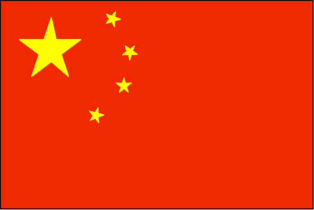
id
Pays
Pays en Anglais
China
Pays
Chine
countryucasefr
CHINE
Pays en Chinois
Pays en Espagnol
China
Pays en Italien
La Cina
Pays en Portugais
China
Pays en Allemand
China
countrypy
zhong1 guo2, zhong1 hua2
countrylocal
Zhongguo
countryfull
China
countrynm
China
ISO2
CN
ISO3
CHN
countrycodeisono
156
countrycodeolympic
CHN
countrycodeirs
CH
countrycodeirsfr
CN
countrycodeirsmixt
CN
countrycode
86
countrycodefr
86
♀Féminin
5
1
126
languagesfr
Chinois
3
currency
yuan renminbi
currencyfr
Yuan
currencyisocode
CNY
currencyisocodefull
CNY 156
currencypxcode
CNY
currencysymbol
Y
currencysubdivision
10 jiao = 100 fen
currencyregime
m.float
currencyvalue
0.121
nationality
Chinese
nationalityfr
Chinoise
Capitale
Beijing
capitalfr
Pékin
Préfixe Tél.
86
Superficie km2
9 574 479
arealand
9 326 410
areawater
270 550
landarablerate
0.1331
landforestrate
0.175
coastline
14500
summit
Mont Everest 8 850m
boundarycountries
Inde, Pakistan, Afghanistan, Tadjikistan, Kirghizstan, Kazakhstan, Russie, Mongolie, Corée du Nord, Vietnam, Laos, Birmanie, Bhoutan, Népal
timezonedeltabegin
8
zipcodelength
6
flaglink
maplink
cncolor.gif
outlinemaplink
cnout.gif
visapassenger
-1
maincities
Shanghaï, Tianjin, Shenyang, Wuhan, Canton, Harbin, Chongqing, Nanjing, Xi'an, Dalian, Chengdu, Changchun, Taiyuan, Jinan.
largestcity
Shanghai
largestcitypopulation
13 584 000
rankpopulation
1
Population
1 339 724 852
rankgdp
7
gdp
1417000000000
rankgdpppp
2
gdpppp
6446033000000
rankgni
6
gni
1416751000000
rankincomeorigin
134
rankincome
146
income
1100
rankincomeppp
119
incomeppp
4980
lifeexpectation
71.9
alphabetizationrate
0.835
mortalityrateinfantile
0.0272
precipitation
1331.7
nationalevent
Anniversary of the Founding of the People's Republic of China
nationaleventfr
Déclaration de la République Populaire de Chine
nationalholiday
1 October (1949)
Date de naissance aaaa-mm-jj
1949-10-01 00:00:00
6
2
president
HU Jintao
location
Eastern Asia, bordering the East China Sea, Korea Bay, Yellow Sea, and South China Sea, between North Korea and Vietnam
terrain
mostly mountains, high plateaus, deserts in west; plains, deltas, and hills in east
naturalresources
coal, iron ore, petroleum, natural gas, mercury, t
cooking
Riz, Cuisine à la Vapeur, Canard laqué de Pékin - Révolutionnaire !
phoneinputmask
CC CC CCC CCCCCCCCCCCCCCCCCCCCCCCCCCCCCCCCCCCCCCC;;_
8
Web
rgbback
12303359
todate
1
Notes
Riz, Cuisine à la Vapeur, Canard laqué de Pékin - Révolutionnaire !
Ce Buffle de la Terre laboure depuis la nuit des temps dans les rizières. Et fouirnit aux peuples du monde entier de produits peu onéreux depuis 1979 du petit timonier DENG Xiaoping.
10
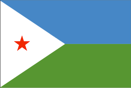
id
Pays
Pays en Anglais
Djibouti
Pays
Djibouti
countryucasefr
DJIBOUTI
Pays en Chinois
Pays en Espagnol
Djibouti
Pays en Italien
Djibouti
Pays en Portugais
Djibouti
Pays en Allemand
Djibouti
countrypy
ji2 bu4 ti2
countrylocal
Djibouti
countryfull
Djibouti
countrynm
Djibouti
ISO2
DJ
ISO3
DJI
countrycodeisono
262
countrycodeolympic
DJI
countrycodeirs
DJ
countrycodeirsfr
DJ
countrycodeirsmixt
DJ
15
4
3
languagesfr
Arabe
133
currency
franc
currencyfr
franc de Djibouti
currencyisocode
DJF
currencyisocodefull
DJF 262
currencypxcode
DJF
currencysymbol
DF
currencysubdivision
100 centimes
currencyregime
US-$ (177.72)
currencyvalue
0.00603
Capitale
Jibuti
capitalfr
Djibouti
Préfixe Tél.
253
Superficie km2
23 200
arealand
22 980
areawater
20
landforestrate
0.003
coastline
314
summit
Moussa Ali 2 063 m.
boundarycountries
Ethiopie, Somaliland, Erythrée.
timezonedeltabegin
3
flaglink
maplink
djcolor.gif
outlinemaplink
djout.gif
visapassenger
-1
maincities
Tadjourah, Dikhil, Obock, Ali-Sabieh.
largestcity
Djibouti
largestcitypopulation
493 000
rankpopulation
158
Population
705 000
rankgdp
166
gdp
625000000
rankgdpppp
154
gdpppp
1471000000
rankgni
185
gni
643000000
rankincomeorigin
141
rankincome
154
income
910
rankincomeppp
157
incomeppp
2140
lifeexpectation
43.12
alphabetizationrate
0.669
natalityrate
0.04039
fecondity
5.7
mortalityrate
0.01942
mortalityrateinfantile
0.10554
hdi
0.462
urbanization
0.842
precipitation
163
nationalevent
Independence Day
nationaleventfr
Jour de l'Indépendance
nationalholiday
27 June (1977)
Date de naissance aaaa-mm-jj
1977-06-27 00:00:00
4
6
location
Eastern Africa, bordering the Gulf of Aden and the Red Sea, between Eritrea and Somalia
terrain
coastal plain and plateau separated by central mountains
naturalresources
geothermal areas
9
rgbback
16777215
todate
1
| Pays/Territoires | Régions en Chine | Provinces de Chine | Régions en France | Départements de France | Provinces du Monde | Villes/Villages | Localités | Continents du Monde | Vins AOP

