印度尼西亚 Indonesia => 一个盛产木材的国家
印度尼西亚 Indonesia => 一个盛产木材的国家
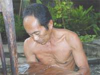 艺人 |
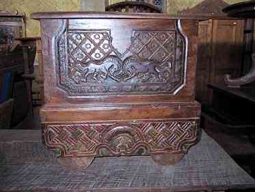 印度尼西亚家具精选 |
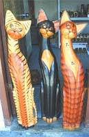 小物件 |
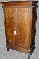 印度尼西亚家具演变史 |
印度尼西亚 Indonesia => 一个盛产木材的国家
最后修正 2023-11-09 09:24:11
印度尼西亚是一个地处亚洲的国家, 首都/首府是雅加达 。 它的行政划分如下: 印度尼西亚 被划分成 省, 然后又被细划分成 县 (kabupaten),市 (kota), 然后又被细划分成 区, 然后又被细划分成 乡,镇,村.
在此您可以得到世界各国和地区的法文,英文,中文名称。 这个珍贵的全人类共享的土地的集合,不仅包括世界上的独立国家, 而且也包括非联合国联合国:我联合国人民,团结起来追求更美好的世界!会员国的特殊领域。 请咨询 法语国名/地区名阴阳性详表。
1
id
国家/地区
英语国家/地区名
Macau
法语国家/地区名
Macao
countryucasefr
MACAO
国家/地区名
西班牙语国家/地区名
Macau
意大利语国家/地区名
Macau
葡萄牙语国家/地区名
Macau
德语国家/地区名
Macau
countryfull
Macau
countrynm
Macau
国际编码2
MO
国际编码3
MAC
countrycodeisono
446
countrycodeirs
MC
countrycodeirsfr
MC
countrycodeirsmixt
MC
♂男性
8
1
34
languagesfr
Chinois, Portuguais
147
currency
pataca
currencyfr
patacas
currencyisocode
MOP
currencyisocodefull
MOP 446
currencypxcode
MOP
currencysymbol
P
currencysubdivision
100 avos
currencyregime
HK-$ (1.03)
currencyvalue
0.1303
nationalityfr
Chinoise
首都
Macau
capitalfr
Macao
电话号码前缀
853
面积 km2
15.50
arealand
25.40
coastline
41
summit
Coloane Alto 174 m.
boundarycountries
Chine.
timezonedeltabegin
8
flaglink
maplink
macau.gif
visapassenger
-1
maincities
Taipa, Coloane.
largestcity
Macau
rankpopulation
165
人口
444 000
rankgdp
105
gdp
6765000000
rankgdpppp
130
gdpppp
8615000000
rankgni
105
gni
6335000000
rankincomeorigin
43
rankincome
39
income
14600
rankincomeppp
35
incomeppp
21950
lifeexpectation
82.03
alphabetizationrate
0.945
natalityrate
0.00804
fecondity
0.93
mortalityrate
0.00423
mortalityrateinfantile
0.00439
growthrate
0.00866
urbanization
1
nationalevent
National Day (Anniversary of the Founding of the People's Republic of China)
nationaleventfr
Jour National
nationalholiday
1 October (1949
生日 年-月-日
1949-10-01 00:00:00
6
2
location
Eastern Asia, bordering the South China Sea and China
terrain
generally flat
naturalresources
NEGL
8
网站
rgbback
16777215
todate
1
2
id
国家/地区
英语国家/地区名
Macedonia
法语国家/地区名
Macédoine
countryucasefr
MACEDOINE
国家/地区名
西班牙语国家/地区名
Macedonia
意大利语国家/地区名
Macedonia
葡萄牙语国家/地区名
Macedonia
德语国家/地区名
Macedonia
countrypy
ma3 qi2 dun4
countrylocal
Makedonija
countryfull
Macedonia, The Former Yugoslav Republic of
countrynm
Macedonia, The Former Yugoslav Republic of
国际编码2
MK
国际编码3
MKD
countrycodeisono
807
countrycodevehicle
MK
countrycodeolympic
MKD
countrycodeirs
MK
countrycodeirsfr
MK
countrycodeirsmixt
MK
♀女性
18
6
97
languagesfr
Macédonien
66
currency
denar
currencyfr
Dinar macédonien
currencyisocode
MKD
currencyisocodefull
MKD 807
currencypxcode
MKD
currencysymbol
MKD
currencysubdivision
100 deni
currencyregime
composite
nationalityfr
Macédonienne
首都
Skopje
capitalfr
Skopje
电话号码前缀
389
面积 km2
25 713
arealand
24 856
areawater
477
landarablerate
0.2359
landforestrate
0.356
summit
Korabi 2 764 m.
boundarycountries
Albanie, Bulgarie, Grèce, Yougoslavie
timezonedeltabegin
1
flaglink
maplink
mk-map.gif
outlinemaplink
mk.gif
visapassenger
-1
maincities
Bitola, Prilep, Brod, Titov, Tetovo, Kumanovo.
largestcity
Skopje
largestcitypopulation
466 000
rankpopulation
140
人口
2 049 000
rankgdp
120
gdp
4666000000
rankgdpppp
112
gdpppp
13922000000
rankgni
128
gni
4052000000
rankincomeorigin
111
rankincome
121
income
1980
rankincomeppp
93
incomeppp
6750
lifeexpectation
74.73
alphabetizationrate
0.96
natalityrate
0.01314
mortalityrate
0.00783
mortalityrateinfantile
0.01174
growthrate
0.00594
hdi
0.784
urbanization
0.594
precipitation
507
nationalevent
Uprising Day
nationaleventfr
Jour de la Résurrection
nationalholiday
2 August (1903)
生日 年-月-日
1903-08-02 00:00:00
10
4
location
Southeastern Europe, north of Greece
terrain
mountainous territory covered with deep basins and valleys; three large lakes, each divided by a frontier line; country bisected by the Vardar River
naturalresources
chromium, lead, zinc, manganese, tungsten, nickel,
7
rgbback
16777215
todate
1
3
id
国家/地区
英语国家/地区名
Madagascar
法语国家/地区名
Madagascar
countryucasefr
MADAGASCAR
国家/地区名
西班牙语国家/地区名
Madagascar
意大利语国家/地区名
Il Madagascar
葡萄牙语国家/地区名
Madagascar
德语国家/地区名
Madagaskar
countrypy
ma3 da2 jia1 si1 jia1
countrylocal
Madagascar
countryfull
Madagascar
countrynm
Madagascar
国际编码2
MG
国际编码3
MDG
countrycodeisono
450
countrycodevehicle
RM
countrycodeolympic
MAD
countrycodeirs
MA
countrycodeirsfr
MA
countrycodeirsmixt
MDG
15
7
193
languagesfr
Malgache, Français
148
currency
franc
currencyfr
franc malgache
currencyisocode
MGF
currencyisocodefull
MGF 450
currencypxcode
MGF
currencysymbol
FMG
currencysubdivision
1 francs = 100 centimes [*]
currencyregime
float
currencyvalue
0.00011
首都
Antananarivo
capitalfr
Antananarivo
电话号码前缀
261
面积 km2
587 040
arealand
581 540
areawater
5 500
landarablerate
0.0441
landforestrate
0.202
coastline
4828
summit
Maromokotro 2 876 m.
timezonedeltabegin
3
flaglink
maplink
mgcolor.gif
outlinemaplink
mgout.gif
visapassenger
-1
maincities
Toamasina, Majunga, Fianarantsoa, Antsirabé, Toliara, Antsiranana.
largestcity
Antananarivo
largestcitypopulation
876 000
rankpopulation
54
人口
16 894 000
rankgdp
115
gdp
5474000000
rankgdpppp
115
gdpppp
13669000000
rankgni
121
gni
4857000000
rankincomeorigin
187
rankincome
201
income
290
rankincomeppp
199
incomeppp
800
lifeexpectation
56.54
alphabetizationrate
0.682
natalityrate
0.04191
mortalityrate
0.01162
mortalityrateinfantile
0.07852
hdi
0.468
urbanization
0.301
precipitation
1459
nationalevent
Independence Day
nationaleventfr
Jour de l'Indépendance
nationalholiday
26 June (1960)
生日 年-月-日
1960-06-26 00:00:00
7
1
location
Southern Africa, island in the Indian Ocean, east of Mozambique
terrain
narrow coastal plain, high plateau and mountains in center
naturalresources
graphite, chromite, coal, bauxite, salt, quartz, t
cooking
Fruits de Mer Tropicaux.
9
网站
rgbback
16777215
todate
1
小注
Fruits de Mer Tropicaux.
4
id
国家/地区
英语国家/地区名
Madeira
法语国家/地区名
Madère
countryucasefr
MADERE
国家/地区名
西班牙语国家/地区名
Madeira
意大利语国家/地区名
La Madera
葡萄牙语国家/地区名
Madeira
德语国家/地区名
Madeira
countryfull
Madeira
countrynm
Madeira
国际编码2
PRTM
国际编码3
PRTM
countrycodeisono
620
countrycodevehicle
P
countrycodeolympic
POR
countrycodeirs
PT
countrycodeirsfr
PT
countrycodeirsmixt
PT
♀女性
18
6
114
2
currencyisocode
EUR
currencypxcode
EUR
currencyvalue
1.2203
首都
Funchal
capitalfr
Funchal
电话号码前缀
351
flaglink
maplink
madeiran.gif
outlinemaplink
madeira.gif
visapassenger
-1
largestcity
Funchal
rankincome
222
7
rgbback
16777215
todate
1
5
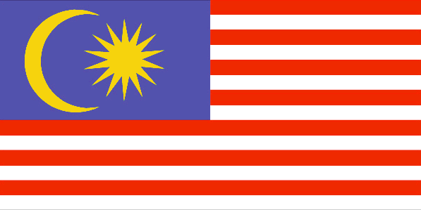
id
国家/地区
英语国家/地区名
Malaysia
法语国家/地区名
Malaisie
countryucasefr
MALAISIE
国家/地区名
西班牙语国家/地区名
Malasia
意大利语国家/地区名
La Malesia
葡萄牙语国家/地区名
Malaysia
德语国家/地区名
Malaysia
countrypy
ma3 lai2 xi1 ya4
countrylocal
Malaysia
countryfull
Malaysia
countrynm
Malaysia
国际编码2
MY
国际编码3
MYS
countrycodeisono
458
countrycodevehicle
MAL
countrycodeolympic
MAS
countrycodeirs
MY
countrycodeirsfr
MY
countrycodeirsmixt
ML
♀女性
12
5
100
languagesfr
Malais
67
currency
ringgit
currencyfr
dollar de la Malaysie
currencyisocode
MYR
currencyisocodefull
MYR 458
currencypxcode
MYR
currencysymbol
RM
currencysubdivision
100 sen
currencyregime
m.float
currencyvalue
0.2632
nationalityfr
Malaise
首都
Kuala Lumpur
capitalfr
Kuala Lumpur
电话号码前缀
60
面积 km2
329 750
arealand
328 550
areawater
1 200
landarablerate
0.0554
landforestrate
0.587
coastline
4675
summit
Gunung Kinabalu 4 101 m.
boundarycountries
Thaïlande, Indonésie, Brunei.
timezonedeltabegin
8
flaglink
maplink
mylarge.gif
outlinemaplink
myout.gif
visapassenger
-1
maincities
Ipoh, Johore Bharu, Taiping, George Town, Kota Bharu, Kuala Trengganu, Kuantan, Seremban, Malacca, Kuching, Alor Setar, Kota Kinabalu.
largestcity
Kuala Lumpur
largestcitypopulation
1 236 000
rankpopulation
42
人口
24 774 000
rankgdp
37
gdp
103737000000
rankgdpppp
34
gdpppp
235662000000
rankgni
37
gni
96082000000
rankincomeorigin
82
rankincome
91
income
3880
rankincomeppp
81
incomeppp
8970
lifeexpectation
73.05
alphabetizationrate
0.784
natalityrate
0.0214
mortalityrate
0.0044
mortalityrateinfantile
0.0051
hdi
0.794
precipitation
2366
nationalevent
Independence Day/Malaysia Day
nationaleventfr
Jour de l'Indépendance
nationalholiday
31 August (1957)
生日 年-月-日
1957-08-31 00:00:00
4
10
location
Southeastern Asia, peninsula and northern one-third of the island of Borneo, bordering Indonesia and the South China Sea, south of Vietnam
terrain
coastal plains rising to hills and mountains
naturalresources
tin, petroleum, timber, copper, iron ore, natural
cooking
Fruits de Mer.
9
网站
rgbback
16777215
todate
1
小注
Fruits de Mer.
6
id
国家/地区
英语国家/地区名
Malawi
法语国家/地区名
Malawi
countryucasefr
MALAWI
国家/地区名
西班牙语国家/地区名
Malawi
意大利语国家/地区名
Il Malawi
葡萄牙语国家/地区名
Malawi
德语国家/地区名
Malawi
countrypy
ma3 la1 wei1
countrylocal
Malawi
countryfull
Malawi
countrynm
Malawi
国际编码2
MW
国际编码3
MWI
countrycodeisono
454
countrycodevehicle
MW
countrycodeolympic
MAW
countrycodeirs
MI
countrycodeirsfr
MI
countrycodeirsmixt
MI
♂男性
14
6
194
languagesfr
Chewa, Anglais
149
currency
kwacha
currencyfr
kwacha
currencyisocode
MWK
currencyisocodefull
MWK 454
currencypxcode
MWK
currencysymbol
MK
currencysubdivision
100 tambala
currencyregime
float
currencyvalue
0.00851
首都
Lilongwe
capitalfr
Lilongwe
电话号码前缀
265
面积 km2
118 484
arealand
94 080
areawater
24 400
landarablerate
0.1993
landforestrate
0.272
summit
Mlanje Sapitwa 3 002 m.
boundarycountries
Zambie, Tanzanie, Mozambique.
timezonedeltabegin
2
flaglink
maplink
mwcolor.gif
outlinemaplink
mwout.gif
visapassenger
-1
maincities
Blantyre, Mzuzu, Zomba, Karonga, Nkhotakota.
largestcity
Lilongwe
largestcitypopulation
437 000
rankpopulation
70
人口
10 962 000
rankgdp
147
gdp
1714000000
rankgdpppp
136
gdpppp
6630000000
rankgni
155
gni
1808000000
rankincomeorigin
200
rankincome
215
income
160
rankincomeppp
207
incomeppp
590
lifeexpectation
37.48
alphabetizationrate
0.621
natalityrate
0.04435
mortalityrate
0.02301
mortalityrateinfantile
0.10423
hdi
0.387
urbanization
0.151
precipitation
922
nationalevent
Independence Day (Republic Day)
nationaleventfr
Jour de l'Indépendance (Jour de la République)
nationalholiday
6 July (1964)
生日 年-月-日
1964-07-06 00:00:00
1
5
location
Southern Africa, east of Zambia
terrain
narrow elongated plateau with rolling plains, rounded hills, some mountains
naturalresources
limestone, arable land, hydropower, unexploited de
9
网站
rgbback
16777215
todate
1
7
id
国家/地区
英语国家/地区名
Maldives
法语国家/地区名
Maldives
countryucasefr
MALDIVES
国家/地区名
西班牙语国家/地区名
Maldives
意大利语国家/地区名
I Maldives
葡萄牙语国家/地区名
Maldives
德语国家/地区名
Maldives
countrypy
ma3 er3 dai4 fu1
countrylocal
Dhivehi Raajje
countryfull
Maldives
countrynm
Maldives
国际编码2
MV
国际编码3
MDV
countrycodeisono
462
countrycodeolympic
MDV
countrycodeirs
MV
countrycodeirsfr
MV
countrycodeirsmixt
MV
♀女性
15
6
195
languagesfr
Divehi
150
currency
rufiyaa
currencyfr
roupie maldive
currencyisocode
MVR
currencyisocodefull
MVR 462
currencypxcode
MVR
currencysymbol
Rf
currencysubdivision
100 lari
currencyregime
m.float
currencyvalue
0.07843
首都
Male
capitalfr
Male
电话号码前缀
960
面积 km2
298
arealand
300
landarablerate
0.0333
landforestrate
0.033
coastline
644
summit
24 m.
timezonedeltabegin
5
flaglink
maplink
mv.jpg
outlinemaplink
mv.gif
visapassenger
-1
maincities
Gan.
largestcity
Male
largestcitypopulation
68 000
rankpopulation
170
人口
293 000
rankgdp
163
gdp
715000000
rankgni
181
gni
690000000
rankincomeorigin
99
rankincome
109
income
2350
lifeexpectation
73
alphabetizationrate
0.9894
natalityrate
0.018
mortalityrate
0.004
mortalityrateinfantile
0.018
hdi
0.725
precipitation
1951
nationalevent
Independence Day
nationaleventfr
Jour de l'Indépendance
nationalholiday
26 July (1965)
生日 年-月-日
1965-07-26 00:00:00
2
6
location
Southern Asia, group of atolls in the Indian Ocean, south-southwest of India
terrain
flat, with white sandy beaches
naturalresources
fish
9
rgbback
16777215
todate
1
8
id
国家/地区
英语国家/地区名
Mali
法语国家/地区名
Mali
countryucasefr
MALI
国家/地区名
西班牙语国家/地区名
Malí
意大利语国家/地区名
Il Mali
葡萄牙语国家/地区名
Mali
德语国家/地区名
Mali
countrypy
ma3 li3
countrylocal
Mali
countryfull
Mali
countrynm
Mali
国际编码2
ML
国际编码3
MLI
countrycodeisono
466
countrycodevehicle
RMM
countrycodeolympic
MLI
countrycodeirs
ML
countrycodeirsfr
ML
countrycodeirsmixt
MLI
♂男性
15
6
57
languagesfr
Français
119
currency
franc
currencyfr
franc C.F.A.
currencyisocode
XOF
currencyisocodefull
XOF 952
currencypxcode
XOF
currencysymbol
CFAF
currencysubdivision
100 centimes
currencyregime
Euro (655.957)
currencyvalue
0.00186
nationalityfr
Malienne
首都
Bamako
capitalfr
Bamako
电话号码前缀
223
面积 km2
1 240 190
arealand
1 220 000
areawater
20 000
landarablerate
0.0377
landforestrate
0.108
summit
Hombori Tondo 1 155 m.
boundarycountries
Mauritanie, Algérie, Burkina Faso, Niger, Côte d'Ivoire, Guinée, Sénégal.
flaglink

maplink
mlcolor.gif
outlinemaplink
mlout.gif
visapassenger
-1
maincities
Ségou, Mopti, Sikasso, Kayes, Gao, Tombouctou.
largestcity
Bamako
largestcitypopulation
919 000
rankpopulation
67
人口
11 652 000
rankgdp
122
gdp
4326000000
rankgdpppp
119
gdpppp
11583000000
rankgni
137
gni
3428000000
rankincomeorigin
187
rankincome
201
income
290
rankincomeppp
192
incomeppp
960
lifeexpectation
45.28
alphabetizationrate
0.4495
natalityrate
0.04729
fecondity
7
mortalityrate
0.01912
mortalityrateinfantile
0.11799
growthrate
0.02783
hdi
0.337
precipitation
878
nationalevent
Independence Day
nationaleventfr
Jour de l'Indépendance
nationalholiday
22 September (1960)
生日 年-月-日
1960-09-22 00:00:00
7
1
president
Amadou Toumani Touré
location
Western Africa, southwest of Algeria
terrain
mostly flat to rolling northern plains covered by sand; savanna in south, rugged hills in northeast
naturalresources
gold, phosphates, kaolin, salt, limestone, uranium
9
网站
rgbback
16777215
todate
1
9
id
国家/地区
英语国家/地区名
Malta
法语国家/地区名
Malte
countryucasefr
MALTE
国家/地区名
西班牙语国家/地区名
Malta
意大利语国家/地区名
Malta
葡萄牙语国家/地区名
Malta
德语国家/地区名
Malta
countrypy
ma3 er3 ta1
countrylocal
Malta
countryfull
Malta
countrynm
Malta
国际编码2
MT
国际编码3
MLT
countrycodeisono
470
countrycodevehicle
M
countrycodeolympic
MLT
countrycodeirs
MT
countrycodeirsfr
MT
countrycodeirsmixt
MT
countrycode
356
♂男性
15
6
101
languagesfr
Maltais, Anglais.
2
currency
lira, pl., liri
currencyfr
livre maltaise
currencyisocode
MTL
currencyisocodefull
MTL 470
currencypxcode
MTL
currencysymbol
Lm
currencysubdivision
100 cents
currencyregime
composite
currencyvalue
2.8718
nationalityfr
Maltaise
首都
Valletta
capitalfr
La Valette
电话号码前缀
356
面积 km2
310
arealand
316
landarablerate
0.3125
coastline
196.8
summit
Dingli Cliffs 249 m.
timezonedeltabegin
1
flaglink
maplink
mt-map.gif
outlinemaplink
mt.gif
visapassenger
-1
maincities
Birkirkara, Qormi, Sliema, Victoria, Rabat, Mosta.
largestcity
Valletta
largestcitypopulation
99 000
rankpopulation
167
人口
399 000
rankgdp
118
gdp
4851000000
rankgdpppp
134
gdpppp
7036000000
rankgni
125
gni
4302000000
rankincomeorigin
54
rankincome
57
income
10780
rankincomeppp
49
incomeppp
17780
lifeexpectation
78.43
alphabetizationrate
0.8798
natalityrate
0.00702
mortalityrate
0.00611
mortalityrateinfantile
0.00562
hdi
0.866
precipitation
553
nationalevent
Independence Day
nationaleventfr
Jour de l'Indépendance
nationalholiday
21 September (1964)
生日 年-月-日
1964-09-21 00:00:00
1
5
location
Southern Europe, islands in the Mediterranean Sea, south of Sicily (Italy)
terrain
mostly low, rocky, flat to dissected plains; many coastal cliffs
naturalresources
limestone, salt, arable land
7
网站
rgbback
16777215
todate
1
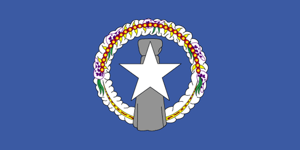
10
id
国家/地区
英语国家/地区名
Northern Mariana Islands
法语国家/地区名
Mariannes (îles de)
countryucasefr
MARIANNES (ILES DE)
国家/地区名
西班牙语国家/地区名
Islas De Mariana Norteñas
意大利语国家/地区名
Isole Di Mariana Del Nord
葡萄牙语国家/地区名
Consoles De Mariana Do norte
德语国家/地区名
NordcMarianacInseln
countryfull
Northern Mariana Islands
countrynm
Northern Mariana Islands
国际编码2
MP
国际编码3
MNP
countrycodeisono
580
countrycodeirs
CQ
countrycodeirsfr
CQ
countrycodeirsmixt
CQ
♀女性
12
6
51
1
currencypxcode
USD
首都
Saipan
capitalfr
Saipan
电话号码前缀
1-670
面积 km2
477
arealand
477
landarablerate
0.1522
landforestrate
0.304
coastline
1482
timezonedeltabegin
10
flaglink
maplink
nmarmap.gif
visapassenger
-1
largestcity
Saipan
rankpopulation
193
人口
76 000
rankincome
222
nationalevent
Commonwealth Day
nationaleventfr
Jour du Commonwealth
nationalholiday
8 January (1978)
生日 年-月-日
1978-01-08 00:00:00
4
6
location
Oceania, islands in the North Pacific Ocean, about three-quarters of the way from Hawaii to the Philippines
terrain
southern islands are limestone with level terraces and fringing coral reefs; northern islands are volcanic
naturalresources
arable land, fish
cooking
The islands, which include Saipan, Rota, Farallon de Pajaros and Tinian, total some 477 square kilometers. Saipan and Tinian have the best ports and harbors. Download high resolution version (992x496, 124 KB)Large flag of the Northern Mariana Islands. ... Image taken from www. ... Flag ratio: 1:2 The flag of the Northern Mariana Islands was adopted on July 4, 1976. ... A motto is a phrase or collection of words intended to describe the motivation or intention of a sociological grouping or organization. ... locator map for the Northern Marianas - made for Wikipedia File links The following pages link to this file: Northern Mariana Islands User:DanielZm/test Roman Catholic Diocese of Chalan Kanoa Categories: Country locator maps | Northern Mariana Islands | GFDL images ... As with any complex, emergent concept, language is somewhat resistant to definition. ... The English language is a West Germanic language that originates in England. ... Chamorro, or Chamoru, is the native language used in Guam and Northern Mariana Islands. ... Carolinian is an Austronesian language spoken in the Northern Mariana Islands, where it is an official language along with English and Chamorro. ... In politics a capital (also called capital city or political capital — although the latter phrase has an alternative meaning based on an alternative meaning of capital) is the principal city or town associated with its government. ... Saipan is the largest island and capital of the Northern Mariana Islands of the western Pacific Ocean, with a total area of 120 km² (46. ... A head of state or chief of state is the chief public representative of a nation-state, federation or commonwealth, whose role generally includes personifying the continuity and legitimacy of the state and exercising the political powers, functions and duties granted to the head of state in the countrys... List of Northern Mariana Islands Governors Carlos S. Camacho Democrat 1978-1982 Pedro P. Tenorio Republican 1982-1990 Lorenzo I. De Leon Guerrero Republican 1990-1994 Froilan C. Tenorio Democrat 1994-1998 Pedro P. Tenorio Republican 1998-2002 Juan N. Babauta Republican 2002- Categories: Lists of governors of U.S... Juan Nekai Babauta (born September 7, 1953, Tapanag, Saipan) is current governor of the Northern Mariana Islands. ... This article explains the meaning of area as a physical quantity. ... Here is a list of the countries of the world sorted by area. ... (Redirected from 1 E8 m2) To help compare different orders of magnitude and geographical regions, we list here areas between 100 km² and 1000 km². See also areas of other orders of magnitude. ... Square kilometre (US spelling: Square kilometer), symbol km², is an SI unit of surface area. ... In the most common sense of the word, a population is the collection of people—or organisms of a particular species—living in a given geographic area. ... Population density can be used as a measurement of any tangible item. ... This is a list of sovereign states and other territories by population. ... Independence is autonomous self-government of a country by its residents and indigenous population. ... The dollar is the name of the official currency in several countries, dependencies and other regions (see list below), including the US dollar, the worlds most widely circulated currency (see list below). ... -1... UTC also stands for the University of Tennessee at Chattanooga Coordinated Universal Time or UTC, also sometimes referred to as Zulu time, the basis for civil time, differs by an integral number of seconds from atomic time and a fractional number of seconds from UT1. ... The National Anthem is the name of a song by the band Radiohead. ... A top-level domain (TLD) is the last part of which Internet domain names consist of. ... .mp is the Internet country code top-level domain ( ccTLD) for Northern Mariana Islands. ... Saipan is the largest island and capital of the Northern Mariana Islands of the western Pacific Ocean, with a total area of 120 km² (46. ... Rota, also known as the peaceful island, is the southernmost island of the United States Commonwealth of the Northern Mariana Islands (CNMI). ... Farallon de Pajaros (from spanish Farallón de los pájaros, meaning Birds Rock), also known as Uracas (from Spanish Urracas, meaning Ravens), is the westernmost island in the Northern Mariana Islands chain. ... Tinian is one of the three principal islands of the Commonwealth of the Northern Marianas Islands. ... (Redirected from 1 E8 m2) To help compare different orders of magnitude and geographical regions, we list here areas between 100 km² and 1000 km². See also areas of other orders of magnitude. ...
9
rgbback
16777215
todate
1
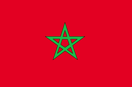
11
id
国家/地区
英语国家/地区名
Morocco
法语国家/地区名
Maroc
countryucasefr
MAROC
国家/地区名
西班牙语国家/地区名
Marruecos
意大利语国家/地区名
Il Marocco
葡萄牙语国家/地区名
Marrocos
德语国家/地区名
Marokko
countrypy
mo2 luo4 ge1
countrylocal
Al Maghrib
countryfull
Morocco
countrynm
Morocco
国际编码2
MA
国际编码3
MAR
countrycodeisono
504
countrycodevehicle
MA
countrycodeolympic
MAR
countrycodeirs
MO
countrycodeirsfr
MO
countrycodeirsmixt
MO
countrycode
212
♂男性
12
6
3
languagesfr
Arabe
121
currency
dirham
currencyfr
dirham
currencyisocode
MAD
currencyisocodefull
MAD 504
currencypxcode
MAD
currencysymbol
DH
currencysubdivision
100 centimes
currencyregime
composite
currencyvalue
0.1111
nationalityfr
Marocaine
首都
Rabat
capitalfr
Rabat
电话号码前缀
212
面积 km2
446 550
arealand
446 300
areawater
250
landarablerate
0.2012
landforestrate
0.068
coastline
1835
summit
Jebel Toubkal 4 165 m.
boundarycountries
Algérie, Sahara occidental.
flaglink
maplink
macolor.gif
outlinemaplink
maout.gif
visapassenger
-1
maincities
Casablanca, Marrakech, Fès, Oujda, Kenitra, Tetouan, Safi, Meknès, Agadir, Tanger.
largestcity
Casablanca
largestcitypopulation
3 101 000
rankpopulation
37
人口
30 113 000
rankgdp
56
gdp
43727000000
rankgdpppp
53
gdpppp
120578000000
rankgni
57
gni
39367000000
rankincomeorigin
128
rankincome
140
income
1310
rankincomeppp
132
incomeppp
3940
lifeexpectation
70.35
alphabetizationrate
0.5085
natalityrate
0.02279
mortalityrate
0.00571
mortalityrateinfantile
0.04325
hdi
0.606
urbanization
0.551
precipitation
426
nationalevent
Throne Day (accession of King MOHAMED VI to the throne)
nationaleventfr
Jour du Tronc (accession du Roi MOHAMED VI au Tronc)
nationalholiday
30 July (1999)
生日 年-月-日
1999-07-30 00:00:00
6
4
location
Northern Africa, bordering the North Atlantic Ocean and the Mediterranean Sea, between Algeria and Western Sahara
terrain
northern coast and interior are mountainous with large areas of bordering plateaus, intermontane valleys, and rich coastal plains
naturalresources
phosphates, iron ore, manganese, lead, zinc, fish,
cooking
Tagines.
7
网站
rgbback
16777215
todate
1
小注
Tagines.
Nation de suprême intelligence, le Lapin de Terre a inventé les chiffres numériques 0,1,2,3,4,5,6,7,8,9, algèbre, mathématiques.
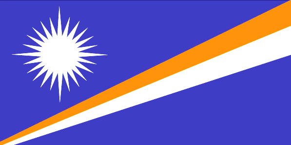
12
id
国家/地区
英语国家/地区名
Marshall Islands
法语国家/地区名
Marshall (îles)
countryucasefr
MARSHALL (ILES)
国家/地区名
西班牙语国家/地区名
Forme Las Islas
意大利语国家/地区名
Ordini Le Isole
葡萄牙语国家/地区名
Marshall Consoles
德语国家/地区名
Marshall Inseln
countryfull
Marshall Islands
countrynm
Marshall Islands
国际编码2
MH
国际编码3
MHL
countrycodeisono
584
countrycodeolympic
MHL
countrycodeirs
RM
countrycodeirsfr
RM
countrycodeirsmixt
RM
♀女性
19
6
51
languagesfr
Anglais
1
currencyfr
dollar
currencysymbol
$
首都
Majuro
capitalfr
Uliga
电话号码前缀
692
面积 km2
181.30
arealand
181.30
landarablerate
0.1667
coastline
370.4
summit
10 m.
timezonedeltabegin
12
flaglink
maplink
mhcolor.gif
outlinemaplink
mh.gif
visapassenger
-1
maincities
Ebeye
largestcity
Majuro
largestcitypopulation
28 000
rankpopulation
200
人口
53 000
rankgdp
183
gdp
106000000
rankgni
205
gni
142000000
rankincomeorigin
96
rankincome
106
income
2710
lifeexpectation
70.01
alphabetizationrate
0.937
natalityrate
0.03352
fecondity
4.02
mortalityrate
0.00488
mortalityrateinfantile
0.02945
growthrate
0.02274
hdi
0.738
urbanization
0.6618
nationalevent
Constitution Day
nationaleventfr
Jour de la Constitution
nationalholiday
1 May (1979)
生日 年-月-日
1979-05-01 00:00:00
6
8
location
Oceania, group of atolls and reefs in the North Pacific Ocean, about one-half of the way from Hawaii to Australia
terrain
low coral limestone and sand islands
naturalresources
coconut products, marine products, deep seabed min
9
rgbback
16777215
todate
1
13
id
国家/地区
英语国家/地区名
Martinique
法语国家/地区名
Martinique
countryucasefr
MARTINIQUE
国家/地区名
西班牙语国家/地区名
Martinica
意大利语国家/地区名
La Martinica
葡萄牙语国家/地区名
Martinica
德语国家/地区名
Martinique
countrypy
ma3 ding1 ni2 ke4 dao3
countrylocal
Martinique
countryfull
Martinique
countrynm
Martinique
国际编码2
MQ
国际编码3
MTQ
countrycodeisono
474
countrycodeirs
MB
countrycodeirsfr
MB
countrycodeirsmixt
MB
♀女性
15
6
57
languagesfr
Français
2
currency
euro
currencyfr
Euro
currencyisocode
EUR
currencyisocodefull
EUR 978
currencypxcode
EUR
currencysymbol
€
currencysubdivision
100 cents
currencyregime
float
currencyvalue
1.2203
nationalityfr
Martinicaise
首都
Fort-de-France
capitalfr
Fort-de-France
电话号码前缀
596
面积 km2
1 079
arealand
1 060
areawater
40
landarablerate
0.0943
landforestrate
0.439
coastline
350
summit
Montagne Pelée 1 397 m.
timezonedeltabegin
-4
flaglink
maplink
mqcolor.gif
outlinemaplink
mq.gif
visapassenger
-1
maincities
Le Lamentin, Sainte Marie, Schoelcher, Le François, La Trinité, Saint Pierre, Ducos
largestcity
Fort-de-France
rankpopulation
172
人口
422 277
rankgni
117
gni
5080000000
rankincomeorigin
45
rankincome
45
income
13026
lifeexpectation
78.88
alphabetizationrate
0.976
natalityrate
0.01456
mortalityrate
0.00643
mortalityrateinfantile
0.00727
urbanization
0.97
nationalevent
Bastille Day
nationaleventfr
Jour de la prise de la Bastille
nationalholiday
14 July (1789)
生日 年-月-日
1789-07-14 00:00:00
6
10
location
Caribbean, island between the Caribbean Sea and North Atlantic Ocean, north of Trinidad and Tobago
terrain
mountainous with indented coastline; dormant volcano
naturalresources
coastal scenery and beaches, cultivable land
cooking
Cuisine des Îles, Alcool fort.
2
网站
rgbback
16777215
todate
1
小注
Cuisine des Îles, Alcool fort.
14
id
国家/地区
英语国家/地区名
Mauritius
法语国家/地区名
Maurice (îles)
countryucasefr
MAURICE (ILES)
国家/地区名
西班牙语国家/地区名
Isla Mauricio
意大利语国家/地区名
L'isola Maurizio
葡萄牙语国家/地区名
Mauritius
德语国家/地区名
Mauritius
countrypy
mao2 li3 qiu2 si1
countrylocal
Mauritius
countryfull
Mauritius
countrynm
Mauritius
国际编码2
MU
国际编码3
MUS
countrycodeisono
480
countrycodevehicle
MS
countrycodeolympic
MRI
countrycodeirs
MP
countrycodeirsfr
MP
countrycodeirsmixt
MP
♀女性
18
6
51
languagesfr
Anglais
68
currency
rupee
currencyfr
roupie mauricienne
currencyisocode
MUR
currencyisocodefull
MUR 480
currencypxcode
MUR
currencysymbol
Mau Rs
currencysubdivision
100 cents
currencyregime
composite
currencyvalue
0.03458
nationalityfr
Mauricienne
首都
Port Louis
capitalfr
Port-Louis
电话号码前缀
230
面积 km2
1 865
arealand
2 030
areawater
10
landarablerate
0.4926
landforestrate
0.079
coastline
177
summit
Piton de la Petite Rivière Noire 826 m.
timezonedeltabegin
4
flaglink
maplink
mucolor.gif
outlinemaplink
muout.gif
visapassenger
-1
maincities
Beau Bassin, Quatre Bornes, Curepipe, Vacoas-Phoenix, Rose Hill, Mahébourg.
largestcity
Port Louis
largestcitypopulation
165 000
rankpopulation
150
人口
1 222 000
rankgdp
117
gdp
5224000000
rankgdpppp
114
gdpppp
13795000000
rankgni
119
gni
5009000000
rankincomeorigin
78
rankincome
86
income
4100
rankincomeppp
68
incomeppp
11280
lifeexpectation
72.09
alphabetizationrate
0.8535
natalityrate
0.01585
mortalityrate
0.00682
mortalityrateinfantile
0.01557
hdi
0.779
urbanization
0.616
precipitation
1793
nationalevent
Independence Day
nationaleventfr
Jour de l'Indépendance
nationalholiday
12 March (1968)
生日 年-月-日
1968-03-12 00:00:00
5
9
location
Southern Africa, island in the Indian Ocean, east of Madagascar
terrain
small coastal plain rising to discontinuous mountains encircling central plateau
naturalresources
arable land, fish
9
网站
rgbback
16777215
todate
1
15
id
国家/地区
英语国家/地区名
Mauritania
法语国家/地区名
Mauritanie
countryucasefr
MAURITANIE
国家/地区名
西班牙语国家/地区名
Mauritania
意大利语国家/地区名
La Mauritania
葡萄牙语国家/地区名
Mauritânia
德语国家/地区名
Mauretanien
countrypy
mao2 li4 ta3 ni2 ya4
countrylocal
Muritaniyah
countryfull
Mauritania
countrynm
Mauritania
国际编码2
MR
国际编码3
MRT
countrycodeisono
478
countrycodevehicle
RIM
countrycodeolympic
MTN
countrycodeirs
MR
countrycodeirsfr
MR
countrycodeirsmixt
MR
♀女性
15
4
3
languagesfr
Arabe, Français
123
currency
ouguiya
currencyfr
ougiya
currencyisocode
MRO
currencyisocodefull
MRO 478
currencypxcode
MRO
currencysymbol
UM
currencysubdivision
5 khoums
currencyregime
composite
currencyvalue
0.0038
nationalityfr
Mauritanienne
首都
Nouakchott
capitalfr
Nouakchott
电话号码前缀
222
面积 km2
1 030 700
arealand
1 030 400
areawater
300
landarablerate
0.0048
landforestrate
0.003
coastline
754
summit
Kediet Ijill 915 m.
boundarycountries
Sahara occidental, Algérie, Mali, Sénégal.
flaglink
maplink
mrcolor.gif
outlinemaplink
mrout.gif
visapassenger
-1
maincities
Nouadhibou, Kaédi, Zouerate, Rosso, Atar, Kiffa, Sélibaby, Néma.
largestcity
Nouakchott
largestcitypopulation
694 000
rankpopulation
134
人口
2 848 000
rankgdp
154
gdp
1093000000
rankgdpppp
140
gdpppp
5029000000
rankgni
167
gni
1142000000
rankincomeorigin
173
rankincome
187
income
400
rankincomeppp
163
incomeppp
1870
lifeexpectation
51.93
alphabetizationrate
0.34
natalityrate
0.04216
mortalityrate
0.01304
mortalityrateinfantile
0.0738
nationalevent
Independence Day
nationaleventfr
Jour de l'Indépendance
nationalholiday
28 November (1960)
生日 年-月-日
1960-11-28 00:00:00
7
1
location
Northern Africa, bordering the North Atlantic Ocean, between Senegal and Western Sahara
terrain
mostly barren, flat plains of the Sahara; some central hills
naturalresources
iron ore, gypsum, copper, phosphate, diamonds, gol
9
网站
rgbback
16777215
todate
1
16
id
国家/地区
英语国家/地区名
Mayotte
法语国家/地区名
Mayotte
countryucasefr
MAYOTTE
国家/地区名
西班牙语国家/地区名
Mayotte
意大利语国家/地区名
Mayotte
葡萄牙语国家/地区名
Mayotte
德语国家/地区名
Mayotte
countryfull
Mayotte
countrynm
Mayotte
国际编码2
YT
国际编码3
MYT
countrycodeisono
175
countrycodeirs
MF
countrycodeirsfr
MF
countrycodeirsmixt
MF
♀女性
15
6
57
2
currencypxcode
EUR
首都
Mamoutzou
capitalfr
Mamoutzou
电话号码前缀
269
面积 km2
374
arealand
374
coastline
185.2
timezonedeltabegin
3
flaglink
maplink
kmcolor.gif
outlinemaplink
kmout.gif
visapassenger
-1
largestcity
Mamoutzou
rankpopulation
179
人口
166 000
rankgni
189
gni
420000000
rankincomeorigin
103
rankincome
108
income
2471
lifeexpectation
60.99
natalityrate
0.04219
mortalityrate
0.00811
mortalityrateinfantile
0.06419
growthrate
0.04087
urbanization
0.7
nationalevent
Bastille Day
nationaleventfr
Jour de la prise de la Bastille
nationalholiday
14 July (1789)
生日 年-月-日
1789-07-14 00:00:00
6
10
location
Southern Africa, island in the Mozambique Channel, about one-half of the way from northern Madagascar to northern Mozambique
terrain
generally undulating, with deep ravines and ancient volcanic peaks
naturalresources
NEGL
3
rgbback
16777215
todate
1
17
id
国家/地区
英语国家/地区名
Mexico
法语国家/地区名
Mexique
countryucasefr
MEXIQUE
国家/地区名
西班牙语国家/地区名
México
意大利语国家/地区名
Il Messico
葡萄牙语国家/地区名
México
德语国家/地区名
Mexiko
countrypy
mo4 xi1 ge1
countrylocal
Estados Unidos Mexicanos
countryfull
Mexico
countrynm
Mexico
国际编码2
MX
国际编码3
MEX
countrycodeisono
484
countrycodevehicle
MEX
countrycodeolympic
MEX
countrycodeirs
MX
countrycodeirsfr
MX
countrycodeirsmixt
MX
countrycode
52
♂男性
7
131
languagesfr
Espagnol
69
currency
peso
currencyfr
peso mexicain
currencyisocode
MXN
currencyisocodefull
MXN 484
currencypxcode
MXN
currencysymbol
Mex$
currencysubdivision
100 centavos
currencyregime
float
currencyvalue
0.09239
nationalityfr
Mexicaine
首都
Mexico City
capitalfr
Mexico
电话号码前缀
52
面积 km2
1 972 547
arealand
1 923 040
areawater
49 510
landarablerate
0.132
landforestrate
0.289
coastline
9330
summit
Citlaltépelt 5 700 m.
boundarycountries
Etats-Unis, Guatémala, Bélize.
timezonedeltabegin
-6
flaglink
maplink
mxcolor.gif
outlinemaplink
mxout.gif
visapassenger
-1
maincities
Guadalajara, Monterrey, Zaragoza, León, Ciudad Juárez, Culiacán, Mexicali, Tijuana, Mérida, Acapulco, Chihuahua, San Luis Potosî, Hermosillo
largestcity
Mexico City
largestcitypopulation
16 562 000
rankpopulation
11
人口
102 291 000
rankgdp
10
gdp
626080000000
rankgdpppp
12
gdpppp
937836000000
rankgni
10
gni
637159000000
rankincomeorigin
68
rankincome
75
income
6230
rankincomeppp
80
incomeppp
8980
lifeexpectation
74.94
alphabetizationrate
0.917
natalityrate
0.02144
mortalityrate
0.00473
mortalityrateinfantile
0.02169
hdi
0.8
precipitation
848
nationalevent
Independence Day
nationaleventfr
Jour de l'Indépendance
nationalholiday
16 September (1810)
生日 年-月-日
1810-09-16 00:00:00
7
7
location
Middle America, bordering the Caribbean Sea and the Gulf of Mexico, between Belize and the US and bordering the North Pacific Ocean, between Guatemala and the US
terrain
high, rugged mountains; low coastal plains; high plateaus; desert
naturalresources
petroleum, silver, copper, gold, lead, zinc, natur
cooking
Spécialités très Epicées.
9
网站
rgbback
16777215
todate
1
小注
Spécialités très Epicées.
18
id
国家/地区
英语国家/地区名
Micronesia, Federated States of
法语国家/地区名
Micronésie
countryucasefr
MICRONESIE
国家/地区名
西班牙语国家/地区名
Micronesia, estados federados de
意大利语国家/地区名
La Micronesia, condizioni federated di
葡萄牙语国家/地区名
Micronesia, estados federados de
德语国家/地区名
Mikronesien, zu einem Bündnis vereingigte Zustände von
countryfull
Micronesia, Federated States of
countrynm
Micronesia, Federated States of
国际编码2
FM
国际编码3
FSM
countrycodeisono
583
countrycodeolympic
FSM
countrycodeirs
FM
countrycodeirsfr
FM
countrycodeirsmixt
FM
♀女性
19
7
51
languagesfr
Anglais
6
currency
dollar
currencyfr
dollar
currencyisocode
USD
currencyisocodefull
USD 840
currencypxcode
USD
currencysymbol
$
currencysubdivision
100 cents
currencyregime
float
currencyvalue
1
nationalityfr
Micronésienne
首都
Palikir
capitalfr
Palikir
电话号码前缀
691
面积 km2
707
arealand
702
landarablerate
0.0571
landforestrate
0.217
coastline
6112
summit
Totolom 791 m.
timezonedeltabegin
10
flaglink
maplink
fmcolor.gif
outlinemaplink
fm.gif
visapassenger
-1
maincities
Pohnpei, Yap.
largestcity
Palikir
rankpopulation
184
人口
125 000
rankgdp
179
gdp
243000000
rankgni
198
gni
258000000
rankincomeorigin
109
rankincome
119
income
2070
lifeexpectation
69.44
alphabetizationrate
0.895
natalityrate
0.0258
fecondity
3.8
mortalityrate
0.00497
mortalityrateinfantile
0.03128
urbanization
0.286
nationalevent
Constitution Day
nationaleventfr
Jour de la Constitution
nationalholiday
10 May (1979)
生日 年-月-日
1979-05-10 00:00:00
6
8
location
Oceania, island group in the North Pacific Ocean, about three-quarters of the way from Hawaii to Indonesia
terrain
islands vary geologically from high mountainous islands to low, coral atolls; volcanic outcroppings on Pohnpei, Kosrae, and Chuuk
naturalresources
forests, marine products, deep-seabed minerals
9
rgbback
16777215
todate
1
19
id
国家/地区
英语国家/地区名
Middle East & North Africa
法语国家/地区名
Middle East & North Africa
countryucasefr
Middle East & North Africa
国家/地区名
西班牙语国家/地区名
Middle East & North Africa
意大利语国家/地区名
Middle East & North Africa
葡萄牙语国家/地区名
Middle East & North Africa
德语国家/地区名
Middle East & North Africa
国际编码2
MEA
国际编码3
MEA
todate
1
20
id
国家/地区
英语国家/地区名
Middle East & North Africa (excluding high income)
法语国家/地区名
Middle East & North Africa (excluding high income)
countryucasefr
Middle East & North Africa (excluding high income)
国家/地区名
西班牙语国家/地区名
Middle East & North Africa (excluding high income)
意大利语国家/地区名
Middle East & North Africa (excluding high income)
葡萄牙语国家/地区名
Middle East & North Africa (excluding high income)
德语国家/地区名
Middle East & North Africa (excluding high income)
国际编码2
MNA
国际编码3
MNA
todate
1
21
id
国家/地区
英语国家/地区名
Middle East & North Africa (IDA & IBRD countries)
法语国家/地区名
Middle East & North Africa (IDA & IBRD countries)
countryucasefr
Middle East & North Africa (IDA & IBRD countries)
国家/地区名
西班牙语国家/地区名
Middle East & North Africa (IDA & IBRD countries)
意大利语国家/地区名
Middle East & North Africa (IDA & IBRD countries)
葡萄牙语国家/地区名
Middle East & North Africa (IDA & IBRD countries)
德语国家/地区名
Middle East & North Africa (IDA & IBRD countries)
国际编码2
TMN
国际编码3
TMN
todate
1
23
id
国家/地区
英语国家/地区名
Moldova
法语国家/地区名
Moldavie
countryucasefr
MOLDAVIE
国家/地区名
西班牙语国家/地区名
Moldova
意大利语国家/地区名
Moldova
葡萄牙语国家/地区名
Moldova
德语国家/地区名
Moldova
countrypy
mo2 er3 duo1 wa3
countrylocal
Moldova
countryfull
Moldova
countrynm
Moldova
国际编码2
MD
国际编码3
MDA
countrycodeisono
498
countrycodevehicle
MD
countrycodeolympic
MDA
countrycodeirs
MD
countrycodeirsfr
MD
countrycodeirsmixt
MD
♀女性
15
6
196
languagesfr
Moldave
122
currency
leu, pl., lei
currencyfr
leu
currencyisocode
MDL
currencyisocodefull
MDL 498
currencypxcode
MDL
currencyregime
float
首都
Chisinau
capitalfr
Chisinau
电话号码前缀
373
面积 km2
33 700
arealand
33 371
areawater
472
landarablerate
0.5408
landforestrate
0.099
summit
Balaneshty 430 m.
boundarycountries
Roumanie, Ukraine
timezonedeltabegin
2
flaglink
maplink
md-map.gif
outlinemaplink
md.gif
visapassenger
-1
maincities
Tiraspol, Bel'tsy, Bendery, Rybnica, Orgejev, Soroki.
largestcity
Kishinev
largestcitypopulation
765 000
rankpopulation
118
人口
4 238 000
rankgdp
142
gdp
1964000000
rankgdpppp
137
gdpppp
6399000000
rankgni
150
gni
2137000000
rankincomeorigin
157
rankincome
171
income
590
rankincomeppp
167
incomeppp
1760
lifeexpectation
65.03
alphabetizationrate
0.9673
natalityrate
0.01481
mortalityrate
0.01276
mortalityrateinfantile
0.041
hdi
0.7
urbanization
0.414
precipitation
547
nationalevent
Independence Day
nationaleventfr
Jour de l'Indépendance
nationalholiday
27 August (1991)
生日 年-月-日
1991-08-27 00:00:00
8
8
location
Eastern Europe, northeast of Romania
terrain
rolling steppe, gradual slope south to Black Sea
naturalresources
lignite, phosphorites, gypsum, arable land, limest
9
网站
rgbback
16777215
todate
1
24
id
国家/地区
英语国家/地区名
Monaco
法语国家/地区名
Monaco
countryucasefr
MONACO
国家/地区名
西班牙语国家/地区名
Mónaco
意大利语国家/地区名
La Monaco
葡萄牙语国家/地区名
Monaco
德语国家/地区名
Monaco
countrypy
mo2 na4 ge1
countrylocal
Monaco
countryfull
Monaco
countrynm
Monaco
国际编码2
MC
国际编码3
MCO
countrycodeisono
492
countrycodevehicle
MC
countrycodeolympic
MON
countrycodeirs
MN
countrycodeirsfr
MN
countrycodeirsmixt
MN
countrycode
33
♂男性
12
6
57
languagesfr
Français
2
currency
euro
currencyfr
euro
currencyisocode
EUR
currencyisocodefull
EUR 978
currencypxcode
EUR
currencysymbol
€
currencysubdivision
100 cents
currencyregime
float
currencyvalue
1.2203
nationalityfr
Monégasque
首都
Monaco
capitalfr
Monaco
电话号码前缀
377
面积 km2
1.90
arealand
1.95
coastline
4.1
summit
Mont Agel 163 m.
boundarycountries
France.
timezonedeltabegin
1
flaglink
maplink
mn-map.gif
outlinemaplink
mc.gif
visapassenger
-1
maincities
Monte Carlo, La Condamine, Fontvieille.
largestcity
Monaco
largestcitypopulation
32 000
rankpopulation
205
人口
33 000
rankgni
171
gni
850000000
rankincomeorigin
11
rankincome
13
income
26563
rankincomeppp
20
lifeexpectation
79.57
alphabetizationrate
1
natalityrate
0.00926
mortalityrate
0.01271
mortalityrateinfantile
0.00543
urbanization
1
nationalevent
National Day (Prince of Monaco Holiday)
nationaleventfr
Jour National (Jour du Prince de Monaco)
nationalholiday
19 November
生日 年-月-日
2000-11-19 00:00:00
7
5
location
Western Europe, bordering the Mediterranean Sea on the southern coast of France, near the border with Italy
terrain
hilly, rugged, rocky
naturalresources
none
1
网站
rgbback
16777215
todate
1
25
id
英语国家/地区名
World
法语国家/地区名
Monde
countryucasefr
MONDE
国家/地区名
countrypy
quan2 shi4 jie4
countryfull
World
countrynm
World
国际编码2
WLD
国际编码3
WLD
♂男性
51
languagesfr
Anglais
1
currency
Special Drawing Right
currencyisocode
XDR
currencyisocodefull
XDR 960
currencypxcode
XDR
currencysymbol
SDR
nationality
Earthling
nationalityfr
Terrienne
首都
New York
capitalfr
New York
面积 km2
149 400 000
arealand
146 060 000
areawater
3 460 000
landarablerate
0.2323
landforestrate
0.2603
coastline
1180000
summit
Mont Everest 8 850m
timezonedeltabegin
-5
flaglink
maplink
worldcolors.gif
outlinemaplink
woutline.gif
visapassenger
-1
largestcity
New York
人口
6 453 521 837
gdp
36460632000000
gdpppp
51816029000000
gni
34577479000000
rankincome
76
income
5510
incomeppp
8190
precipitation
1310.2
president
PENG Kimu
location
Voie lactique dans l'Univers
terrain
Terre ferme, grande plaine, Océans profonds, Monta
9
rgbback
16777215
todate
1
26
id
国家/地区
英语国家/地区名
Mongolia
法语国家/地区名
Mongolie
countryucasefr
MONGOLIE
国家/地区名
西班牙语国家/地区名
Mongolia
意大利语国家/地区名
La Mongolia
葡萄牙语国家/地区名
Mongolia
德语国家/地区名
Mongolei
countrypy
meng3 gu3
countrylocal
Mongol Uls
countryfull
Mongolia
countrynm
Mongolia
国际编码2
MN
国际编码3
MNG
countrycodeisono
496
countrycodevehicle
MGL
countrycodeolympic
MGL
countrycodeirs
MG
countrycodeirsfr
MG
countrycodeirsmixt
MG
♀女性
13
6
106
languagesfr
Mongol
70
currency
tugrik (tughrik?)
currencyfr
tugrik
currencyisocode
MNT
currencyisocodefull
MNT 496
currencypxcode
MNT
currencysymbol
Tug
currencysubdivision
100 mongos
currencyregime
float
currencyvalue
0.00089
nationalityfr
Mogole
首都
Ulaanbaatar
capitalfr
Oulan Bator
电话号码前缀
976
面积 km2
1 564 619
arealand
1 555 400
areawater
9 600
landarablerate
0.0084
landforestrate
0.068
summit
Najramdal Uul 4 356 m.
boundarycountries
Russie, Chine.
timezonedeltabegin
8
flaglink
maplink
mn.jpg
outlinemaplink
asoutl.gif
visapassenger
-1
maincities
Darhan, Erdene, Tchoïbalsan, Nalayh, Oulangom, Uliastay.
largestcity
Ulan Bator
largestcitypopulation
666 000
rankpopulation
137
人口
2 480 000
rankgdp
150
gdp
1274000000
rankgdpppp
144
gdpppp
4588000000
rankgni
164
gni
1188000000
rankincomeorigin
165
rankincome
178
income
480
rankincomeppp
165
incomeppp
1820
lifeexpectation
64.17
alphabetizationrate
0.99
natalityrate
0.02144
mortalityrate
0.0071
mortalityrateinfantile
0.05545
hdi
0.661
urbanization
0.566
precipitation
217
nationalevent
Independence Day/Revolution Day
nationaleventfr
Jour de l'Indépendance
nationalholiday
11 July (1921)
生日 年-月-日
1921-07-11 00:00:00
8
10
location
Northern Asia, between China and Russia
terrain
vast semidesert and desert plains, grassy steppe, mountains in west and southwest; Gobi Desert in south-central
naturalresources
oil, coal, copper, molybdenum, tungsten, phosphate
9
网站
rgbback
16777215
todate
1
27
id
国家/地区
英语国家/地区名
Montenegro
法语国家/地区名
Montenégro
countryucasefr
MONTENEGRO
国家/地区名
西班牙语国家/地区名
Montenegro
意大利语国家/地区名
Montenegro
葡萄牙语国家/地区名
Montenegro
德语国家/地区名
Montenegro
countryfull
Montenegro
countrynm
Montenegro
国际编码2
ME
国际编码3
MNE
countrycodeisono
891
countrycodeirs
MW
countrycodeirsfr
MW
countrycodeirsmixt
MW
♂男性
15
6
182
2
currencyfr
dinar
currencypxcode
CSD
nationalityfr
Montenégrine
首都
Podgorica
capitalfr
Podgorica
面积 km2
13 812
timezonedeltabegin
1
flaglink
maplink
yi-map.gif
outlinemaplink
yu.gif
visapassenger
-1
maincities
Podgorica
largestcity
Podgorica
人口
616 258
rankincome
222
生日 年-月-日
2006-06-03 00:00:00
3
11
7
rgbback
16777215
todate
1
小注
Déclaration Indépendece le 02/06/2006 samedi vis-à-vis de la Serbie.
28
id
国家/地区
英语国家/地区名
Montserrat
法语国家/地区名
Montserrat
countryucasefr
MONTSERRAT
国家/地区名
西班牙语国家/地区名
Montserrat
意大利语国家/地区名
Montserrat
葡萄牙语国家/地区名
Montserrat
德语国家/地区名
Montserrat
countryfull
Montserrat
countrynm
Montserrat
国际编码2
MS
国际编码3
MSR
countrycodeisono
500
countrycodeirs
MH
countrycodeirsfr
MH
countrycodeirsmixt
MH
♂男性
12
6
51
35
currency
dollar
currencyfr
dollar des Caraïbes orientales
currencyisocode
XCD
currencyisocodefull
XCD 951
currencypxcode
GBP
currencysymbol
EC$
currencysubdivision
100 cents
currencyregime
US-$ (2.7)
currencyvalue
0.3745
首都
Plymouth
capitalfr
Plymouth
电话号码前缀
1-664
面积 km2
91
arealand
102
landarablerate
0.2
landforestrate
0.273
coastline
40
timezonedeltabegin
-4
flaglink
maplink
bwi.gif
visapassenger
-1
maincities
Plymouth
largestcity
Plymouth
rankpopulation
224
人口
9 000
rankgni
187
gni
500000000
rankincomeorigin
60
rankincome
62
income
8333
nationalevent
Birthday of Queen ELIZABETH II
nationaleventfr
Anniversaire de la Reine ELIZABETH II
nationalholiday
Second Saturday in June (1926)
生日 年-月-日
1926-06-01 00:00:00
3
3
location
Caribbean, island in the Caribbean Sea, southeast of Puerto Rico
terrain
volcanic island, mostly mountainous, with small coastal lowland
naturalresources
NEGL
7
rgbback
16777215
todate
1
29
id
国家/地区
英语国家/地区名
Middle East
法语国家/地区名
Moyen-Orient
countryucasefr
Moyen-Orient
国家/地区名
countryfull
Moyen-Orient
countrynm
Moyen-Orient
国际编码2
MOYO
国际编码3
MOYO
♂男性
3
languagesfr
Arabe
religions
Islam
1
currency
US Dollar
currencyfr
US Dollar
currencyisocode
US Dollar
currencypxcode
USD
currencysymbol
$
生日 年-月-日
2012-03-13 00:00:00
9
5
9
rgbback
16777215
todate
1
30
id
国家/地区
英语国家/地区名
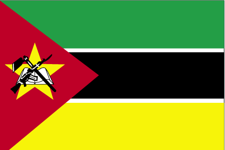
Mozambique
法语国家/地区名
Mozambique
countryucasefr
MOZAMBIQUE
国家/地区名
西班牙语国家/地区名
Mozambique
意大利语国家/地区名
Il Mozambico
葡萄牙语国家/地区名
Mozambique
德语国家/地区名
Mosambik
countrypy
mo4 sang1 bi3 ke4
countrylocal
Mocambique
countryfull
Mozambique
countrynm
Mozambique
国际编码2
MZ
国际编码3
MOZ
countrycodeisono
508
countrycodevehicle
MOC
countrycodeolympic
MOZ
countrycodeirs
MZ
countrycodeirsfr
MZ
countrycodeirsmixt
MZ
♂男性
15
6
114
languagesfr
Portugais
71
currency
metical
currencyfr
metical
currencyisocode
MZM
currencyisocodefull
MZM 508
currencypxcode
MZM
currencysymbol
Mt
currencysubdivision
100 centavos
currencyregime
float
currencyvalue
0.00004
nationalityfr
Mozambicaine
首都
Maputo
capitalfr
Maputo
电话号码前缀
258
面积 km2
801 590
arealand
784 090
areawater
17 500
landarablerate
0.0398
landforestrate
0.39
coastline
2470
summit
Monte Binga 2 436 m.
boundarycountries
Zimbabwe, Zambie, Malawi, Tanzanie, Afrique du Sud, Swaziland.
timezonedeltabegin
2
flaglink
maplink
mzcolor.gif
outlinemaplink
mzout.gif
visapassenger
-1
maincities
Beira, Nampula, Nacala, Machaze, Mandie, Chibuto.
largestcity
Maputo
largestcitypopulation
2 212 000
rankpopulation
52
人口
18 791 000
rankgdp
123
gdp
4321000000
rankgdpppp
98
gdpppp
20984000000
rankgni
131
gni
3906000000
rankincomeorigin
195
rankincome
209
income
210
rankincomeppp
187
incomeppp
1060
lifeexpectation
49.8
alphabetizationrate
0.433
natalityrate
0.04
mortalityrate
0.0149
mortalityrateinfantile
0.1206
hdi
0.378
nationalevent
Independence Day
nationaleventfr
Jour de l'Indépendance
nationalholiday
25 June (1975)
生日 年-月-日
1975-06-25 00:00:00
2
4
location
South-eastern Africa, bordering the Mozambique Channel, between South Africa and Tanzania
terrain
mostly coastal lowlands, uplands in center, high plateaus in northwest, mountains in west
naturalresources
coal, titanium, natural gas, hydropower, tantalum,
9
网站
rgbback
16777215
todate
1
