Countries/Territories
Updated 2021-01-12 18:58:07
The names of countries/territories of the world are taught in English and Chinese. This collection of precious dry lands that shares the whole mankind includes not only the world's independent countries, but also specific areas that are not a UNUnited Nations: We the peoples...A stronger UN for a better world. member. Please visit the table of male and female genders of country names in French.
Countries/locations Close
1
id
Country
Country
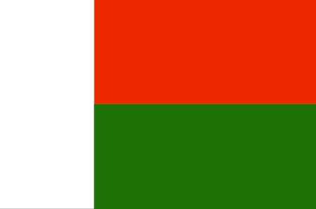
Madagascar
Country in French
Madagascar
countryucasefr
MADAGASCAR
Country in Chinese
Country in Spanish
Madagascar
Country in Italian
Il Madagascar
Country in Portuguese
Madagascar
Country in Germain
Madagaskar
countrypy
ma3 da2 jia1 si1 jia1
countrylocal
Madagascar
countryfull
Madagascar
countrynm
Madagascar
ISO2
MG
ISO3
MDG
countrycodeisono
450
countrycodevehicle
RM
countrycodeolympic
MAD
countrycodeirs
MA
countrycodeirsfr
MA
countrycodeirsmixt
MDG
15
7
193
languagesfr
Malgache, Français
148
currency
franc
currencyfr
franc malgache
currencyisocode
MGF
currencyisocodefull
MGF 450
currencypxcode
MGF
currencysymbol
FMG
currencysubdivision
1 francs = 100 centimes [*]
currencyregime
float
currencyvalue
0.00011
Capital
Antananarivo
capitalfr
Antananarivo
Phone Prefix
261
Area km2
587 040
arealand
581 540
areawater
5 500
landarablerate
0.0441
landforestrate
0.202
coastline
4828
summit
Maromokotro 2 876 m.
timezonedeltabegin
3
flaglink
maplink
mgcolor.gif
outlinemaplink
mgout.gif
visapassenger
-1
maincities
Toamasina, Majunga, Fianarantsoa, Antsirabé, Toliara, Antsiranana.
largestcity
Antananarivo
largestcitypopulation
876 000
rankpopulation
54
Population
16 894 000
rankgdp
115
gdp
5474000000
rankgdpppp
115
gdpppp
13669000000
rankgni
121
gni
4857000000
rankincomeorigin
187
rankincome
201
income
290
rankincomeppp
199
incomeppp
800
lifeexpectation
56.54
alphabetizationrate
0.682
natalityrate
0.04191
mortalityrate
0.01162
mortalityrateinfantile
0.07852
hdi
0.468
urbanization
0.301
precipitation
1459
nationalevent
Independence Day
nationaleventfr
Jour de l'Indépendance
nationalholiday
26 June (1960)
Birthday yyyy-mm-dd
1960-06-26 00:00:00
7
1
location
Southern Africa, island in the Indian Ocean, east of Mozambique
terrain
narrow coastal plain, high plateau and mountains in center
naturalresources
graphite, chromite, coal, bauxite, salt, quartz, t
cooking
Fruits de Mer Tropicaux.
9
Web
rgbback
16777215
todate
1
Notes
Fruits de Mer Tropicaux.
2
id
Country
Country
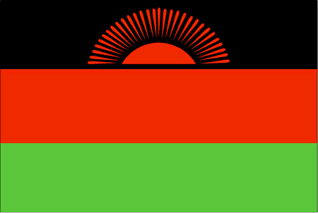
Malawi
Country in French
Malawi
countryucasefr
MALAWI
Country in Chinese
Country in Spanish
Malawi
Country in Italian
Il Malawi
Country in Portuguese
Malawi
Country in Germain
Malawi
countrypy
ma3 la1 wei1
countrylocal
Malawi
countryfull
Malawi
countrynm
Malawi
ISO2
MW
ISO3
MWI
countrycodeisono
454
countrycodevehicle
MW
countrycodeolympic
MAW
countrycodeirs
MI
countrycodeirsfr
MI
countrycodeirsmixt
MI
♂Male
14
6
194
languagesfr
Chewa, Anglais
149
currency
kwacha
currencyfr
kwacha
currencyisocode
MWK
currencyisocodefull
MWK 454
currencypxcode
MWK
currencysymbol
MK
currencysubdivision
100 tambala
currencyregime
float
currencyvalue
0.00851
Capital
Lilongwe
capitalfr
Lilongwe
Phone Prefix
265
Area km2
118 484
arealand
94 080
areawater
24 400
landarablerate
0.1993
landforestrate
0.272
summit
Mlanje Sapitwa 3 002 m.
boundarycountries
Zambie, Tanzanie, Mozambique.
timezonedeltabegin
2
flaglink
maplink
mwcolor.gif
outlinemaplink
mwout.gif
visapassenger
-1
maincities
Blantyre, Mzuzu, Zomba, Karonga, Nkhotakota.
largestcity
Lilongwe
largestcitypopulation
437 000
rankpopulation
70
Population
10 962 000
rankgdp
147
gdp
1714000000
rankgdpppp
136
gdpppp
6630000000
rankgni
155
gni
1808000000
rankincomeorigin
200
rankincome
215
income
160
rankincomeppp
207
incomeppp
590
lifeexpectation
37.48
alphabetizationrate
0.621
natalityrate
0.04435
mortalityrate
0.02301
mortalityrateinfantile
0.10423
hdi
0.387
urbanization
0.151
precipitation
922
nationalevent
Independence Day (Republic Day)
nationaleventfr
Jour de l'Indépendance (Jour de la République)
nationalholiday
6 July (1964)
Birthday yyyy-mm-dd
1964-07-06 00:00:00
1
5
location
Southern Africa, east of Zambia
terrain
narrow elongated plateau with rolling plains, rounded hills, some mountains
naturalresources
limestone, arable land, hydropower, unexploited de
9
Web
rgbback
16777215
todate
1
3
id
Country
Country
Mali
Country in French
Mali
countryucasefr
MALI
Country in Chinese
Country in Spanish
Malí
Country in Italian
Il Mali
Country in Portuguese
Mali
Country in Germain
Mali
countrypy
ma3 li3
countrylocal
Mali
countryfull
Mali
countrynm
Mali
ISO2
ML
ISO3
MLI
countrycodeisono
466
countrycodevehicle
RMM
countrycodeolympic
MLI
countrycodeirs
ML
countrycodeirsfr
ML
countrycodeirsmixt
MLI
♂Male
15
6
57
languagesfr
Français
119
currency
franc
currencyfr
franc C.F.A.
currencyisocode
XOF
currencyisocodefull
XOF 952
currencypxcode
XOF
currencysymbol
CFAF
currencysubdivision
100 centimes
currencyregime
Euro (655.957)
currencyvalue
0.00186
nationalityfr
Malienne
Capital
Bamako
capitalfr
Bamako
Phone Prefix
223
Area km2
1 240 190
arealand
1 220 000
areawater
20 000
landarablerate
0.0377
landforestrate
0.108
summit
Hombori Tondo 1 155 m.
boundarycountries
Mauritanie, Algérie, Burkina Faso, Niger, Côte d'Ivoire, Guinée, Sénégal.
flaglink

maplink
mlcolor.gif
outlinemaplink
mlout.gif
visapassenger
-1
maincities
Ségou, Mopti, Sikasso, Kayes, Gao, Tombouctou.
largestcity
Bamako
largestcitypopulation
919 000
rankpopulation
67
Population
11 652 000
rankgdp
122
gdp
4326000000
rankgdpppp
119
gdpppp
11583000000
rankgni
137
gni
3428000000
rankincomeorigin
187
rankincome
201
income
290
rankincomeppp
192
incomeppp
960
lifeexpectation
45.28
alphabetizationrate
0.4495
natalityrate
0.04729
fecondity
7
mortalityrate
0.01912
mortalityrateinfantile
0.11799
growthrate
0.02783
hdi
0.337
precipitation
878
nationalevent
Independence Day
nationaleventfr
Jour de l'Indépendance
nationalholiday
22 September (1960)
Birthday yyyy-mm-dd
1960-09-22 00:00:00
7
1
president
Amadou Toumani Touré
location
Western Africa, southwest of Algeria
terrain
mostly flat to rolling northern plains covered by sand; savanna in south, rugged hills in northeast
naturalresources
gold, phosphates, kaolin, salt, limestone, uranium
9
Web
rgbback
16777215
todate
1
4
id
Country
Country
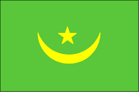
Mauritania
Country in French
Mauritanie
countryucasefr
MAURITANIE
Country in Chinese
Country in Spanish
Mauritania
Country in Italian
La Mauritania
Country in Portuguese
Mauritânia
Country in Germain
Mauretanien
countrypy
mao2 li4 ta3 ni2 ya4
countrylocal
Muritaniyah
countryfull
Mauritania
countrynm
Mauritania
ISO2
MR
ISO3
MRT
countrycodeisono
478
countrycodevehicle
RIM
countrycodeolympic
MTN
countrycodeirs
MR
countrycodeirsfr
MR
countrycodeirsmixt
MR
♀Female
15
4
3
languagesfr
Arabe, Français
123
currency
ouguiya
currencyfr
ougiya
currencyisocode
MRO
currencyisocodefull
MRO 478
currencypxcode
MRO
currencysymbol
UM
currencysubdivision
5 khoums
currencyregime
composite
currencyvalue
0.0038
nationalityfr
Mauritanienne
Capital
Nouakchott
capitalfr
Nouakchott
Phone Prefix
222
Area km2
1 030 700
arealand
1 030 400
areawater
300
landarablerate
0.0048
landforestrate
0.003
coastline
754
summit
Kediet Ijill 915 m.
boundarycountries
Sahara occidental, Algérie, Mali, Sénégal.
flaglink
maplink
mrcolor.gif
outlinemaplink
mrout.gif
visapassenger
-1
maincities
Nouadhibou, Kaédi, Zouerate, Rosso, Atar, Kiffa, Sélibaby, Néma.
largestcity
Nouakchott
largestcitypopulation
694 000
rankpopulation
134
Population
2 848 000
rankgdp
154
gdp
1093000000
rankgdpppp
140
gdpppp
5029000000
rankgni
167
gni
1142000000
rankincomeorigin
173
rankincome
187
income
400
rankincomeppp
163
incomeppp
1870
lifeexpectation
51.93
alphabetizationrate
0.34
natalityrate
0.04216
mortalityrate
0.01304
mortalityrateinfantile
0.0738
nationalevent
Independence Day
nationaleventfr
Jour de l'Indépendance
nationalholiday
28 November (1960)
Birthday yyyy-mm-dd
1960-11-28 00:00:00
7
1
location
Northern Africa, bordering the North Atlantic Ocean, between Senegal and Western Sahara
terrain
mostly barren, flat plains of the Sahara; some central hills
naturalresources
iron ore, gypsum, copper, phosphate, diamonds, gol
9
Web
rgbback
16777215
todate
1
5
id
Country
Country
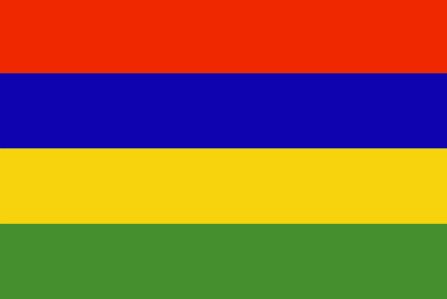
Mauritius
Country in French
Maurice (îles)
countryucasefr
MAURICE (ILES)
Country in Chinese
Country in Spanish
Isla Mauricio
Country in Italian
L'isola Maurizio
Country in Portuguese
Mauritius
Country in Germain
Mauritius
countrypy
mao2 li3 qiu2 si1
countrylocal
Mauritius
countryfull
Mauritius
countrynm
Mauritius
ISO2
MU
ISO3
MUS
countrycodeisono
480
countrycodevehicle
MS
countrycodeolympic
MRI
countrycodeirs
MP
countrycodeirsfr
MP
countrycodeirsmixt
MP
♀Female
18
6
51
languagesfr
Anglais
68
currency
rupee
currencyfr
roupie mauricienne
currencyisocode
MUR
currencyisocodefull
MUR 480
currencypxcode
MUR
currencysymbol
Mau Rs
currencysubdivision
100 cents
currencyregime
composite
currencyvalue
0.03458
nationalityfr
Mauricienne
Capital
Port Louis
capitalfr
Port-Louis
Phone Prefix
230
Area km2
1 865
arealand
2 030
areawater
10
landarablerate
0.4926
landforestrate
0.079
coastline
177
summit
Piton de la Petite Rivière Noire 826 m.
timezonedeltabegin
4
flaglink
maplink
mucolor.gif
outlinemaplink
muout.gif
visapassenger
-1
maincities
Beau Bassin, Quatre Bornes, Curepipe, Vacoas-Phoenix, Rose Hill, Mahébourg.
largestcity
Port Louis
largestcitypopulation
165 000
rankpopulation
150
Population
1 222 000
rankgdp
117
gdp
5224000000
rankgdpppp
114
gdpppp
13795000000
rankgni
119
gni
5009000000
rankincomeorigin
78
rankincome
86
income
4100
rankincomeppp
68
incomeppp
11280
lifeexpectation
72.09
alphabetizationrate
0.8535
natalityrate
0.01585
mortalityrate
0.00682
mortalityrateinfantile
0.01557
hdi
0.779
urbanization
0.616
precipitation
1793
nationalevent
Independence Day
nationaleventfr
Jour de l'Indépendance
nationalholiday
12 March (1968)
Birthday yyyy-mm-dd
1968-03-12 00:00:00
5
9
location
Southern Africa, island in the Indian Ocean, east of Madagascar
terrain
small coastal plain rising to discontinuous mountains encircling central plateau
naturalresources
arable land, fish
9
Web
rgbback
16777215
todate
1
6
id
Country
Country
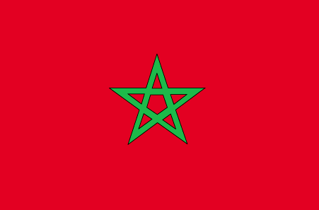
Morocco
Country in French
Maroc
countryucasefr
MAROC
Country in Chinese
Country in Spanish
Marruecos
Country in Italian
Il Marocco
Country in Portuguese
Marrocos
Country in Germain
Marokko
countrypy
mo2 luo4 ge1
countrylocal
Al Maghrib
countryfull
Morocco
countrynm
Morocco
ISO2
MA
ISO3
MAR
countrycodeisono
504
countrycodevehicle
MA
countrycodeolympic
MAR
countrycodeirs
MO
countrycodeirsfr
MO
countrycodeirsmixt
MO
countrycode
212
♂Male
12
6
3
languagesfr
Arabe
121
currency
dirham
currencyfr
dirham
currencyisocode
MAD
currencyisocodefull
MAD 504
currencypxcode
MAD
currencysymbol
DH
currencysubdivision
100 centimes
currencyregime
composite
currencyvalue
0.1111
nationalityfr
Marocaine
Capital
Rabat
capitalfr
Rabat
Phone Prefix
212
Area km2
446 550
arealand
446 300
areawater
250
landarablerate
0.2012
landforestrate
0.068
coastline
1835
summit
Jebel Toubkal 4 165 m.
boundarycountries
Algérie, Sahara occidental.
flaglink
maplink
macolor.gif
outlinemaplink
maout.gif
visapassenger
-1
maincities
Casablanca, Marrakech, Fès, Oujda, Kenitra, Tetouan, Safi, Meknès, Agadir, Tanger.
largestcity
Casablanca
largestcitypopulation
3 101 000
rankpopulation
37
Population
30 113 000
rankgdp
56
gdp
43727000000
rankgdpppp
53
gdpppp
120578000000
rankgni
57
gni
39367000000
rankincomeorigin
128
rankincome
140
income
1310
rankincomeppp
132
incomeppp
3940
lifeexpectation
70.35
alphabetizationrate
0.5085
natalityrate
0.02279
mortalityrate
0.00571
mortalityrateinfantile
0.04325
hdi
0.606
urbanization
0.551
precipitation
426
nationalevent
Throne Day (accession of King MOHAMED VI to the throne)
nationaleventfr
Jour du Tronc (accession du Roi MOHAMED VI au Tronc)
nationalholiday
30 July (1999)
Birthday yyyy-mm-dd
1999-07-30 00:00:00
6
4
location
Northern Africa, bordering the North Atlantic Ocean and the Mediterranean Sea, between Algeria and Western Sahara
terrain
northern coast and interior are mountainous with large areas of bordering plateaus, intermontane valleys, and rich coastal plains
naturalresources
phosphates, iron ore, manganese, lead, zinc, fish,
cooking
Tagines.
7
Web
rgbback
16777215
todate
1
Notes
Tagines.
Nation de suprême intelligence, le Lapin de Terre a inventé les chiffres numériques 0,1,2,3,4,5,6,7,8,9, algèbre, mathématiques.
7
id
Country
Country
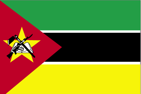
Mozambique
Country in French
Mozambique
countryucasefr
MOZAMBIQUE
Country in Chinese
Country in Spanish
Mozambique
Country in Italian
Il Mozambico
Country in Portuguese
Mozambique
Country in Germain
Mosambik
countrypy
mo4 sang1 bi3 ke4
countrylocal
Mocambique
countryfull
Mozambique
countrynm
Mozambique
ISO2
MZ
ISO3
MOZ
countrycodeisono
508
countrycodevehicle
MOC
countrycodeolympic
MOZ
countrycodeirs
MZ
countrycodeirsfr
MZ
countrycodeirsmixt
MZ
♂Male
15
6
114
languagesfr
Portugais
71
currency
metical
currencyfr
metical
currencyisocode
MZM
currencyisocodefull
MZM 508
currencypxcode
MZM
currencysymbol
Mt
currencysubdivision
100 centavos
currencyregime
float
currencyvalue
0.00004
nationalityfr
Mozambicaine
Capital
Maputo
capitalfr
Maputo
Phone Prefix
258
Area km2
801 590
arealand
784 090
areawater
17 500
landarablerate
0.0398
landforestrate
0.39
coastline
2470
summit
Monte Binga 2 436 m.
boundarycountries
Zimbabwe, Zambie, Malawi, Tanzanie, Afrique du Sud, Swaziland.
timezonedeltabegin
2
flaglink
maplink
mzcolor.gif
outlinemaplink
mzout.gif
visapassenger
-1
maincities
Beira, Nampula, Nacala, Machaze, Mandie, Chibuto.
largestcity
Maputo
largestcitypopulation
2 212 000
rankpopulation
52
Population
18 791 000
rankgdp
123
gdp
4321000000
rankgdpppp
98
gdpppp
20984000000
rankgni
131
gni
3906000000
rankincomeorigin
195
rankincome
209
income
210
rankincomeppp
187
incomeppp
1060
lifeexpectation
49.8
alphabetizationrate
0.433
natalityrate
0.04
mortalityrate
0.0149
mortalityrateinfantile
0.1206
hdi
0.378
nationalevent
Independence Day
nationaleventfr
Jour de l'Indépendance
nationalholiday
25 June (1975)
Birthday yyyy-mm-dd
1975-06-25 00:00:00
2
4
location
South-eastern Africa, bordering the Mozambique Channel, between South Africa and Tanzania
terrain
mostly coastal lowlands, uplands in center, high plateaus in northwest, mountains in west
naturalresources
coal, titanium, natural gas, hydropower, tantalum,
9
Web
rgbback
16777215
todate
1
| Countries/Territories | Regions of China | Provinces of China | Regions in France | French Departments | States/Provinces | Cities/Towns | Locations | World Continents | French AOP Wines
