Countries/Territories
Updated 2021-01-12 18:58:07
The names of countries/territories of the world are taught in English and Chinese. This collection of precious dry lands that shares the whole mankind includes not only the world's independent countries, but also specific areas that are not a UNUnited Nations: We the peoples...A stronger UN for a better world. member. Please visit the table of male and female genders of country names in French.
Countries/locations Close
1
id
Country
Country
Pacific island small states
Country in French
Pacific island small states
countryucasefr
Pacific island small states
Country in Chinese
Country in Spanish
Pacific island small states
Country in Italian
Pacific island small states
Country in Portuguese
Pacific island small states
Country in Germain
Pacific island small states
ISO2
PSS
ISO3
PSS
todate
1
2
id
Country
Country
Pacific Ocean
Country in French
Océan Pacific
countryucasefr
OCEAN PACIFIC
Country in Chinese
countryfull
Pacific Ocean
countrynm
Pacific Ocean
ISO2
POO2
ISO3
POO2
♂Male
108
1
currencypxcode
XDR
Area km2
155 557 000
coastline
135663
rankincome
222
location
body of water between the Southern Ocean, Asia, Australia, and the Western Hemisphere
terrain
surface currents in the northern Pacific are dominated by a clockwise, warm-water gyre (broad circular system of currents) and in the southern Pacific by a counterclockwise, cool-water gyre; in the northern Pacific, sea ice forms in the Bering Sea and Sea of Okhotsk in winter; in the southern Pacific, sea ice from Antarctica reaches its northernmost extent in October; the ocean floor in the eastern Pacific is dominated by the East Pacific Rise, while the western Pacific is dissected by deep trenches, including the Mariana Trench, which is the world's deepest
naturalresources
oil and gas fields, polymetallic nodules, sand and
cooking
includes Bali Sea, Bering Sea, Bering Strait, Coral Sea, East China Sea, Flores Sea, Gulf of Alaska, Gulf of Tonkin, Java Sea, Philippine Sea, Savu Sea, Sea of Japan, Sea of Okhotsk, South China Sea, Tasman Sea, Timor Sea, and other tributary water bodies
9
rgbback
16777215
todate
1
3
id
Country
Country
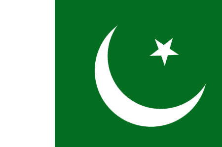
Pakistan
Country in French
Pakistan
countryucasefr
PAKISTAN
Country in Chinese
Country in Spanish
Paquistán
Country in Italian
Il Pakistan
Country in Portuguese
Paquistão
Country in Germain
Pakistan
countrypy
ba1 ji1 si1 tan3
countrylocal
Pakistan
countryfull
Pakistan
countrynm
Pakistan
ISO2
PK
ISO3
PAK
countrycodeisono
586
countrycodevehicle
PK
countrycodeolympic
PAK
countrycodeirs
PK
countrycodeirsfr
PK
countrycodeirsmixt
PK
♂Male
4
183
languagesfr
Ourdou
80
currency
rupee
currencyfr
roupie pakistanaise
currencyisocode
PKR
currencyisocodefull
PKR 586
currencypxcode
PKR
currencysymbol
Rs
currencysubdivision
100 paisa
currencyregime
m.float
currencyvalue
0.01679
nationalityfr
Pakistanaise
Capital
Islamabad
capitalfr
Islamabad
Phone Prefix
92
Area km2
803 943
arealand
778 720
areawater
25 220
landarablerate
0.2781
landforestrate
0.031
coastline
1046
summit
Goldwin Austen 8 611 m.
boundarycountries
Iran, Afghanistan, Chine, Inde.
timezonedeltabegin
5
flaglink
maplink
pkcolor.gif
outlinemaplink
pkout.gif
visapassenger
-1
maincities
Karachi, Lahore, Faisalabad, Rawalpindi, Hyderabad, Multan, Gujranwala, Peshawar, Sialkot, Sargodha.
largestcity
Islamabad
largestcitypopulation
9 733 000
rankpopulation
6
Population
148 439 000
rankgdp
43
gdp
82324000000
rankgdpppp
25
gdpppp
311258000000
rankgni
44
gni
77575000000
rankincomeorigin
161
rankincome
175
income
520
rankincomeppp
159
incomeppp
2040
lifeexpectation
62.2
alphabetizationrate
0.348
natalityrate
0.02959
mortalityrate
0.00879
mortalityrateinfantile
0.07653
precipitation
218
nationalevent
Republic Day
nationaleventfr
Jour de la République
nationalholiday
23 March (1956)
Birthday yyyy-mm-dd
1956-03-23 00:00:00
3
9
location
Southern Asia, bordering the Arabian Sea, between India on the east and Iran and Afghanistan on the west and China in the north
terrain
flat Indus plain in east; mountains in north and northwest; Balochistan plateau in west
naturalresources
land, extensive natural gas reserves, limited petr
9
Web
rgbback
16777215
todate
1
4
id
Country
Country
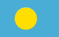
Palau
Country in French
Palaos
countryucasefr
PALAOS
Country in Chinese
countryfull
Palau
countrynm
Palau
ISO2
PW
ISO3
PLW
countrycodeisono
585
countrycodeolympic
PLW
countrycodeirs
PW
countrycodeirsfr
PW
countrycodeirsmixt
PW
♂Male
19
6
51
languagesfr
Anglais
6
currency
dollar
currencyfr
Dollar
currencyisocode
USD
currencyisocodefull
USD 840
currencypxcode
USD
currencysymbol
$
currencysubdivision
100 cents
currencyregime
float
currencyvalue
1
Capital
Koror
capitalfr
Koror
Phone Prefix
680
Area km2
494
arealand
458
landarablerate
0.2174
landforestrate
0.761
coastline
1519
summit
Mount Ngerchelchauus 242 m.
boundarycountries
Anies.
timezonedeltabegin
9
flaglink
maplink
palau.jpg
maincities
Anies
largestcity
Koror
largestcitypopulation
12 000
rankpopulation
207
Population
20 000
rankgdp
182
gdp
126000000
rankgni
206
gni
130000000
rankincomeorigin
66
rankincome
73
income
6500
nationalevent
Constitution Day
nationaleventfr
Jour de la Constitution
nationalholiday
9 July (1979)
Birthday yyyy-mm-dd
1979-07-09 00:00:00
6
8
location
Oceania, group of islands in the North Pacific Ocean, southeast of the Philippines
terrain
varying geologically from the high, mountainous main island of Babelthuap to low, coral islands usually fringed by large barrier reefs
naturalresources
forests, minerals (especially gold), marine produc
9
rgbback
16777215
todate
1
5
id
Country
Country
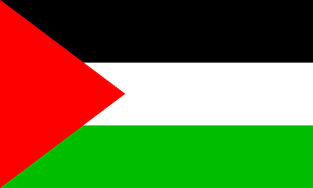
Palestina
Country in French
Paléstine
countryucasefr
PALESTINE
Country in Chinese
countrypy
ba1 le4 si1 tan3
countrylocal
Filastin
countryfull
Palestine
countrynm
Palestine
ISO2
PS
ISO3
PSE
countrycodeisono
275
countrycodeolympic
PLE
countrycodeirs
PS
countrycodeirsfr
PS
countrycodeirsmixt
PS
♀Female
7
2
3
languagesfr
Ramala
151
currency
Dinar
currencyfr
Livre palestinienne
currencypxcode
ILS
nationalityfr
Paléstinienne
Capital
Ramala
capitalfr
Ramala
Phone Prefix
970
Area km2
6 236
summit
Tail Asur 1 016 m.
boundarycountries
Egypte, Israël, Jordanie.
timezonedeltabegin
2
flaglink
maplink
palestine_map.gif
maincities
Naplouse, Jéricho, Hebron, Gaza, Bethléem, Ramallah.
largestcity
Ramala
rankpopulation
129
Population
3 152 361
gni
3340000000
rankincome
153
income
919
lifeexpectation
72.24
alphabetizationrate
0.843
natalityrate
0.03692
mortalityrate
0.00401
mortalityrateinfantile
0.02185
growthrate
0.04519
hdi
0.731
urbanization
0.671
9
rgbback
16777215
todate
1
6
id
Country
Country
Palmyra Atoll
Country in French
Atoll Palmyra
countryucasefr
ATOLL PALMYRA
Country in Chinese
Country in Spanish
Palmyra Atoll
Country in Italian
Palmyra Atoll
Country in Portuguese
Palmyra Atoll
Country in Germain
Palmyra Atoll
countryfull
Palmyra Atoll
countrynm
Palmyra Atoll
ISO2
UMI4
ISO3
UMI4
countrycodeisono
581
countrycodeirs
LQ
countrycodeirsfr
LQ
countrycodeirsmixt
LQ
♂Male
17
7
51
1
currencypxcode
USD
Area km2
12
arealand
11.90
coastline
14.5
timezonedeltabegin
-11
flaglink
maplink
lq-map.gif
visapassenger
-1
rankincome
222
location
Oceania, atoll in the North Pacific Ocean, about half way between Hawaii and American Samoa
terrain
very low
naturalresources
terrestrial and aquatic wildlife
cooking
Oceania, atoll in the North Pacific Ocean, about half way between Hawaii and American Samoa
9
rgbback
16777215
todate
1
7
id
Country
Country
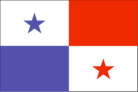
Panama
Country in French
Panama
countryucasefr
PANAMA
Country in Chinese
Country in Spanish
Panamá
Country in Italian
Il Panama
Country in Portuguese
Panamá
Country in Germain
Panama
countrypy
ba1 na2 ma3
countrylocal
Panama
countryfull
Panama
countrynm
Panama
ISO2
PA
ISO3
PAN
countrycodeisono
591
countrycodevehicle
PA
countrycodeolympic
PAN
countrycodeirs
PM
countrycodeirsfr
PM
countrycodeirsmixt
PM
countrycode
507
19
6
131
languagesfr
Espagnol
81
currency
balboa
currencyfr
balboa
currencyisocode
PAB
currencyisocodefull
PAB 590
currencypxcode
PAB
currencysymbol
B
currencysubdivision
100 centesimos
currencyregime
US-$ (1.0)
currencyvalue
1.005
nationalityfr
Panamienne
Capital
Panama City
capitalfr
Panama
Phone Prefix
507
Area km2
78 046
arealand
75 990
areawater
2 210
landarablerate
0.0672
landforestrate
0.386
coastline
2490
summit
Volcán de Chiriquí 3 475 m.
boundarycountries
Costa Rica, Colombie.
timezonedeltabegin
-5
flaglink
maplink
pacolor.gif
outlinemaplink
paoutl.gif
visapassenger
-1
maincities
David, La Chorrera, Santiago, Tocumen, Colón.
largestcity
Panama City
largestcitypopulation
967 000
rankpopulation
133
Population
2 984 000
rankgdp
85
gdp
12887000000
rankgdpppp
99
gdpppp
20452000000
rankgni
85
gni
12127000000
rankincomeorigin
79
rankincome
87
income
4060
rankincomeppp
96
incomeppp
6420
lifeexpectation
72.14
alphabetizationrate
0.9235
natalityrate
0.02036
mortalityrate
0.00639
mortalityrateinfantile
0.02095
hdi
0.788
urbanization
0.565
nationalevent
Independence Day
nationaleventfr
Jour de l'Indépendance
nationalholiday
3 November (1903)
Birthday yyyy-mm-dd
1903-11-03 00:00:00
10
4
location
Middle America, bordering both the Caribbean Sea and the North Pacific Ocean, between Colombia and Costa Rica
terrain
interior mostly steep, rugged mountains and dissected, upland plains; coastal areas largely plains and rolling hills
naturalresources
copper, mahogany forests, shrimp, hydropower
9
Web
rgbback
16777215
todate
1
8
id
Country
Country
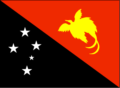
Papua New Guinea
Country in French
Papouasie-Nouvelle-Guinée
countryucasefr
PAPOUASIE-NOUVELLE-GUINEE
Country in Chinese
Country in Spanish
Papua Nueva Guinea
Country in Italian
La Papuasia Nuova Guinea
Country in Portuguese
Papua Nova Guiné
Country in Germain
Papua Neu-Guinea
countrypy
ba1 bu4 ya4 xin1 ji3 nei4 ya4
countrylocal
Papua Niu Gini
countryfull
Papua New Guinea
countrynm
Papua New Guinea
ISO2
PG
ISO3
PNG
countrycodeisono
598
countrycodevehicle
PNG
countrycodeolympic
PNG
countrycodeirs
PP
countrycodeirsfr
PP
countrycodeirsmixt
PP
♀Female
12
6
51
languagesfr
Anglais
152
currency
kina
currencyfr
kina
currencyisocode
PGK
currencyisocodefull
PGK 598
currencypxcode
PGK
currencysymbol
K
currencysubdivision
100 toeas
currencyregime
composite
currencyvalue
0.321
Capital
Port Moresby
capitalfr
Port-Moresby
Phone Prefix
675
Area km2
461 691
arealand
452 860
areawater
9 980
landarablerate
0.0013
landforestrate
0.676
coastline
5152
summit
Mount Wilhelm 4 694 m.
boundarycountries
Indonésie.
timezonedeltabegin
10
flaglink
maplink
pgcolor.gif
outlinemaplink
pg.gif
visapassenger
-1
maincities
Lae, Madang, Wewak, Goroka, Rabaul, Mount Hagen.
largestcity
Port Moresby
largestcitypopulation
247 000
rankpopulation
102
Population
5 502 000
rankgdp
133
gdp
3182000000
rankgdpppp
109
gdpppp
14408000000
rankgni
144
gni
2753000000
rankincomeorigin
163
rankincome
177
income
500
rankincomeppp
153
incomeppp
2250
lifeexpectation
64.56
alphabetizationrate
0.658
natalityrate
0.03052
mortalityrate
0.0075
mortalityrateinfantile
0.05315
hdi
0.548
urbanization
0.176
nationalevent
Independence Day
nationaleventfr
Jour de l'Indépendance
nationalholiday
16 September (1975)
Birthday yyyy-mm-dd
1975-09-16 00:00:00
2
4
location
Oceania, group of islands including the eastern half of the island of New Guinea between the Coral Sea and the South Pacific Ocean, east of Indonesia
terrain
mostly mountains with coastal lowlands and rolling foothills
naturalresources
gold, copper, silver, natural gas, timber, oil, fi
9
rgbback
16777215
todate
1
9
id
Country
Country
Paracel Islands
Country in French
Iles Paracel
countryucasefr
ILES PARACEL
Country in Chinese
Country in Spanish
Islas De Paracel
Country in Italian
Isole Di Paracel
Country in Portuguese
Consoles De Paracel
Country in Germain
Inseln Paracel
countryfull
Paracel Islands
countrynm
Paracel Islands
ISO2
CHNP
ISO3
CHNP
countrycodeisono
156
countrycodeolympic
CHN
countrycodeirs
PF
countrycodeirsfr
PF
countrycodeirsmixt
PF
♀Female
5
1
126
3
Phone Prefix
86
coastline
518
timezonedeltabegin
8
flaglink
maplink
pf-map.gif
visapassenger
-1
rankincome
222
location
Southeastern Asia, group of small islands and reefs in the South China Sea, about one-third of the way from central Vietnam to the northern Philippines
terrain
mostly low and flat
naturalresources
none
cooking
Southeastern Asia, group of small islands and reefs in the South China Sea, about one-third of the way from central Vietnam to the northern Philippines
9
rgbback
16777215
todate
1
10
id
Country
Country
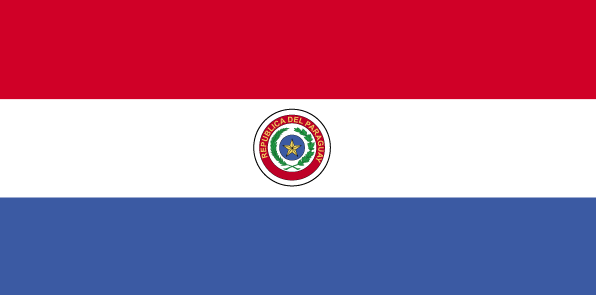
Paraguay
Country in French
Paraguay
countryucasefr
PARAGUAY
Country in Chinese
Country in Spanish
Paraguay
Country in Italian
Il Paraguay
Country in Portuguese
Paraguai
Country in Germain
Paraguay
countrypy
ba1 la1 gui1
countrylocal
Paraguay
countryfull
Paraguay
countrynm
Paraguay
ISO2
PY
ISO3
PRY
countrycodeisono
600
countrycodevehicle
PY
countrycodeolympic
PAR
countrycodeirs
PA
countrycodeirsfr
PA
countrycodeirsmixt
PA
countrycode
595
♂Male
15
6
131
languagesfr
Guarani, Espagnol
82
currency
guarani
currencyfr
guarani
currencyisocode
PYG
currencyisocodefull
PYG 600
currencypxcode
PYG
currencysymbol
slashed G
currencysubdivision
100 centimos [*]
currencyregime
float
currencyvalue
0.00016
nationalityfr
Paraguayenne
Capital
Asuncion
capitalfr
Asuncion
Phone Prefix
595
Area km2
406 750
arealand
397 300
areawater
9 450
landarablerate
0.0554
landforestrate
0.588
summit
Cerro San Rafael 850 m.
boundarycountries
Bolivie, Brésil, Argentine.
timezonedeltabegin
-4
flaglink
maplink
pycolor.gif
outlinemaplink
py.gif
visapassenger
-1
maincities
Puerto Strossner, Encarnación, Ciudad del Este, San Lorenzo, Pedro Juan Caballero, Concepción, Fernando de la Mora, Pilar, Villarrica, Coronel Oviedo.
largestcity
Asuncion
largestcitypopulation
1 081 000
rankpopulation
100
Population
5 643 000
rankgdp
112
gdp
6030000000
rankgdpppp
90
gdpppp
26430000000
rankgni
110
gni
6273000000
rankincomeorigin
132
rankincome
144
income
1110
rankincomeppp
127
incomeppp
4690
lifeexpectation
74.64
alphabetizationrate
0.937
natalityrate
0.02978
mortalityrate
0.00458
mortalityrateinfantile
0.02667
hdi
0.751
urbanization
0.567
precipitation
1333
nationalevent
Independence Day
nationaleventfr
Jour de l'Indépendance
nationalholiday
14 May (1811)
Birthday yyyy-mm-dd
1811-05-14 00:00:00
8
8
location
Central South America, northeast of Argentina
terrain
grassy plains and wooded hills east of Rio Paraguay; Gran Chaco region west of Rio Paraguay mostly low, marshy plain near the river, and dry forest and thorny scrub elsewhere
naturalresources
hydropower, timber, iron ore, manganese, limestone
9
Web
rgbback
16777215
todate
1
| Countries/Territories | Regions of China | Provinces of China | Regions in France | French Departments | States/Provinces | Cities/Towns | Locations | World Continents | French AOP Wines
