Countries/Territories
Updated 2021-01-12 18:58:07
The names of countries/territories of the world are taught in English and Chinese. This collection of precious dry lands that shares the whole mankind includes not only the world's independent countries, but also specific areas that are not a UNUnited Nations: We the peoples...A stronger UN for a better world. member. Please visit the table of male and female genders of country names in French.
Countries/locations Close
1
id
Country
Country
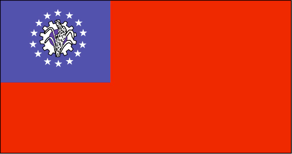
Myanmar
Country in French
Birmanie
countryucasefr
BIRMANIE
Country in Chinese
Country in Spanish
Birmania
Country in Italian
La Birmania
Country in Portuguese
Burma
Country in Germain
Birma
countrypy
mian3 dian4
countrylocal
Myanma Naingngandaw
countryfull
Burma
countrynm
Burma
ISO2
MM
ISO3
MMR
countrycodeisono
104
countrycodevehicle
BUR
countrycodeolympic
MYA
countrycodeirs
BM
countrycodeirsfr
BM
countrycodeirsmixt
BM
♀Female
2
1
30
languagesfr
Birman
120
currency
kyat
currencyfr
kyat
currencyisocode
MMK
currencyisocodefull
MMK 104
currencypxcode
MMK
currencysymbol
K
currencysubdivision
100 pyas
currencyregime
US-$ (5.86of, 200-300bm)
currencyvalue
0.1599
Capital
Rangoon
capitalfr
Rangoon
Phone Prefix
95
Area km2
676 552
arealand
657 740
areawater
20 760
landarablerate
0.1453
landforestrate
0.523
coastline
1930
summit
Hkakabo Razi 5 881 m.
boundarycountries
Bangladesh, Inde, Tibet, Chine, Laos, Thaïlande.
timezonedeltabegin
6.5
flaglink
maplink
mmcolor.gif
outlinemaplink
mmout.gif
visapassenger
-1
maincities
Mandalay, Moulmein, Pegu, Bassein, Akyab, Myeik.
largestcity
Yangon
largestcitypopulation
3 873 000
rankpopulation
24
Population
49 363 000
rankgni
38
gni
92900000000
rankincomeorigin
117
rankincome
126
income
1896
lifeexpectation
55.79
alphabetizationrate
0.806
natalityrate
0.01915
mortalityrate
0.01217
mortalityrateinfantile
0.07035
precipitation
2681
nationalevent
Independence Day
nationaleventfr
Jour de l'Indépendance
nationalholiday
4 January (1948)
Birthday yyyy-mm-dd
1948-01-04 00:00:00
4
12
location
Southeastern Asia, bordering the Andaman Sea and the Bay of Bengal, between Bangladesh and Thailand
terrain
central lowlands ringed by steep, rugged highlands
naturalresources
petroleum, timber, tin, antimony, zinc, copper, tu
9
rgbback
16777215
todate
1
2
id
Country
Country
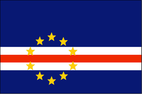
Cape Verde
Country in French
Cap-Vert
countryucasefr
CAP-VERT
Country in Chinese
Country in Spanish
Cabo Verde
Country in Italian
Cape Verde
Country in Portuguese
Cape Verde
Country in Germain
Cape Verde
countrypy
fo2 de2 jiao3
countrylocal
Cabo Verde
countryfull
Cape Verde
countrynm
Cape Verde
ISO2
CV
ISO3
CPV
countrycodeisono
132
countrycodeolympic
CPV
countrycodeirs
CV
countrycodeirsfr
CV
countrycodeirsmixt
CV
♂Male
15
6
114
languagesfr
Portugais
2
currency
escudo
currencyfr
escudo du Cap Vert
currencyisocode
CVE
currencyisocodefull
CVE 132
currencypxcode
CVE
currencysymbol
C.V.Esc.
currencysubdivision
100 centavos
currencyregime
composite
currencyvalue
0.01107
Capital
Praia
capitalfr
Praia
Phone Prefix
238
Area km2
4 033
arealand
4 033
landarablerate
0.0968
landforestrate
0.211
coastline
965
summit
Pico 2 829 m.
timezonedeltabegin
-1
flaglink
maplink
cvcolor
outlinemaplink
cvout.gif
visapassenger
-1
maincities
Mindelo, Ribeira Grande, Sal, Santa Maria.
largestcity
Praia
largestcitypopulation
68 000
rankpopulation
162
Population
470 000
rankgdp
157
gdp
797000000
rankgdpppp
152
gdpppp
2449000000
rankgni
183
gni
675000000
rankincomeorigin
124
rankincome
136
income
1440
rankincomeppp
115
incomeppp
5130
lifeexpectation
70.14
alphabetizationrate
0.768
natalityrate
0.02613
fecondity
3.3
mortalityrate
0.00672
mortalityrateinfantile
0.04914
hdi
0.727
urbanization
0.635
nationalevent
Independence Day
nationaleventfr
Jour de l'Indépendance
nationalholiday
5 July (1975)
Birthday yyyy-mm-dd
1975-07-05 00:00:00
2
4
location
Western Africa, group of islands in the North Atlantic Ocean, west of Senegal
terrain
steep, rugged, rocky, volcanic
naturalresources
salt, basalt rock, limestone, kaolin, fish
9
Web
rgbback
16777215
todate
1
3
id
Country
Country
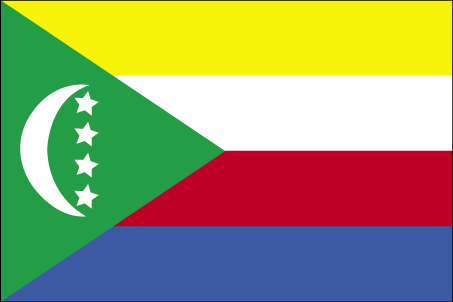
Comoros
Country in French
Comores
countryucasefr
COMORES
Country in Chinese
Country in Spanish
El Comoro
Country in Italian
Le Comore
Country in Portuguese
Cômoros
Country in Germain
Comoren
countryfull
Comoros
countrynm
Comoros
ISO2
KM
ISO3
COM
countrycodeisono
174
countrycodeolympic
COM
countrycodeirs
CN
countrycodeirsfr
CN
countrycodeirsmixt
CMR
♀Female
15
2
57
languagesfr
Français
119
currency
franc
currencyfr
franc C.F.A.
currencyisocode
KMF
currencyisocodefull
KMF 174
currencypxcode
KMF
currencysymbol
CF
currencysubdivision
-
currencyregime
Euro (491.96775)
currencyvalue
0.00257
Capital
Moroni
capitalfr
Moroni
Phone Prefix
269
Area km2
2 171
arealand
2 170
landarablerate
0.3498
landforestrate
0.043
coastline
340
summit
Kartala 2 361 m.
timezonedeltabegin
3
flaglink
maplink
kmcolor.gif
outlinemaplink
kmout.gif
visapassenger
-1
maincities
Mutsamudu, Fomboni, Mitsamiouli.
largestcity
Moroni
largestcitypopulation
36 000
rankpopulation
160
Population
600 000
rankgdp
174
gdp
323000000
rankgdpppp
157
gdpppp
1029000000
rankgni
197
gni
269000000
rankincomeorigin
169
rankincome
183
income
450
rankincomeppp
172
incomeppp
1720
lifeexpectation
61.57
alphabetizationrate
0.563
natalityrate
0.038
fecondity
4.9
mortalityrate
0.00863
mortalityrateinfantile
0.07722
hdi
0.528
urbanization
0.338
nationalevent
Independence Day
nationaleventfr
Jour de l'Indépendance
nationalholiday
6 July (1975)
Birthday yyyy-mm-dd
1975-07-06 00:00:00
2
4
location
Southern Africa, group of islands at the northern mouth of the Mozambique Channel, about two-thirds of the way between northern Madagascar and northern Mozambique
terrain
volcanic islands, interiors vary from steep mountains to low hills
naturalresources
NEGL
9
Web
rgbback
16777215
todate
1
4
id
Country
Country
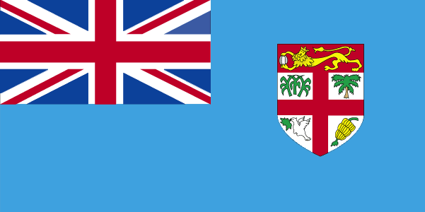
Fiji
Country in French
Fidji
countryucasefr
FIDJI
Country in Chinese
Country in Spanish
Las Islas Fiji
Country in Italian
Le Isole Figi
Country in Portuguese
Consoles De Fiji
Country in Germain
Fidschi-Inseln
countrypy
fei3 ji4
countrylocal
Fiji
countryfull
Fiji
countrynm
Fiji
ISO2
FJ
ISO3
FJI
countrycodeisono
242
countrycodevehicle
FJI
countrycodeolympic
FIJ
countrycodeirs
FJ
countrycodeirsfr
FJ
countrycodeirsmixt
FJ
♀Female
15
6
51
languagesfr
Anglais
40
currency
dollar
currencyfr
dollar fidjien
currencyisocode
FJD
currencyisocodefull
FJD 242
currencypxcode
FJD
currencysymbol
F$
currencysubdivision
100 cents
currencyregime
composite
currencyvalue
0.5944
Capital
Suva
capitalfr
Suva
Phone Prefix
679
Area km2
18 270
arealand
18 270
landarablerate
0.1095
landforestrate
0.446
coastline
1129
summit
Mount Tomaniivi 1 324 m.
timezonedeltabegin
12
flaglink
maplink
fjcolor.gif
outlinemaplink
fj.gif
visapassenger
-1
maincities
Lautoka, Nadi, Lambasa, Singatoka, Nausori, Levuka.
largestcity
Suva
largestcitypopulation
166 000
rankpopulation
154
Population
835 000
rankgdp
141
gdp
2036000000
rankgdpppp
141
gdpppp
4910000000
rankgni
153
gni
1871000000
rankincomeorigin
103
rankincome
113
income
2240
rankincomeppp
109
incomeppp
5650
lifeexpectation
69.2
alphabetizationrate
0.937
natalityrate
0.02291
mortalityrate
0.00568
mortalityrateinfantile
0.01299
hdi
0.754
urbanization
0.502
nationalevent
Independence Day
nationaleventfr
Jour de l'Indépendance
nationalholiday
Second Monday of October (1970)
Birthday yyyy-mm-dd
1970-10-01 00:00:00
7
11
location
Oceania, island group in the South Pacific Ocean, about two-thirds of the way from Hawaii to New Zealand
terrain
mostly mountains of volcanic origin
naturalresources
timber, fish, gold, copper, offshore oil potential
cooking
Fruits de Mer
9
Web
rgbback
16777215
todate
1
Notes
Fruits de Mer
5
id
Country
Country
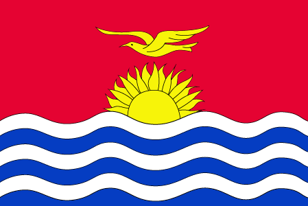
Kiribati
Country in French
Kiribati
countryucasefr
KIRIBATI
Country in Chinese
Country in Spanish
Kiribati
Country in Italian
Kiribati
Country in Portuguese
Kiribati
Country in Germain
Kiribati
countrypy
ji2 li3 ba1 si1
countrylocal
Kiribati, Kiribas
countryfull
Kiribati
countrynm
Kiribati
ISO2
KI
ISO3
KIR
countrycodeisono
296
countrycodeolympic
KIR
countrycodeirs
KR
countrycodeirsfr
KR
countrycodeirsmixt
KRB
♂Male
15
6
51
languagesfr
Anglais
10
currency
dollar
currencyfr
dollar australien
currencyisocode
AUD
currencyisocodefull
AUD 036
currencypxcode
AUD
currencysymbol
A$
currencysubdivision
100 cents
currencyregime
float
currencyvalue
0.7485
Capital
Tarawa
capitalfr
Tarawa
Phone Prefix
686
Area km2
717
arealand
811
landforestrate
0.384
coastline
1143
summit
Joes Hill 81 m.
timezonedeltabegin
12
flaglink
maplink
kicolor.gif
visapassenger
-1
maincities
Ooma.
largestcity
Tarawa
rankpopulation
190
Population
96 000
rankgdp
185
gdp
55000000
rankgni
207
gni
83000000
rankincomeorigin
144
rankincome
157
income
860
lifeexpectation
61.32
natalityrate
0.03099
fecondity
3.6
mortalityrate
0.00849
mortalityrateinfantile
0.0499
growthrate
0.0225
nationalevent
Independence Day
nationaleventfr
Jour de l'Indépendance
nationalholiday
12 July (1979)
Birthday yyyy-mm-dd
1979-07-12 00:00:00
6
8
location
Oceania, group of 33 coral atolls in the Pacific Ocean, straddling the equator; the capital Tarawa is about one-half of the way from Hawaii to Australia; note - on 1 January 1995, Kiribati proclaimed that all of its territory lies in the same time zone as
terrain
mostly low-lying coral atolls surrounded by extensive reefs
naturalresources
phosphate (production discontinued in 1979)
9
rgbback
16777215
todate
1
6
id
Country
Country
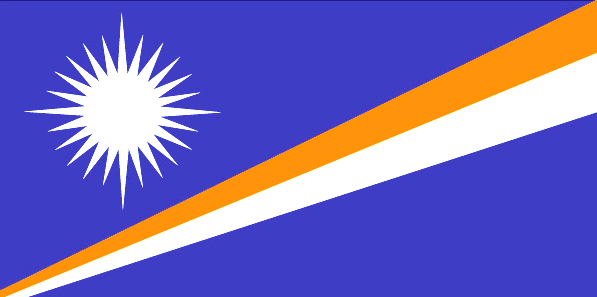
Marshall Islands
Country in French
Marshall (îles)
countryucasefr
MARSHALL (ILES)
Country in Chinese
Country in Spanish
Forme Las Islas
Country in Italian
Ordini Le Isole
Country in Portuguese
Marshall Consoles
Country in Germain
Marshall Inseln
countryfull
Marshall Islands
countrynm
Marshall Islands
ISO2
MH
ISO3
MHL
countrycodeisono
584
countrycodeolympic
MHL
countrycodeirs
RM
countrycodeirsfr
RM
countrycodeirsmixt
RM
♀Female
19
6
51
languagesfr
Anglais
1
currencyfr
dollar
currencysymbol
$
Capital
Majuro
capitalfr
Uliga
Phone Prefix
692
Area km2
181.30
arealand
181.30
landarablerate
0.1667
coastline
370.4
summit
10 m.
timezonedeltabegin
12
flaglink
maplink
mhcolor.gif
outlinemaplink
mh.gif
visapassenger
-1
maincities
Ebeye
largestcity
Majuro
largestcitypopulation
28 000
rankpopulation
200
Population
53 000
rankgdp
183
gdp
106000000
rankgni
205
gni
142000000
rankincomeorigin
96
rankincome
106
income
2710
lifeexpectation
70.01
alphabetizationrate
0.937
natalityrate
0.03352
fecondity
4.02
mortalityrate
0.00488
mortalityrateinfantile
0.02945
growthrate
0.02274
hdi
0.738
urbanization
0.6618
nationalevent
Constitution Day
nationaleventfr
Jour de la Constitution
nationalholiday
1 May (1979)
Birthday yyyy-mm-dd
1979-05-01 00:00:00
6
8
location
Oceania, group of atolls and reefs in the North Pacific Ocean, about one-half of the way from Hawaii to Australia
terrain
low coral limestone and sand islands
naturalresources
coconut products, marine products, deep seabed min
9
rgbback
16777215
todate
1
7
id
Country
Country
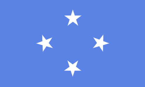
Micronesia, Federated States of
Country in French
Micronésie
countryucasefr
MICRONESIE
Country in Chinese
Country in Spanish
Micronesia, estados federados de
Country in Italian
La Micronesia, condizioni federated di
Country in Portuguese
Micronesia, estados federados de
Country in Germain
Mikronesien, zu einem Bündnis vereingigte Zustände von
countryfull
Micronesia, Federated States of
countrynm
Micronesia, Federated States of
ISO2
FM
ISO3
FSM
countrycodeisono
583
countrycodeolympic
FSM
countrycodeirs
FM
countrycodeirsfr
FM
countrycodeirsmixt
FM
♀Female
19
7
51
languagesfr
Anglais
6
currency
dollar
currencyfr
dollar
currencyisocode
USD
currencyisocodefull
USD 840
currencypxcode
USD
currencysymbol
$
currencysubdivision
100 cents
currencyregime
float
currencyvalue
1
nationalityfr
Micronésienne
Capital
Palikir
capitalfr
Palikir
Phone Prefix
691
Area km2
707
arealand
702
landarablerate
0.0571
landforestrate
0.217
coastline
6112
summit
Totolom 791 m.
timezonedeltabegin
10
flaglink
maplink
fmcolor.gif
outlinemaplink
fm.gif
visapassenger
-1
maincities
Pohnpei, Yap.
largestcity
Palikir
rankpopulation
184
Population
125 000
rankgdp
179
gdp
243000000
rankgni
198
gni
258000000
rankincomeorigin
109
rankincome
119
income
2070
lifeexpectation
69.44
alphabetizationrate
0.895
natalityrate
0.0258
fecondity
3.8
mortalityrate
0.00497
mortalityrateinfantile
0.03128
urbanization
0.286
nationalevent
Constitution Day
nationaleventfr
Jour de la Constitution
nationalholiday
10 May (1979)
Birthday yyyy-mm-dd
1979-05-10 00:00:00
6
8
location
Oceania, island group in the North Pacific Ocean, about three-quarters of the way from Hawaii to Indonesia
terrain
islands vary geologically from high mountainous islands to low, coral atolls; volcanic outcroppings on Pohnpei, Kosrae, and Chuuk
naturalresources
forests, marine products, deep-seabed minerals
9
rgbback
16777215
todate
1
8
id
Country
Country
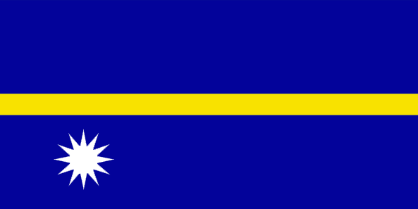
Nauru
Country in French
Nauru
countryucasefr
NAURU
Country in Chinese
Country in Spanish
Nauru
Country in Italian
Il Nauru
Country in Portuguese
Nauru
Country in Germain
Nauru
countrypy
nao4 lu3
countrylocal
Nauru
countryfull
Nauru
countrynm
Nauru
ISO2
NR
ISO3
NRU
countrycodeisono
520
countrycodevehicle
NAU
countrycodeolympic
NRU
countrycodeirs
NR
countrycodeirsfr
NR
countrycodeirsmixt
NR
♂Male
15
6
186
languagesfr
Nauru
10
currency
dollar
currencyfr
dollar australien
currencyisocode
AUD
currencyisocodefull
AUD 036
currencypxcode
AUD
currencysymbol
A$
currencysubdivision
100 cents
currencyregime
float
currencyvalue
0.7485
Capital
Yaren District
capitalfr
Yaren
Phone Prefix
674
Area km2
21
arealand
21
coastline
30
summit
61 m.
timezonedeltabegin
12
flaglink
maplink
nrcolor.gif
outlinemaplink
nr.gif
visapassenger
-1
maincities
Anabar, Anibare, Anna, Ijuw, Uaboe, Yangor.
largestcity
Yaren District
largestcitypopulation
10 000
rankpopulation
220
Population
12 809
rankgni
205
gni
140000000
rankincomeorigin
48
rankincome
52
income
11667
lifeexpectation
62.33
natalityrate
0.02561
mortalityrate
0.00695
mortalityrateinfantile
0.01014
urbanization
1
nationalevent
Independence Day
nationaleventfr
Jour de l'Indépendance
nationalholiday
31 January (1968)
Birthday yyyy-mm-dd
1968-01-31 00:00:00
5
9
location
Oceania, island in the South Pacific Ocean, south of the Marshall Islands
terrain
sandy beach rises to fertile ring around raised coral reefs with phosphate plateau in center
naturalresources
phosphates, fish
9
rgbback
16777215
todate
1
9
id
Country
Country
New Zealand
Country in French
Nouvelle-Zélande
countryucasefr
NOUVELLE-ZELANDE
Country in Chinese
Country in Spanish
Zealand Nuevo
Country in Italian
La Nuova Zelanda
Country in Portuguese
Zealand Novo
Country in Germain
Neues Seeland
countrypy
xin1 xi1 lan2
countrylocal
Aotearoa
countryfull
New Zealand
countrynm
New Zealand
ISO2
NZ
ISO3
NZL
countrycodeisono
554
countrycodevehicle
NZ
countrycodeolympic
NZL
countrycodeirs
NZ
countrycodeirsfr
NZ
countrycodeirsmixt
NZ
♀Female
18
6
51
languagesfr
Anglais, Maori
75
currency
dollar
currencyfr
dollar néo-zélandais
currencyisocode
NZD
currencyisocodefull
NZD 554
currencypxcode
NZD
currencysymbol
NZ$
currencysubdivision
100 cents
currencyregime
float
currencyvalue
0.6966
nationalityfr
Nouvelle Zélandaise
Capital
Wellington
capitalfr
Wellington
Phone Prefix
64
Area km2
268 676
landarablerate
0.058
landforestrate
0.297
coastline
15134
summit
Mount Cook 3 764 m.
timezonedeltabegin
12
flaglink
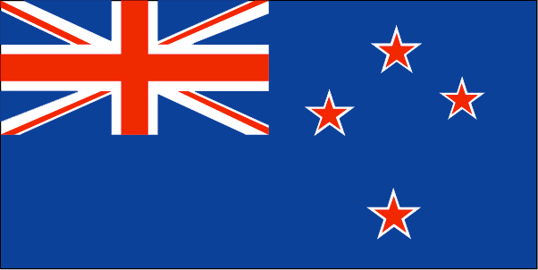
maplink
nzcolor.gif
outlinemaplink
nz.gif
maincities
Auckland, Christchurch, Napier-Hastings, Dunedin, Hamilton, Waitemata, Palmerston North, Invercargill, New Plymouth, Nelson, Whangarei, Whanganui.
largestcity
Auckland
largestcitypopulation
945 000
rankpopulation
121
Population
4 009 000
rankgdp
45
gdp
79572000000
rankgdpppp
57
gdpppp
90538000000
rankgni
48
gni
62249000000
rankincomeorigin
40
rankincome
34
income
15530
rankincomeppp
36
incomeppp
21350
lifeexpectation
78.5
alphabetizationrate
0.99
natalityrate
0.0146
mortalityrate
0.007
mortalityrateinfantile
0.0055
hdi
0.777
urbanization
0.434
precipitation
1120
nationalevent
Waitangi Day (Treaty of Waitangi established British sovereignty over New Zealand)
nationaleventfr
Jour Waitangi
nationalholiday
6 February (1840)
Birthday yyyy-mm-dd
1840-02-06 00:00:00
7
1
location
Oceania, islands in the South Pacific Ocean, southeast of Australia
terrain
predominately mountainous with some large coastal plains
naturalresources
natural gas, iron ore, sand, coal, timber, hydropo
cooking
Fruits de Mer
9
Web
rgbback
16777215
todate
1
Notes
Fruits de Mer
10
id
Country
Country
Papua New Guinea
Country in French
Papouasie-Nouvelle-Guinée
countryucasefr
PAPOUASIE-NOUVELLE-GUINEE
Country in Chinese
Country in Spanish
Papua Nueva Guinea
Country in Italian
La Papuasia Nuova Guinea
Country in Portuguese
Papua Nova Guiné
Country in Germain
Papua Neu-Guinea
countrypy
ba1 bu4 ya4 xin1 ji3 nei4 ya4
countrylocal
Papua Niu Gini
countryfull
Papua New Guinea
countrynm
Papua New Guinea
ISO2
PG
ISO3
PNG
countrycodeisono
598
countrycodevehicle
PNG
countrycodeolympic
PNG
countrycodeirs
PP
countrycodeirsfr
PP
countrycodeirsmixt
PP
♀Female
12
6
51
languagesfr
Anglais
152
currency
kina
currencyfr
kina
currencyisocode
PGK
currencyisocodefull
PGK 598
currencypxcode
PGK
currencysymbol
K
currencysubdivision
100 toeas
currencyregime
composite
currencyvalue
0.321
Capital
Port Moresby
capitalfr
Port-Moresby
Phone Prefix
675
Area km2
461 691
arealand
452 860
areawater
9 980
landarablerate
0.0013
landforestrate
0.676
coastline
5152
summit
Mount Wilhelm 4 694 m.
boundarycountries
Indonésie.
timezonedeltabegin
10
flaglink
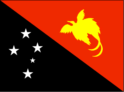
maplink
pgcolor.gif
outlinemaplink
pg.gif
visapassenger
-1
maincities
Lae, Madang, Wewak, Goroka, Rabaul, Mount Hagen.
largestcity
Port Moresby
largestcitypopulation
247 000
rankpopulation
102
Population
5 502 000
rankgdp
133
gdp
3182000000
rankgdpppp
109
gdpppp
14408000000
rankgni
144
gni
2753000000
rankincomeorigin
163
rankincome
177
income
500
rankincomeppp
153
incomeppp
2250
lifeexpectation
64.56
alphabetizationrate
0.658
natalityrate
0.03052
mortalityrate
0.0075
mortalityrateinfantile
0.05315
hdi
0.548
urbanization
0.176
nationalevent
Independence Day
nationaleventfr
Jour de l'Indépendance
nationalholiday
16 September (1975)
Birthday yyyy-mm-dd
1975-09-16 00:00:00
2
4
location
Oceania, group of islands including the eastern half of the island of New Guinea between the Coral Sea and the South Pacific Ocean, east of Indonesia
terrain
mostly mountains with coastal lowlands and rolling foothills
naturalresources
gold, copper, silver, natural gas, timber, oil, fi
9
rgbback
16777215
todate
1
| Countries/Territories | Regions of China | Provinces of China | Regions in France | French Departments | States/Provinces | Cities/Towns | Locations | World Continents | French AOP Wines
