Pays/Territoires
Mise à jour 2021-01-12 18:58:07
Les noms des pays/territoires du monde sont donnés en Français et Chinois. Cette collection des précieuses terres fermes du monde que toute l'humanité partage inclut non seulement les pays indépendants, mais aussi des régions spécifiques qui ne sont pas membre de l'ONUOrganisation des Nations Unies: Nous, peuples des Nations Unies ... Une ONU plus forte pour un monde meilleur. Veuillez aussi consulter les noms des pays en masculin et féminin en Français.
GéoPays Fermer
1
id
Pays
Pays en Anglais
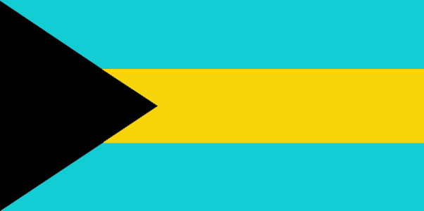
Bahamas, The
Pays
Bahamas
countryucasefr
BAHAMAS
Pays en Chinois
Pays en Espagnol
Bahamas
Pays en Italien
Le Bahamas
Pays en Portugais
Bahamas
Pays en Allemand
Bahamas
countrypy
ba1 ha1 ma3
countrylocal
Bahamas
countryfull
Bahamas, The
countrynm
Bahamas, The
ISO2
BS
ISO3
BHS
countrycodeisono
044
countrycodevehicle
BS
countrycodeolympic
BAH
countrycodeirs
BF
countrycodeirsfr
BF
countrycodeirsmixt
BF
♀Féminin
20
6
51
languagesfr
Anglais
12
currency
dollar
currencyfr
dollar des Bahamas
currencyisocode
BSD
currencyisocodefull
BSD 044
currencypxcode
BSD
currencysymbol
B$
currencysubdivision
100 cents
currencyregime
US-$ (1.0)
currencyvalue
1.005
Capitale
Nassau
capitalfr
Nassau
Préfixe Tél.
1-242
Superficie km2
13 935
arealand
10 070
areawater
3 870
landarablerate
0.006
landforestrate
0.841
coastline
3542
summit
Mount Alvernia 63 m.
timezonedeltabegin
-5
flaglink
maplink
bscolor.gif
outlinemaplink
bs.gif
visapassenger
-1
maincities
Freeport, Nicolls Town, West End, Andros Town.
largestcity
Nassau
largestcitypopulation
195 000
rankpopulation
169
Population
317 000
rankgdp
116
gdp
5260000000
rankgdpppp
138
gdpppp
5291000000
rankgni
120
gni
4684000000
rankincomeorigin
41
rankincome
37
income
14920
rankincomeppp
54
incomeppp
16140
lifeexpectation
65.63
alphabetizationrate
0.9555
natalityrate
0.01822
fecondity
2.29
mortalityrate
0.00882
mortalityrateinfantile
0.0257
hdi
0.812
urbanization
0.889
precipitation
1360
nationalevent
Independence Day
nationaleventfr
Jour de l'Indépendance
nationalholiday
10 July (1973)
Date de naissance aaaa-mm-jj
1973-07-10 00:00:00
10
2
location
Caribbean, chain of islands in the North Atlantic Ocean, southeast of Florida, northeast of Cuba
terrain
long, flat coral formations with some low rounded hills
naturalresources
salt, aragonite, timber, arable land
9
Web
rgbback
16777215
todate
1
2
id
Pays
Pays en Anglais
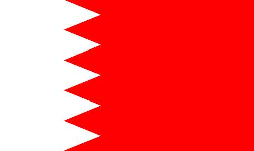
Bahrain
Pays
Bahreïn
countryucasefr
BAHREIN
Pays en Chinois
Pays en Espagnol
Bahrein
Pays en Italien
La Bahrain
Pays en Portugais
Barém
Pays en Allemand
Bahrain
countrypy
ba1 lin2
countrylocal
Al Bahrayn
countryfull
Bahrain
countrynm
Bahrain
ISO2
BH
ISO3
BHR
countrycodeisono
048
countrycodevehicle
BRN
countrycodeolympic
BRN
countrycodeirs
BA
countrycodeirsfr
BA
countrycodeirsmixt
BA
♂Masulin
12
4
3
languagesfr
Arabe
128
currency
dinar
currencyfr
dinar de Bahraïn
currencyisocode
BHD
currencyisocodefull
BHD 048
currencypxcode
BHD
currencysymbol
BD
currencysubdivision
1,000 fils
currencyregime
US-$ (lim.flex.)
currencyvalue
2.6527
Capitale
Manama
capitalfr
Manama
Préfixe Tél.
973
Superficie km2
680
arealand
665
landarablerate
0.0435
coastline
161
summit
Jabal ad Dukhan 122 m.
timezonedeltabegin
3
flaglink
maplink
bhcolor.gif
outlinemaplink
bhout.gif
visapassenger
-1
maincities
Al Muharraq, Jidd Hafs, Isa, Al Hadd.
largestcity
Manama
largestcitypopulation
148 000
rankpopulation
157
Population
712 000
rankgdp
99
gdp
7683000000
rankgdpppp
118
gdpppp
11979000000
rankgni
98
gni
7569000000
rankincomeorigin
52
rankincome
55
income
10850
rankincomeppp
53
incomeppp
16180
lifeexpectation
73.98
alphabetizationrate
0.879
natalityrate
0.01854
fecondity
2.66
mortalityrate
0.00403
mortalityrateinfantile
0.01791
hdi
0.839
urbanization
0.925
precipitation
72
nationalevent
National Day
nationaleventfr
Jour National
nationalholiday
16 December (1971)
Date de naissance aaaa-mm-jj
1971-12-16 00:00:00
8
12
location
Middle East, archipelago in the Persian Gulf, east of Saudi Arabia
terrain
mostly low desert plain rising gently to low central escarpment
naturalresources
oil, associated and nonassociated natural gas, fis
9
Web
rgbback
16777215
todate
1
3
id
Pays
Pays en Anglais
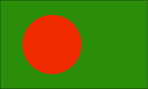
Bangladesh
Pays
Bangladesh
countryucasefr
BANGLADESH
Pays en Chinois
Pays en Espagnol
Bangladesh
Pays en Italien
La Bangladesh
Pays en Portugais
Bangladesh
Pays en Allemand
Bangladesh
countrypy
meng4 jia1 la1 guo2
countrylocal
Bangladesh
countryfull
Bangladesh
countrynm
Bangladesh
ISO2
BD
ISO3
BGD
countrycodeisono
050
countrycodevehicle
BD
countrycodeolympic
BAN
countrycodeirs
BG
countrycodeirsfr
BG
countrycodeirsmixt
BGD
♂Masulin
18
6
26
languagesfr
Bengali
129
currency
taka
currencyfr
taka
currencyisocode
BDT
currencyisocodefull
BDT 050
currencypxcode
BDT
currencysymbol
Tk
currencysubdivision
100 paisa (poisha)
currencyregime
composite
currencyvalue
0.01569
Capitale
Dhaka
capitalfr
Dacca
Préfixe Tél.
880
Superficie km2
144 000
arealand
133 910
areawater
10 090
landarablerate
0.607
landforestrate
0.102
coastline
580
summit
Reng Tlang 957 m.
boundarycountries
Inde, Birmanie..
timezonedeltabegin
6
flaglink
maplink
bdcolor.gif
outlinemaplink
bdout.gif
visapassenger
-1
maincities
Chittagong, Khulna, Narayanganj, Rajshali, Mymensingh, Comilla, Barisal, Sylhet, Ranjpur.
largestcity
Dhaka
largestcitypopulation
8 545 000
rankpopulation
8
Population
138 066 000
rankgdp
54
gdp
51914000000
rankgdpppp
31
gdpppp
244402000000
rankgni
51
gni
55009000000
rankincomeorigin
173
rankincome
187
income
400
rankincomeppp
163
incomeppp
1870
lifeexpectation
61.71
alphabetizationrate
0.423
natalityrate
0.03003
fecondity
3.46
mortalityrate
0.00852
mortalityrateinfantile
0.06432
hdi
0.502
nationalevent
Independence Day
nationaleventfr
Jour de l'Indépendance
nationalholiday
26 March (1971)
Date de naissance aaaa-mm-jj
1971-03-26 00:00:00
8
12
location
Southern Asia, bordering the Bay of Bengal, between Burma and India
terrain
mostly flat alluvial plain; hilly in southeast
naturalresources
natural gas, arable land, timber, coal
cooking
Meilleurs Gambas, Crevettes: Black Tiger.
9
Web
rgbback
16777215
todate
1
Notes
Meilleurs Gambas, Crevettes: Black Tiger.
4
id
Pays
Pays en Anglais
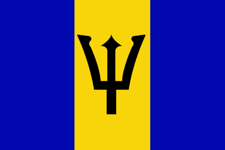
Barbados
Pays
Barbade
countryucasefr
BARBADE
Pays en Chinois
Pays en Espagnol
Barbados
Pays en Italien
Le Barbados
Pays en Portugais
Barbados
Pays en Allemand
Barbados
countrypy
ba1 bei4 duo1
countrylocal
Barbados
countryfull
Barbados
countrynm
Barbados
ISO2
BB
ISO3
BRB
countrycodeisono
052
countrycodevehicle
BDS
countrycodeolympic
BAR
countrycodeirs
BB
countrycodeirsfr
BB
countrycodeirsmixt
BB
♀Féminin
18
6
51
languagesfr
Anglais
13
currency
dollar
currencyfr
dollar de la Barbade
currencyisocode
BBD
currencyisocodefull
BBD 052
currencypxcode
BBD
currencysymbol
Bds$
currencysubdivision
100 cents
currencyregime
US-$ (2.0)
currencyvalue
0.5128
Capitale
Bridgetown
capitalfr
Bridgetown
Préfixe Tél.
1-246
Superficie km2
430
arealand
431
landarablerate
0.3721
landforestrate
0.047
coastline
97
summit
Mount Hillaby 336 m.
timezonedeltabegin
-4
flaglink
maplink
bbcolor.gif
outlinemaplink
bb.gif
visapassenger
-1
maincities
Oistins, Holetown, Speightstown, Crab Hill, Hastings, Bathsheba.
largestcity
Bridgetown
largestcitypopulation
123 000
rankpopulation
173
Population
271 000
rankgdp
138
gdp
2627000000
rankgdpppp
145
gdpppp
4254000000
rankgni
146
gni
2507000000
rankincomeorigin
55
rankincome
59
income
9260
rankincomeppp
57
incomeppp
15060
lifeexpectation
71.64
alphabetizationrate
0.997
natalityrate
0.01298
fecondity
1.5
mortalityrate
0.00908
mortalityrateinfantile
0.01261
hdi
0.888
urbanization
0.504
nationalevent
Independence Day
nationaleventfr
Jour de l'Indépendance
nationalholiday
30 November (1966)
Date de naissance aaaa-mm-jj
1966-11-30 00:00:00
3
7
location
Caribbean, island in the North Atlantic Ocean, northeast of Venezuela
terrain
relatively flat; rises gently to central highland region
naturalresources
petroleum, fish, natural gas
9
Web
rgbback
16777215
todate
1
5
id
Pays
Pays en Anglais
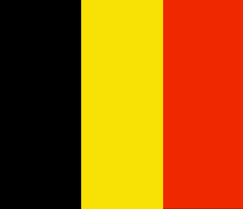
Belgium
Pays
Belgique
countryucasefr
BELGIQUE
Pays en Chinois
Pays en Espagnol
Bélgica
Pays en Italien
Il Belgio
Pays en Portugais
Bélgica
Pays en Allemand
Belgien
countrypy
bi3 li4 shi2
countrylocal
Belgique/Belgie
countryfull
Belgium
countrynm
Belgium
ISO2
BE
ISO3
BEL
countrycodeisono
056
countrycodevehicle
B
countrycodeolympic
BEL
countrycodeirs
BE
countrycodeirsfr
BE
countrycodeirsmixt
BE
countrycode
32
♀Féminin
1
20
7
57
languagesfr
Néerlandais, Français, Allemand
2
currency
euro
currencyfr
euro
currencyisocode
EUR
currencyisocodefull
EUR 978
currencypxcode
EUR
currencysymbol
€
currencysubdivision
100 cents
currencyregime
float
currencyvalue
1.2203
nationalityfr
Belge
Capitale
Brussels
capitalfr
Bruxelles
Préfixe Tél.
32
Superficie km2
31 100
arealand
30 230
areawater
280
landarablerate
0.25
coastline
66
summit
Signal de Botrange 694 m.
boundarycountries
France, Pays-Bas, Allemagne, Luxembourg
timezonedeltabegin
1
flaglink
maplink
becolor.gif
outlinemaplink
be.gif
maincities
Anvers, Gand, Charleroi, Liège, Bruges, Namur, Mons, Louvain, Alost, Courtrai.
largestcity
Brussels
largestcitypopulation
1 122 000
rankpopulation
73
Population
10 376 000
rankgdp
18
gdp
301896000000
rankgdpppp
28
gdpppp
294001000000
rankgni
18
gni
267250000000
rankincomeorigin
20
rankincome
16
income
25760
rankincomeppp
14
incomeppp
28920
lifeexpectation
78.13
alphabetizationrate
0.99
natalityrate
0.0106
mortalityrate
0.01008
mortalityrateinfantile
0.00464
nationalevent
Ascension to the Throne of King Leopold I
nationaleventfr
Ascension au Tronc du Roi Léopold I
nationalholiday
21 July (1831)
Date de naissance aaaa-mm-jj
1831-06-21 00:00:00
8
4
location
Western Europe, bordering the North Sea, between France and the Netherlands
terrain
flat coastal plains in northwest, central rolling hills, rugged mountains of Ardennes Forest in southeast
naturalresources
coal, natural gas
cooking
Bonbons.
4
Web
rgbback
16777215
todate
1
Notes
Bonbons.
6
id
Pays
Pays en Anglais
Belize
Pays
Belize
countryucasefr
BELIZE
Pays en Chinois
Pays en Espagnol
Belice
Pays en Italien
Belize
Pays en Portugais
Belize
Pays en Allemand
Belize
countryfull
Belize
countrynm
Belize
ISO2
BZ
ISO3
BLZ
countrycodeisono
084
countrycodevehicle
BH
countrycodeolympic
BIZ
countrycodeirs
BH
countrycodeirsfr
BH
countrycodeirsmixt
BH
♂Masulin
18
6
51
languagesfr
Anglais
15
currency
dollar
currencyfr
dollar de Bélize
currencyisocode
BZD
currencyisocodefull
BZD 084
currencypxcode
BZD
currencysymbol
BZ$
currencysubdivision
100 cents
currencyregime
US-$ (2.0)
currencyvalue
0.5089
Capitale
Belmopan
capitalfr
Belmopan
Préfixe Tél.
501
Superficie km2
22 963
arealand
22 806
areawater
160
landarablerate
0.0281
landforestrate
0.591
coastline
386
summit
Victoria Peak 1 122 m.
boundarycountries
Guatémala, Mexique.
timezonedeltabegin
-6
flaglink
maplink
bzcolor.gif
outlinemaplink
bzoutl.gif
visapassenger
-1
maincities
Belize, Corozal, San Ignacio, Dangriga, Orange Walk.
largestcity
Belmopan
largestcitypopulation
6 000
rankpopulation
172
Population
274 000
rankgdp
155
gdp
988000000
rankgdpppp
153
gdpppp
1902000000
rankgni
174
gni
923000000
rankincomeorigin
88
rankincome
98
income
3370
rankincomeppp
98
incomeppp
6320
lifeexpectation
67.43
alphabetizationrate
0.937
natalityrate
0.02989
fecondity
3.15
mortalityrate
0.00604
mortalityrateinfantile
0.02637
growthrate
0.02385
hdi
0.776
urbanization
0.481
nationalevent
Independence Day
nationaleventfr
Jour de l'Indépendance
nationalholiday
21 September (1981)
Date de naissance aaaa-mm-jj
1981-09-21 00:00:00
8
10
location
Middle America, bordering the Caribbean Sea, between Guatemala and Mexico
terrain
flat, swampy coastal plain; low mountains in south
naturalresources
arable land potential, timber, fish, hydropower
9
Web
rgbback
16777215
todate
1
7
id
Pays
Pays en Anglais
Benin
Pays
Bénin
countryucasefr
BENIN
Pays en Chinois
Pays en Espagnol
Benin
Pays en Italien
Il Benin
Pays en Portugais
Benin
Pays en Allemand
Benin
countrypy
bei4 ning2
countrylocal
Benin
countryfull
Benin
countrynm
Benin
ISO2
BJ
ISO3
BEN
countrycodeisono
204
countrycodevehicle
DY
countrycodeolympic
BEN
countrycodeirs
BN
countrycodeirsfr
BN
countrycodeirsmixt
BN
♂Masulin
15
4
57
languagesfr
Français
119
currency
franc
currencyfr
franc C.F.A.
currencyisocode
XOF
currencyisocodefull
XOF 952
currencypxcode
XOF
currencysymbol
CFAF
currencysubdivision
100 centimes
currencyregime
Euro (655.957)
currencyvalue
0.00186
nationalityfr
Béninoise
Capitale
Porto-Novo
capitalfr
Porto-Novo
Préfixe Tél.
229
Superficie km2
112 622
arealand
110 620
areawater
2 000
landarablerate
0.1528
landforestrate
0.24
coastline
121
summit
Mont Tanekas 641 m.
boundarycountries
Togo, Burkina Faso, Niger, Nigeria.
timezonedeltabegin
1
flaglink
maplink
bjcolor.gif
outlinemaplink
bjout.gif
visapassenger
-1
maincities
Cotonou, Parakou, Abomey, Natitingou.
largestcity
Porto-Novo
largestcitypopulation
194 000
rankpopulation
95
Population
6 720 000
rankgdp
131
gdp
3476000000
rankgdpppp
133
gdpppp
7490000000
rankgni
141
gni
2972000000
rankincomeorigin
170
rankincome
184
income
440
rankincomeppp
184
incomeppp
1110
lifeexpectation
50.81
alphabetizationrate
0.4015
natalityrate
0.04257
mortalityrate
0.01369
mortalityrateinfantile
0.08588
hdi
0.411
urbanization
0.43
nationalevent
National Day
nationaleventfr
Jour National
nationalholiday
1 August (1960)
Date de naissance aaaa-mm-jj
1960-08-01 00:00:00
7
1
location
Western Africa, bordering the Bight of Benin, between Nigeria and Togo
terrain
mostly flat to undulating plain; some hills and low mountains
naturalresources
small offshore oil deposits, limestone, marble, ti
9
Web
rgbback
16777215
todate
1
8
id
Pays
Pays en Anglais
Bhutan
Pays
Bhoutan
countryucasefr
BHOUTAN
Pays en Chinois
Pays en Espagnol
Bhután
Pays en Italien
Il Bhutan
Pays en Portugais
Bhutan
Pays en Allemand
Bhutan
countrypy
bu4 dan1
countrylocal
Bhutan
countryfull
Bhutan
countrynm
Bhutan
ISO2
BT
ISO3
BTN
countrycodeisono
064
countrycodeolympic
BHU
countrycodeirs
BT
countrycodeirsfr
BT
countrycodeirsmixt
BT
♂Masulin
1
3
179
languagesfr
Dzongkha
130
currency
ngultrum
currencyfr
ngultrom et roupie indienne
currencyisocode
BTN
currencyisocodefull
BTN 064
currencypxcode
BTN
currencysymbol
Nu
currencysubdivision
100 chetrum
currencyregime
Indian Rupee (1.0)
currencyvalue
0.0221
nationalityfr
Bhoutanaise
Capitale
Thimphu
capitalfr
Thimbu
Préfixe Tél.
975
Superficie km2
46 620
arealand
47 000
landarablerate
0.0298
landforestrate
0.642
summit
Kula Kangri 7 554 m.
boundarycountries
Inde, Chine.
timezonedeltabegin
6
flaglink
maplink
btcolor.gif
outlinemaplink
btout.gif
visapassenger
-1
maincities
Taga Dzong, Punakha, Bumtang, Phuntsholing.
largestcity
Thimphu
largestcitypopulation
22 000
rankpopulation
153
Population
874 000
rankgdp
164
gdp
697000000
rankgni
188
gni
554000000
rankincomeorigin
154
rankincome
168
income
630
lifeexpectation
53.99
alphabetizationrate
0.4735
natalityrate
0.03441
mortalityrate
0.0132
mortalityrateinfantile
0.10256
hdi
0.511
urbanization
0.084
nationalevent
National Day (Ugyen WANGCHUCK became first hereditary king)
nationaleventfr
Jour National
nationalholiday
17 December (1907)
Date de naissance aaaa-mm-jj
1907-12-17 00:00:00
4
8
location
Southern Asia, between China and India
terrain
mostly mountainous with some fertile valleys and savanna
naturalresources
timber, hydropower, gypsum, calcium carbide
9
rgbback
16777215
todate
1
9
id
Pays
Pays en Anglais
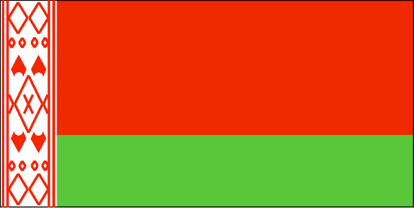
Belarus
Pays
Biélorussie
countryucasefr
BIELORUSSIE
Pays en Chinois
Pays en Espagnol
Belarus
Pays en Italien
Belarus
Pays en Portugais
Belarus
Pays en Allemand
Belarus
countrypy
bai2 e2 luo2 si1
countrylocal
Byelarus
countryfull
Belarus
countrynm
Belarus
ISO2
BY
ISO3
BLR
countrycodeisono
112
countrycodevehicle
BY
countrycodeolympic
BLR
countrycodeirs
BO
countrycodeirsfr
BO
countrycodeirsmixt
BO
♀Féminin
15
4
31
languagesfr
Biélorusse
14
currency
ruble
currencyfr
rouble
currencyisocode
BYR
currencyisocodefull
BYR 112
currencypxcode
BYR
currencysymbol
BR
currencyregime
m.float
Capitale
Minsk
capitalfr
Minsk
Préfixe Tél.
375
Superficie km2
207 600
arealand
207 600
landarablerate
0.2976
landforestrate
0.453
summit
Dzyarzhynskaya Hara 346 m.
boundarycountries
Pologne, Lituanie, Lettonie, Russie, Ukraine
timezonedeltabegin
2
flaglink
maplink
bo-map.gif
outlinemaplink
by.gif
visapassenger
-1
maincities
Gomel, Vitebsk, Brest, Grodno, Mogilev, Bobruysk, Baranovichi, Borisov, Orsha, Pinsk, Mozyr.
largestcity
Minsk
largestcitypopulation
1 784 000
rankpopulation
78
Population
9 881 000
rankgdp
77
gdp
17493000000
rankgdpppp
64
gdpppp
59803000000
rankgni
79
gni
15831000000
rankincomeorigin
121
rankincome
133
income
1600
rankincomeppp
102
incomeppp
6050
lifeexpectation
68.57
alphabetizationrate
1
natalityrate
0.01052
mortalityrate
0.0141
mortalityrateinfantile
0.01362
hdi
0.804
urbanization
0.711
nationalevent
Independence Day
nationaleventfr
Jour de l'Indépendance
nationalholiday
3 July (1944)
Date de naissance aaaa-mm-jj
1944-07-03 00:00:00
1
9
location
Eastern Europe, east of Poland
terrain
generally flat and contains much marshland
naturalresources
forests, peat deposits, small quantities of oil an
7
Web
rgbback
16777215
todate
1
10
id
Pays
Pays en Anglais
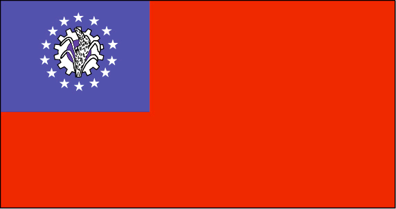
Myanmar
Pays
Birmanie
countryucasefr
BIRMANIE
Pays en Chinois
Pays en Espagnol
Birmania
Pays en Italien
La Birmania
Pays en Portugais
Burma
Pays en Allemand
Birma
countrypy
mian3 dian4
countrylocal
Myanma Naingngandaw
countryfull
Burma
countrynm
Burma
ISO2
MM
ISO3
MMR
countrycodeisono
104
countrycodevehicle
BUR
countrycodeolympic
MYA
countrycodeirs
BM
countrycodeirsfr
BM
countrycodeirsmixt
BM
♀Féminin
2
1
30
languagesfr
Birman
120
currency
kyat
currencyfr
kyat
currencyisocode
MMK
currencyisocodefull
MMK 104
currencypxcode
MMK
currencysymbol
K
currencysubdivision
100 pyas
currencyregime
US-$ (5.86of, 200-300bm)
currencyvalue
0.1599
Capitale
Rangoon
capitalfr
Rangoon
Préfixe Tél.
95
Superficie km2
676 552
arealand
657 740
areawater
20 760
landarablerate
0.1453
landforestrate
0.523
coastline
1930
summit
Hkakabo Razi 5 881 m.
boundarycountries
Bangladesh, Inde, Tibet, Chine, Laos, Thaïlande.
timezonedeltabegin
6.5
flaglink
maplink
mmcolor.gif
outlinemaplink
mmout.gif
visapassenger
-1
maincities
Mandalay, Moulmein, Pegu, Bassein, Akyab, Myeik.
largestcity
Yangon
largestcitypopulation
3 873 000
rankpopulation
24
Population
49 363 000
rankgni
38
gni
92900000000
rankincomeorigin
117
rankincome
126
income
1896
lifeexpectation
55.79
alphabetizationrate
0.806
natalityrate
0.01915
mortalityrate
0.01217
mortalityrateinfantile
0.07035
precipitation
2681
nationalevent
Independence Day
nationaleventfr
Jour de l'Indépendance
nationalholiday
4 January (1948)
Date de naissance aaaa-mm-jj
1948-01-04 00:00:00
4
12
location
Southeastern Asia, bordering the Andaman Sea and the Bay of Bengal, between Bangladesh and Thailand
terrain
central lowlands ringed by steep, rugged highlands
naturalresources
petroleum, timber, tin, antimony, zinc, copper, tu
9
rgbback
16777215
todate
1
| Pays/Territoires | Régions en Chine | Provinces de Chine | Régions en France | Départements de France | Provinces du Monde | Villes/Villages | Localités | Continents du Monde | Vins AOP
