Pays/Territoires
Mise à jour 2021-01-12 18:58:07
Les noms des pays/territoires du monde sont donnés en Français et Chinois. Cette collection des précieuses terres fermes du monde que toute l'humanité partage inclut non seulement les pays indépendants, mais aussi des régions spécifiques qui ne sont pas membre de l'ONUOrganisation des Nations Unies: Nous, peuples des Nations Unies ... Une ONU plus forte pour un monde meilleur. Veuillez aussi consulter les noms des pays en masculin et féminin en Français.
GéoPays Fermer
1
id
Pays
Pays en Anglais
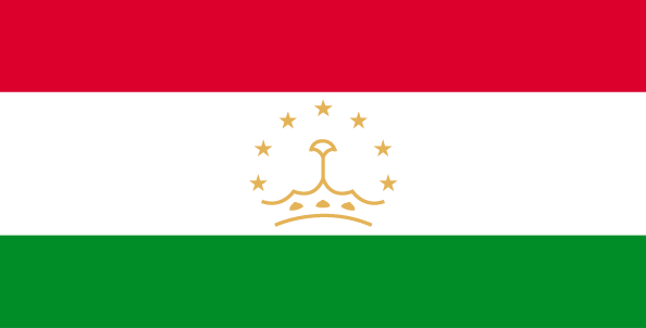
Tajikistan
Pays
Tadjikistan
countryucasefr
TADJIKISTAN
Pays en Chinois
Pays en Espagnol
Tajikistan
Pays en Italien
Tajikistan
Pays en Portugais
Tajikistan
Pays en Allemand
Tajikistan
countrypy
ta3 ji2 ke4 si1 tan3
countrylocal
Jumhurii Tojikiston
countryfull
Tajikistan
countrynm
Tajikistan
ISO2
TJ
ISO3
TJK
countrycodeisono
762
countrycodevehicle
TJ
countrycodeolympic
TJK
countrycodeirs
TI
countrycodeirsfr
TI
countrycodeirsmixt
TI
♂Masulin
15
4
199
languagesfr
Tadjik
158
currency
somoni
currencyfr
rouble
currencyisocode
TJS
currencyisocodefull
TJS 762
currencypxcode
TJS
currencysymbol
100 dirams
nationalityfr
Tajik
Capitale
Dushanbe
capitalfr
Douchanbe
Préfixe Tél.
992
Superficie km2
143 100
arealand
142 700
areawater
400
landarablerate
0.0541
landforestrate
0.028
summit
Qullai Kommunizm 7 495 m.
boundarycountries
Ouzbekistan, Kirghizstan, Chine, Afghanistan.
timezonedeltabegin
5
flaglink
maplink
tjcolor.gif
outlinemaplink
tjout.gif
visapassenger
-1
maincities
Khodzent, Kulyab, Kurgan-Tyube, Kanibadam, Tursunzade, Khorogl.
largestcity
Dushanbe
largestcitypopulation
664 000
rankpopulation
98
Population
6 305 000
rankgdp
149
gdp
1553000000
rankgdpppp
135
gdpppp
6976000000
rankgni
162
gni
1343000000
rankincomeorigin
195
rankincome
209
income
210
rankincomeppp
188
incomeppp
1040
lifeexpectation
64.47
alphabetizationrate
0.994
natalityrate
0.03263
mortalityrate
0.00842
mortalityrateinfantile
0.1121
hdi
0.677
urbanization
0.277
precipitation
569
nationalevent
Independence Day (or National Day)
nationaleventfr
Jour de l'Indépendance (ou Jour National)
nationalholiday
9 September (1991)
Date de naissance aaaa-mm-jj
1991-09-09 00:00:00
8
8
location
Central Asia, west of China
terrain
Pamir and Alay Mountains dominate landscape; western Fergana Valley in north, Kofarnihon and Vakhsh Valleys in southwest
naturalresources
hydropower, some petroleum, uranium, mercury, brow
9
Web
rgbback
16777215
todate
1
2
id
Pays
Pays en Anglais
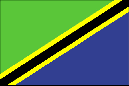
Tanzania
Pays
Tanzanie
countryucasefr
TANZANIE
Pays en Chinois
Pays en Espagnol
Tanzania, república unida de
Pays en Italien
La Tanzania, Repubblica unita di
Pays en Portugais
Tanzânia, república unida de
Pays en Allemand
Tanzania, vereinigte Republik von
countrypy
tan3 sang1 ni2 ya4
countrylocal
Tanzania
countryfull
Tanzania
countrynm
Tanzania
ISO2
TZ
ISO3
TZA
countrycodeisono
834
countrycodeolympic
TAN
countrycodeirs
TZ
countrycodeirsfr
TZ
countrycodeirsmixt
TZ
♀Féminin
15
5
151
languagesfr
Swahili, Anglais
159
currency
shilling
currencyfr
shilling
currencyisocode
TZS
currencyisocodefull
TZS 834
currencypxcode
TZS
currencysymbol
TSh
currencysubdivision
100 cents
currencyregime
float
currencyvalue
0.00092
nationalityfr
Tanzanienne
Capitale
Dar es Salaam
capitalfr
Dar-Es-Salam
Préfixe Tél.
255
Superficie km2
945 090
arealand
886 037
areawater
59 050
landarablerate
0.0424
landforestrate
0.439
coastline
1424
summit
Kilimanjaro 5 895 m.
boundarycountries
Congo démocratique, Burundi, Rwanda, Ouganda, Kenya, Zambie, Mozambique, Malawi.
timezonedeltabegin
3
flaglink
maplink
tzcolor.gif
outlinemaplink
tzout.gif
visapassenger
-1
maincities
Dar es Salaam, Zanzibar, Mwanza, Tanga, Mbeya, Tabora, Arusha.
largestcity
Dar Es Salaam
largestcitypopulation
1 747 000
rankpopulation
32
Population
35 889 000
rankgdp
93
gdp
10297000000
rankgdpppp
97
gdpppp
22300000000
rankgni
89
gni
10665000000
rankincomeorigin
183
rankincome
197
income
300
rankincomeppp
206
incomeppp
620
lifeexpectation
44.56
alphabetizationrate
0.5157
natalityrate
0.0395
mortalityrate
0.01738
mortalityrateinfantile
0.10368
precipitation
1148
nationalevent
Union Day (Tanganyika and Zanzibar)
nationaleventfr
Jour de l'Union (Tanganyika et Zanzibar)
nationalholiday
26 April (1964)
Date de naissance aaaa-mm-jj
1964-04-26 00:00:00
1
5
location
Eastern Africa, bordering the Indian Ocean, between Kenya and Mozambique
terrain
plains along coast; central plateau; highlands in north, south
naturalresources
hydropower, tin, phosphates, iron ore, coal, diamo
9
Web
rgbback
16777215
todate
1
3
id
Pays
Pays en Anglais
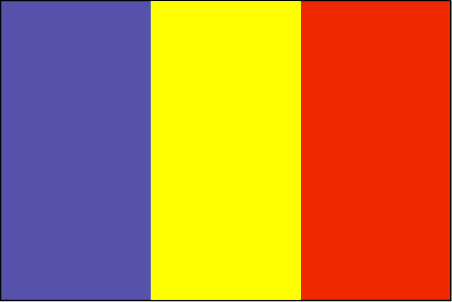
Chad
Pays
Tchad
countryucasefr
TCHAD
Pays en Chinois
Pays en Espagnol
Sábalo
Pays en Italien
Il Ritaglio
Pays en Portugais
República do Tchad
Pays en Allemand
Tschad
countrypy
zha4 de2
countrylocal
Tchad
countryfull
Chad
countrynm
Chad
ISO2
TD
ISO3
TCD
countrycodeisono
148
countrycodevehicle
TCH
countrycodeolympic
CHA
countrycodeirs
CD
countrycodeirsfr
CD
countrycodeirsmixt
CD
♂Masulin
15
4
57
languagesfr
Arabe, Français
119
currency
franc
currencyfr
franc C.F.A.
currencyisocode
XAF
currencyisocodefull
XAF 950
currencypxcode
XAF
currencysymbol
CFAF
currencysubdivision
100 centimes
currencyregime
Euro (655.957)
currencyvalue
0.00186
nationalityfr
Chadienne
Capitale
N'Djamena
capitalfr
N'Djamena
Préfixe Tél.
235
Superficie km2
1 284 000
arealand
1 259 200
areawater
24 800
landarablerate
0.0278
landforestrate
0.101
summit
Emi Koussi 3 415 m.
boundarycountries
Niger, Libye, Soudan, Centrafrique, Cameroun, Nigeria.
timezonedeltabegin
1
flaglink
maplink
tdcolor.gif
outlinemaplink
tdout.gif
visapassenger
-1
maincities
Sarh, Moundou, Abéché, Bongor, Doba, Lai, Koumra, Kélo.
largestcity
Ndjamena
largestcitypopulation
826 000
rankpopulation
83
Population
8 582 000
rankgdp
139
gdp
2608000000
rankgdpppp
123
gdpppp
10386000000
rankgni
151
gni
2073000000
rankincomeorigin
192
rankincome
206
income
240
rankincomeppp
185
incomeppp
1080
lifeexpectation
48.24
alphabetizationrate
0.46
natalityrate
0.0465
mortalityrate
0.01638
mortalityrateinfantile
0.09478
hdi
0.376
urbanization
0.241
nationalevent
Independence Day
nationaleventfr
Jour de l'Indépendance
nationalholiday
11 August (1960)
Date de naissance aaaa-mm-jj
1960-08-11 00:00:00
7
1
location
Central Africa, south of Libya
terrain
broad, arid plains in center, desert in north, mountains in northwest, lowlands in south
naturalresources
petroleum (unexploited but exploration under way),
9
Web
rgbback
16777215
todate
1
4
id
Pays
Pays en Anglais
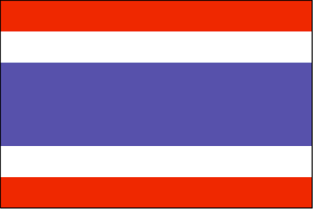
Thailand
Pays
Thaïlande
countryucasefr
THAILANDE
Pays en Chinois
Pays en Espagnol
Tailandia
Pays en Italien
La Tailandia
Pays en Portugais
Tailândia
Pays en Allemand
Thailand
countrypy
tai4 guo2
countrylocal
Prathet Thai
countryfull
Thailand
countrynm
Thailand
ISO2
TH
ISO3
THA
countrycodeisono
764
countrycodevehicle
T
countrycodeolympic
THA
countrycodeirs
TH
countrycodeirsfr
TH
countrycodeirsmixt
TH
countrycode
66
♀Féminin
12
6
161
languagesfr
Thaï
103
currency
baht
currencyfr
baht
currencyisocode
THB
currencyisocodefull
THB 764
currencypxcode
THB
currencysymbol
Bht or Bt
currencysubdivision
100 stang
currencyregime
float
currencyvalue
0.02457
nationalityfr
Taïlandaise
Capitale
Bangkok
capitalfr
Bankok
Préfixe Tél.
66
Superficie km2
514 820
arealand
511 770
areawater
2 230
landarablerate
0.3288
landforestrate
0.289
coastline
3219
summit
Doi Inthanon 2 595 m.
boundarycountries
Birmanie, Laos, Cambodge, Malaisie.
timezonedeltabegin
7
flaglink
maplink
thcolor.gif
outlinemaplink
thout.gif
visapassenger
-1
maincities
Nakhon Ratchasima, Phuket, Chiang Mai, Songkhla, Khon Kaen, Chon Buri, Nakhon Si Thammarat, Ban Hat Yai, Phitsanulok.
largestcity
Bangkok
largestcitypopulation
6 547 000
rankpopulation
19
Population
62 014 000
rankgdp
33
gdp
142953000000
rankgdpppp
20
gdpppp
470992000000
rankgni
31
gni
135877000000
rankincomeorigin
105
rankincome
115
income
2190
rankincomeppp
87
incomeppp
7450
lifeexpectation
71.24
alphabetizationrate
0.93
natalityrate
0.01637
mortalityrate
0.00686
mortalityrateinfantile
0.02183
precipitation
1498
nationalevent
Birthday of King PHUMIPHON
nationaleventfr
Anniversaire du Roi PHUMIPHON
nationalholiday
5 December (1927)
Date de naissance aaaa-mm-jj
1927-12-05 00:00:00
4
4
location
Southeastern Asia, bordering the Andaman Sea and the Gulf of Thailand, southeast of Burma
terrain
central plain; Khorat Plateau in the east; mountains elsewhere
naturalresources
tin, rubber, natural gas, tungsten, tantalum, timb
cooking
Meilleurs Riz Parfumés du Monde.
8
Web
rgbback
16777215
todate
1
Notes
Meilleurs Riz Parfumés du Monde. Grâce à son intelligence suprême,
Ce Lapin de Feu gère bien la cohabitation de la modernité et le boudhisme traditionnel. Avec un tempérament chaud, il est aimé de tous.
5
id
Pays
Pays en Anglais
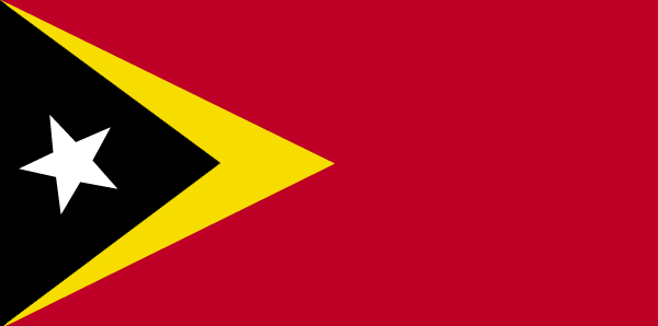
East Timor
Pays
Timor Oriental
countryucasefr
TIMOR ORIENTAL
Pays en Chinois
Pays en Espagnol
Timor (Del este)
Pays en Italien
Timor (Orientale)
Pays en Portugais
Timor (Oriental)
Pays en Allemand
Timor (Östlich)
countrypy
dong1 di4 wen4
countrylocal
Timor
countryfull
East Timor
countrynm
East Timor
ISO2
TL
ISO3
TLS
countrycodeisono
626
countrycodeolympic
TLS
countrycodeirs
TL
countrycodeirsfr
TL
countrycodeirsmixt
TOL
♂Masulin
15
6
114
languagesfr
Portugais
51
currency
rupiah
currencyfr
Escudo de Timor
currencyisocode
IDR
currencyisocodefull
IDR 360
currencypxcode
IDR
currencysymbol
Rp
currencysubdivision
100 sen (no longer used)
currencyregime
m.float
currencyvalue
0.0001
Capitale
Dili
capitalfr
Dili
Préfixe Tél.
670
Superficie km2
18 997
coastline
706
summit
Tata Mailau 2 960 m.
boundarycountries
Indonésie.
timezonedeltabegin
7
timezonedeltaend
9
flaglink
maplink
etimorcl.gif
visapassenger
-1
maincities
Ocussi, Manatuto, Ermera, Viqueque, Same, Ainaro, Maliana, Suai, Baucau.
largestcity
Dili
rankpopulation
152
Population
877 000
rankgdp
173
gdp
341000000
rankgni
194
gni
372000000
rankincomeorigin
167
rankincome
181
income
460
lifeexpectation
65.2
alphabetizationrate
0.48
natalityrate
0.02775
mortalityrate
0.00641
mortalityrateinfantile
0.05047
nationalevent
Independence Day
nationaleventfr
Jour de l'Indépendance
nationalholiday
28 November (1975)
Date de naissance aaaa-mm-jj
1975-11-28 00:00:00
2
4
location
Southeastern Asia, northwest of Australia in the Lesser Sunda Islands at the eastern end of the Indonesian archipelago; note - East Timor includes the eastern half of the island of Timor, the Oecussi (Ambeno) region on the northwest portion of the island
terrain
mountainous
naturalresources
gold, petroleum, natural gas, manganese, marble
9
rgbback
16777215
todate
1
6
id
Pays
Pays en Anglais
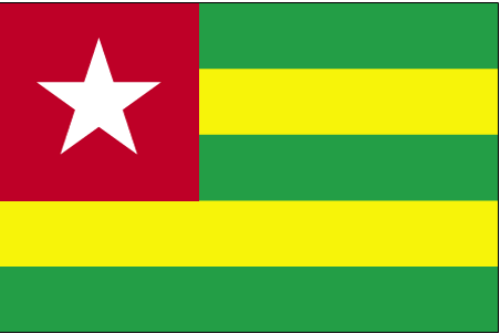
Togo
Pays
Togo
countryucasefr
TOGO
Pays en Chinois
Pays en Espagnol
Toga
Pays en Italien
Toga
Pays en Portugais
Toga
Pays en Allemand
Toga
countrypy
duo1 ge1
countrylocal
Republique Togolaise
countryfull
Togo
countrynm
Togo
ISO2
TG
ISO3
TGO
countrycodeisono
768
countrycodevehicle
TG
countrycodeolympic
TOG
countrycodeirs
TO
countrycodeirsfr
TO
countrycodeirsmixt
TO
♂Masulin
15
4
57
languagesfr
Français
119
currency
franc
currencyfr
franc C.F.A.
currencyisocode
XOF
currencyisocodefull
XOF 952
currencypxcode
XOF
currencysymbol
CFAF
currencysubdivision
100 centimes
currencyregime
Euro (655.957)
currencyvalue
0.00186
nationalityfr
Togalaise
Capitale
Lome
capitalfr
Lomé
Préfixe Tél.
228
Superficie km2
56 790
arealand
54 385
areawater
2 400
landarablerate
0.4137
landforestrate
0.094
coastline
56
summit
Pic Baumann 986 m.
boundarycountries
Ghana, Burkina Faso, Bénin.
flaglink
maplink
tgcolor.gif
outlinemaplink
tgout.gif
visapassenger
-1
maincities
Sokodé, Palimé, Atakpamé, Bassari, Tsévié, Anécho, Mango, Bafilo, Tabligbo.
largestcity
Lome
largestcitypopulation
662 000
rankpopulation
112
Population
4 861 000
rankgdp
146
gdp
1759000000
rankgdpppp
132
gdpppp
8247000000
rankgni
159
gni
1528000000
rankincomeorigin
182
rankincome
196
income
310
rankincomeppp
176
incomeppp
1640
lifeexpectation
53.43
alphabetizationrate
0.433
natalityrate
0.03523
mortalityrate
0.01151
mortalityrateinfantile
0.06873
hdi
0.489
precipitation
878
nationalevent
Independence Day
nationaleventfr
Jour de l'Indépendance
nationalholiday
27 April (1960)
Date de naissance aaaa-mm-jj
1960-04-27 00:00:00
7
1
location
Western Africa, bordering the Bight of Benin, between Benin and Ghana
terrain
gently rolling savanna in north; central hills; southern plateau; low coastal plain with extensive lagoons and marshes
naturalresources
phosphates, limestone, marble, arable land
9
Web
rgbback
16777215
todate
1
7
id
Pays
Pays en Anglais
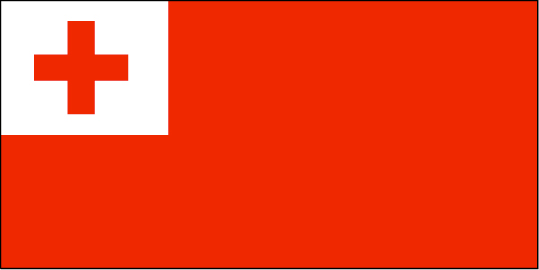
Tonga
Pays
Tonga
countryucasefr
TONGA
Pays en Chinois
Pays en Espagnol
Tonga
Pays en Italien
La Tonga
Pays en Portugais
Tonga
Pays en Allemand
Tonga
countryfull
Tonga
countrynm
Tonga
ISO2
TO
ISO3
TON
countrycodeisono
776
countrycodeolympic
TGA
countrycodeirs
TN
countrycodeirsfr
TN
countrycodeirsmixt
TN
♀Féminin
12
4
202
languagesfr
Tongan, Anglais
160
currency
pa'anga
currencyfr
paanga
currencyisocode
TOP
currencyisocodefull
TOP 776
currencypxcode
TOP
currencysymbol
PT or T$
currencysubdivision
100 seniti
currencyregime
composite
currencyvalue
0.5262
Capitale
Nuku'alofa
capitalfr
Nukualofa
Préfixe Tél.
676
Superficie km2
748
arealand
718
areawater
30
landarablerate
0.2361
landforestrate
0.055
coastline
419
summit
1 033 m.
timezonedeltabegin
13
flaglink
maplink
tocolor.gif
outlinemaplink
to.gif
visapassenger
-1
maincities
Neiafu, Pangai.
largestcity
Nuku' alofa
largestcitypopulation
40 000
rankpopulation
188
Population
102 000
rankgdp
181
gdp
163000000
rankgdpppp
162
gdpppp
710000000
rankgni
204
gni
152000000
rankincomeorigin
123
rankincome
135
income
1490
rankincomeppp
91
incomeppp
6910
lifeexpectation
69.2
natalityrate
0.02487
fecondity
3.71
mortalityrate
0.00545
mortalityrateinfantile
0.01299
growthrate
0.011
urbanization
0.53
nationalevent
Independence Day
nationaleventfr
Jour de l'Indépendance
nationalholiday
4 June (1970)
Date de naissance aaaa-mm-jj
1970-06-04 00:00:00
7
11
location
Oceania, archipelago in the South Pacific Ocean, about two-thirds of the way from Hawaii to New Zealand
terrain
most islands have limestone base formed from uplifted coral formation; others have limestone overlying volcanic base
naturalresources
fish, fertile soil
9
rgbback
16777215
todate
1
8
id
Pays
Pays en Anglais
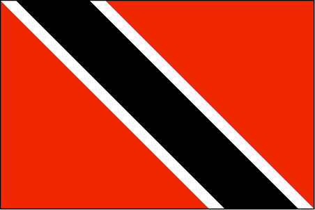
Trinidad and Tobago
Pays
Trinité-et-Tobago
countryucasefr
TRINITE-ET-TOBAGO
Pays en Chinois
Pays en Espagnol
Trinidad y Trinidad y Tobago
Pays en Italien
La Trinidad ed il Tobago
Pays en Portugais
Trinidad e tobago
Pays en Allemand
Trinidad und Tobago
countrypy
te4 li4 ni2 da2 he2 duo1 ba1 ge1
countrylocal
Trinidad and Tobago
countryfull
Trinidad and Tobago
countrynm
Trinidad and Tobago
ISO2
TT
ISO3
TTO
countrycodeisono
780
countrycodevehicle
TT
countrycodeolympic
TRI
countrycodeirs
TD
countrycodeirsfr
TD
countrycodeirsmixt
TD
18
6
51
languagesfr
Anglais
104
currency
dollar
currencyfr
dollar de la Trinité
currencyisocode
TTD
currencyisocodefull
TTD 780
currencypxcode
TTD
currencysymbol
TT$
currencysubdivision
100 cents
currencyregime
float
currencyvalue
0.1613
Capitale
Port-of-Spain
capitalfr
Port of Spain
Préfixe Tél.
1-868
Superficie km2
5 128
arealand
5 128
landarablerate
0.1462
landforestrate
0.505
coastline
362
summit
El Cerro del Aripo 940 m.
timezonedeltabegin
-4
flaglink
maplink
tt.jpg
outlinemaplink
trintbgo.gif
visapassenger
-1
maincities
San Fernando, Arima, Scarborough .
largestcity
Port of Spain
largestcitypopulation
52 000
rankpopulation
149
Population
1 313 000
rankgdp
92
gdp
10511000000
rankgdpppp
111
gdpppp
14132000000
rankgni
90
gni
10220000000
rankincomeorigin
60
rankincome
66
income
7790
rankincomeppp
74
incomeppp
10390
lifeexpectation
69.28
alphabetizationrate
0.985
natalityrate
0.01275
mortalityrate
0.00902
mortalityrateinfantile
0.02464
hdi
0.802
urbanization
0.745
precipitation
1870
nationalevent
Independence Day
nationaleventfr
Jour de l'Indépendance
nationalholiday
31 August (1962)
Date de naissance aaaa-mm-jj
1962-08-31 00:00:00
9
3
location
Caribbean, islands between the Caribbean Sea and the North Atlantic Ocean, northeast of Venezuela
terrain
mostly plains with some hills and low mountains
naturalresources
petroleum, natural gas, asphalt
9
Web
rgbback
16777215
todate
1
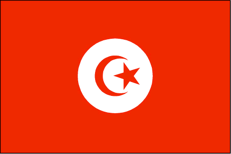
9
id
Pays
Pays en Anglais
Tunisia
Pays
Tunisie
countryucasefr
TUNISIE
Pays en Chinois
Pays en Espagnol
Túnez
Pays en Italien
La Tunisia
Pays en Portugais
Tunísia
Pays en Allemand
Tunesien
countrypy
tu1 ni2 xi1 ya4
countrylocal
Tunis
countryfull
Tunisia
countrynm
Tunisia
ISO2
TN
ISO3
TUN
countrycodeisono
788
countrycodevehicle
TN
countrycodeolympic
TUN
countrycodeirs
TS
countrycodeirsfr
TS
countrycodeirsmixt
TS
countrycode
216
♀Féminin
15
4
3
languagesfr
Arabe
161
currency
dinar
currencyfr
dinar tunisien
currencyisocode
TND
currencyisocodefull
TND 788
currencypxcode
TND
currencysymbol
TD
currencysubdivision
1,000 millimes
currencyregime
m.float (1.0)
currencyvalue
0.7685
nationalityfr
Tunisienne
Capitale
Tunis
capitalfr
Tunis
Préfixe Tél.
216
Superficie km2
163 610
arealand
155 360
areawater
8 250
landarablerate
0.1867
landforestrate
0.031
coastline
1148
summit
Jabal ash Sha'ambi 1 544 m.
boundarycountries
Algérie, Libye.
timezonedeltabegin
1
flaglink
maplink
tncolor.gif
outlinemaplink
tnout.gif
visapassenger
-1
maincities
Sfax, Bizerte, Djerba, Gabès, Sousse, Kairouan, Gafsa.
largestcity
Tunis
largestcitypopulation
1 722 000
rankpopulation
77
Population
9 895 000
rankgdp
65
gdp
25037000000
rankgdpppp
60
gdpppp
70863000000
rankgni
68
gni
22204000000
rankincomeorigin
103
rankincome
113
income
2240
rankincomeppp
92
incomeppp
6850
lifeexpectation
72.9
alphabetizationrate
0.753
natalityrate
0.0169
mortalityrate
0.0055
mortalityrateinfantile
0.0228
precipitation
466
nationalevent
Independence Day
nationaleventfr
Jour de l'Indépendance
nationalholiday
20 March (1956)
Date de naissance aaaa-mm-jj
1956-03-20 00:00:00
3
9
location
Northern Africa, bordering the Mediterranean Sea, between Algeria and Libya
terrain
mountains in north; hot, dry central plain; semiarid south merges into the Sahara
naturalresources
petroleum, phosphates, iron ore, lead, zinc, salt
cooking
Couscous.
7
Web
rgbback
16777215
todate
1
Notes
Couscous.
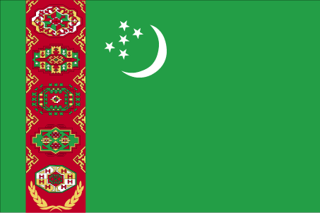
10
id
Pays
Pays en Anglais
Turkmenistan
Pays
Turkménistan
countryucasefr
TURKMENISTAN
Pays en Chinois
Pays en Espagnol
Turkmenistan
Pays en Italien
Turkmenistan
Pays en Portugais
Turkmenistan
Pays en Allemand
Turkmenistan
countrypy
tu3 ku4 man4
countrylocal
Turkmenistan
countryfull
Turkmenistan
countrynm
Turkmenistan
ISO2
TM
ISO3
TKM
countrycodeisono
795
countrycodevehicle
TM
countrycodeolympic
TKM
countrycodeirs
TX
countrycodeirsfr
TX
countrycodeirsmixt
TX
♂Masulin
15
1
201
languagesfr
Turkmen
162
currency
manat
currencyfr
rouble
currencyisocode
TMM
currencyisocodefull
TMM 795
currencypxcode
TMM
currencysubdivision
100 tenga
currencyregime
US-$ (10.0;230.0)
nationalityfr
Turkmen
Capitale
Ashgabat
capitalfr
Achkhabad
Préfixe Tél.
993
Superficie km2
488 100
arealand
488 100
landarablerate
0.0347
landforestrate
0.08
summit
Ayrybaba 3 189 m.
boundarycountries
Iran, Kazakhstan, Ouzbekistan, Afghanistan.
timezonedeltabegin
5
flaglink
maplink
tmcolor.gif
outlinemaplink
tmout.gif
visapassenger
-1
maincities
Chardzhou, Tashauz, Krasnovodsk
largestcity
Ashkhabad
largestcitypopulation
462 000
rankpopulation
111
Population
4 864 000
rankgdp
109
gdp
6201000000
rankgdpppp
86
gdpppp
28881000000
rankgni
116
gni
5442000000
rankincomeorigin
131
rankincome
143
income
1120
rankincomeppp
106
incomeppp
5860
lifeexpectation
61.29
alphabetizationrate
0.98
natalityrate
0.02782
mortalityrate
0.00882
mortalityrateinfantile
0.07313
hdi
0.748
urbanization
0.449
precipitation
227
nationalevent
Independence Day
nationaleventfr
Jour de l'Indépendance
nationalholiday
27 October (1991)
Date de naissance aaaa-mm-jj
1991-10-27 00:00:00
8
8
location
Central Asia, bordering the Caspian Sea, between Iran and Kazakhstan
terrain
flat-to-rolling sandy desert with dunes rising to mountains in the south; low mountains along border with Iran; borders Caspian Sea in west
naturalresources
petroleum, natural gas, coal, sulfur, salt
9
Web
rgbback
16777215
todate
1
| Pays/Territoires | Régions en Chine | Provinces de Chine | Régions en France | Départements de France | Provinces du Monde | Villes/Villages | Localités | Continents du Monde | Vins AOP
