Pays/Territoires
Mise à jour 2021-01-12 18:58:56
Les noms des pays/territoires du monde sont donnés en Français et Chinois. Cette collection des précieuses terres fermes du monde que toute l'humanité partage inclut non seulement les pays indépendants, mais aussi des régions spécifiques qui ne sont pas membre de l'ONUOrganisation des Nations Unies: Nous, peuples des Nations Unies ... Une ONU plus forte pour un monde meilleur. Veuillez aussi consulter les noms des pays en masculin et féminin en Français.
GéoPays Fermer
11
id
Pays
Pays en Anglais
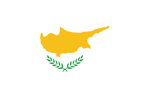
Cyprus
Pays
Chypre
countryucasefr
CHYPRE
Pays en Chinois
Pays en Espagnol
Chipre
Pays en Italien
La Cipro
Pays en Portugais
Chipre
Pays en Allemand
Zypern
countrypy
se4 pu3 lu4 si1
countrylocal
Kibris, Kypros
countryfull
Cyprus
countrynm
Cyprus
ISO2
CY
ISO3
CYP
countrycodeisono
196
countrycodevehicle
CY
countrycodeolympic
CYP
countrycodeirs
CY
countrycodeirsfr
CY
countrycodeirsmixt
CY
♂Masulin
15
6
77
languagesfr
Grec, Turc
2
currency
pound
currencyfr
livre cypriote
currencyisocode
CYP
currencyisocodefull
CYP 196
currencypxcode
CYP
currencysymbol
£C
currencysubdivision
100 cents
currencyregime
1.7086 EUR/CYP +/- 2.25%
currencyvalue
2.1246
nationalityfr
Cypriote
Capitale
Nicosia
capitalfr
Nicosie
Préfixe Tél.
357
Superficie km2
9 251
arealand
9 240
areawater
10
landarablerate
0.1061
landforestrate
0.186
coastline
648
summit
Olimbos 1 951 m.
timezonedeltabegin
2
flaglink
maplink
cy-map.gif
outlinemaplink
cy.gif
visapassenger
-1
maincities
Limassol, Larnaca, Famagusta
largestcity
Nicosia
largestcitypopulation
178 000
rankpopulation
155
Population
770 000
rankgdp
87
gdp
11385000000
rankgdpppp
113
gdpppp
13813000000
rankgni
96
gni
9373000000
rankincomeorigin
47
rankincome
46
income
12320
rankincomeppp
42
incomeppp
19600
lifeexpectation
77.46
alphabetizationrate
0.975
natalityrate
0.01266
mortalityrate
0.00763
mortalityrateinfantile
0.00736
hdi
0.891
urbanization
0.691
precipitation
320
nationalevent
Independence Day
nationaleventfr
Jour de l'Indépendance
nationalholiday
1 October (1960)
Date de naissance aaaa-mm-jj
1960-10-01 00:00:00
7
1
location
Middle East, island in the Mediterranean Sea, south of Turkey
terrain
central plain with mountains to north and south; scattered but significant plains along southern coast
naturalresources
copper, pyrites, asbestos, gypsum, timber, salt, m
7
Web
rgbback
16777215
todate
1
12
id
Pays
Pays en Anglais
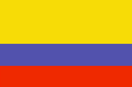
Colombia
Pays
Colombie
countryucasefr
COLOMBIE
Pays en Chinois
Pays en Espagnol
Colombia
Pays en Italien
La Colombia
Pays en Portugais
Colômbia
Pays en Allemand
Kolumbien
countrypy
ge1 lun2 bi3 ya4
countrylocal
Colombia
countryfull
Colombia
countrynm
Colombia
ISO2
CO
ISO3
COL
countrycodeisono
170
countrycodevehicle
CO
countrycodeolympic
COL
countrycodeirs
CO
countrycodeirsfr
CO
countrycodeirsmixt
CO
countrycode
57
♀Féminin
15
6
131
languagesfr
Espagnol
28
currency
peso
currencyfr
peso
currencyisocode
COP
currencyisocodefull
COP 170
currencypxcode
COP
currencysymbol
Col$
currencysubdivision
100 centavos
currencyregime
m.float
currencyvalue
0.00043
nationalityfr
Colombienne
Capitale
Bogota
capitalfr
Bogota
Préfixe Tél.
57
Superficie km2
1 138 914
arealand
1 038 700
areawater
100 210
landarablerate
0.019
landforestrate
0.478
coastline
3208
summit
Pico Cristóbal Colón 5 775 m.
boundarycountries
Panama, Vénézuéla, Brésil, Pérou, Equateur.
timezonedeltabegin
-5
flaglink
maplink
cocolor.gif
outlinemaplink
co.gif
visapassenger
-1
maincities
Medellín, Cali, Barranquilla, Cartagena, Pereira, Cúcuta, Bucaramanga, Manizales
largestcity
Bogota
largestcitypopulation
6 079 000
rankpopulation
28
Population
44 584 000
rankgdp
46
gdp
78651000000
rankgdpppp
26
gdpppp
298799000000
rankgni
42
gni
80540000000
rankincomeorigin
118
rankincome
130
income
1810
rankincomeppp
97
incomeppp
6410
lifeexpectation
70.9
alphabetizationrate
0.867
natalityrate
0.0232
nationalevent
Independence Day
nationaleventfr
Jour de l'Indépendance
nationalholiday
20 July (1810)
Date de naissance aaaa-mm-jj
1810-07-20 00:00:00
7
7
location
Northern South America, bordering the Caribbean Sea, between Panama and Venezuela, and bordering the North Pacific Ocean, between Ecuador and Panama
terrain
flat coastal lowlands, central highlands, high Andes Mountains, eastern lowland plains
naturalresources
petroleum, natural gas, coal, iron ore, nickel, go
cooking
Fruits de Mer, Epices.
9
Web
rgbback
16777215
todate
1
Notes
Fruits de Mer, Epices.
13
id
Pays
Pays en Anglais
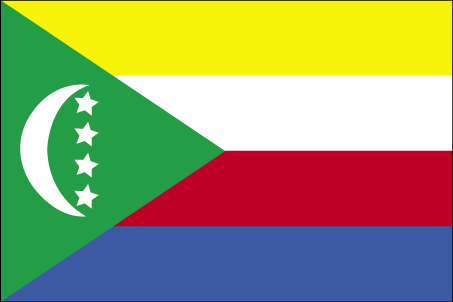
Comoros
Pays
Comores
countryucasefr
COMORES
Pays en Chinois
Pays en Espagnol
El Comoro
Pays en Italien
Le Comore
Pays en Portugais
Cômoros
Pays en Allemand
Comoren
countryfull
Comoros
countrynm
Comoros
ISO2
KM
ISO3
COM
countrycodeisono
174
countrycodeolympic
COM
countrycodeirs
CN
countrycodeirsfr
CN
countrycodeirsmixt
CMR
♀Féminin
15
2
57
languagesfr
Français
119
currency
franc
currencyfr
franc C.F.A.
currencyisocode
KMF
currencyisocodefull
KMF 174
currencypxcode
KMF
currencysymbol
CF
currencysubdivision
-
currencyregime
Euro (491.96775)
currencyvalue
0.00257
Capitale
Moroni
capitalfr
Moroni
Préfixe Tél.
269
Superficie km2
2 171
arealand
2 170
landarablerate
0.3498
landforestrate
0.043
coastline
340
summit
Kartala 2 361 m.
timezonedeltabegin
3
flaglink
maplink
kmcolor.gif
outlinemaplink
kmout.gif
visapassenger
-1
maincities
Mutsamudu, Fomboni, Mitsamiouli.
largestcity
Moroni
largestcitypopulation
36 000
rankpopulation
160
Population
600 000
rankgdp
174
gdp
323000000
rankgdpppp
157
gdpppp
1029000000
rankgni
197
gni
269000000
rankincomeorigin
169
rankincome
183
income
450
rankincomeppp
172
incomeppp
1720
lifeexpectation
61.57
alphabetizationrate
0.563
natalityrate
0.038
fecondity
4.9
mortalityrate
0.00863
mortalityrateinfantile
0.07722
hdi
0.528
urbanization
0.338
nationalevent
Independence Day
nationaleventfr
Jour de l'Indépendance
nationalholiday
6 July (1975)
Date de naissance aaaa-mm-jj
1975-07-06 00:00:00
2
4
location
Southern Africa, group of islands at the northern mouth of the Mozambique Channel, about two-thirds of the way between northern Madagascar and northern Mozambique
terrain
volcanic islands, interiors vary from steep mountains to low hills
naturalresources
NEGL
9
Web
rgbback
16777215
todate
1
14
id
Pays
Pays en Anglais
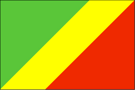
Congo
Pays
Congo
countryucasefr
CONGO
Pays en Chinois
Pays en Espagnol
Congo
Pays en Italien
Il Congo
Pays en Portugais
Congo
Pays en Allemand
Der Kongo
countrypy
gang1 guo3 gong4 he2 guo2
countrylocal
République du Congo
countryfull
Congo, Republic of the
countrynm
Congo, Republic of the
ISO2
CG
ISO3
COG
countrycodeisono
178
countrycodevehicle
RCB
countrycodeolympic
CGO
countrycodeirs
CF
countrycodeirsfr
CF
countrycodeirsmixt
CF
♂Masulin
15
57
languagesfr
Français
119
currency
franc
currencyfr
franc C.F.A.
currencyisocode
XAF
currencyisocodefull
XAF 950
currencypxcode
XAF
currencysymbol
CFAF
currencysubdivision
100 centimes [*]
currencyregime
Euro (655.957)
currencyvalue
0.00186
nationalityfr
Congolaise
Capitale
Brazzaville
capitalfr
Brazzaville
Préfixe Tél.
242
Superficie km2
342 000
arealand
341 500
areawater
500
landarablerate
0.005
coastline
169
summit
Monts de la Lékéti 1 040 m.
boundarycountries
Gabon, Cameroun, Centrafrique, Congo démocratique, Angola.
timezonedeltabegin
1
flaglink
maplink
cgcolor.gif
outlinemaplink
cgout.gif
visapassenger
-1
maincities
Pointe Noire, N'Kayi, Loubomo, Ngamaba-Mfilou, Loandjili, Massendjo.
largestcity
Brazzaville
rankpopulation
126
Population
3 757 000
rankgdp
130
gdp
3564000000
rankgdpppp
148
gdpppp
3625000000
rankgni
147
gni
2443000000
rankincomeorigin
153
rankincome
167
income
650
rankincomeppp
200
incomeppp
730
lifeexpectation
50.02
alphabetizationrate
0.566
natalityrate
0.02946
mortalityrate
0.0142
mortalityrateinfantile
0.09534
nationalevent
Independence Day
nationaleventfr
Jour de l'Indépendance
nationalholiday
15 August (1960)
Date de naissance aaaa-mm-jj
1960-08-15 00:00:00
7
1
location
Western Africa, bordering the South Atlantic Ocean, between Angola and Gabon
terrain
coastal plain, southern basin, central plateau, northern basin
naturalresources
petroleum, timber, potash, lead, zinc, uranium, co
9
Web
rgbback
16777215
todate
1
15
id
Pays
Pays en Anglais
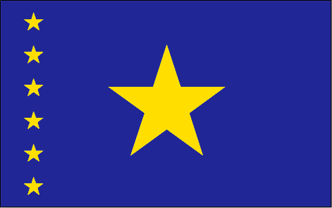
Congo, Democratic
Pays
Congo Démocratique
countryucasefr
CONGO (REPUBLIQUE DEMOCRATIQUE DU)
Pays en Chinois
Pays en Espagnol
Zaire
Pays en Italien
Lo Zaire
Pays en Portugais
Zaire
Pays en Allemand
Zaire
countrypy
gang1 guo3 min2 zhu3 gong4 he2 guo2
countrylocal
République Démocratique du Congo
countryfull
Congo, Democratic Republic of the
countrynm
Congo, Democratic Republic of the
ISO2
CD
ISO3
COD
countrycodeisono
180
countrycodevehicle
ZRE
countrycodeolympic
COD
countrycodeirs
CG
countrycodeirsfr
CG
countrycodeirsmixt
CG
♂Masulin
3
2
57
languagesfr
Français
132
currency
franc
currencyfr
zaïre
currencyisocode
CDF
currencyisocodefull
CDF 180
currencypxcode
CDF
currencysubdivision
100 centimes
currencyregime
US-$ (2.50)
nationalityfr
Congolaise
Capitale
Kinshasa
capitalfr
Kinshasa
Préfixe Tél.
243
Superficie km2
2 345 410
arealand
2 267 600
areawater
77 810
landarablerate
0.0296
landforestrate
0.596
coastline
37
summit
Pic Marguerite 5 109 m.
boundarycountries
Congo, Centrafrique, Soudan, Ouganda, Rwanda, Burundi, Tanzanie, Zambie, Angola.
timezonedeltabegin
1
flaglink
maplink
cdcolor.gif
outlinemaplink
cdout.gif
visapassenger
-1
maincities
Lubumbashi, Mbuji Mayi, Kananga, Kisangani, Likasi, Kalémié, Bukavu, Kamina, Kikwit, Matadi, Mbandaka.
largestcity
Brazzaville
largestcitypopulation
1 004 000
rankpopulation
23
Population
53 153 000
rankgdp
114
gdp
5671000000
rankgdpppp
76
gdpppp
37026000000
rankgni
117
gni
5425000000
rankincomeorigin
206
rankincome
219
income
100
rankincomeppp
204
incomeppp
660
lifeexpectation
49.14
alphabetizationrate
0.6435
natalityrate
0.04473
mortalityrate
0.01464
mortalityrateinfantile
0.09469
hdi
0.363
nationalevent
Independence Day
nationaleventfr
Jour de l'Indépendance
nationalholiday
30 June (1960)
Date de naissance aaaa-mm-jj
1960-06-30 00:00:00
7
1
location
Central Africa, northeast of Angola
terrain
vast central basin is a low-lying plateau; mountains in east
naturalresources
cobalt, copper, cadmium, petroleum, industrial and
9
Web
rgbback
16777215
todate
1
16
id
Pays
Pays en Anglais
Council of Europe
Pays
Conseil de l'Europe
countryucasefr
Conseil de l'Europe
Pays en Chinois
countryfull
Conseil de l'Europe
countrynm
Conseil de l'Europe
ISO2
COE
ISO3
COE
♂Masulin
7
rgbback
16777215
todate
1
17
id
Pays
Pays en Anglais
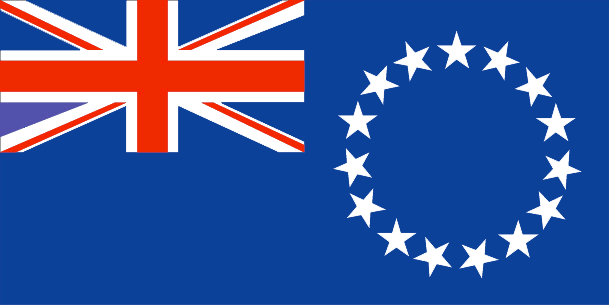
Cook Islands
Pays
Cook (îles)
countryucasefr
COOK (ILES)
Pays en Chinois
Pays en Espagnol
Islas De Cocinero
Pays en Italien
Isole Di Cuoco
Pays en Portugais
Consoles De Cozinheiro
Pays en Allemand
KochcInseln
countryfull
Cook Islands
countrynm
Cook Islands
ISO2
CK
ISO3
COK
countrycodeisono
184
countrycodeolympic
COK
countrycodeirs
CW
countrycodeirsfr
CW
countrycodeirsmixt
CW
♀Féminin
18
6
57
75
currency
dollar
currencyisocode
NZD
currencyisocodefull
NZD 554
currencypxcode
EUR
currencysymbol
NZ$
currencysubdivision
100 cents
currencyregime
float
currencyvalue
0.6966
Capitale
Avarua
capitalfr
Avarua
Préfixe Tél.
682
Superficie km2
236
arealand
240
landarablerate
0.1739
landforestrate
0.957
coastline
120
timezonedeltabegin
-10
flaglink
maplink
ckcolor.gif
outlinemaplink
ck.gif
visapassenger
-1
largestcity
Avarua
rankpopulation
214
Population
20 407
rankgni
210
gni
70000000
rankincomeorigin
94
rankincome
96
income
3500
nationalevent
Constitution Day
nationaleventfr
Jour de la Constitution
nationalholiday
First Monday in August (1965)
Date de naissance aaaa-mm-jj
1965-08-01 00:00:00
2
6
location
Oceania, group of islands in the South Pacific Ocean, about one-half of the way from Hawaii to New Zealand
terrain
low coral atolls in north; volcanic, hilly islands in south
naturalresources
NEGL
9
rgbback
16777215
todate
1
18
id
Pays
Pays en Anglais
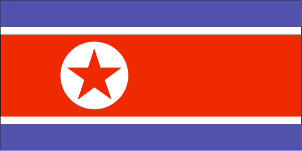
Korea, North
Pays
Corée du Nord
countryucasefr
COREE DU NORD
Pays en Chinois
Pays en Espagnol
Corea, Del norte (Representante Democrático De la Gente)
Pays en Italien
La Corea, Del nord (Rappresentante Democratico Della Gente)
Pays en Portugais
Coreia, Norte (Representante Democrático Dos Povos)
Pays en Allemand
Korea, Nord (Demokratischer VölkercRepräsentant)
countrypy
bei3 han2, bei3 chao2 xian3
countrylocal
Choson
countryfull
Korea, North
countrynm
Korea, North
ISO2
KP
ISO3
PRK
countrycodeisono
408
countrycodeolympic
PRK
countrycodeirs
KN
countrycodeirsfr
KN
countrycodeirsmixt
KN
♀Féminin
6
1
92
languagesfr
Coréen
58
currency
won
currencyfr
won
currencyisocode
KPW
currencyisocodefull
KPW 408
currencypxcode
KPW
currencysymbol
Wn
currencysubdivision
100 chon
currencyvalue
0.4545
nationalityfr
Coréenne
Capitale
Pyongyang
capitalfr
Pyongyang
Préfixe Tél.
850
Superficie km2
120 540
arealand
120 410
areawater
130
landarablerate
0.1412
landforestrate
0.682
coastline
2495
summit
Paektu-san 2 744 m.
boundarycountries
Chine, Corée du Sud.
timezonedeltabegin
9
flaglink
maplink
kpcolor.gif
outlinemaplink
kpout.gif
visapassenger
-1
maincities
Ch'ongjin, Chinnamp'o, Sinuiju, Hungnam, Wonsan, Kaesong, Hamhung, Kimch'aek, Haeju, Sariwon.
largestcity
Pyongyang
largestcitypopulation
3 245 305
rankpopulation
45
Population
22 612 000
rankincome
164
income
735
lifeexpectation
70.79
alphabetizationrate
0.999
natalityrate
0.01761
mortalityrate
0.00693
mortalityrateinfantile
0.02566
precipitation
1001
nationalevent
Founding of the Democratic People's Republic of Korea (DPRK)
nationaleventfr
Création de la République Populaire de Corée
nationalholiday
9 September (1948)
Date de naissance aaaa-mm-jj
1948-09-09 00:00:00
5
1
location
Eastern Asia, northern half of the Korean Peninsula bordering the Korea Bay and the Sea of Japan, between China and South Korea
terrain
mostly hills and mountains separated by deep, narrow valleys; coastal plains wide in west, discontinuous in east
naturalresources
coal, lead, tungsten, zinc, graphite, magnesite, i
9
rgbback
16777215
todate
1
19
id
Pays
Pays en Anglais
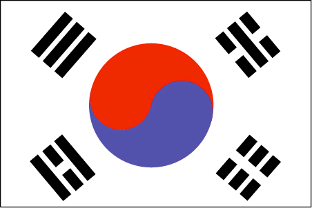
Korea, South
Pays
Corée du Sud
countryucasefr
COREE DU SUD
Pays en Chinois
Pays en Espagnol
Corea, del sur (república de)
Pays en Italien
La Corea, del sud (Repubblica di)
Pays en Portugais
Coreia, sul (república de)
Pays en Allemand
Korea, Süd (Republik von)
countrypy
han2 guo2, guang1 zhou1
countrylocal
Han-guk
countryfull
Korea, South
countrynm
Korea, South
ISO2
KR
ISO3
KOR
countrycodeisono
410
countrycodevehicle
ROK
countrycodeolympic
KOR
countrycodeirs
KS
countrycodeirsfr
CR
countrycodeirsmixt
KR
countrycode
82
♀Féminin
15
6
92
languagesfr
Coréen
59
currency
won
currencyfr
won
currencyisocode
KRW
currencyisocodefull
KRW 410
currencypxcode
KRW
currencysymbol
W
currencysubdivision
100 chon [*]
currencyregime
float
currencyvalue
0.00099
nationalityfr
Coréenne
Capitale
Soul
capitalfr
Séoul
Préfixe Tél.
82
Superficie km2
98 992
arealand
98 190
areawater
290
landarablerate
0.1744
landforestrate
0.633
coastline
2413
summit
Halla-san 1 950 m.
boundarycountries
Corée du Nord.
timezonedeltabegin
9
flaglink
maplink
krcolor.gif
outlinemaplink
krout.gif
maincities
Pusan, Taegu, Inch'on, Kwangju, Taejon, Ulsan, Masan, Sunwon, Chonju.
largestcity
Soul
largestcitypopulation
21 738 345
rankpopulation
26
Population
47 912 000
rankgdp
11
gdp
605331000000
rankgdpppp
14
gdpppp
861042000000
rankgni
11
gni
576426000000
rankincomeorigin
49
rankincome
49
income
12030
rankincomeppp
47
incomeppp
18000
lifeexpectation
75.36
alphabetizationrate
0.9796
natalityrate
0.0126
mortalityrate
0.00603
mortalityrateinfantile
0.00731
precipitation
1371
nationalevent
Liberation Day
nationaleventfr
Jour de la Libération
nationalholiday
15 August (1945)
Date de naissance aaaa-mm-jj
1945-08-15 00:00:00
2
10
location
Eastern Asia, southern half of the Korean Peninsula bordering the Sea of Japan and the Yellow Sea
terrain
mostly hills and mountains; wide coastal plains in west and south
naturalresources
coal, tungsten, graphite, molybdenum, lead, hydrop
cooking
Nouilles Piquantes: Climant froid.
8
Web
rgbback
16777215
todate
1
Notes
Nouilles Piquantes: Climant froid.
20
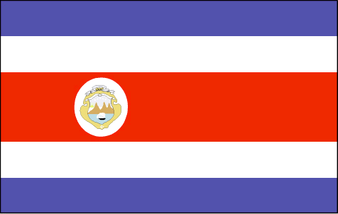
id
Pays
Pays en Anglais
Costa Rica
Pays
Costa Rica
countryucasefr
COSTA RICA
Pays en Chinois
Pays en Espagnol
Costa Rica
Pays en Italien
Costa Rica
Pays en Portugais
Costa Rica
Pays en Allemand
Costa Rica
countrypy
ge1 si1 da4 li2 jia1
countrylocal
Costa Rica
countryfull
Costa Rica
countrynm
Costa Rica
ISO2
CR
ISO3
CRI
countrycodeisono
188
countrycodevehicle
CR
countrycodeolympic
CRC
countrycodeirs
CS
countrycodeirsfr
CS
countrycodeirsmixt
CS
countrycode
506
♀Féminin
15
6
131
languagesfr
Espagnol
29
currency
colon
currencyfr
Colon
currencyisocode
CRC
currencyisocodefull
CRC 188
currencypxcode
CRC
currencysymbol
slashed C
currencysubdivision
100 centimos
currencyregime
float
currencyvalue
0.00211
nationalityfr
Costa Ricaine
Capitale
San Jose
capitalfr
San Jose
Préfixe Tél.
506
Superficie km2
51 100
arealand
50 660
areawater
440
landarablerate
0.0441
landforestrate
0.385
coastline
1290
summit
Cerro Chirripó 3 819 m.
boundarycountries
Nicaragua, Panama.
timezonedeltabegin
-6
flaglink
maplink
crcolor.gif
outlinemaplink
croutl.gif
visapassenger
-1
maincities
Alajuela, Cartago, Limón, Puntarenas, Herdia, Liberia.
largestcity
San Jose
largestcitypopulation
920 000
rankpopulation
122
Population
4 005 000
rankgdp
79
gdp
17427000000
rankgdpppp
74
gdpppp
38469000000
rankgni
75
gni
17203000000
rankincomeorigin
77
rankincome
84
income
4300
rankincomeppp
79
incomeppp
9140
lifeexpectation
77.7
alphabetizationrate
0.928
natalityrate
0.0194
mortalityrate
0.00431
mortalityrateinfantile
0.01082
nationalevent
Independence Day
nationaleventfr
Jour de l'Indépendance
nationalholiday
15 September (1821)
Date de naissance aaaa-mm-jj
1821-09-15 00:00:00
8
6
location
Middle America, bordering both the Caribbean Sea and the North Pacific Ocean, between Nicaragua and Panama
terrain
coastal plains separated by rugged mountains including over 100 volcanic cones, of which several are major volcanoes
naturalresources
hydropower
cooking
Fruits de Mer
9
Web
rgbback
16777215
todate
1
Notes
Fruits de Mer
| Pays/Territoires | Régions en Chine | Provinces de Chine | Régions en France | Départements de France | Provinces du Monde | Villes/Villages | Localités | Continents du Monde | Vins AOP
