国家/地区
最后修正 2021-01-12 18:58:56
在此您可以得到世界各国和地区的法文,英文,中文名称。 这个珍贵的全人类共享的土地的集合,不仅包括世界上的独立国家, 而且也包括非联合国联合国:我联合国人民,团结起来追求更美好的世界!会员国的特殊领域。 请咨询 法语国名/地区名阴阳性详表。
2
id
国家/地区
英语国家/地区名
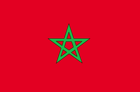
Western Sahara
法语国家/地区名
Sahara d'Ouest
countryucasefr
SAHARA D'OUEST
国家/地区名
西班牙语国家/地区名
Sáhara (Occidental)
意大利语国家/地区名
Il Sahara (Occidentale)
葡萄牙语国家/地区名
Sahara (Ocidental)
德语国家/地区名
Sahara (Westlich)
countryfull
Western Sahara
countrynm
Western Sahara
国际编码2
EH
国际编码3
ESH
countrycodeisono
732
countrycodeirs
WI
countrycodeirsfr
WI
countrycodeirsmixt
WI
♂男性
12
2
3
languagesfr
Arabe
2
currency
euro
currencyfr
Dirham
currencyisocode
EUR
currencyisocodefull
EUR 978
currencypxcode
EUR
currencysymbol
€
currencysubdivision
100 cents
currencyregime
float
currencyvalue
1.2203
首都
El Aioun
capitalfr
El Aioun
面积 km2
266 000
arealand
266 000
landforestrate
0.006
coastline
1110
summit
701 m.
boundarycountries
Maroc, Algérie, Mauritanie.
timezonedeltabegin
1
flaglink
maplink
ehcolor.gif
outlinemaplink
ehout.gif
visapassenger
-1
maincities
Dakhla, Smara.
largestcity
El Aioun
rankpopulation
175
人口
300 905
rankincome
222
lifeexpectation
49.81
natalityrate
0.04507
mortalityrate
0.01611
mortalityrateinfantile
0.13359
growthrate
0.02291
location
Northern Africa, bordering the North Atlantic Ocean, between Mauritania and Morocco
terrain
mostly low, flat desert with large areas of rocky or sandy surfaces rising to small mountains in south and northeast
naturalresources
phosphates, iron ore
9
rgbback
16777215
todate
1
4
id
国家/地区
英语国家/地区名
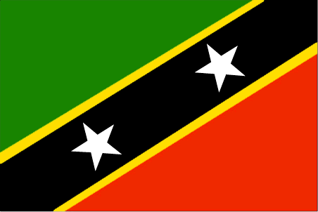
Saint Kitts and Nevis
法语国家/地区名
Saint-Christophe-et-Niévès
countryucasefr
SAINT-CHRISTOPHE-ET-NIEVES
国家/地区名
西班牙语国家/地区名
St. Kitts y Nevis
意大利语国家/地区名
St Kitts e Nevis
葡萄牙语国家/地区名
St. Kitts e Nevis
德语国家/地区名
Str. Kitts und Nevis
countrypy
sheng4 ji1 ci2 he2 ni2 wei2 si1
countrylocal
Saint Kitts and Nevis
countryfull
Saint Kitts and Nevis
countrynm
Saint Kitts and Nevis
国际编码2
KN
国际编码3
KNA
countrycodeisono
659
countrycodeolympic
SKN
countrycodeirs
SC
countrycodeirsfr
SC
countrycodeirsmixt
SC
♂男性
12
6
51
languagesfr
Anglais
35
currency
dollar
currencyfr
dollar des Caraïbes oriental
currencyisocode
XCD
currencyisocodefull
XCD 951
currencypxcode
XCD
currencysymbol
EC$
currencysubdivision
100 cents
currencyregime
US-$ (2.7)
currencyvalue
0.3745
首都
Basseterre
capitalfr
Basseterre
电话号码前缀
1-869
面积 km2
261
arealand
261
landarablerate
0.1667
landforestrate
0.111
coastline
135
summit
Mount Liamuiga 1 156 m.
timezonedeltabegin
-4
flaglink
maplink
kncolor.gif
outlinemaplink
kn.gif
visapassenger
-1
maincities
Charlestown, Newcastle, Sandy Point .
largestcity
Basse-Terre
largestcitypopulation
12 000
rankpopulation
202
人口
47 000
rankgdp
172
gdp
346000000
rankgdpppp
165
gdpppp
579000000
rankgni
196
gni
309000000
rankincomeorigin
65
rankincome
72
income
6630
rankincomeppp
70
incomeppp
10740
nationalevent
Independence Day
nationaleventfr
Jour de l'Indépendance
nationalholiday
19 September (1983)
生日 年-月-日
1983-09-19 00:00:00
10
12
location
Caribbean, islands in the Caribbean Sea, about one-third of the way from Puerto Rico to Trinidad and Tobago
terrain
volcanic with mountainous interiors
naturalresources
arable land
9
网站
rgbback
16777215
todate
1
5
id
国家/地区
英语国家/地区名
San Marino
法语国家/地区名
Saint-Marin
countryucasefr
SAINT-MARIN
国家/地区名
西班牙语国家/地区名
San Marino
意大利语国家/地区名
San Marino
葡萄牙语国家/地区名
San Marino
德语国家/地区名
San Marino
countrypy
sheng4 ma3 li4 nuo4
countrylocal
San Marino
countryfull
San Marino
countrynm
San Marino
国际编码2
SM
国际编码3
SMR
countrycodeisono
674
countrycodevehicle
RSM
countrycodeolympic
SMR
countrycodeirs
SM
countrycodeirsfr
SM
countrycodeirsmixt
SM
15
6
84
languagesfr
Italien
2
currency
euro
currencyfr
euro
currencyisocode
EUR
currencyisocodefull
EUR 978
currencypxcode
EUR
currencysymbol
€
currencysubdivision
100 cents
currencyregime
float
currencyvalue
1.2203
首都
Saint-Marin
capitalfr
Saint-Marin
电话号码前缀
378
面积 km2
62
arealand
61.20
landarablerate
0.1667
summit
Monte Titano 739 m.
boundarycountries
Italie.
timezonedeltabegin
1
flaglink
maplink
sm-map.gif
outlinemaplink
sm.gif
visapassenger
-1
maincities
Serravalle, Borgo Maggiore
largestcity
San Marino
largestcitypopulation
5 000
rankpopulation
206
人口
28 000
rankgdp
156
gdp
880000000
rankgni
178
gni
653000000
rankincomeorigin
15
rankincome
222
rankincomeppp
13
nationalevent
Founding of the Republic
nationaleventfr
Jour National
nationalholiday
3 September (301)
生日 年-月-日
1753-01-01 00:00:00
9
9
location
Southern Europe, an enclave in central Italy
terrain
rugged mountains
naturalresources
building stone
9
网站
rgbback
16777215
todate
1
6
id
国家/地区
英语国家/地区名
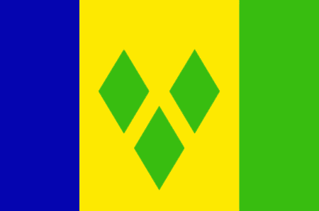
Saint Vincent and the Grenadines
法语国家/地区名
Saint-Vincent-et-les Grenadines
countryucasefr
SAINT-VINCENT-ET-LES GRENADINES
国家/地区名
西班牙语国家/地区名
St. Vincent y el Grenadines
意大利语国家/地区名
St Vincent & il Grenadines
葡萄牙语国家/地区名
St. Vincent & o Grenadines
德语国家/地区名
Str. Vincent u. das Grenadines
countrypy
sheng4 wen2 sen1 te4 he2 ge2 lin2 na4 ding1 si1
countrylocal
Saint Vincent and the Grenadines
countryfull
Saint Vincent and the Grenadines
countrynm
Saint Vincent and the Grenadines
国际编码2
VC
国际编码3
VCT
countrycodeisono
670
countrycodevehicle
WV
countrycodeolympic
VIN
countrycodeirs
VC
countrycodeirsfr
VC
countrycodeirsmixt
VC
18
6
51
languagesfr
Anglais
35
currency
dollar
currencyfr
dollar des Caraïbes orientales
currencyisocode
XCD
currencyisocodefull
XCD 951
currencypxcode
XCD
currencysymbol
EC$
currencysubdivision
100 cents
currencyregime
US-$ (2.7)
currencyvalue
0.3745
nationalityfr
Française
首都
Kingstown
capitalfr
Kingstown
电话号码前缀
1-784
面积 km2
389
arealand
389
landarablerate
0.1026
landforestrate
0.154
coastline
84
summit
Soufrière 1 234 m.
timezonedeltabegin
-4
flaglink
maplink
vccolor.gif
outlinemaplink
vc.gif
visapassenger
-1
maincities
Georgetown, Fancy, Chateaubelair, Layou.
largestcity
Kingstown
largestcitypopulation
27 000
rankpopulation
186
人口
109 000
rankgdp
171
gdp
371000000
rankgdpppp
163
gdpppp
668000000
rankgni
192
gni
361000000
rankincomeorigin
91
rankincome
101
income
3310
rankincomeppp
105
incomeppp
5870
lifeexpectation
73.35
alphabetizationrate
0.96
natalityrate
0.01677
fecondity
2.23
mortalityrate
0.00604
mortalityrateinfantile
0.01524
hdi
0.755
urbanization
0.56
nationalevent
Independence Day
nationaleventfr
Jour de l'Indépendance
nationalholiday
27 October (1979)
生日 年-月-日
1979-10-27 00:00:00
6
8
location
Caribbean, islands between the Caribbean Sea and North Atlantic Ocean, north of Trinidad and Tobago
terrain
volcanic, mountainous
naturalresources
hydropower, cropland
9
网站
rgbback
16777215
todate
1
7
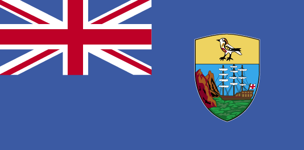
id
国家/地区
英语国家/地区名
Saint Helena
法语国家/地区名
Sainte Hélène
countryucasefr
SAINTE HELENE
国家/地区名
西班牙语国家/地区名
St. Helena
意大利语国家/地区名
La Sant'Elena
葡萄牙语国家/地区名
St. Helena
德语国家/地区名
St. Helena
countryfull
Saint Helena
countrynm
Saint Helena
国际编码2
SH
国际编码3
SHN
countrycodeisono
654
countrycodeirs
SH
countrycodeirsfr
SH
countrycodeirsmixt
SH
12
6
51
89
currency
pound
currencyisocode
SHP
currencyisocodefull
SHP 654
currencypxcode
SHP
currencysymbol
£S
currencysubdivision
100 new pence
currencyregime
GBP (1.0)
currencyvalue
1.8345
首都
Jamestown
capitalfr
Jamestown
电话号码前缀
290
面积 km2
122
arealand
410
landarablerate
0.129
landforestrate
0.065
coastline
60
flaglink
maplink
sh-map.gif
visapassenger
-1
largestcity
Jamestown
rankpopulation
222
人口
7 212
rankgni
215
gni
30000000
rankincomeorigin
78
rankincome
85
income
4286
nationalevent
Birthday of Queen ELIZABETH II
nationaleventfr
Anniversaire de la Reine ELIZABETH II
nationalholiday
Second Saturday in June (1926)
生日 年-月-日
1926-06-01 00:00:00
3
3
location
islands in the South Atlantic Ocean, about midway between South America and Africa
terrain
Saint Helena - rugged, volcanic; small scattered plateaus and plains (the other islands of the group have a volcanic origin)
naturalresources
fish
9
rgbback
16777215
todate
1
8
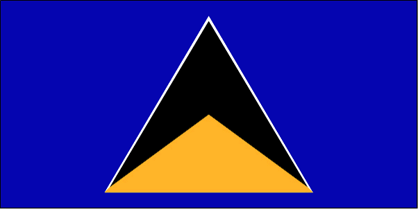
id
国家/地区
英语国家/地区名
Saint Lucia
法语国家/地区名
Sainte-Lucie
countryucasefr
SAINTE-LUCIE
国家/地区名
西班牙语国家/地区名
St. Lucia
意大利语国家/地区名
St Lucia
葡萄牙语国家/地区名
St. Lucia
德语国家/地区名
Str. Lucia
countrypy
sheng4 lu2 xi1 ya4
countrylocal
Saint Lucia
countryfull
Saint Lucia
countrynm
Saint Lucia
国际编码2
LC
国际编码3
LCA
countrycodeisono
662
countrycodevehicle
WL
countrycodeolympic
LCA
countrycodeirs
ST
countrycodeirsfr
ST
countrycodeirsmixt
ST
♀女性
18
6
51
languagesfr
Anglais
35
currency
dollar
currencyfr
dollar des Caraïbes orientales
currencyisocode
XCD
currencyisocodefull
XCD 951
currencypxcode
XCD
currencysymbol
EC$
currencysubdivision
100 cents
currencyregime
US-$ (2.7)
currencyvalue
0.3745
首都
Castries
capitalfr
Castries
电话号码前缀
1-758
面积 km2
620
arealand
606
areawater
10
landarablerate
0.0492
landforestrate
0.148
coastline
158
summit
Mont Gimie 950 m.
timezonedeltabegin
-4
flaglink
maplink
lccolor.gif
outlinemaplink
lc.gif
visapassenger
-1
maincities
Vieux Fort, Dennery, Micoud, Soufrière.
largestcity
Castries
largestcitypopulation
53 000
rankpopulation
181
人口
161 000
rankgdp
165
gdp
693000000
rankgdpppp
158
gdpppp
917000000
rankgni
184
gni
650000000
rankincomeorigin
80
rankincome
88
income
4050
rankincomeppp
114
incomeppp
5310
lifeexpectation
73.34
alphabetizationrate
0.67
natalityrate
0.0205
fecondity
2.27
mortalityrate
0.00518
mortalityrateinfantile
0.01395
hdi
0.775
urbanization
0.38
nationalevent
Independence Day
nationaleventfr
Jour de l'Indépendance
nationalholiday
22 February (1979)
生日 年-月-日
1979-02-22 00:00:00
6
8
president
Reine Elisabeth II
location
Caribbean, island between the Caribbean Sea and North Atlantic Ocean, north of Trinidad and Tobago
terrain
volcanic and mountainous with some broad, fertile valleys
naturalresources
forests, sandy beaches, minerals (pumice), mineral
9
网站
rgbback
16777215
todate
1
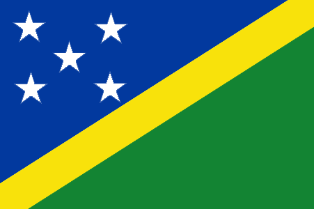
9
id
国家/地区
英语国家/地区名
Solomon Islands
法语国家/地区名
Salomon
countryucasefr
SALOMON
国家/地区名
西班牙语国家/地区名
Islas De Solomon
意大利语国家/地区名
Isole Di Solomon
葡萄牙语国家/地区名
Consoles De Solomon
德语国家/地区名
Inseln Solomon
countryfull
Solomon Islands
countrynm
Solomon Islands
国际编码2
SB
国际编码3
SLB
countrycodeisono
090
countrycodeolympic
SOL
countrycodeirs
BP
countrycodeirsfr
BP
countrycodeirsmixt
BP
18
6
51
languagesfr
Anglais
94
currency
dollar
currencyfr
dollar des Salomon
currencyisocode
SBD
currencyisocodefull
SBD 090
currencypxcode
SBD
currencysymbol
SI$
currencysubdivision
100 cents
currencyregime
composite
currencyvalue
0.1358
首都
Honiara
capitalfr
Honiara
电话号码前缀
677
面积 km2
28 450
arealand
27 540
areawater
910
landarablerate
0.015
landforestrate
0.888
coastline
5313
summit
Mount Makarakomburu 2 447 m.
timezonedeltabegin
11
flaglink
maplink
sbcolor.gif
outlinemaplink
sb.gif
visapassenger
-1
maincities
Kirakira, Auki, Tangarare, Gizo, Gateri.
largestcity
Honiara
largestcitypopulation
53 000
rankpopulation
163
人口
457 000
rankgdp
178
gdp
253000000
rankgdpppp
161
gdpppp
800000000
rankgni
200
gni
255000000
rankincomeorigin
158
rankincome
172
income
560
rankincomeppp
174
incomeppp
1710
lifeexpectation
72.38
alphabetizationrate
0.77
natalityrate
0.0316
fecondity
4.42
mortalityrate
0.00404
mortalityrateinfantile
0.02209
growthrate
0.02756
hdi
0.632
urbanization
0.202
precipitation
3290
nationalevent
Independence Day
nationaleventfr
Jour de l'Indépendance
nationalholiday
7 July (1978)
生日 年-月-日
1978-07-07 00:00:00
5
7
location
Oceania, group of islands in the South Pacific Ocean, east of Papua New Guinea
terrain
mostly rugged mountains with some low coral atolls
naturalresources
fish, forests, gold, bauxite, phosphates, lead, zi
9
rgbback
16777215
todate
1
10
id
国家/地区
英语国家/地区名
American Samoa
法语国家/地区名
Samoa Americaines
countryucasefr
SAMOA AMERICAINES
国家/地区名
西班牙语国家/地区名
Samoa Americana
意大利语国家/地区名
Le Samoa americane
葡萄牙语国家/地区名
Samoa Americanas
德语国家/地区名
Amerikanische Samoa-Inseln
countryfull
American Samoa
countrynm
American Samoa
国际编码2
AS
国际编码3
ASM
countrycodeisono
016
countrycodeolympic
ASA
countrycodeirs
AQ
countrycodeirsfr
AQ
countrycodeirsmixt
AQ
♀女性
17
6
51
languagesfr
Anglais
6
currency
dollar
currencyfr
dollar
currencyisocode
USD
currencyisocodefull
USD 840
currencypxcode
USD
currencysymbol
$
currencysubdivision
100 cents
currencyregime
float
currencyvalue
1
nationalityfr
Andorrane
首都
Pago
capitalfr
Pago
电话号码前缀
1-684
面积 km2
201
arealand
199
landarablerate
0.05
landforestrate
0.601
coastline
116
timezonedeltabegin
-11
flaglink

maplink
ascolor.gif
outlinemaplink
tutuila.gif
visapassenger
-1
largestcity
Pago
rankpopulation
198
人口
57 000
rankincome
222
nationalevent
Flag Day
nationaleventfr
Jour du Drapeau
nationalholiday
17 April (1900)
生日 年-月-日
1900-04-17 00:00:00
7
1
location
Oceania, group of islands in the South Pacific Ocean, about half way between Hawaii and New Zealand
terrain
five volcanic islands with rugged peaks and limited coastal plains, two coral atolls (Rose Island, Swains Island)
naturalresources
pumice, pumicite
9
rgbback
16777215
special
Yes
todate
1
