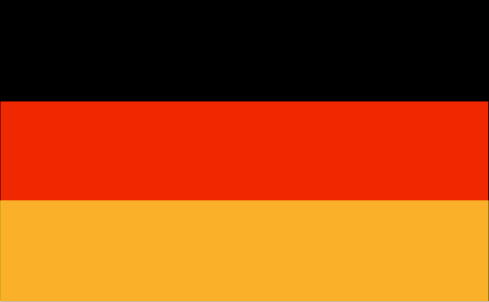
Indonesia 印度尼西亚 => A Country of Beautiful Wood

Indonesia 印度尼西亚 => A Country of Beautiful Wood


The Artisans

Indonesian Furniture Selection

The Objects

History of Indonesian Furniture

Indonesia 印度尼西亚 => A Country of Beautiful Wood

Updated 2023-11-09 09:24:11

Indonesia is a country on the continent Asia, her capital is Jakarta. Here is the hierarchy of the Indonesia administrative divisions: Indonesia is subdivided into provinces, that are at their turn subdivided into regencies (kabupaten), cities (kota), that are at their turn subdivided into districts, that are at their turn subdivided into towns and villages.

The names of countries/territories of the world are taught in English and Chinese. This collection of precious dry lands that shares the whole mankind includes not only the world's independent countries, but also specific areas that are not a UNUnited Nations: We the peoples...A stronger UN for a better world. member. Please visit the table of male and female genders of country names in French.

Countries/locations    Close
Indonesia | Countries/Territories | Regions of China | Provinces of China | Regions in France | French Departments | States/Provinces | Cities/Towns | Locations | World Continents | French AOP Wines

1

id
Country
Country
Gabon
Country in French
Gabon
countryucasefr
GABON
Country in Chinese
Country in Spanish
Gabón
Country in Italian
Il Gabon
Country in Portuguese
Gabon
Country in Germain
Gabun
countrypy
jia1 peng2
countrylocal
Gabon
countryfull
Gabon
countrynm
Gabon
ISO2
GA
ISO3
GAB
countrycodeisono
266
countrycodevehicle
G
countrycodeolympic
GAB
countrycodeirs
GB
countrycodeirsfr
GB
countrycodeirsmixt
GB
♂Male
15
4
57
languagesfr
Français
119
currency
franc
currencyfr
franc C.F.A.
currencyisocode
XAF
currencyisocodefull
XAF 950
currencypxcode
XAF
currencysymbol
CFAF
currencysubdivision
100 centimes [*]
currencyregime
Euro (655.957)
currencyvalue
0.00186
nationalityfr
Française
Capital
Libreville
capitalfr
Libreville
Phone Prefix
241
Area km2
267 667
arealand
257 667
areawater
10 000
landarablerate
0.0126
landforestrate
0.847
coastline
885
summit
Mont Iboudji 1 580 m.
boundarycountries
Guinée équatoriale, Cameroun, Congo.
timezonedeltabegin
1
flaglink
maplink
gacolor.gif
outlinemaplink
gaout.gif
visapassenger
-1
maincities
Port Gentil, Lambarené, Mouila, Tchibanga, Oyem.
largestcity
Libreville
largestcitypopulation
419 000
rankpopulation
148
Population
1 344 000
rankgdp
111
gdp
6057000000
rankgdpppp
131
gdpppp
8600000000
rankgni
124
gni
4489000000
rankincomeorigin
89
rankincome
99
income
3340
rankincomeppp
110
incomeppp
5500
lifeexpectation
56.46
alphabetizationrate
0.71
natalityrate
0.0364
mortalityrate
0.01143
mortalityrateinfantile
0.05434
hdi
0.653
urbanization
0.823
precipitation
2841
nationalevent
Founding of the Gabonese Democratic Party (PDG)
nationaleventfr
Création du Parti Démocratique Gabonais
nationalholiday
12 March (1968)
Birthday yyyy-mm-dd
1968-03-12 00:00:00
5
9
location
Western Africa, bordering the Atlantic Ocean at the Equator, between Republic of the Congo and Equatorial Guinea
terrain
narrow coastal plain; hilly interior; savanna in east and south
naturalresources
petroleum, manganese, uranium, gold, timber, iron
9
Web
rgbback
16777215
todate
1

2

id
Country
Country
Gambia, The
Country in French
Gambie
countryucasefr
GAMBIE
Country in Chinese
Country in Spanish
Gambia
Country in Italian
La Gambia
Country in Portuguese
Gambia
Country in Germain
Gambia
countrypy
gang1 bi3 ya4
countrylocal
The Gambia
countryfull
Gambia, The
countrynm
Gambia, The
ISO2
GM
ISO3
GMB
countrycodeisono
270
countrycodevehicle
WAG
countrycodeolympic
GAM
countrycodeirs
GA
countrycodeirsfr
GA
countrycodeirsmixt
GA
♀Female
15
4
51
languagesfr
Anglais
136
currency
dalasi
currencyfr
Dalasi
currencyisocode
GMD
currencyisocodefull
GMD 270
currencypxcode
GMD
currencysymbol
D
currencysubdivision
100 butut
currencyregime
float
currencyvalue
0.03663
nationalityfr
Gambienne
Capital
Banjul
capitalfr
Banjul
Phone Prefix
220
Area km2
11 295
arealand
10 000
areawater
1 300
landarablerate
0.195
landforestrate
0.481
coastline
80
summit
53 m.
boundarycountries
Sénégal.
flaglink
maplink
gmcolor.gif
outlinemaplink
gmout.gif
visapassenger
-1
maincities
Serrekunda, Brikama, Bakau, Farafenni, Guntur, Sukuta.
largestcity
Banjul
largestcitypopulation
186 000
rankpopulation
146
Population
1 421 000
rankgdp
170
gdp
395000000
rankgdpppp
151
gdpppp
2641000000
rankgni
191
gni
387000000
rankincomeorigin
189
rankincome
203
income
270
rankincomeppp
169
incomeppp
1740
lifeexpectation
54.79
alphabetizationrate
0.3905
natalityrate
0.0403
mortalityrate
0.01208
mortalityrateinfantile
0.07348
hdi
0.463
urbanization
0.536
nationalevent
Independence Day
nationaleventfr
Jour de l'Indépendance
nationalholiday
18 February (1965)
Birthday yyyy-mm-dd
1965-02-18 00:00:00
2
6
location
Western Africa, bordering the North Atlantic Ocean and Senegal
terrain
flood plain of the Gambia River flanked by some low hills
naturalresources
fish
9
Web
rgbback
16777215
todate
1

3

id
Country
Country
Gaza Strip
Country in French
Bande de Gaza
countryucasefr
BANDE DE GAZA
Country in Chinese
Country in Spanish
Tira De Gaza
Country in Italian
Striscia Di Gaza
Country in Portuguese
Tira De Gaza
Country in Germain
Streifen Gaza
countryfull
Gaza Strip
countrynm
Gaza Strip
ISO2
PSEG
ISO3
PSEG
countrycodeisono
275
countrycodeolympic
PLE
countrycodeirs
GZ
countrycodeirsfr
GZ
countrycodeirsmixt
GZ
♀Female
7
2
3
languagesfr
Arabe
54
currency
new shekel
currencyfr
Livre palestinienne
currencyisocode
ILS
currencyisocodefull
ILS 376
currencypxcode
ILS
currencysymbol
NIS
currencysubdivision
100 new agorot
currencyregime
m.float
currencyvalue
0.2268
nationalityfr
Gabonaise
Capital
Hamala
capitalfr
Gaza
Phone Prefix
970
Area km2
360
arealand
360
landarablerate
0.2632
coastline
40
timezonedeltabegin
2
flaglink
maplink
gaza.gif
visapassenger
-1
largestcity
Hamala
Population
1 225 911
rankincome
222
natalityrate
0.04185
mortalityrate
0.00412
mortalityrateinfantile
0.02476
growthrate
0.04
location
Middle East, bordering the Mediterranean Sea, between Egypt and Israel
terrain
flat to rolling, sand- and dune-covered coastal plain
naturalresources
arable land, natural gas
9
rgbback
16777215
todate
1

4

id
Country
Country
Georgia
Country in French
Géorgie
countryucasefr
GEORGIE
Country in Chinese
Country in Spanish
Georgia
Country in Italian
Georgia
Country in Portuguese
Geórgia
Country in Germain
Georgia
countrypy
ge2 lu3 ji2 ya4
countrylocal
Sak'art'velo
countryfull
Georgia
countrynm
Georgia
ISO2
GE
ISO3
GEO
countrycodeisono
268
countrycodevehicle
GE
countrycodeolympic
GEO
countrycodeirs
GG
countrycodeirsfr
GG
countrycodeirsmixt
GG
♀Female
15
6
72
languagesfr
Géorgien
137
currency
lari
currencyfr
rouble
currencyisocode
GEL
currencyisocodefull
GEL 981
currencypxcode
GEL
currencysubdivision
100 tetri
currencyregime
float
nationalityfr
Georgienne
Capital
Tbilisi
capitalfr
Tbilissi
Phone Prefix
995
Area km2
69 700
arealand
69 700
landarablerate
0.1121
landforestrate
0.437
coastline
310
summit
Mt'a Mqinvartsveri 5 048 m.
boundarycountries
Russie, Azerbaïdjan, Arménie, Turquie.
timezonedeltabegin
3
flaglink
maplink
gg-map.gif
outlinemaplink
ge.gif
visapassenger
-1
maincities
Kutaisi, Sukhumi, Rustavi, Batumi, Poti, Tskhinvali, Chiatura, Gori.
largestcity
Tbilisi
largestcitypopulation
1 342 000
rankpopulation
109
Population
5 126 000
rankgdp
128
gdp
3988000000
rankgdpppp
116
gdpppp
13264000000
rankgni
130
gni
3934000000
rankincomeorigin
147
rankincome
161
income
770
rankincomeppp
148
incomeppp
2610
lifeexpectation
64.67
natalityrate
0.01148
mortalityrate
0.01461
mortalityrateinfantile
0.05181
precipitation
498
nationalevent
Independence Day
nationaleventfr
Jour de l'Indépendance
nationalholiday
26 May (1918)
Birthday yyyy-mm-dd
1918-05-26 00:00:00
5
7
location
Southwestern Asia, bordering the Black Sea, between Turkey and Russia
terrain
largely mountainous with Great Caucasus Mountains in the north and Lesser Caucasus Mountains in the south; Kolkhet'is Dablobi (Kolkhida Lowland) opens to the Black Sea in the west; Mtkvari River Basin in the east; good soils in river valley flood plains, foothills of Kolkhida Lowland
naturalresources
forests, hydropower, manganese deposits, iron ore,
7
rgbback
16777215
todate
1

5

id
Country
Country
Germany
Country in French
Allemagne
countryucasefr
ALLEMAGNE
Country in Chinese
Country in Spanish
Alemania
Country in Italian
La Germania
Country in Portuguese
Germany
Country in Germain
Deutschland
countrypy
de2 guo2
countrylocal
Deutschland
countryfull
Germany
countrynm
Germany
ISO2
DE
ISO3
DEU
countrycodeisono
276
countrycodevehicle
D
countrycodeolympic
GER
countrycodeirs
GM
countrycodeirsfr
GM
countrycodeirsmixt
GM
countrycode
49
♀Female
1
17
7
73
languagesfr
Allemand
2
currency
euro
currencyfr
euro
currencyisocode
EUR
currencyisocodefull
EUR 978
currencypxcode
EUR
currencysymbol
currencysubdivision
100 cents
currencyregime
float
currencyvalue
1.2203
nationality
Germain
nationalityfr
Allemande
Capital
Berlin
capitalfr
Berlin
Phone Prefix
49
Area km2
357 000
arealand
349 223
areawater
7 798
landarablerate
0.3388
landforestrate
0.307
coastline
2389
summit
Zugspitze 2 963 m
boundarycountries
France, Luxembourg, Pays-Bas, Belgique, Danemark, Pologne, Tchéquie, Autriche, Suisse.
timezonedeltabegin
1
flaglink
maplink
decolor.gif
outlinemaplink
de.gif
maincities
Hambourg, Munich, Cologne, Essen, Francfort, Dortmund, Stuttgart, Düsseldorf, Leipzig.
largestcity
Berlin
largestcitypopulation
6 482 000
rankpopulation
12
Population
82 541 000
rankgdp
3
gdp
2403160000000
rankgdpppp
5
gdpppp
2291007000000
rankgni
3
gni
2085464000000
rankincomeorigin
22
rankincome
17
income
25270
rankincomeppp
23
incomeppp
27610
lifeexpectation
77.8
alphabetizationrate
0.99
natalityrate
0.00899
mortalityrate
0.01036
mortalityrateinfantile
0.0046
precipitation
933
nationalevent
Unity Day
nationaleventfr
Jour de l'Unité
nationalholiday
3 October (1990)
Birthday yyyy-mm-dd
1990-10-03 00:00:00
7
7
location
Central Europe, bordering the Baltic Sea and the North Sea, between the Netherlands and Poland, south of Denmark
terrain
lowlands in north, uplands in center, Bavarian Alps in south
naturalresources
iron ore, coal, potash, timber, lignite, uranium,
cooking
Bières
4
Web
rgbback
16777215
todate
1
Notes
Spécialiste de Bières. 
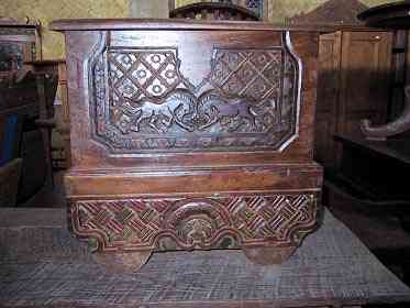
Qu'y a-t-il d'étonnant, le cheval de métal ne fait-il pas penser aux Mercedes-Benz, BMW et à Michael Schumacher ?

More+
A | B | C | D | E | F | G | H | I | J | K | L | M | N | O | P | Q | R | S | T | U | V | W | X | Y | Z
 

Give us feedback (37)

37. Visitor *.*.164.* - 2022-03-16 17:43:29
Buenas recomendaciones y todo lo que lleva el contenido de la web es increíble!
36. Visitor *.*.222.* - 2022-02-09 12:45:33
Los materiales que se utilizan para realizar este tipo de prácticas están todos hechos de madera!
35. Visitor *.*.225.* - 2022-01-24 16:55:06
Buenas ideas sabemos como podemos inspirarnos gracias a links así!
34. Visitor *.*.32.* - 2022-01-19 19:32:41
Los sitios web de esta manera me inspiran a seguir trabajando duro!
33. Visitor *.*.146.* - 2021-11-26 15:19:37
Excellent information on your content, thank you for taking the time to share with us.
Email Web

Please copy the string:
String to copy.

Asia Home™ > Indonesia > Gabon 加蓬 => Indonesia 印度尼西亚 => A Country of Beautiful Wood | General Sales Conditions | Returns and refunding | Privacy Policy | FAQ
  

Want to come? | Call us 7/700 33 467 790 487 (Phone)

Popup Window    Close
Patience please...