Countries/Territories
Updated 2021-01-12 18:58:07
The names of countries/territories of the world are taught in English and Chinese. This collection of precious dry lands that shares the whole mankind includes not only the world's independent countries, but also specific areas that are not a UNUnited Nations: We the peoples...A stronger UN for a better world. member. Please visit the table of male and female genders of country names in French.
Countries/locations Close
1
id
Country
Country
Namibia
Country in French
Namibie
countryucasefr
NAMIBIE
Country in Chinese
Country in Spanish
Namibia
Country in Italian
Il Namibia
Country in Portuguese
Namíbia
Country in Germain
Namibia
countrypy
na4 mi3 bi3 ya4
countrylocal
Namibia
countryfull
Namibia
countrynm
Namibia
ISO2
NA
ISO3
NAM
countrycodeisono
516
countrycodevehicle
NAM
countrycodeolympic
NAM
countrycodeirs
WA
countrycodeirsfr
WA
countrycodeirsmixt
WA
♀Female
15
4
1
languagesfr
Afrikaans, allemand, anglais
72
currency
dollar
currencyfr
rand
currencyisocode
NAD
currencyisocodefull
NAD 516
currencypxcode
NAD
currencysymbol
N$
currencysubdivision
100 cents
currencyregime
South African Rand (1.0)
currencyvalue
0.1457
nationalityfr
Namibienne
Capital
Windhoek
capitalfr
Windhoek
Phone Prefix
264
Area km2
825 418
arealand
825 418
landarablerate
0.0099
landforestrate
0.098
coastline
1572
summit
Konigstein 2 606 m.
boundarycountries
Angola, Zambie, Afrique du Sud, Botswana.
timezonedeltabegin
2
flaglink
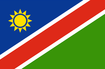
maplink
nacolor.gif
outlinemaplink
naout.gif
visapassenger
-1
maincities
Walvis Bay, Tsumeb, Lüderitz, Keetmanshoop, Otjiwarongo, Swakopmund.
largestcity
Windhoek
largestcitypopulation
190 000
rankpopulation
141
Population
2 015 000
rankgdp
124
gdp
4271000000
rankgdpppp
117
gdpppp
12450000000
rankgni
132
gni
3883000000
rankincomeorigin
112
rankincome
122
income
1930
rankincomeppp
95
incomeppp
6660
lifeexpectation
42.77
alphabetizationrate
0.814
natalityrate
0.0341
mortalityrate
0.01917
mortalityrateinfantile
0.06844
hdi
0.601
nationalevent
Independence Day
nationaleventfr
Jour de l'Indépendance
nationalholiday
21 March (1990)
Birthday yyyy-mm-dd
1990-03-21 00:00:00
7
7
location
Southern Africa, bordering the South Atlantic Ocean, between Angola and South Africa
terrain
mostly high plateau; Namib Desert along coast; Kalahari Desert in east
naturalresources
diamonds, copper, uranium, gold, lead, tin, lithiu
9
Web
rgbback
16777215
todate
1
2
id
Country
Country
Nauru
Country in French
Nauru
countryucasefr
NAURU
Country in Chinese
Country in Spanish
Nauru
Country in Italian
Il Nauru
Country in Portuguese
Nauru
Country in Germain
Nauru
countrypy
nao4 lu3
countrylocal
Nauru
countryfull
Nauru
countrynm
Nauru
ISO2
NR
ISO3
NRU
countrycodeisono
520
countrycodevehicle
NAU
countrycodeolympic
NRU
countrycodeirs
NR
countrycodeirsfr
NR
countrycodeirsmixt
NR
♂Male
15
6
186
languagesfr
Nauru
10
currency
dollar
currencyfr
dollar australien
currencyisocode
AUD
currencyisocodefull
AUD 036
currencypxcode
AUD
currencysymbol
A$
currencysubdivision
100 cents
currencyregime
float
currencyvalue
0.7485
Capital
Yaren District
capitalfr
Yaren
Phone Prefix
674
Area km2
21
arealand
21
coastline
30
summit
61 m.
timezonedeltabegin
12
flaglink
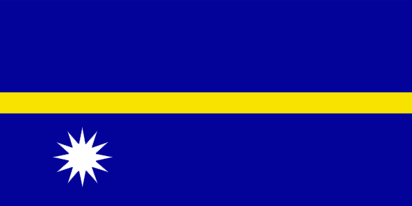
maplink
nrcolor.gif
outlinemaplink
nr.gif
visapassenger
-1
maincities
Anabar, Anibare, Anna, Ijuw, Uaboe, Yangor.
largestcity
Yaren District
largestcitypopulation
10 000
rankpopulation
220
Population
12 809
rankgni
205
gni
140000000
rankincomeorigin
48
rankincome
52
income
11667
lifeexpectation
62.33
natalityrate
0.02561
mortalityrate
0.00695
mortalityrateinfantile
0.01014
urbanization
1
nationalevent
Independence Day
nationaleventfr
Jour de l'Indépendance
nationalholiday
31 January (1968)
Birthday yyyy-mm-dd
1968-01-31 00:00:00
5
9
location
Oceania, island in the South Pacific Ocean, south of the Marshall Islands
terrain
sandy beach rises to fertile ring around raised coral reefs with phosphate plateau in center
naturalresources
phosphates, fish
9
rgbback
16777215
todate
1
3
id
Country
Country
Nepal
Country in French
Népal
countryucasefr
NEPAL
Country in Chinese
Country in Spanish
Nepal
Country in Italian
Il Nepal
Country in Portuguese
Nepal
Country in Germain
Nepal
countrypy
ni2 bo2 er3
countrylocal
Nepal
countryfull
Nepal
countrynm
Nepal
ISO2
NP
ISO3
NPL
countrycodeisono
524
countrycodevehicle
NEP
countrycodeolympic
NEP
countrycodeirs
NP
countrycodeirsfr
NP
countrycodeirsmixt
NP
♂Male
18
6
107
languagesfr
Nepali
73
currency
rupee
currencyfr
roupie népalaise
currencyisocode
NPR
currencyisocodefull
NPR 524
currencypxcode
NPR
currencysymbol
NRs
currencysubdivision
100 paise
currencyregime
composite
currencyvalue
0.01505
nationalityfr
Népalaise
Capital
Kathmandu
capitalfr
Katmandou
Phone Prefix
977
Area km2
140 791
arealand
136 800
areawater
4 000
landarablerate
0.2027
landforestrate
0.273
summit
Everest 8 850 m.
boundarycountries
Inde, Chine.
timezonedeltabegin
5.75
flaglink
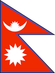
maplink
npcolor.gif
outlinemaplink
npout.gif
visapassenger
-1
maincities
Sallyana, Patan, Jumla, Biratnagar, Lalitpur, Bhaktapur, Pokhara.
largestcity
Kathmandu
largestcitypopulation
533 000
rankpopulation
44
Population
24 660 000
rankgdp
113
gdp
5851000000
rankgdpppp
78
gdpppp
35015000000
rankgni
113
gni
5868000000
rankincomeorigin
192
rankincome
206
income
240
rankincomeppp
179
incomeppp
1420
lifeexpectation
59
alphabetizationrate
0.3816
natalityrate
0.03246
mortalityrate
0.00984
mortalityrateinfantile
0.07057
hdi
0.49
nationalevent
Birthday of King GYANENDRA
nationaleventfr
Anniversaire du Roi GYANENDRA
nationalholiday
7 July (1946)
Birthday yyyy-mm-dd
1946-07-07 00:00:00
3
11
location
Southern Asia, between China and India
terrain
Terai or flat river plain of the Ganges in south, central hill region, rugged Himalayas in north
naturalresources
quartz, water, timber, hydropower, scenic beauty,
cooking
Encens spirituels.
9
rgbback
16777215
todate
1
Notes
Encens spirituels.
4
id
Country
Country
Netherlands
Country in French
Pays-Bas
countryucasefr
PAYS-BAS
Country in Chinese
Country in Spanish
Países Bajos
Country in Italian
I Paesi Bassi
Country in Portuguese
Países Baixos
Country in Germain
Die Niederlande
countrypy
he2 lan2
countrylocal
Nederland/Holland
countryfull
Netherlands
countrynm
Netherlands
ISO2
NL
ISO3
NLD
countrycodeisono
528
countrycodevehicle
NL
countrycodeolympic
NED
countrycodeirs
NL
countrycodeirsfr
NL
countrycodeirsmixt
NL
countrycode
31
♂Male
1
12
6
24
languagesfr
Néerlandais
2
currency
euro
currencyfr
euro
currencyisocode
EUR
currencyisocodefull
EUR 978
currencypxcode
EUR
currencysymbol
€
currencysubdivision
100 cents
currencyregime
float
currencyvalue
1.2203
nationality
Hollandese
nationalityfr
Hollandaise
Capital
Amsterdam
capitalfr
Amsterdam
Phone Prefix
31
Area km2
41 000
arealand
33 883
areawater
7 643
landarablerate
0.2653
landforestrate
0.111
coastline
451
summit
Vaalserberg 321 m.
boundarycountries
Allemagne, Belgique.
timezonedeltabegin
1
flaglink
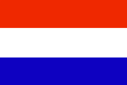
maplink
nlcolor.gif
outlinemaplink
nl.gif
maincities
Rotterdam, La Haye, Utrecht, Eindhoven, Groningue, Tilburg, Haarlem, Nimégue, Apeldoorn, Enschede
largestcity
Amsterdam
largestcitypopulation
1 108 000
rankpopulation
56
Population
16 222 000
rankgdp
14
gdp
511502000000
rankgdpppp
18
gdpppp
476454000000
rankgni
15
gni
425556000000
rankincomeorigin
18
rankincome
14
income
26230
rankincomeppp
18
incomeppp
28560
lifeexpectation
78.6
alphabetizationrate
0.99
natalityrate
0.0043
precipitation
760
nationalevent
Queen's Day (Birthday of Queen-Mother JULIANA in 1909 and accession to the throne of her oldest daughter BEATRIX in 1980)
nationaleventfr
Jour de la Reine (Anniversaire de la Reine Mère JULIANA en 1909)
nationalholiday
30 April
Birthday yyyy-mm-dd
2000-04-30 00:00:00
7
5
president
Reine BEATRIX des Pays Bas
location
Western Europe, bordering the North Sea, between Belgium and Germany
terrain
mostly coastal lowland and reclaimed land (polders); some hills in southeast
naturalresources
natural gas, petroleum, arable land
cooking
Purées de Piments.
phoneinputmask
CC CC CC CC CC CCCCCCCCCCCCCCCCCCCCCCCCCCCCCCCCCCC;;_
4
Web
rgbback
16777215
todate
1
Notes
Purées de Piments.
5
id
Country
Country
New Zealand
Country in French
Nouvelle-Zélande
countryucasefr
NOUVELLE-ZELANDE
Country in Chinese
Country in Spanish
Zealand Nuevo
Country in Italian
La Nuova Zelanda
Country in Portuguese
Zealand Novo
Country in Germain
Neues Seeland
countrypy
xin1 xi1 lan2
countrylocal
Aotearoa
countryfull
New Zealand
countrynm
New Zealand
ISO2
NZ
ISO3
NZL
countrycodeisono
554
countrycodevehicle
NZ
countrycodeolympic
NZL
countrycodeirs
NZ
countrycodeirsfr
NZ
countrycodeirsmixt
NZ
♀Female
18
6
51
languagesfr
Anglais, Maori
75
currency
dollar
currencyfr
dollar néo-zélandais
currencyisocode
NZD
currencyisocodefull
NZD 554
currencypxcode
NZD
currencysymbol
NZ$
currencysubdivision
100 cents
currencyregime
float
currencyvalue
0.6966
nationalityfr
Nouvelle Zélandaise
Capital
Wellington
capitalfr
Wellington
Phone Prefix
64
Area km2
268 676
landarablerate
0.058
landforestrate
0.297
coastline
15134
summit
Mount Cook 3 764 m.
timezonedeltabegin
12
flaglink
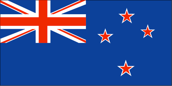
maplink
nzcolor.gif
outlinemaplink
nz.gif
maincities
Auckland, Christchurch, Napier-Hastings, Dunedin, Hamilton, Waitemata, Palmerston North, Invercargill, New Plymouth, Nelson, Whangarei, Whanganui.
largestcity
Auckland
largestcitypopulation
945 000
rankpopulation
121
Population
4 009 000
rankgdp
45
gdp
79572000000
rankgdpppp
57
gdpppp
90538000000
rankgni
48
gni
62249000000
rankincomeorigin
40
rankincome
34
income
15530
rankincomeppp
36
incomeppp
21350
lifeexpectation
78.5
alphabetizationrate
0.99
natalityrate
0.0146
mortalityrate
0.007
mortalityrateinfantile
0.0055
hdi
0.777
urbanization
0.434
precipitation
1120
nationalevent
Waitangi Day (Treaty of Waitangi established British sovereignty over New Zealand)
nationaleventfr
Jour Waitangi
nationalholiday
6 February (1840)
Birthday yyyy-mm-dd
1840-02-06 00:00:00
7
1
location
Oceania, islands in the South Pacific Ocean, southeast of Australia
terrain
predominately mountainous with some large coastal plains
naturalresources
natural gas, iron ore, sand, coal, timber, hydropo
cooking
Fruits de Mer
9
Web
rgbback
16777215
todate
1
Notes
Fruits de Mer
6
id
Country
Country
Nicaragua
Country in French
Nicaragua
countryucasefr
NICARAGUA
Country in Chinese
Country in Spanish
Nicaragua
Country in Italian
La Nicaragua
Country in Portuguese
Nicarágua
Country in Germain
Nicaragua
countrypy
ni2 jia1 la1 gua1
countrylocal
Nicaragua
countryfull
Nicaragua
countrynm
Nicaragua
ISO2
NI
ISO3
NIC
countrycodeisono
558
countrycodevehicle
NIC
countrycodeolympic
NCA
countrycodeirs
NU
countrycodeirsfr
NU
countrycodeirsmixt
NU
countrycode
505
♂Male
15
6
131
languagesfr
Espagnol
76
currency
gold cordoba
currencyfr
cordoba
currencyisocode
NIO
currencyisocodefull
NIO 558
currencypxcode
NIO
currencysymbol
C$
currencysubdivision
100 centavos
currencyregime
indicators
currencyvalue
0.06146
nationalityfr
Nicaraquaïenne
Capital
Managua
capitalfr
Managua
Phone Prefix
505
Area km2
129 494
arealand
120 254
areawater
9 240
landarablerate
0.2024
landforestrate
0.27
coastline
910
summit
Cerro Mogotón 2 438 m
boundarycountries
Honduras, Costa Rica.
timezonedeltabegin
-5
flaglink
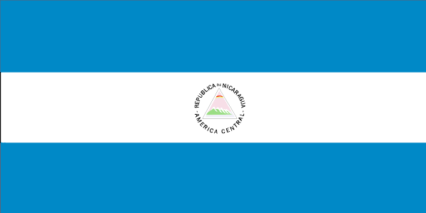
maplink
nicolor.gif
outlinemaplink
nioutl.gif
visapassenger
-1
maincities
Rosita, León, Granada, Masaya, Chinandega, Matagalpa, San Carlos, Estelí, Jinotepe .
largestcity
Managua
largestcitypopulation
1 124 000
rankpopulation
103
Population
5 480 000
rankgdp
127
gdp
4083000000
rankgdpppp
102
gdpppp
17877000000
rankgni
127
gni
4082000000
rankincomeorigin
148
rankincome
162
income
740
rankincomeppp
143
incomeppp
3180
lifeexpectation
70
alphabetizationrate
0.672
natalityrate
0.02558
mortalityrate
0.00463
mortalityrateinfantile
0.03025
hdi
0.643
urbanization
0.565
precipitation
1147
nationalevent
Independence Day
nationaleventfr
Jour de l'Indépendance
nationalholiday
15 September (1821)
Birthday yyyy-mm-dd
1821-09-15 00:00:00
8
6
location
Middle America, bordering both the Caribbean Sea and the North Pacific Ocean, between Costa Rica and Honduras
terrain
extensive Atlantic coastal plains rising to central interior mountains; narrow Pacific coastal plain interrupted by volcanoes
naturalresources
gold, silver, copper, tungsten, lead, zinc, timber
9
Web
rgbback
16777215
todate
1
7
id
Country
Country
Niger
Country in French
Niger
countryucasefr
NIGER
Country in Chinese
Country in Spanish
Niger
Country in Italian
Il Niger
Country in Portuguese
Niger
Country in Germain
Niger
countrypy
ni2 ri4 er3
countrylocal
Niger
countryfull
Niger
countrynm
Niger
ISO2
NE
ISO3
NER
countrycodeisono
562
countrycodevehicle
RN
countrycodeolympic
NIG
countrycodeirs
NG
countrycodeirsfr
NG
countrycodeirsmixt
NG
♂Male
15
6
57
languagesfr
Français
119
currency
franc
currencyfr
franc C.F.A.
currencyisocode
XOF
currencyisocodefull
XOF 952
currencypxcode
XOF
currencysymbol
CFAF
currencysubdivision
100 centimes
currencyregime
Euro (655.957)
currencyvalue
0.00186
nationalityfr
Nigérienne
Capital
Niamey
capitalfr
Niamey
Phone Prefix
227
Area km2
1 267 000
arealand
1 266 700
areawater
300
landarablerate
0.0394
landforestrate
0.01
summit
Mont Gréboun 1 944 m.
boundarycountries
Burkina Faso, Mali, Algérie, Libye, Tchad, Nigeria, Bénin.
timezonedeltabegin
1
flaglink
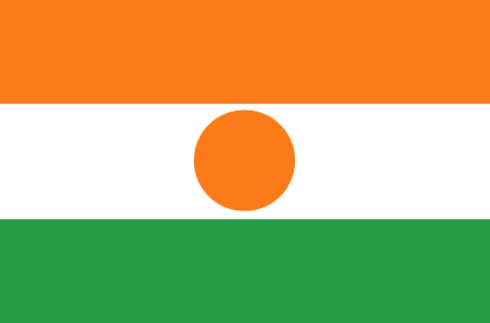
maplink
necolor.gif
outlinemaplink
neout.gif
visapassenger
-1
maincities
Zinder, Maradi, Tahoua, Birni n'Konni, Agadez, Filigué, Dosso.
largestcity
Niamey
largestcitypopulation
587 000
rankpopulation
66
Population
11 762 000
rankgdp
137
gdp
2731000000
rankgdpppp
125
gdpppp
9818000000
rankgni
148
gni
2382000000
rankincomeorigin
197
rankincome
211
income
200
rankincomeppp
195
incomeppp
830
lifeexpectation
42.18
alphabetizationrate
0.172
natalityrate
0.04891
mortalityrate
0.02151
mortalityrateinfantile
0.12266
hdi
0.292
urbanization
0.211
nationalevent
Republic Day
nationaleventfr
Jour de la République
nationalholiday
18 December (1958)
Birthday yyyy-mm-dd
1958-12-18 00:00:00
5
11
location
Western Africa, southeast of Algeria
terrain
predominately desert plains and sand dunes; flat to rolling plains in south; hills in north
naturalresources
uranium, coal, iron ore, tin, phosphates, gold, pe
9
Web
rgbback
16777215
todate
1
8
id
Country
Country
Nigeria
Country in French
Nigeria
countryucasefr
NIGERIA
Country in Chinese
Country in Spanish
Nigeria
Country in Italian
La Nigeria
Country in Portuguese
Nigéria
Country in Germain
Nigeria
countrypy
ni2 ri4 li4 ya4
countrylocal
Nigeria
countryfull
Nigeria
countrynm
Nigeria
ISO2
NG
ISO3
NGA
countrycodeisono
566
countrycodevehicle
WAN
countrycodeolympic
NGR
countrycodeirs
NI
countrycodeirsfr
NI
countrycodeirsmixt
NI
countrycode
234
♂Male
15
7
51
languagesfr
Anglais
77
currency
naira
currencyfr
naira
currencyisocode
NGN
currencyisocodefull
NGN 566
currencypxcode
NGN
currencysymbol
double-das
currencysubdivision
100 kobo
currencyregime
US-$ ((82.0))
currencyvalue
0.00768
nationalityfr
Nigérianne
Capital
Abuja
capitalfr
Abuja
Phone Prefix
234
Area km2
923 768
arealand
910 768
areawater
13 000
landarablerate
0.3096
landforestrate
0.148
coastline
853
summit
Chappal Wadi 2 419 m.
boundarycountries
Bénin, Niger, Tchad, Cameroun.
timezonedeltabegin
1
flaglink
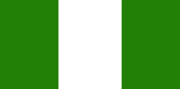
maplink
ngcolor.gif
outlinemaplink
ngout.gif
visapassenger
-1
maincities
Lagos, Ibadan, Ogbomosho, Kano, Oshogbo, Ilorin, Port Harcourt, Abeokuta, Zaria, Ilesha, Onitsha, Kaduna, Enugu, Aba, Benin City, Sokoto, Calabar.
largestcity
Lagos
largestcitypopulation
10 287 000
rankpopulation
9
Population
136 461 000
rankgdp
52
gdp
58390000000
rankgdpppp
49
gdpppp
143238000000
rankgni
53
gni
47549000000
rankincomeorigin
178
rankincome
192
income
350
rankincomeppp
193
incomeppp
900
lifeexpectation
51.01
alphabetizationrate
0.507
natalityrate
0.03875
mortalityrate
0.01376
mortalityrateinfantile
0.07135
precipitation
1507
nationalevent
Independence Day (National Day)
nationaleventfr
Jour de l'Indépendance (Jour National)
nationalholiday
1 October (1960)
Birthday yyyy-mm-dd
1960-10-01 00:00:00
7
1
location
Western Africa, bordering the Gulf of Guinea, between Benin and Cameroon
terrain
southern lowlands merge into central hills and plateaus; mountains in southeast, plains in north
naturalresources
natural gas, petroleum, tin, columbite, iron ore,
9
Web
rgbback
16777215
todate
1
9
id
Country
Country
North America
Country in French
North America
countryucasefr
North America
Country in Chinese
Country in Spanish
North America
Country in Italian
North America
Country in Portuguese
North America
Country in Germain
North America
ISO2
NAC
ISO3
NAC
todate
1
10
id
Country
Country
Norway
Country in French
Norvège
countryucasefr
NORVEGE
Country in Chinese
Country in Spanish
Noruega
Country in Italian
La Norvegia
Country in Portuguese
Noruega
Country in Germain
Norwegen
countrypy
nuo2 wei1
countrylocal
Norge
countryfull
Norway
countrynm
Norway
ISO2
NO
ISO3
NOR
countrycodeisono
578
countrycodevehicle
N
countrycodeolympic
NOR
countrycodeirs
NO
countrycodeirsfr
NO
countrycodeirsmixt
NO
countrycode
47
♀Female
1
12
6
110
languagesfr
Norvégien
78
currency
krone (pl. kroner)
currencyfr
krone
currencyisocode
NOK
currencyisocodefull
NOK 578
currencypxcode
NOK
currencysymbol
NKr
currencysubdivision
100 øre
currencyregime
float
currencyvalue
0.1546
nationalityfr
Norvégienne
Capital
Oslo
capitalfr
Oslo
Phone Prefix
47
Area km2
324 219
arealand
307 860
areawater
16 360
landarablerate
0.0294
landforestrate
0.289
coastline
21925
summit
Glittertinden 2 472 m.
boundarycountries
Suède, Finlande, Russie.
timezonedeltabegin
1
flaglink
maplink
nocolor.gif
outlinemaplink
no.gif
visapassenger
-1
maincities
Bergen, Trondheim, Stavanger, Kristianstad, Drammen, Tromsø, Alesund, Bodø, Skien, Fredrikstad.
largestcity
Oslo
largestcitypopulation
702 000
rankpopulation
113
Population
4 562 000
rankgdp
22
gdp
220854000000
rankgdpppp
41
gdpppp
171850000000
rankgni
23
gni
197991000000
rankincomeorigin
3
rankincome
2
income
43400
rankincomeppp
3
incomeppp
37910
lifeexpectation
79.25
alphabetizationrate
1
natalityrate
0.01189
mortalityrate
0.00951
mortalityrateinfantile
0.00373
hdi
0.944
urbanization
0.776
precipitation
763
nationalevent
Constitution Day
nationaleventfr
Jour de la Constitution
nationalholiday
17 May (1814)
Birthday yyyy-mm-dd
1814-05-17 00:00:00
1
11
location
Northern Europe, bordering the North Sea and the North Atlantic Ocean, west of Sweden
terrain
glaciated; mostly high plateaus and rugged mountains broken by fertile valleys; small, scattered plains; coastline deeply indented by fjords; arctic tundra in north
naturalresources
petroleum, copper, natural gas, pyrites, nickel, i
cooking
Saumons Sauvages.
7
Web
rgbback
16777215
todate
1
Notes
Saumons Sauvages.
| Countries/Territories | Regions of China | Provinces of China | Regions in France | French Departments | States/Provinces | Cities/Towns | Locations | World Continents | French AOP Wines
