Countries/Territories
Updated 2021-01-12 18:58:56
The names of countries/territories of the world are taught in English and Chinese. This collection of precious dry lands that shares the whole mankind includes not only the world's independent countries, but also specific areas that are not a UNUnited Nations: We the peoples...A stronger UN for a better world. member. Please visit the table of male and female genders of country names in French.
Countries/locations Close
1
id
Country
Country
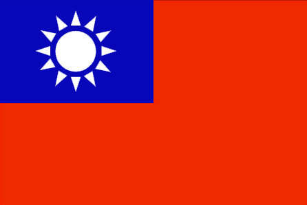
Taiwan
Country in French
Taïwan
countryucasefr
TAIWAN
Country in Chinese
Country in Spanish
Taiwán
Country in Italian
Taiwan
Country in Portuguese
Formosa
Country in Germain
Taiwan
countrypy
tai2 wan1
countrylocal
T'ai-wan
countryfull
Taiwan
countrynm
Taiwan
ISO2
TW
ISO3
TWN
countrycodeisono
158
countrycodeolympic
TPE
countrycodeirs
TW
countrycodeirsfr
TW
countrycodeirsmixt
TW
countrycode
886
14
6
163
languagesfr
Chinois
102
currency
new dollar
currencyfr
dollar de Taïwan
currencyisocode
TWD
currencyisocodefull
TWD 901
currencypxcode
TWD
currencysymbol
NT$
currencysubdivision
100 cents
currencyvalue
0.03191
nationalityfr
Taïwanaise
Capital
Taipei
capitalfr
Taipei
Phone Prefix
886
Area km2
35 980
arealand
32 260
areawater
3 720
landarablerate
0.24
coastline
1566.3
summit
Hsinkao Shan 3 997 m.
timezonedeltabegin
8
flaglink
maplink
twlarge.gif
outlinemaplink
twout.gif
visapassenger
-1
maincities
Kao-hsiung, T'ai-chung, T'ai-nan, Panchiao, Chi-lung, Hsin-chu, Chia-li, Chung-li.
largestcity
Taipei
largestcitypopulation
8 030 751
rankpopulation
47
Population
22 191 087
rankgni
17
gni
321000000000
rankincomeorigin
38
rankincome
40
income
14267
lifeexpectation
76.87
alphabetizationrate
0.919
natalityrate
0.01274
mortalityrate
0.0062
mortalityrateinfantile
0.00665
nationalevent
Republic Day (Anniversary of the Chinese Revolution)
nationaleventfr
Jour de la République (Anniversaire de la Révolution Chinoise)
nationalholiday
10 October (1911)
Birthday yyyy-mm-dd
1911-10-10 00:00:00
8
12
location
Eastern Asia, islands bordering the East China Sea, Philippine Sea, South China Sea, and Taiwan Strait, north of the Philippines, off the southeastern coast of China
terrain
eastern two-thirds mostly rugged mountains; flat to gently rolling plains in west
naturalresources
small deposits of coal, natural gas, limestone, ma
cooking
Nouilles de Riz.
8
Web
rgbback
16777215
todate
1
Notes
Nouilles de Riz.
2
id
Country
Country
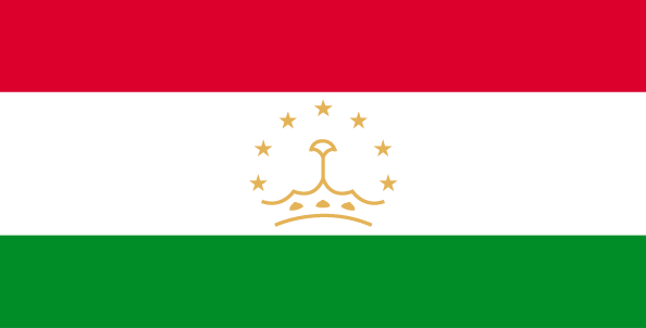
Tajikistan
Country in French
Tadjikistan
countryucasefr
TADJIKISTAN
Country in Chinese
Country in Spanish
Tajikistan
Country in Italian
Tajikistan
Country in Portuguese
Tajikistan
Country in Germain
Tajikistan
countrypy
ta3 ji2 ke4 si1 tan3
countrylocal
Jumhurii Tojikiston
countryfull
Tajikistan
countrynm
Tajikistan
ISO2
TJ
ISO3
TJK
countrycodeisono
762
countrycodevehicle
TJ
countrycodeolympic
TJK
countrycodeirs
TI
countrycodeirsfr
TI
countrycodeirsmixt
TI
♂Male
15
4
199
languagesfr
Tadjik
158
currency
somoni
currencyfr
rouble
currencyisocode
TJS
currencyisocodefull
TJS 762
currencypxcode
TJS
currencysymbol
100 dirams
nationalityfr
Tajik
Capital
Dushanbe
capitalfr
Douchanbe
Phone Prefix
992
Area km2
143 100
arealand
142 700
areawater
400
landarablerate
0.0541
landforestrate
0.028
summit
Qullai Kommunizm 7 495 m.
boundarycountries
Ouzbekistan, Kirghizstan, Chine, Afghanistan.
timezonedeltabegin
5
flaglink
maplink
tjcolor.gif
outlinemaplink
tjout.gif
visapassenger
-1
maincities
Khodzent, Kulyab, Kurgan-Tyube, Kanibadam, Tursunzade, Khorogl.
largestcity
Dushanbe
largestcitypopulation
664 000
rankpopulation
98
Population
6 305 000
rankgdp
149
gdp
1553000000
rankgdpppp
135
gdpppp
6976000000
rankgni
162
gni
1343000000
rankincomeorigin
195
rankincome
209
income
210
rankincomeppp
188
incomeppp
1040
lifeexpectation
64.47
alphabetizationrate
0.994
natalityrate
0.03263
mortalityrate
0.00842
mortalityrateinfantile
0.1121
hdi
0.677
urbanization
0.277
precipitation
569
nationalevent
Independence Day (or National Day)
nationaleventfr
Jour de l'Indépendance (ou Jour National)
nationalholiday
9 September (1991)
Birthday yyyy-mm-dd
1991-09-09 00:00:00
8
8
location
Central Asia, west of China
terrain
Pamir and Alay Mountains dominate landscape; western Fergana Valley in north, Kofarnihon and Vakhsh Valleys in southwest
naturalresources
hydropower, some petroleum, uranium, mercury, brow
9
Web
rgbback
16777215
todate
1
3
id
Country
Country
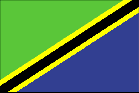
Tanzania
Country in French
Tanzanie
countryucasefr
TANZANIE
Country in Chinese
Country in Spanish
Tanzania, república unida de
Country in Italian
La Tanzania, Repubblica unita di
Country in Portuguese
Tanzânia, república unida de
Country in Germain
Tanzania, vereinigte Republik von
countrypy
tan3 sang1 ni2 ya4
countrylocal
Tanzania
countryfull
Tanzania
countrynm
Tanzania
ISO2
TZ
ISO3
TZA
countrycodeisono
834
countrycodeolympic
TAN
countrycodeirs
TZ
countrycodeirsfr
TZ
countrycodeirsmixt
TZ
♀Female
15
5
151
languagesfr
Swahili, Anglais
159
currency
shilling
currencyfr
shilling
currencyisocode
TZS
currencyisocodefull
TZS 834
currencypxcode
TZS
currencysymbol
TSh
currencysubdivision
100 cents
currencyregime
float
currencyvalue
0.00092
nationalityfr
Tanzanienne
Capital
Dar es Salaam
capitalfr
Dar-Es-Salam
Phone Prefix
255
Area km2
945 090
arealand
886 037
areawater
59 050
landarablerate
0.0424
landforestrate
0.439
coastline
1424
summit
Kilimanjaro 5 895 m.
boundarycountries
Congo démocratique, Burundi, Rwanda, Ouganda, Kenya, Zambie, Mozambique, Malawi.
timezonedeltabegin
3
flaglink
maplink
tzcolor.gif
outlinemaplink
tzout.gif
visapassenger
-1
maincities
Dar es Salaam, Zanzibar, Mwanza, Tanga, Mbeya, Tabora, Arusha.
largestcity
Dar Es Salaam
largestcitypopulation
1 747 000
rankpopulation
32
Population
35 889 000
rankgdp
93
gdp
10297000000
rankgdpppp
97
gdpppp
22300000000
rankgni
89
gni
10665000000
rankincomeorigin
183
rankincome
197
income
300
rankincomeppp
206
incomeppp
620
lifeexpectation
44.56
alphabetizationrate
0.5157
natalityrate
0.0395
mortalityrate
0.01738
mortalityrateinfantile
0.10368
precipitation
1148
nationalevent
Union Day (Tanganyika and Zanzibar)
nationaleventfr
Jour de l'Union (Tanganyika et Zanzibar)
nationalholiday
26 April (1964)
Birthday yyyy-mm-dd
1964-04-26 00:00:00
1
5
location
Eastern Africa, bordering the Indian Ocean, between Kenya and Mozambique
terrain
plains along coast; central plateau; highlands in north, south
naturalresources
hydropower, tin, phosphates, iron ore, coal, diamo
9
Web
rgbback
16777215
todate
1
4
id
Country
Country
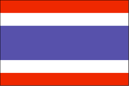
Thailand
Country in French
Thaïlande
countryucasefr
THAILANDE
Country in Chinese
Country in Spanish
Tailandia
Country in Italian
La Tailandia
Country in Portuguese
Tailândia
Country in Germain
Thailand
countrypy
tai4 guo2
countrylocal
Prathet Thai
countryfull
Thailand
countrynm
Thailand
ISO2
TH
ISO3
THA
countrycodeisono
764
countrycodevehicle
T
countrycodeolympic
THA
countrycodeirs
TH
countrycodeirsfr
TH
countrycodeirsmixt
TH
countrycode
66
♀Female
12
6
161
languagesfr
Thaï
103
currency
baht
currencyfr
baht
currencyisocode
THB
currencyisocodefull
THB 764
currencypxcode
THB
currencysymbol
Bht or Bt
currencysubdivision
100 stang
currencyregime
float
currencyvalue
0.02457
nationalityfr
Taïlandaise
Capital
Bangkok
capitalfr
Bankok
Phone Prefix
66
Area km2
514 820
arealand
511 770
areawater
2 230
landarablerate
0.3288
landforestrate
0.289
coastline
3219
summit
Doi Inthanon 2 595 m.
boundarycountries
Birmanie, Laos, Cambodge, Malaisie.
timezonedeltabegin
7
flaglink
maplink
thcolor.gif
outlinemaplink
thout.gif
visapassenger
-1
maincities
Nakhon Ratchasima, Phuket, Chiang Mai, Songkhla, Khon Kaen, Chon Buri, Nakhon Si Thammarat, Ban Hat Yai, Phitsanulok.
largestcity
Bangkok
largestcitypopulation
6 547 000
rankpopulation
19
Population
62 014 000
rankgdp
33
gdp
142953000000
rankgdpppp
20
gdpppp
470992000000
rankgni
31
gni
135877000000
rankincomeorigin
105
rankincome
115
income
2190
rankincomeppp
87
incomeppp
7450
lifeexpectation
71.24
alphabetizationrate
0.93
natalityrate
0.01637
mortalityrate
0.00686
mortalityrateinfantile
0.02183
precipitation
1498
nationalevent
Birthday of King PHUMIPHON
nationaleventfr
Anniversaire du Roi PHUMIPHON
nationalholiday
5 December (1927)
Birthday yyyy-mm-dd
1927-12-05 00:00:00
4
4
location
Southeastern Asia, bordering the Andaman Sea and the Gulf of Thailand, southeast of Burma
terrain
central plain; Khorat Plateau in the east; mountains elsewhere
naturalresources
tin, rubber, natural gas, tungsten, tantalum, timb
cooking
Meilleurs Riz Parfumés du Monde.
8
Web
rgbback
16777215
todate
1
Notes
Meilleurs Riz Parfumés du Monde. Grâce à son intelligence suprême,
Ce Lapin de Feu gère bien la cohabitation de la modernité et le boudhisme traditionnel. Avec un tempérament chaud, il est aimé de tous.
5
id
Country
Country
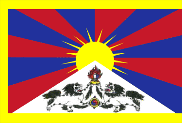
Tibet
Country in French
Tibet
countryucasefr
TIBET
Country in Chinese
countryfull
Tibet
countrynm
Tibet
ISO2
CHNT
ISO3
CHNT
countrycodeisono
156
countrycodeolympic
CHN
countrycodeirs
CN
countrycodeirsfr
CN
countrycodeirsmixt
TB
♂Male
5
1
162
languagesfr
Tibétain
3
currency
Yuan
currencyfr
Yuan
currencypxcode
CNY
currencysymbol
¥
Capital
Lhassa
capitalfr
Lhassa
Phone Prefix
86
Area km2
2 470 000
summit
Jomo Langma 8 850 m.
boundarycountries
Chine, Bhoutan, Népal, Inde.
timezonedeltabegin
8
flaglink
maplink
tibet.gif
maincities
Rikaze, Heihe, Keerzong, Luolong
largestcity
Lhassa
Population
13 500 000
rankincome
222
9
rgbback
16777215
todate
1
6
id
Country
Country
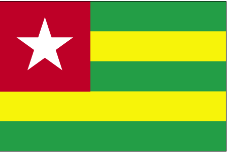
Togo
Country in French
Togo
countryucasefr
TOGO
Country in Chinese
Country in Spanish
Toga
Country in Italian
Toga
Country in Portuguese
Toga
Country in Germain
Toga
countrypy
duo1 ge1
countrylocal
Republique Togolaise
countryfull
Togo
countrynm
Togo
ISO2
TG
ISO3
TGO
countrycodeisono
768
countrycodevehicle
TG
countrycodeolympic
TOG
countrycodeirs
TO
countrycodeirsfr
TO
countrycodeirsmixt
TO
♂Male
15
4
57
languagesfr
Français
119
currency
franc
currencyfr
franc C.F.A.
currencyisocode
XOF
currencyisocodefull
XOF 952
currencypxcode
XOF
currencysymbol
CFAF
currencysubdivision
100 centimes
currencyregime
Euro (655.957)
currencyvalue
0.00186
nationalityfr
Togalaise
Capital
Lome
capitalfr
Lomé
Phone Prefix
228
Area km2
56 790
arealand
54 385
areawater
2 400
landarablerate
0.4137
landforestrate
0.094
coastline
56
summit
Pic Baumann 986 m.
boundarycountries
Ghana, Burkina Faso, Bénin.
flaglink
maplink
tgcolor.gif
outlinemaplink
tgout.gif
visapassenger
-1
maincities
Sokodé, Palimé, Atakpamé, Bassari, Tsévié, Anécho, Mango, Bafilo, Tabligbo.
largestcity
Lome
largestcitypopulation
662 000
rankpopulation
112
Population
4 861 000
rankgdp
146
gdp
1759000000
rankgdpppp
132
gdpppp
8247000000
rankgni
159
gni
1528000000
rankincomeorigin
182
rankincome
196
income
310
rankincomeppp
176
incomeppp
1640
lifeexpectation
53.43
alphabetizationrate
0.433
natalityrate
0.03523
mortalityrate
0.01151
mortalityrateinfantile
0.06873
hdi
0.489
precipitation
878
nationalevent
Independence Day
nationaleventfr
Jour de l'Indépendance
nationalholiday
27 April (1960)
Birthday yyyy-mm-dd
1960-04-27 00:00:00
7
1
location
Western Africa, bordering the Bight of Benin, between Benin and Ghana
terrain
gently rolling savanna in north; central hills; southern plateau; low coastal plain with extensive lagoons and marshes
naturalresources
phosphates, limestone, marble, arable land
9
Web
rgbback
16777215
todate
1
7
id
Country
Country
Tokelau
Country in French
Tokelau
countryucasefr
TOKELAU
Country in Chinese
Country in Spanish
Tokelau
Country in Italian
Il Tokelau
Country in Portuguese
Tokelau
Country in Germain
Tokelau
countryfull
Tokelau
countrynm
Tokelau
ISO2
TK
ISO3
TKL
countrycodeisono
772
countrycodeirs
TL
countrycodeirsfr
TL
countrycodeirsmixt
TL
♂Male
18
6
51
75
currency
dollar
currencyisocode
NZD
currencyisocodefull
NZD 554
currencypxcode
NZD
currencysymbol
NZ$
currencysubdivision
100 cents
currencyregime
float
currencyvalue
0.6966
Phone Prefix
690
Area km2
10
arealand
10
coastline
101
timezonedeltabegin
-12
flaglink
maplink
tokelau.gif
visapassenger
-1
rankpopulation
228
Population
1 800
rankincome
222
nationalevent
Waitangi Day (Treaty of Waitangi established British sovereignty over New Zealand)
nationaleventfr
Jour Waitangi
nationalholiday
6 February (1840)
Birthday yyyy-mm-dd
1840-02-06 00:00:00
7
1
location
Oceania, group of three atolls in the South Pacific Ocean, about one-half of the way from Hawaii to New Zealand
terrain
low-lying coral atolls enclosing large lagoons
naturalresources
NEGL
cooking
Oceania, group of three atolls in the South Pacific Ocean, about one-half of the way from Hawaii to New Zealand
9
rgbback
16777215
todate
1
8
id
Country
Country
Tonga
Country in French
Tonga
countryucasefr
TONGA
Country in Chinese
Country in Spanish
Tonga
Country in Italian
La Tonga
Country in Portuguese
Tonga
Country in Germain
Tonga
countryfull
Tonga
countrynm
Tonga
ISO2
TO
ISO3
TON
countrycodeisono
776
countrycodeolympic
TGA
countrycodeirs
TN
countrycodeirsfr
TN
countrycodeirsmixt
TN
♀Female
12
4
202
languagesfr
Tongan, Anglais
160
currency
pa'anga
currencyfr
paanga
currencyisocode
TOP
currencyisocodefull
TOP 776
currencypxcode
TOP
currencysymbol
PT or T$
currencysubdivision
100 seniti
currencyregime
composite
currencyvalue
0.5262
Capital
Nuku'alofa
capitalfr
Nukualofa
Phone Prefix
676
Area km2
748
arealand
718
areawater
30
landarablerate
0.2361
landforestrate
0.055
coastline
419
summit
1 033 m.
timezonedeltabegin
13
flaglink
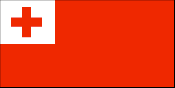
maplink
tocolor.gif
outlinemaplink
to.gif
visapassenger
-1
maincities
Neiafu, Pangai.
largestcity
Nuku' alofa
largestcitypopulation
40 000
rankpopulation
188
Population
102 000
rankgdp
181
gdp
163000000
rankgdpppp
162
gdpppp
710000000
rankgni
204
gni
152000000
rankincomeorigin
123
rankincome
135
income
1490
rankincomeppp
91
incomeppp
6910
lifeexpectation
69.2
natalityrate
0.02487
fecondity
3.71
mortalityrate
0.00545
mortalityrateinfantile
0.01299
growthrate
0.011
urbanization
0.53
nationalevent
Independence Day
nationaleventfr
Jour de l'Indépendance
nationalholiday
4 June (1970)
Birthday yyyy-mm-dd
1970-06-04 00:00:00
7
11
location
Oceania, archipelago in the South Pacific Ocean, about two-thirds of the way from Hawaii to New Zealand
terrain
most islands have limestone base formed from uplifted coral formation; others have limestone overlying volcanic base
naturalresources
fish, fertile soil
9
rgbback
16777215
todate
1
9
id
Country
Country
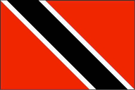
Trinidad and Tobago
Country in French
Trinité-et-Tobago
countryucasefr
TRINITE-ET-TOBAGO
Country in Chinese
Country in Spanish
Trinidad y Trinidad y Tobago
Country in Italian
La Trinidad ed il Tobago
Country in Portuguese
Trinidad e tobago
Country in Germain
Trinidad und Tobago
countrypy
te4 li4 ni2 da2 he2 duo1 ba1 ge1
countrylocal
Trinidad and Tobago
countryfull
Trinidad and Tobago
countrynm
Trinidad and Tobago
ISO2
TT
ISO3
TTO
countrycodeisono
780
countrycodevehicle
TT
countrycodeolympic
TRI
countrycodeirs
TD
countrycodeirsfr
TD
countrycodeirsmixt
TD
18
6
51
languagesfr
Anglais
104
currency
dollar
currencyfr
dollar de la Trinité
currencyisocode
TTD
currencyisocodefull
TTD 780
currencypxcode
TTD
currencysymbol
TT$
currencysubdivision
100 cents
currencyregime
float
currencyvalue
0.1613
Capital
Port-of-Spain
capitalfr
Port of Spain
Phone Prefix
1-868
Area km2
5 128
arealand
5 128
landarablerate
0.1462
landforestrate
0.505
coastline
362
summit
El Cerro del Aripo 940 m.
timezonedeltabegin
-4
flaglink
maplink
tt.jpg
outlinemaplink
trintbgo.gif
visapassenger
-1
maincities
San Fernando, Arima, Scarborough .
largestcity
Port of Spain
largestcitypopulation
52 000
rankpopulation
149
Population
1 313 000
rankgdp
92
gdp
10511000000
rankgdpppp
111
gdpppp
14132000000
rankgni
90
gni
10220000000
rankincomeorigin
60
rankincome
66
income
7790
rankincomeppp
74
incomeppp
10390
lifeexpectation
69.28
alphabetizationrate
0.985
natalityrate
0.01275
mortalityrate
0.00902
mortalityrateinfantile
0.02464
hdi
0.802
urbanization
0.745
precipitation
1870
nationalevent
Independence Day
nationaleventfr
Jour de l'Indépendance
nationalholiday
31 August (1962)
Birthday yyyy-mm-dd
1962-08-31 00:00:00
9
3
location
Caribbean, islands between the Caribbean Sea and the North Atlantic Ocean, northeast of Venezuela
terrain
mostly plains with some hills and low mountains
naturalresources
petroleum, natural gas, asphalt
9
Web
rgbback
16777215
todate
1
10
id
Country
Country
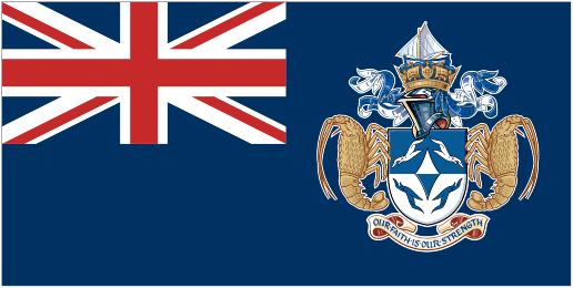
Tristan da Cunha Island
Country in French
Tristan da Cunha
countryucasefr
TRISTAN DA CUNHA
Country in Chinese
countryfull
Tristan da Cunha Island
countrynm
Tristan da Cunha Island
ISO2
TDC
ISO3
TDC
countrycodeisono
654
countrycodeirs
SH
countrycodeirsfr
SH
countrycodeirsmixt
TDC
♂Male
12
8
51
languagesfr
Anglais
22
currency
Livre Sterling
currencyfr
Livre Sterling
Capital
Edingburgh
capitalfr
Edingburgh
Phone Prefix
290
Area km2
65
arealand
65
flaglink
maplink
tristandc.gif
largestcity
Edingburgh
Population
310
rankincome
222
location
Îles situées dans lOcéan Atlantique Sud comprenant lÎle Tristan da Cunha (Tristan da Cunha Island), lÎle Gough (Gough Island), lÎle Inaccessible (Inaccessible Island) et lÎle Nightingale (Nightingale Island).
9
rgbback
16777215
todate
1
Notes
Belongs to Saint Helena
| Countries/Territories | Regions of China | Provinces of China | Regions in France | French Departments | States/Provinces | Cities/Towns | Locations | World Continents | French AOP Wines
